

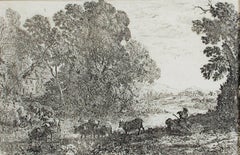
Claude Lorrain17th century etching black and white landscape harbor ruins figures scene1668
1668
About the Item
- Creator:Claude Lorrain (1604 - 1682, French)
- Creation Year:1668
- Dimensions:Height: 18.125 in (46.04 cm)Width: 20.25 in (51.44 cm)
- Medium:
- Movement & Style:
- Period:Mid-17th Century
- Condition:
- Gallery Location:Milwaukee, WI
- Reference Number:
Claude Lorrain
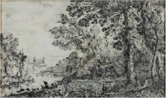
Claude Lorrain, born Claude Gellée, was a French painter, draughtsman and engraver of the Baroque era. He spent most of his life in Italy and is admired for his achievements in landscape painting. He painted a pastoral world of fields and valleys not distant from castles and towns that entered into these quiet scenes. Landscape as a subject was distinctly nontraditional and secular during this time of religious and mythical iconography, and Gellée was certainly breaking with tradition. John Constable described the artist as the most perfect landscape painter the world ever saw and declared that in Claude’s landscape, “all is lovely, all amiable, all is amenity and repose; the calm sunshine of the heart." He passed away on November 23, 1682.
- ShippingRetrieving quote...Ships From: Milwaukee, WI
- Return PolicyA return for this item may be initiated within 14 days of delivery.
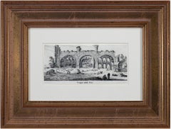
- 17th century engraving black and white landscape ancient building sceneBy Israel SilvestreLocated in Milwaukee, WI"Tempio Della Pace" is an original engraving by Israel Silvestre. The title is printed below the miniature image. It shows a frontal view of the remains of the Temple of Peace in Rom...Category
1650s Old Masters Landscape Prints
MaterialsPaper, Ink, Engraving
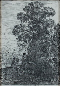
- 17th century etching black and white landscape forest trees figures sceneBy Claude LorrainLocated in Milwaukee, WI"Le Patre et la Bergere (The Herdsman & Shepherdess)" is an etching by Claude Gellee (Le Lorrain). This etching is in the collections of the Metropolitan Museum and the British Museu...Category
Mid-17th Century Old Masters Landscape Prints
MaterialsEtching
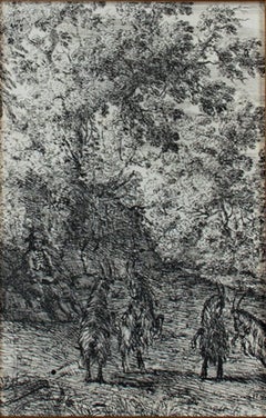
- 17th century etching black and white landscape scene forest trees goatsBy Claude LorrainLocated in Milwaukee, WI"Les Chevres (The Goats)" is an original etching by Claude Lorrain. It depicts two pairs of goats and a shepherd watching over them. This etching is also in the collections of the Me...Category
1630s Old Masters Animal Prints
MaterialsEtching
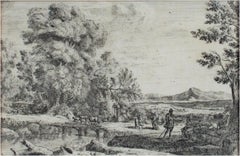
- 17th century etching black and white landscape forest trees river figures sceneBy Claude LorrainLocated in Milwaukee, WI"Le Point de Bois (Rebecca & Eliezer)" is an etching by Claude Gellee (Le Lorrain). This etching is in the collections of the Metropolitan Museum and the Louvre. Publisher: Mannocci ...Category
Mid-17th Century Old Masters Landscape Prints
MaterialsEtching
- 17th century etching black and white landscape scene forest trees cattleBy Claude LorrainLocated in Milwaukee, WI"Le Bouvier (The Cowherd)" is an original etching by Claude Lorrain. It depicts a shepherd with a herd of cows. This etching is also in the collections of the Met and the Louvre. It ...Category
1630s Old Masters Landscape Prints
MaterialsEtching
- 17th century etching black and white landscape forest trees river sceneBy Claude LorrainLocated in Milwaukee, WI"L'Apparition (The Vision)" is an original etching by Claude Lorrain (Claude Gellee). This print depicts a religious vision near the edge of a river. The publisher is Mannocci #5 and...Category
1630s Old Masters Landscape Prints
MaterialsEtching
- University of Oxford Oxonia Illustrata 1675 engraving by David LogganBy David LogganLocated in London, GBTo see our other views of Oxford and Cambridge, scroll down to "More from this Seller" and below it click on "See all from this Seller" - or send us a message if you cannot find the ...Category
1670s Old Masters Prints and Multiples
MaterialsEngraving
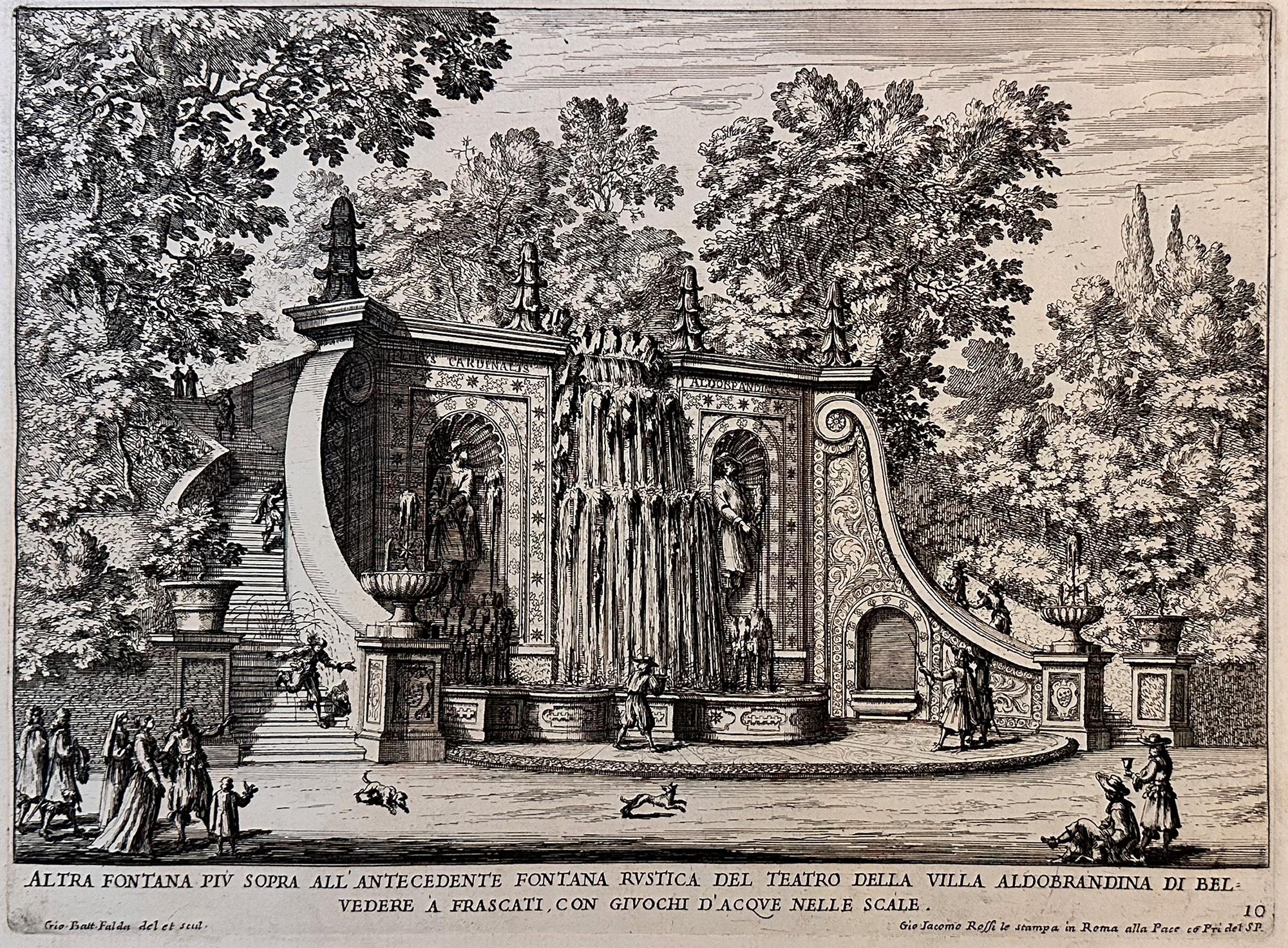
- Fountains of RomeBy Giovan Battista FaldaLocated in Middletown, NYA charming scene with romping dogs and spectators watching the cascading water play a trick on an unsuspecting man who is sprayed as he descends the steps, as the fountain was design...Category
Early 17th Century Old Masters Landscape Prints
MaterialsEngraving, Etching, Laid Paper
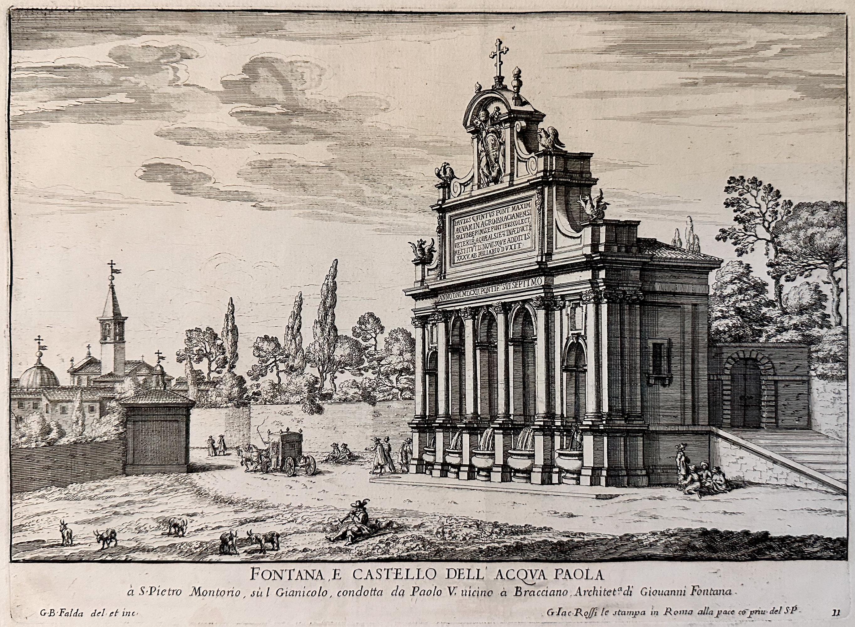
- Fountains of Rome; Fontana e castello dell'AcquaBy Giovan Battista FaldaLocated in Middletown, NYRome: Giovanni Giacomo De Rossi, 1625. Etching and engraving on cream laid paper, 8 3/8 x 11 1/4 inches (222 x 286 mm), full margins. In good condition with some light yellow discol...Category
Early 17th Century Old Masters Landscape Prints
MaterialsLaid Paper, Engraving, Etching
- View of Pisaro, Italy: A 16th Century Hand-colored Map by Braun & HogenbergBy Franz HogenbergLocated in Alamo, CAThis is a 16th century original hand-colored copperplate engraved map of View of Pezaro (Pisaro), Italy entitled "Pisaurum vulgo Pezaro" by Georg Braun & Franz Hogenberg, from their famous city atlas "Civitates Orbis Terrarum", published in Augsberg, Germany in 1575. The map depicts a view of Pesaro, Italy from the west looking over the town to the Adriatic Sea. The River Foglia flows into the Adriatic in the foreground. The only identifiable building is the cathedral of San Domenico, which rises above the other roofs with its tall spire. Two women, dressed in styles of the 16th century are in conversation on a hill in the foreground on the left. Pesaro is in the province of Pesaro and Urbino and lies on the Adriatic and east of Florence. The city, which was founded by the Etruscans and named Pisaurum by the Romans, belonged from AD 754 onwards to the Papal States, and after 1285 was controlled by the princely families of Malatesta, Sforza and della Rovere. Today it is the capital of the province of Pesaro and Urbino and has a population of about 92,000. Pesaro's most famous resident, composer Gioacchino Rossini, was born here in 1792. The following is an English translation of an excerpt from Braun's description of the city: "We believe that the astonishingly short life of the inhabitants of Pesaro comes not only from the insalubrious air, but also from the great quantity of delectable and delicious fruits which they consume to excess. For this causes the production in their bodies of evil humours, which then lead to incurably fatal diseases. The area around the city is most charming and well planted with vineyards, fig trees, olive trees and other fruit-bearing trees." References: Van der Krogt 4, 3369, state 1; Taschen, Braun and Hogenberg...Category
16th Century Old Masters Landscape Prints
MaterialsEngraving
- L'Isle de France: A Hand-colored 17th Century Map by De WitBy Frederick de WitLocated in Alamo, CAThis colorful and detailed 17th century hand-colored copperplate map by Frederick De Wit was published in Amsterdam between 1666 and 1760. The map depicts the Île-de-France, which is one of the ancient provinces of France. Paris is located in the center of the map, with Versailles to the southwest The map extends from Rouen in the west to Reims in the east. The area around Paris, the Véxin Français, was the original domain of the king of France. Other areas were ruled by French feudal lords. For example, the Véxin Normand area was the domain of the Duke of Normandy...Category
Early 18th Century Old Masters More Prints
MaterialsEngraving
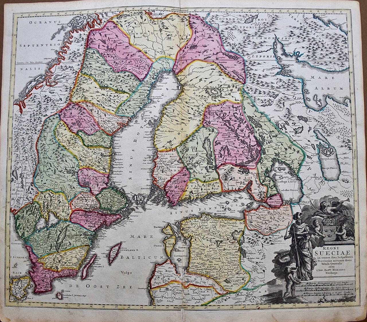
- Sweden and Adjacent Portions of Scandinavia: A Hand-colored 18th C. Homann MapBy Johann Baptist HomannLocated in Alamo, CAThis hand-colored copper-plate map of Sweden and adjacent portions of Scandinavia entitled "Regni Sueciae in Omnes suas Subjacentes Provincias accurate divisi Tabula Generalis" was c...Category
Early 18th Century Old Masters Landscape Prints
MaterialsEngraving