Items Similar to The Deluge - JOSEPH MALLORD WILLIAM TURNER (1775 - 1851)


Want more images or videos?
Request additional images or videos from the seller
1 of 10
The Deluge - JOSEPH MALLORD WILLIAM TURNER (1775 - 1851)1828
1828
About the Item
(after) JOSEPH MALLORD WILLIAM TURNER (1775 - 1851)
THE DELUGE, 1828. Mezzotint, Engraved by I. P. Quilly after a painting by J. M.W. Turner R.A.. Image 15 1/8 x 22 3/4 inches, plate 18 1/8 x 25 inches, sheet 19 3/8 x 25 1/2 inches.
Dramatic iarge scale mage in the manner of John Martin's important mezzotints. Good - fair condition with some surface rubbing as is common in mezzotints of this large size and vintage. Sheet has numerous tiny dots in the margins particularly the lower margin, that are likely not foxing but something else. This example has the lightly engraved dedication line "To The Right Honorable (the late) Earl of Carysfort KP", with the Publication line "London Published June 24, 1828 by Moon, Boys & Graves, Printsellers to the King, 6 Pall Mall"
SEE COMMENTS ON THIS PUBLICATION BELOW
The Tate Gallery discusses this print extensively: It suggests that Turner produced this large scale mezzotint to compete with upstarts John Martin and Francis Danby
TATE GALLERY DESCRIPTION:
Lit: Rawlinson II 1913, no.794, engraver's proof (b); Lyles and Perkins 1989, pp.62–3, no.56, repr.
"In the late 1820s Turner supervised the production of a number of large-scale mezzotints after his oils, chiefly subjects which he had painted much earlier in his career. T 04838 was based on ‘The Deluge’, which was painted c. 1805 and exhibited at the Royal Academy in 1813 (Tate Gallery, N 00493; Butlin and Joll 1984, no.55). In their dark tonality many of Turner's early pictures lent themselves particularly well to translation into mezzotint.
It has been suggested that Turner's wish to bring ‘The Deluge’ to the public's attention again in 1828 by publishing a mezzotint of it may have been prompted by increasing competition from two younger painters who specialised in similar apocalyptic subjects, John Martin and Francis Danby (see Andrew Wilton, Turner and the Sublime, exh. cat., British Museum 1980, p.139). It was in 1826 that Martin produced his first version of a deluge subject, publishing a mezzotint of it in 1828. Danby's first biblical canvas was exhibited in 1825. Quilley's mezzotint includes a number of macabre details which are absent from the original oil and which suggest that Turner may indeed have been responding to the sensationalist canvases of these two rivals. The barest indication of a snake in the water in the foreground of the oil has been transformed in the print into a group of intertwined and writhing serpents; the print also adds a pair of outstretched hands protruding just above the surface of the water to the left, indicating the futile struggle of a panic-stricken victim who has already been engulfed. Both these details were pencilled in by Turner on an early engraver's proof now in the British Museum (1893-6-12-172).
The latest known impression of this engraving (of which there is an example in the British Museum, 1948-4-10-145) carries a dedication line ‘to The Right Honorable (the late) Earl of Carysfort KP’ and the publication line ‘London, Published June 24, 1828, by Moon, Boys & Graves, Printsellers to the King, 6 Pall Mall’. However, Rawlinson expresses doubts as to whether the print was actually published (Rawlinson II 1913, p.383), and indeed the Catalogue of the Fourth Portion of the Engravings from the Works of J.M.W. Turner R.A. (Turner sales, Christie's, 3–7 March 1874) lists ‘The Deluge’ under a sequence of ‘the unpublished mezzotints’.
In 1830 Quilley engraved another large mezzotint after Turner, ‘The Garden of Boccaccio - The Birdcage’ (Rawlinson II 1913, no.797), and in 1831 he also collaborated with John Martin in the production of a large mezzotint of ‘Pandemonium’ (see M.J. Campbell, John Martin: Visionary Printmaker, exh. cat., York City Art Gallery 1992, pp.108–9). However, little is known about his life or training (Rawlinson mistakenly refers to him as ‘J.B.’ Quilley)."
- Creation Year:1828
- Dimensions:Height: 15.15 in (38.49 cm)Width: 25.5 in (64.77 cm)
- Medium:
- Movement & Style:
- After:Joseph Mallord William Turner (1775 - 1851, British)
- Period:
- Condition:
- Gallery Location:Santa Monica, CA
- Reference Number:1stDibs: LU41138286332
About the Seller
5.0
Recognized Seller
These prestigious sellers are industry leaders and represent the highest echelon for item quality and design.
Platinum Seller
These expertly vetted sellers are 1stDibs' most experienced sellers and are rated highest by our customers.
Established in 1977
1stDibs seller since 2016
267 sales on 1stDibs
Typical response time: <1 hour
Associations
International Fine Print Dealers Association
- ShippingRetrieving quote...Ships From: Santa Monica, CA
- Return PolicyA return for this item may be initiated within 7 days of delivery.
More From This SellerView All
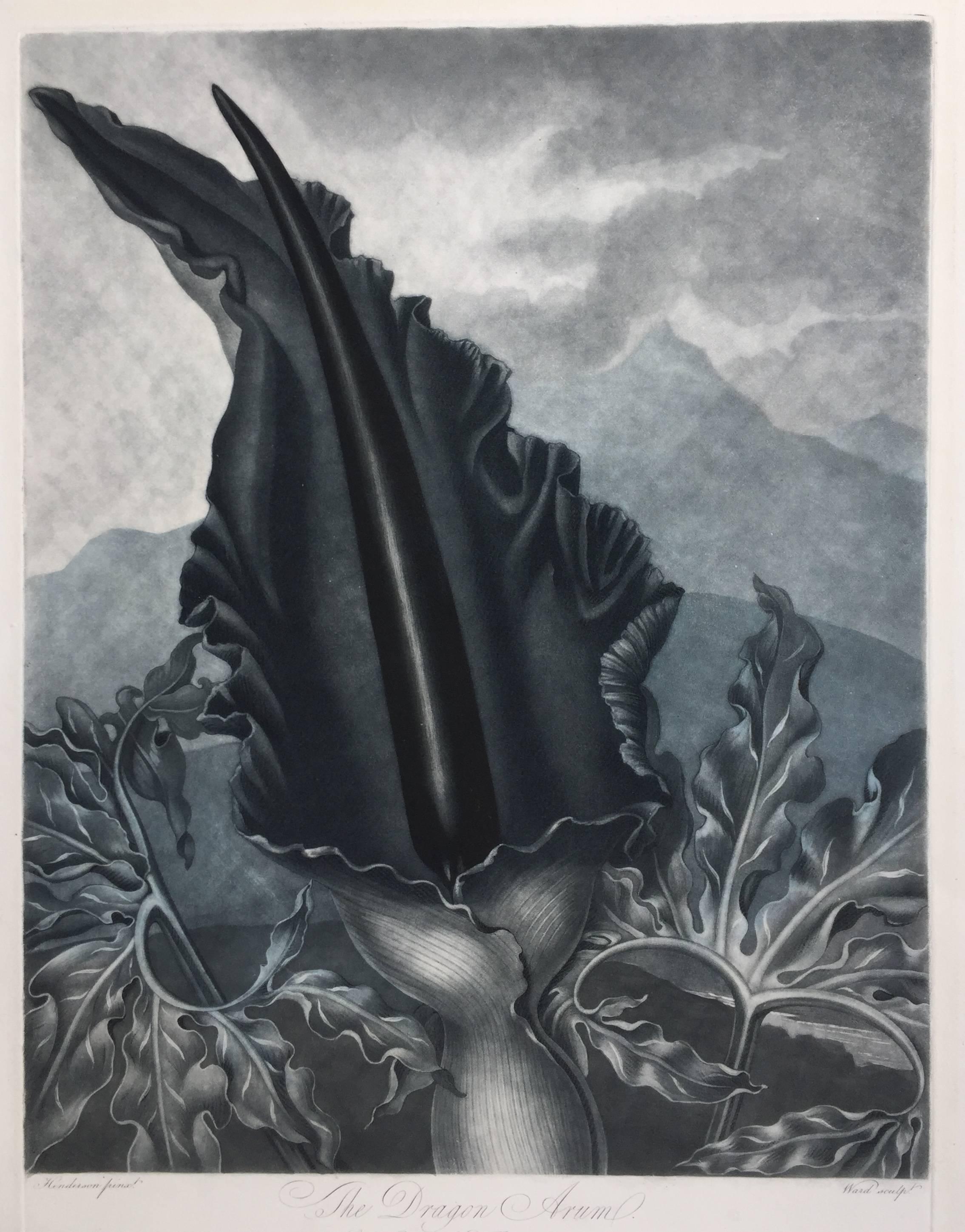
- THE DRAGON ARUMBy Dr. Robert John ThorntonLocated in Santa Monica, CADR. ROBERT JOHN THORNTON (circa 1768- 1837) THE DRAGON ARUM, 1801 (Dunthorne plate 161, pg. 250 i/iii; Nissen 1 955) Mezzotint printed in Payne's grey...Category
Early 1800s Old Masters Landscape Prints
MaterialsMezzotint
- WORLD MAP - Planisphaerium Terrestre Sive Terrarum Orbis... 1696By Carel AllardLocated in Santa Monica, CACAREL ALLARD (1648 – 1709) PLANISPHAERIUM TERRESTRE SIVE TERRARUM ORBIS… 1696 (Shirley 578) Engraving, 20 ½ x 23 ½”, sheet 21 x 24 1/8". A stunning double hemisphere World Map...Category
17th Century Old Masters Landscape Prints
MaterialsEngraving
- AMERICABy John SpeedLocated in Santa Monica, CAIMPORTANT AMERICAN MAP - ONE OF THE FIRST TO SHOW CALIFORNIA as an ISLAND JOHN SPEED (1552-1629) AMERICA - With Those Known Parts In That Unknown Worlde (sic), 1626-(76) (Burden 217 iv/iv) Engraving, uncolored. Engraved by Abraham Goos and published by Thomas Basset and Richard Chiswell - 4th state of 4 in 1676 15 1/8 x 20 1/2” From “A Prospect of the Most Famous Parts of the World”. Generally good condition. A repaired split in lower centerfold. This is the most common version of this important map...Category
1620s Old Masters Landscape Prints
MaterialsEngraving
- New Map of the Terraqueous Globe - WORLD MAP - CALIFORNIA AS AN ISLANDBy Edward WellsLocated in Santa Monica, CAEDWARD WELLS (British 1667- 1727) A NEW MAP of the TERRAQUEOUS GLOBE - according to the latest Discoveries and most general Divisions of it into CONTINENTS and OCEANS, 1700-01 (Shirley 609) Engraved by Michael Burghers, Oxford. Hand-colored, Platemark 14 1/4 x 20 1/8 inches. Central cartouche flanked by figures representing the continents with dedication to William, Duke of Gloucester...Category
Early 1700s Old Masters Landscape Prints
MaterialsEngraving
- PERUBy Johannes JanssonLocated in Santa Monica, CAJOHANNES JANSSON (1588 - 1664) PERU, engraving with early coloring. Platemark 15 1/8 x 19 3/8 inches, sheet 17 x 20 1/2 A nice example of one of the earliest maps of Peru. From the ...Category
1630s Old Masters Landscape Prints
MaterialsEngraving
- AMERICAE - Sive Novi Orbis, Nova DescriptioBy Abraham OrteliusLocated in Santa Monica, CAABRAHAM ORTELIUS (1527 - 1598) AMERICAE SIVE NOVI ORBIS, NOVA DESCRIPTIO, 1587 (1603) (Van Den Broecke 11, Burden 64; Schwartz & Ehrenberg 69) Engraving. A very good, well printed...Category
16th Century Old Masters Landscape Prints
MaterialsEngraving


You May Also Like
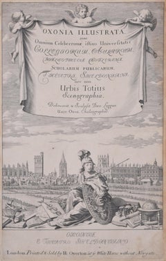
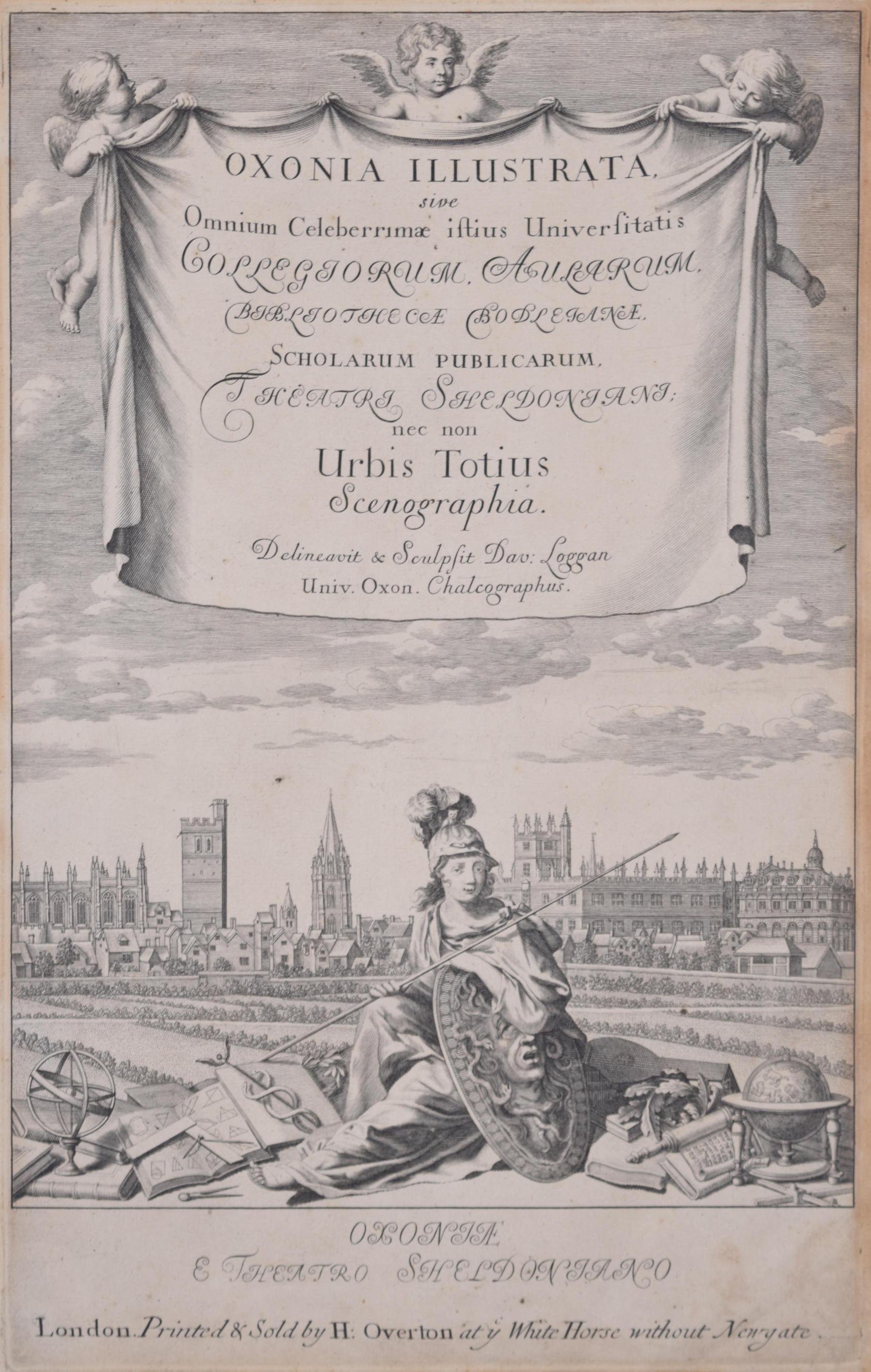
- University of Oxford Oxonia Illustrata 1675 engraving by David LogganBy David LogganLocated in London, GBTo see our other views of Oxford and Cambridge, scroll down to "More from this Seller" and below it click on "See all from this Seller" - or send us a message if you cannot find the ...Category
1670s Old Masters Prints and Multiples
MaterialsEngraving
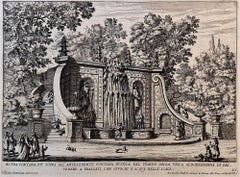
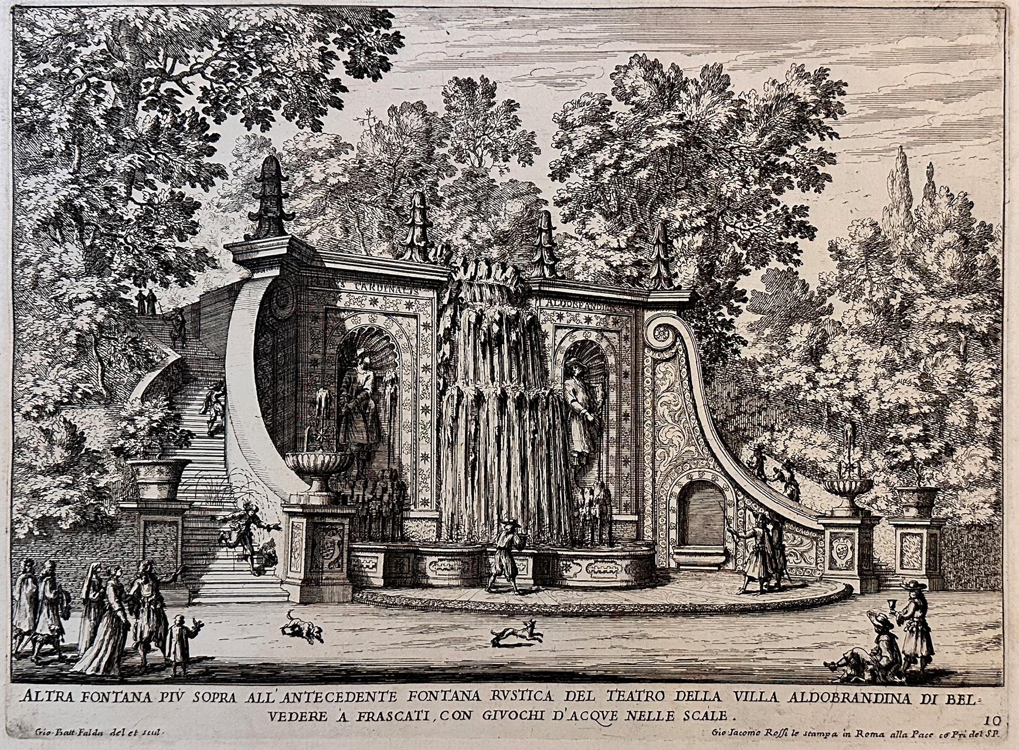
- Fountains of RomeBy Giovan Battista FaldaLocated in Middletown, NYA charming scene with romping dogs and spectators watching the cascading water play a trick on an unsuspecting man who is sprayed as he descends the steps, as the fountain was design...Category
Early 17th Century Old Masters Landscape Prints
MaterialsEngraving, Etching, Laid Paper
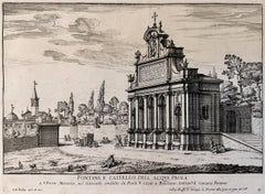
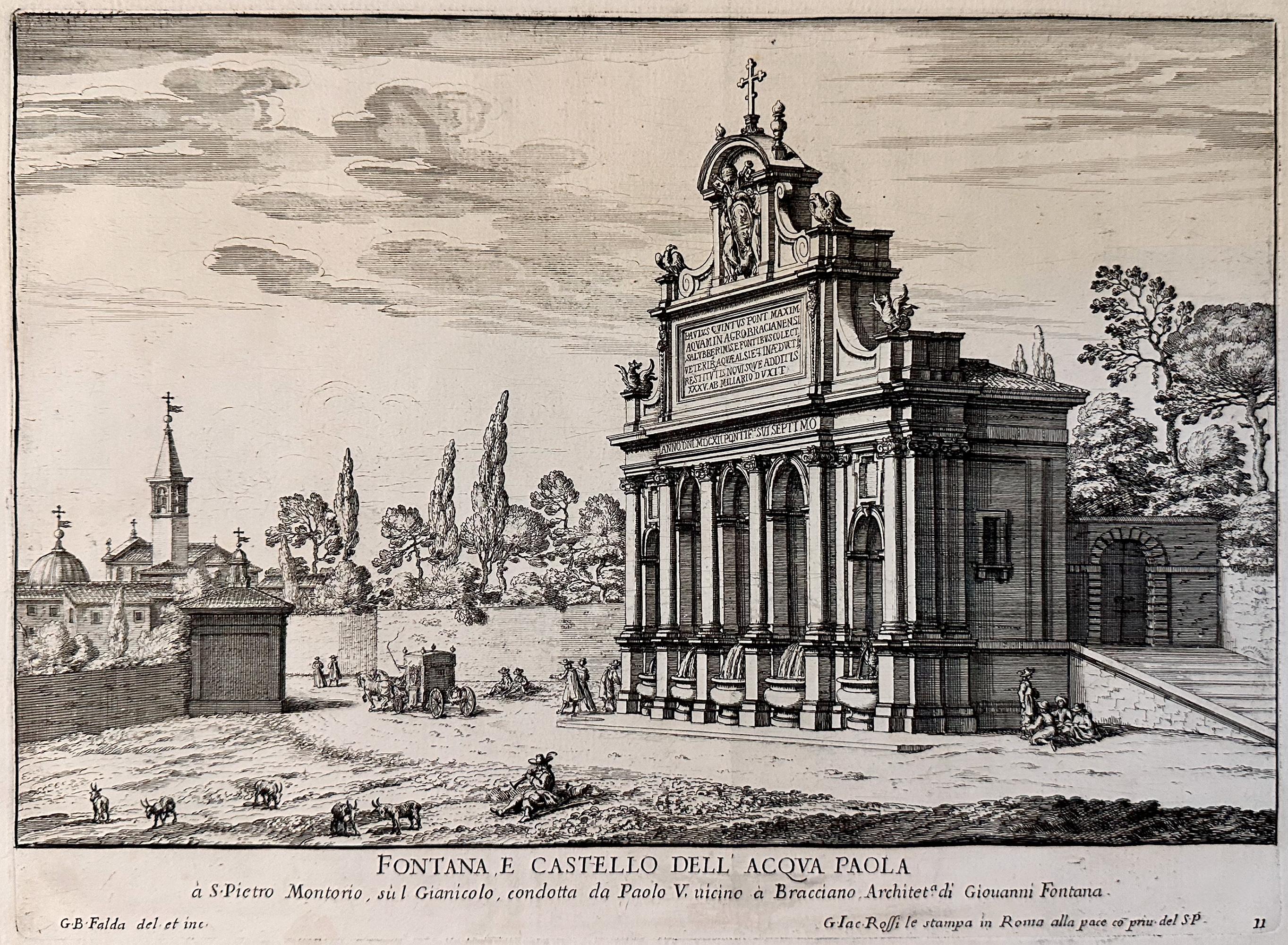
- Fountains of Rome; Fontana e castello dell'AcquaBy Giovan Battista FaldaLocated in Middletown, NYRome: Giovanni Giacomo De Rossi, 1625. Etching and engraving on cream laid paper, 8 3/8 x 11 1/4 inches (222 x 286 mm), full margins. In good condition with some light yellow discol...Category
Early 17th Century Old Masters Landscape Prints
MaterialsLaid Paper, Engraving, Etching
- View of Pisaro, Italy: A 16th Century Hand-colored Map by Braun & HogenbergBy Franz HogenbergLocated in Alamo, CAThis is a 16th century original hand-colored copperplate engraved map of View of Pezaro (Pisaro), Italy entitled "Pisaurum vulgo Pezaro" by Georg Braun & Franz Hogenberg, from their famous city atlas "Civitates Orbis Terrarum", published in Augsberg, Germany in 1575. The map depicts a view of Pesaro, Italy from the west looking over the town to the Adriatic Sea. The River Foglia flows into the Adriatic in the foreground. The only identifiable building is the cathedral of San Domenico, which rises above the other roofs with its tall spire. Two women, dressed in styles of the 16th century are in conversation on a hill in the foreground on the left. Pesaro is in the province of Pesaro and Urbino and lies on the Adriatic and east of Florence. The city, which was founded by the Etruscans and named Pisaurum by the Romans, belonged from AD 754 onwards to the Papal States, and after 1285 was controlled by the princely families of Malatesta, Sforza and della Rovere. Today it is the capital of the province of Pesaro and Urbino and has a population of about 92,000. Pesaro's most famous resident, composer Gioacchino Rossini, was born here in 1792. The following is an English translation of an excerpt from Braun's description of the city: "We believe that the astonishingly short life of the inhabitants of Pesaro comes not only from the insalubrious air, but also from the great quantity of delectable and delicious fruits which they consume to excess. For this causes the production in their bodies of evil humours, which then lead to incurably fatal diseases. The area around the city is most charming and well planted with vineyards, fig trees, olive trees and other fruit-bearing trees." References: Van der Krogt 4, 3369, state 1; Taschen, Braun and Hogenberg...Category
16th Century Old Masters Landscape Prints
MaterialsEngraving
- L'Isle de France: A Hand-colored 17th Century Map by De WitBy Frederick de WitLocated in Alamo, CAThis colorful and detailed 17th century hand-colored copperplate map by Frederick De Wit was published in Amsterdam between 1666 and 1760. The map depicts the Île-de-France, which is one of the ancient provinces of France. Paris is located in the center of the map, with Versailles to the southwest The map extends from Rouen in the west to Reims in the east. The area around Paris, the Véxin Français, was the original domain of the king of France. Other areas were ruled by French feudal lords. For example, the Véxin Normand area was the domain of the Duke of Normandy...Category
Early 18th Century Old Masters More Prints
MaterialsEngraving
- Sweden and Adjacent Portions of Scandinavia: A Hand-colored 18th C. Homann MapBy Johann Baptist HomannLocated in Alamo, CAThis hand-colored copper-plate map of Sweden and adjacent portions of Scandinavia entitled "Regni Sueciae in Omnes suas Subjacentes Provincias accurate divisi Tabula Generalis" was c...Category
Early 18th Century Old Masters Landscape Prints
MaterialsEngraving