Items Similar to Bindon Abbey, Dorset engraving after Samuel and Nathaniel Buck

Want more images or videos?
Request additional images or videos from the seller
1 of 6
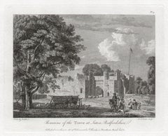
Bindon Abbey, Dorset engraving after Samuel and Nathaniel Buck1733
1733
About the Item
To see more, scroll down to "More from this Seller" and below it click on "See all from this Seller."
after Samuel Buck (1696 - 1779) and Nathaniel Buck (active 1724 - 1759)
The South View of Bindon Abbey, in the County of Dorset (1733)
Engraving
20 x 37 cm
An engraved view of Bindon Abbey, a Cistercian monastery on the River Frome in Dorset. The monastery was founded in 1149 by William de Glastonia on the site since known as Little Bindon near Bindon Hill. In 1172 the monastery moved to a site near Wool, and was supported by the house of Plantagenet. The abbey was scheduled for Dissolution in 1536, and finally dissolved in 1539. Only ruins remain.
Samuel and Nathaniel Buck were brothers and notable 18th century architectural artists, best known for their depictions of ancient castles and monasteries entitled 'Buck's Antiquities' and those of townscapes of England and Wales, ''Sea-Ports and Capital Towns''. Little is known about the brothers' lives. Samuel was born in Yorkshire and died in penury in London in 1779, and was buried in the churchyard of St Clement Danes. Nathaniel pre-deceased him, dying between 1759 and 1774.
- Creation Year:1733
- Dimensions:Height: 7.88 in (20 cm)Width: 14.57 in (37 cm)
- Medium:
- After:Samuel & Nathaniel Buck (1696 - 1779, British)
- Period:1730-1739
- Framing:Framing Options Available
- Condition:Generally good; some age toning; mounted to board; sheet trimmed outside platemark.
- Gallery Location:London, GB
- Reference Number:1stDibs: LU795313545512
About the Seller
4.8
Platinum Seller
These expertly vetted sellers are 1stDibs' most experienced sellers and are rated highest by our customers.
Established in 2014
1stDibs seller since 2017
286 sales on 1stDibs
Typical response time: <1 hour
- ShippingRetrieving quote...Ships From: London, United Kingdom
- Return PolicyA return for this item may be initiated within 14 days of delivery.
More From This SellerView All
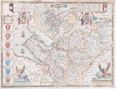
- John Speede Map The Countye Palatine of Chester with that most ancient citieBy John SpeedLocated in London, GBTo see our other views and maps of England - including London, Oxford and Cambridge, scroll down to "More from this Seller" and below it click on "See all from this Seller" - or send...Category
17th Century Realist Landscape Prints
MaterialsEngraving
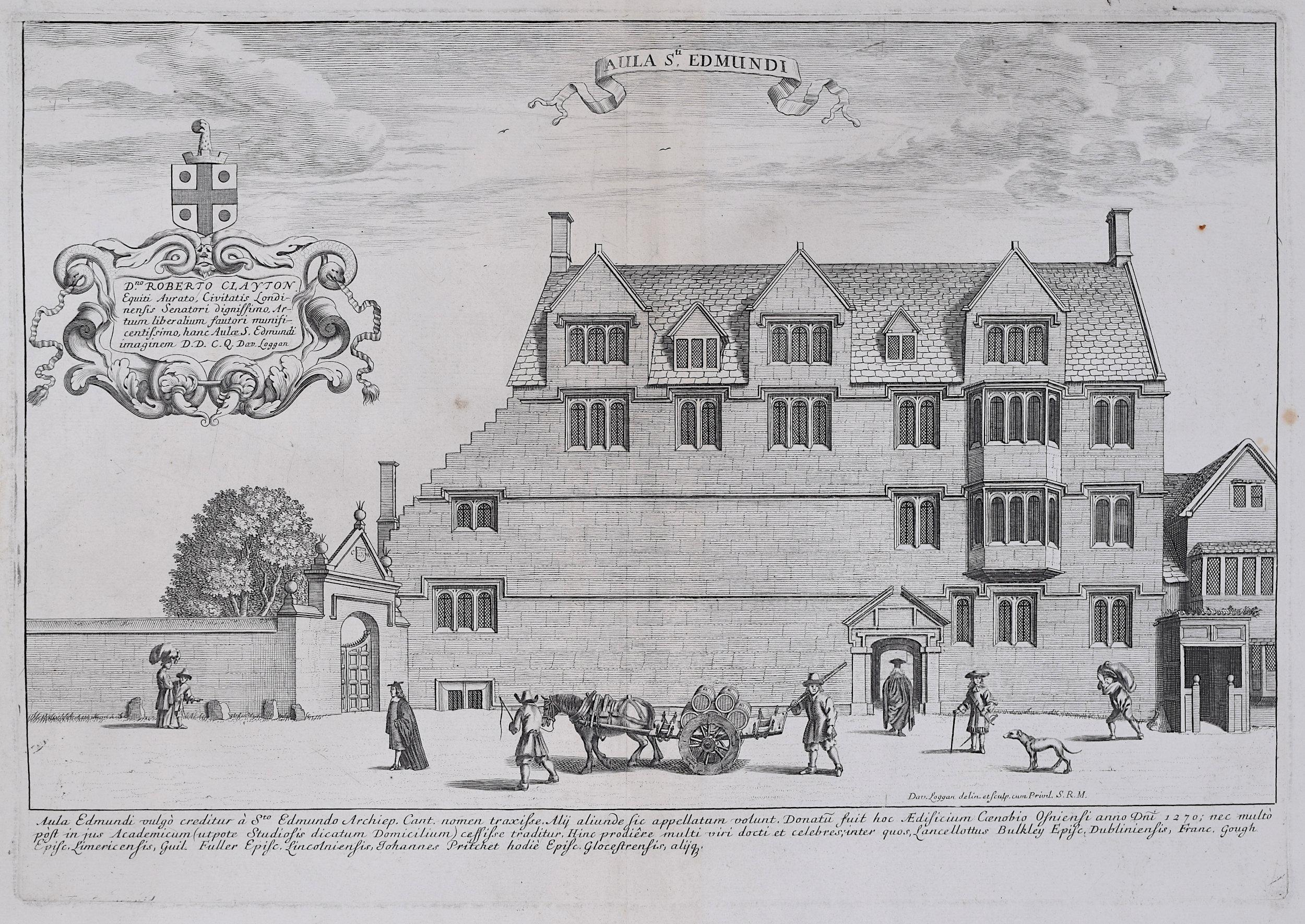
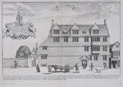
- David Loggan St Edmund Hall Oxford - Aula St Edmundi - 1675 engravingBy David LogganLocated in London, GBTo see our other views of Oxford and Cambridge, scroll down to "More from this Seller" and below it click on "See all from this Seller" - or send us a message if you cannot find the view you want. David Loggan (1634-1692) St Edmund Hall...Category
1670s Realist Prints and Multiples
MaterialsEngraving
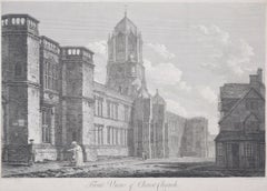
- Christ Church, Oxford 18th century engraving by John Dadley after Edward DayesLocated in London, GBTo see our other views of Oxford and Cambridge, scroll down to "More from this Seller" and below it click on "See all from this Seller" - or send us a message if you cannot find the ...Category
1790s Landscape Prints
MaterialsEngraving
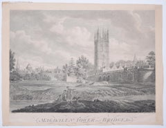
- Magdalen College, Oxford Tower and Bridge 18th century engraving by James BasireLocated in London, GBTo see our other views of Oxford and Cambridge, scroll down to "More from this Seller" and below it click on "See all from this Seller" - or send us a message if you cannot find the ...Category
1790s Landscape Prints
MaterialsEngraving
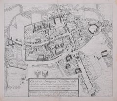
- The First Map of Oxford engraving by William Williams after Ralph AgasLocated in London, GBTo see our other views of Oxford and Cambridge, scroll down to "More from this Seller" and below it click on "See all from this Seller" - or send us a message if you cannot find the view you want. William Williams (active 1724 - 1733) after Ralph Agas (c. 1540 - 1621) The First Map of Oxford (1733) Engraving 47 x 54 cm In 1578, Ralph Agas drew the first ever map of Oxford, studded with the first colleges of the University. In 1733 it was engraved by William Williams for publication in the Oxonia Depicta, a book of illustrations depicting similar views as David Loggan's volume of engravings. Ralph Agas was an English surveyor and cartographer. He was born in Suffolk and lived there throughout his life, although he travelled regularly to London. He began to practise as a surveyor in about 1566, and has been described as "one of the leaders of the emerging body of skilled land surveyors". regular work consisted of drawing up local estate maps...Category
1730s Landscape Prints
MaterialsEngraving
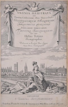
- University of Oxford Oxonia Illustrata 1675 engraving by David LogganBy David LogganLocated in London, GBTo see our other views of Oxford and Cambridge, scroll down to "More from this Seller" and below it click on "See all from this Seller" - or send us a message if you cannot find the ...Category
1670s Old Masters Prints and Multiples
MaterialsEngraving
You May Also Like
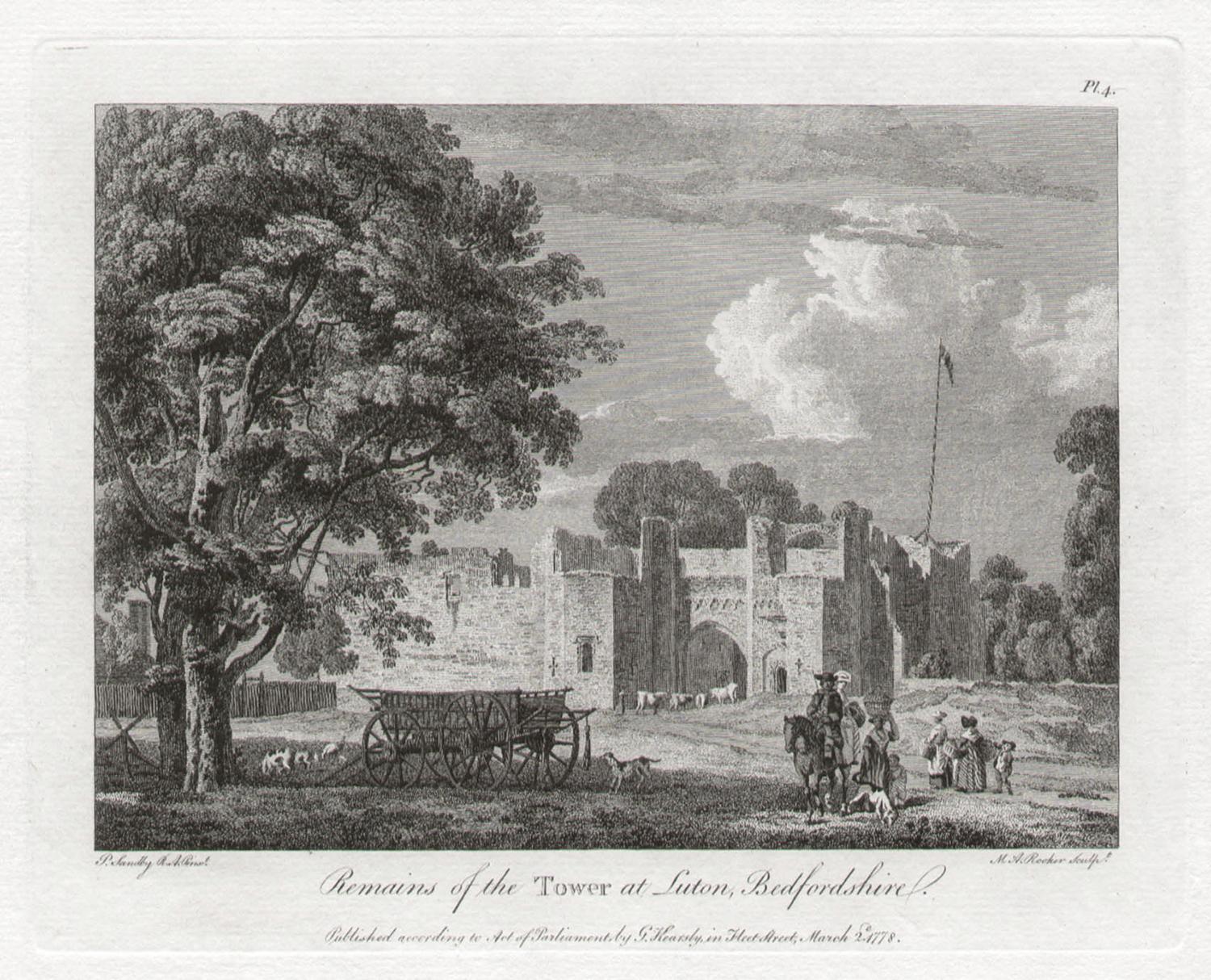
- Tower at Luton, Bedfordshire. Paul Sandby C18th English landscape engravingBy Paul SandbyLocated in Melbourne, Victoria'Remains of the Tower at Luton, Bedfordshire' Engraving by MA Rooker after Paul Sandby (1731-1809). From Paul Sandby's 'The Virtuosi's Museum, Containing Select Views in England, S...Category
18th Century Naturalistic Landscape Prints
MaterialsEngraving
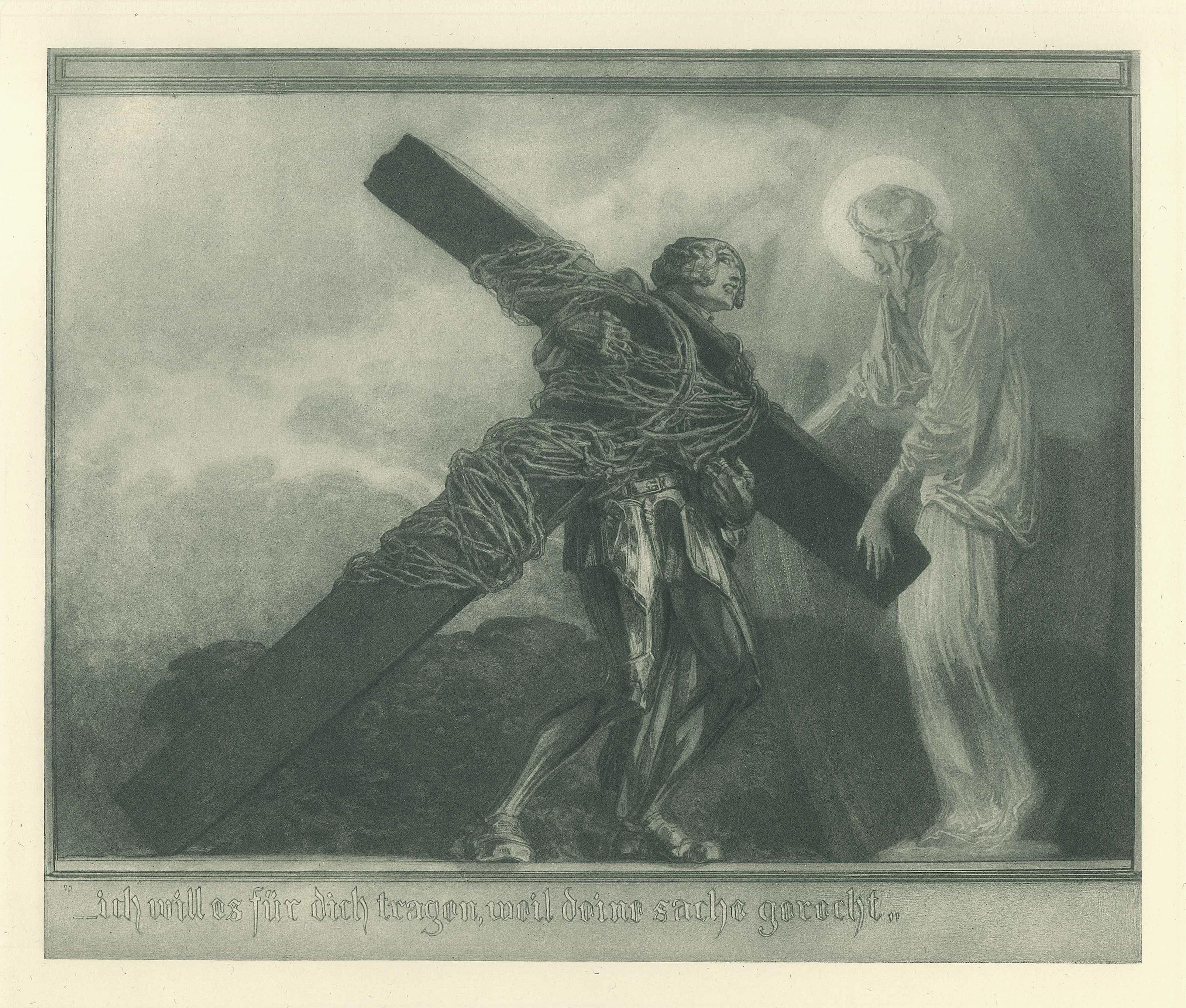
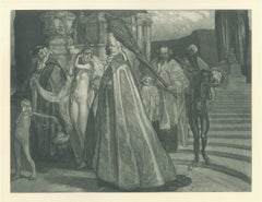
- Ich will es für dich trage - Vintage Héliogravure by Franz von Bayros - 1921 ca.By Franz von Bayros (Choisi Le Conin)Located in Roma, ITIch will es für dich tragen is a black and white héliogravure on cream-colored cardboard realized by Choisy Le Conin, pseudonym of Franz Von Bayros (Agram, 1866 – Vienna, 1924). Fro...Category
1920s Symbolist Figurative Prints
MaterialsEngraving
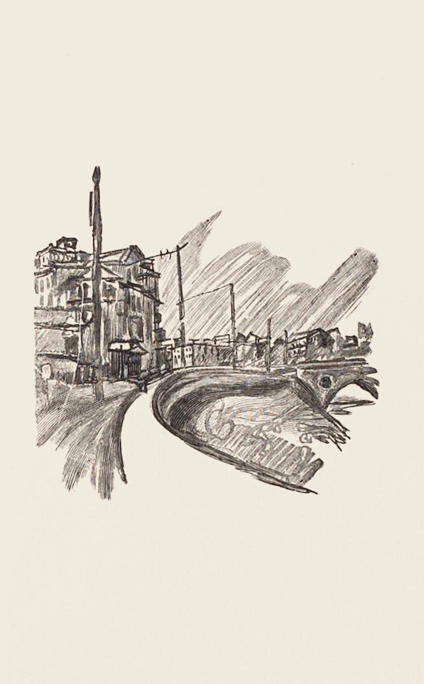
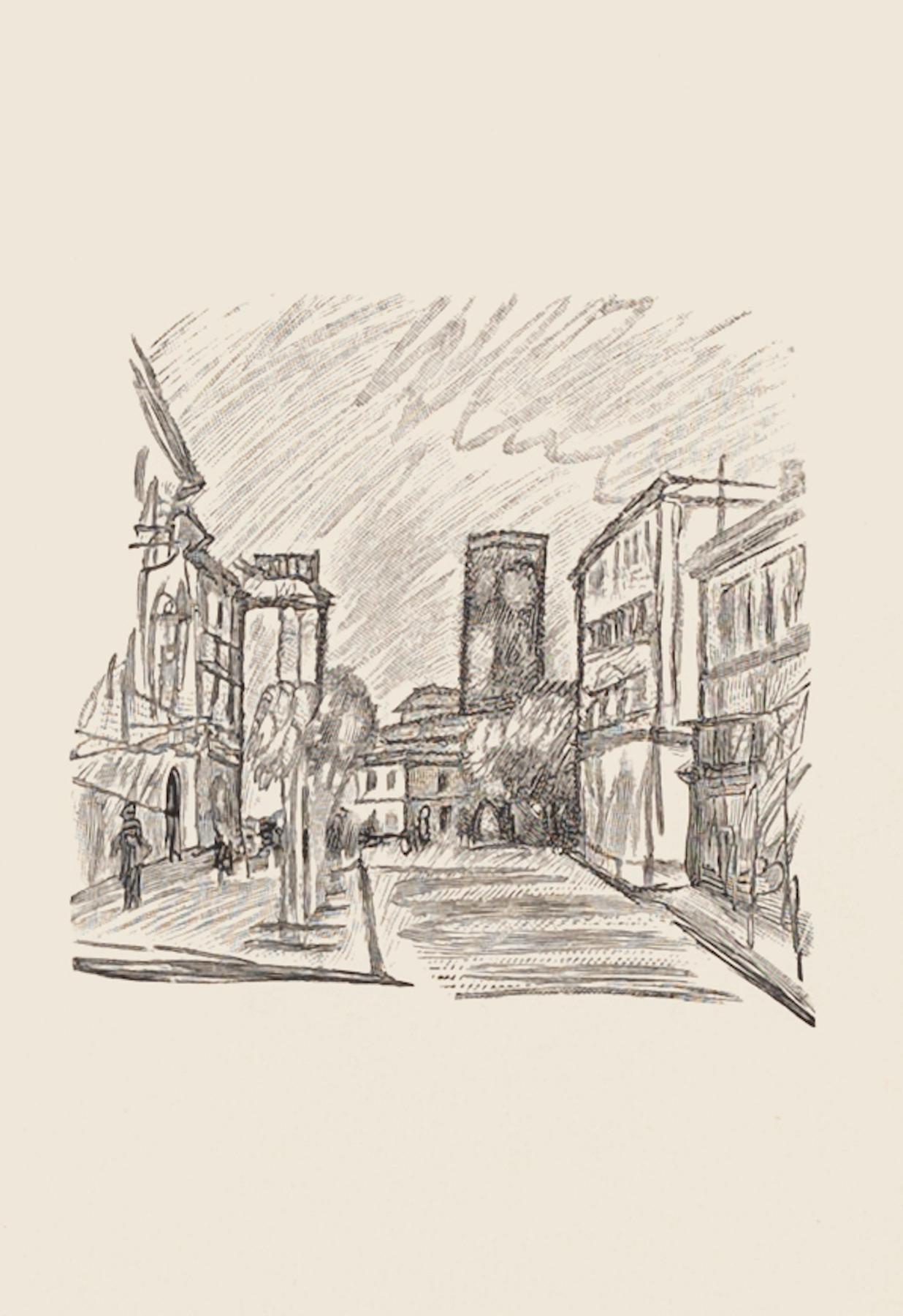
- The Road - Original Zincography by Mino Maccari - 1970sBy Mino MaccariLocated in Roma, ITThe Road is an original zincography artwork realized by Mino Maccari. Included a white Passepartout: 49 x 34 The state of preservation is very good. The artwork represents a land...Category
1970s Figurative Prints
MaterialsEngraving
- City - Original Zincography by Mino Maccari - 1970sBy Mino MaccariLocated in Roma, ITCity is an original zincography artwork realized by Mino Maccari. Included a white Passepartout: 49 x 34 The state of preservation is very good. The artwork represents a landscape...Category
1970s Figurative Prints
MaterialsEngraving
- Triumph der Salome - Vintage Héliogravure by Franz von Bayros - 1921 ca.By Franz von Bayros (Choisi Le Conin)Located in Roma, ITTriumph der Salome is a black and white héliogravure on cream-colored cardboard realized by Choisy Le Conin, pseudonym of Franz Von Bayros (Agram, 1866 – Vienna, 1924). From Mappe, ...Category
1920s Symbolist Figurative Prints
MaterialsEngraving
- Untitled - Original Drypoint by Eugene Corneau - XX CenturyBy Eugene CorneauLocated in Roma, ITUntitled is an original artwork realized by Eugène Corneau during the 1930s. Etching and drypoint on paper. Monogram in pencil on the lower left. Excellent conditions. Precious an...Category
20th Century Modern Landscape Prints
MaterialsDrypoint


Recently Viewed
View AllMore Ways To Browse
Antique Site
Engravings England
London England Engraving
Samuel London
Abbey Antique
Antique Abbey
St Clement
Castle Ruins
18th Century Monastery
Bucks County Antique
Dane Castle
Prince Charles Signed Lithographs
Uncolored Engraving
Waterloo Bridge
White Hogan
Windmill Etching
Black Heart Backpack
Christian Dior Original Sketch