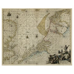
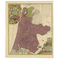
Antique Coastal Chart of the North Sea between England and the Netherlands, 1730
View Similar Items


Want more images or videos?
Request additional images or videos from the seller
1 of 5
Antique Coastal Chart of the North Sea between England and the Netherlands, 1730
About the Item
- Dimensions:Height: 20.63 in (52.4 cm)Width: 24.53 in (62.3 cm)Depth: 0 in (0.02 mm)
- Materials and Techniques:
- Period:1730-1739
- Date of Manufacture:circa 1730
- Condition:Repaired: backed using contemporary paper backed with acid free archival tape. Wear consistent with age and use.
- Seller Location:Langweer, NL
- Reference Number:Seller: PCT-56381 1stDibs: LU3054326706672
About the Seller
5.0
Platinum Seller
These expertly vetted sellers are 1stDibs' most experienced sellers and are rated highest by our customers.
Established in 2009
1stDibs seller since 2017
1,965 sales on 1stDibs
More From This SellerView All
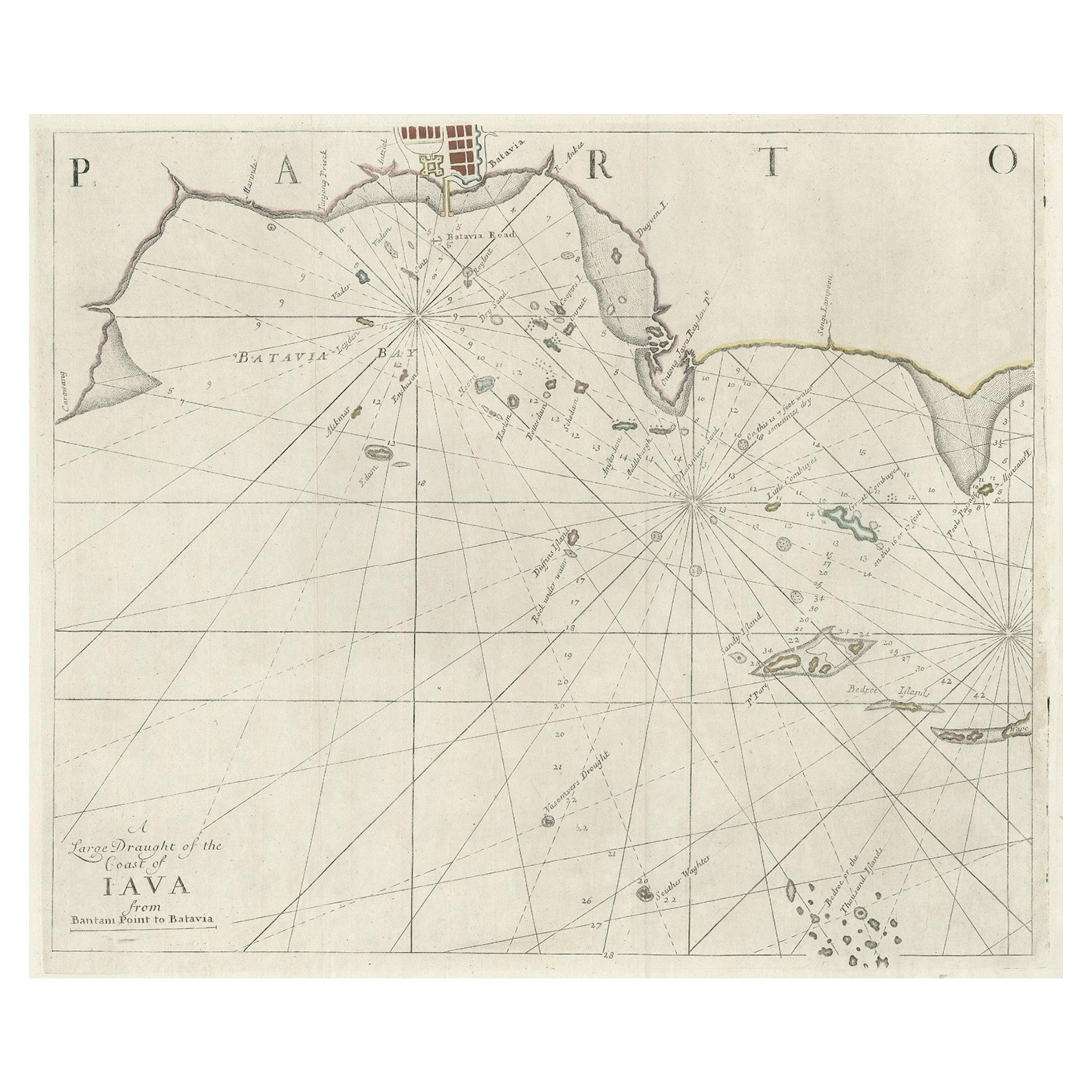
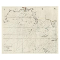
- Two Antique Sea Charts of the Thousand Islands between Batavia and Bantam, c1734Located in Langweer, NLAntique maps titled 'A large draught of the Coast of Iava from Bantam Point to Batavia'. Two seperate sheets, joined together they depict the island of Java, Indonesia. Condition...Category
Antique 1730s Maps
MaterialsPaper
 $1,461 Sale Price / set20% Off
 - Antique Sea Chart of North America by Ottens, circa 1745Located in Langweer, NLAntique map titled 'Septemtrionaliora Americae a Groenlandia (..)'. Sea chart of the northern waters of North America, including the coast of Labrador and pa...Category
Antique Mid-18th Century Maps
MaterialsPaper

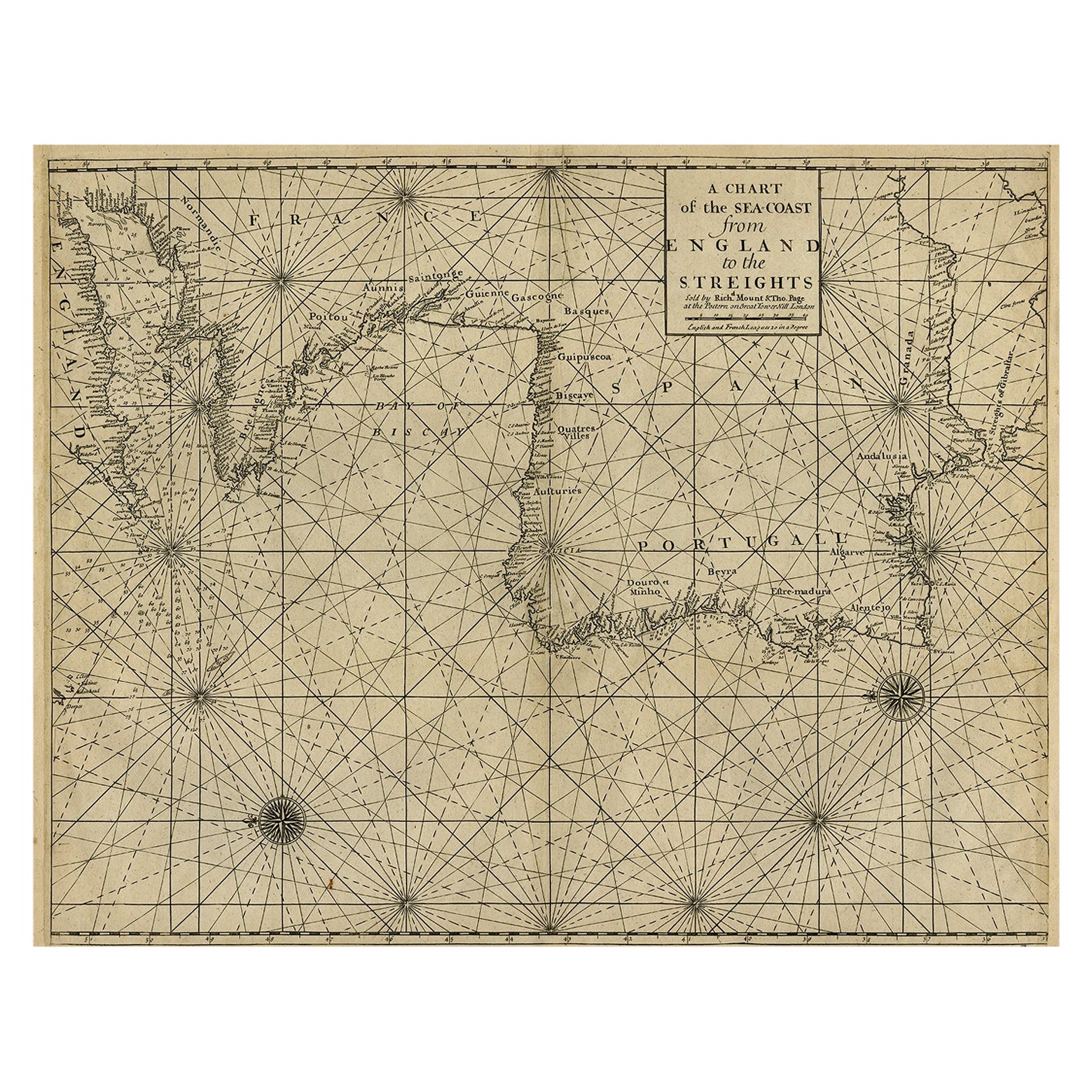
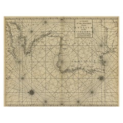
- Original Antique Sea Chart of the Coastline from England to Gibraltar, ca.1700Located in Langweer, NLAntique map titled 'A Chart of the Sea-Coast from England to the Streights.' Original antique map showing the European coastline from the South of England (and North of France) to ...Category
Antique Early 1700s Maps
MaterialsPaper
 $841 Sale Price20% Off
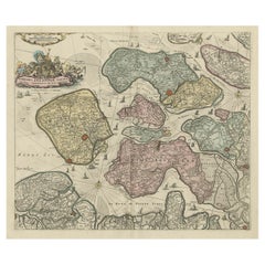
 - Decorative Antique Sea Chart of Zeeland, a Province of the Netherlands, ca.1730Located in Langweer, NLAntique map titled 'Comitatus Zelandiae Tabula emendata a Frederico De Wit'. Decorative sea chart of Zeeland, a province of the Netherlands. Although the title reads F. de Wit, thi...Category
Antique 1730s Maps
MaterialsPaper
 $1,018 Sale Price20% Off
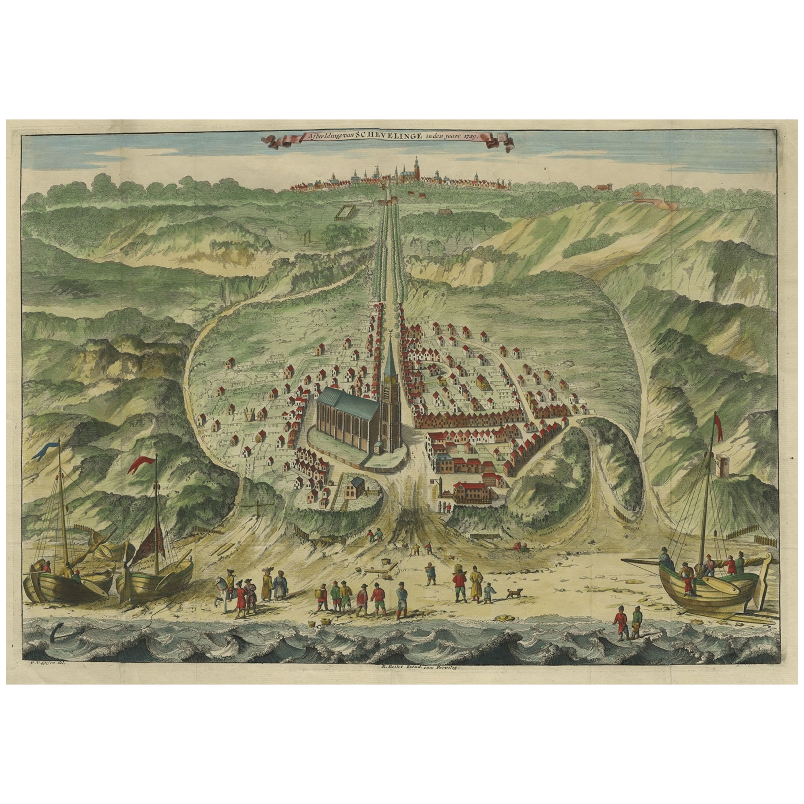
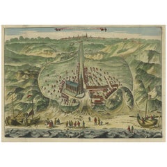
 - Antique Bird's Eye View of Scheveningen Near The Hague, the Netherlands, 1730Located in Langweer, NLAntique print titled 'Afbeeldinge van Schevelinge in den Jaare 1729'. Bird's eye view of Scheveningen near The Hague / Den Haag, the Netherlands. This print originates from 'Besc...Category
Antique 1730s Maps
MaterialsPaper
 $1,196 Sale Price20% Off
 - Beautiful Antique Map of the Province of Noord-Holland, the Netherlands, Ca.1730Located in Langweer, NLAntique map titled 'Kennemaria et Westfrisia vulgo et vernaculé Noord-Holland'. Beautiful original antique map of the province of Noord-Holland, the Netherlands. Two large elaborat...Category
Antique 1730s Maps
MaterialsPaper
You May Also LikeView All
- Antique Anatomical Wall Chart Depicting the Human SkeletonLocated in Berghuelen, DEA rare 19th century anatomical wall chart depicting the human skeleton. On the sides On the sides are detailed description in German language. The wall...Category
Early 20th Century German Victorian Prints
MaterialsPaper
- Original Antique Map of The Netherlands, Sherwood, Neely & Jones, Dated 1809Located in St Annes, LancashireGreat map of The Netherlands Copper-plate engraving by Cooper Published by Sherwood, Neely & Jones. Dated 1809 Unframed.Category
Antique Early 1800s English Maps
MaterialsPaper
- Original Antique Map of The Netherlands, Engraved by Barlow, Dated 1807Located in St Annes, LancashireGreat map of Netherlands Copper-plate engraving by Barlow Published by Brightly & Kinnersly, Bungay, Suffolk. Dated 1807 Unframed.Category
Antique Early 1800s English Maps
MaterialsPaper
- Large Antique 1859 Map of North AmericaLocated in Sag Harbor, NYThis Map was made by Augustus Mitchell in 1859 It is in amazing condition for being 163 years old. This price is for the rolled up easy to ship version of this piece. I will be Frami...Category
Antique Mid-19th Century American Maps
MaterialsCanvas, Paper

- Chart of the East Coast of EnglandLocated in Norwell, MAChart of the East Coast of England, from Dungeness to Flamborough, including the entrances to the Thames River. Drawn by hydrographer J.W. Norie in 1841. Includes Kent, Essex and Suf...Category
Antique 1840s English Nautical Objects
MaterialsPaper
- Anatomical Wall Chart Depicting the Human Lymphatic and Blood VesselsLocated in Berghuelen, DEA rare 19-carat anatomical wall chart depicting the human lymphatic and blood vessels. On the sides with detailed description in German language. Print...Category
Early 20th Century German Victorian Prints
MaterialsPaper


Recently Viewed
View AllMore Ways To Browse
Maritime Rose
Maritime Compass
Antique Compass Maritime Compasses
Antique Compass Maritime
Used Marine Compass
Middle East Maps
Mare Island
American Rose Plate
Map Of Middle East
Dutch Sailing
Antique Marine Compasses
Marine Compass
Antique Map Of Michigan
Astrology Map
Yugoslavia Map
Antique Map Bermuda
William Dampier
Denver Map