Items Similar to Antique Map of New England and Part of Canada by Vaugondy 'circa 1755'


Want more images or videos?
Request additional images or videos from the seller
1 of 5
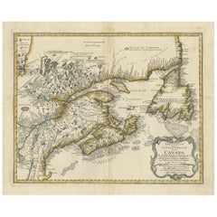
Antique Map of New England and Part of Canada by Vaugondy 'circa 1755'
About the Item
Antique map titled 'Partie de l'Amérique septent qui comprend la nouvelle France ou le Canada'. Decorative and highly detailed map of New England and part of Canada, extending east to Newfoundland, with a large inset map of the Great Lakes. The map covers the Gulf of St. Lawrence, St. Lawrence River, and surrounding territories including Newfoundland and Nova Scotia, as well as parts of Quebec, Ontario, New York, Maine, New Hampshire, and Vermont. Published by Robert de Vaugondy, circa 1755.
- Dimensions:Height: 20.08 in (51 cm)Width: 25.99 in (66 cm)Depth: 0.02 in (0.5 mm)
- Materials and Techniques:
- Period:
- Date of Manufacture:circa 1755
- Condition:Good, given age. A few minor unobtrusive spots. Original middle fold as issued. General age-related toning and/or occasional minor defects from handling. Please study images carefully.
- Seller Location:Langweer, NL
- Reference Number:Seller: PCT-589481stDibs: LU3054321366652
About the Seller
5.0
Platinum Seller
These expertly vetted sellers are 1stDibs' most experienced sellers and are rated highest by our customers.
Established in 2009
1stDibs seller since 2017
1,966 sales on 1stDibs
Typical response time: <1 hour
- ShippingRetrieving quote...Ships From: Langweer, Netherlands
- Return PolicyA return for this item may be initiated within 14 days of delivery.
Auctions on 1stDibs
Our timed auctions are an opportunity to bid on extraordinary design. We do not charge a Buyer's Premium and shipping is facilitated by 1stDibs and/or the seller. Plus, all auction purchases are covered by our comprehensive Buyer Protection. Learn More
More From This SellerView All
- Antique Map of New England and Eastern Canada by Homann Heirs, circa 1755Located in Langweer, NLAntique map titled 'Partie Orientale de la Nouvelle France ou du Canada (..)'. Original antique map of New England and Eastern Canada made a...Category
Antique Mid-18th Century Maps
MaterialsPaper
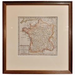
- Antique Map of France by Vaugondy, circa 1750Located in Langweer, NLAntique map titled 'La France divisée (..)'. Map of France published by Robert de Vaugondy, circa 1750. Frame included. We carefully pack our framed items to ensure safe shipping.Category
Antique Early 18th Century Maps
MaterialsPaper
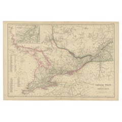
- Antique Map of Canada West and Part of Canada East by W. G. Blackie, 1859Located in Langweer, NLAntique map titled 'Canada West and Part of Canada East'. Original antique map of Canada West and Part of Canada East with inset map of Montreal. This ...Category
Antique Mid-19th Century Maps
MaterialsPaper
- Antique Map of America by Vaugondy, 1778Located in Langweer, NLAntique map titled 'Amerique ou Indes Occidentales (..)'. Vaugondy's map of America, pre-dating information from any of the Cook Voyages. The NW Coast of Amer...Category
Antique Late 18th Century Maps
MaterialsPaper
- Antique Map of the Eastern Part of the World by Tirion, 1755By Isaak TirionLocated in Langweer, NLAntique map titled 'Nieuwe Kaart van het Oostelykste Deel der Weereld, dienende tot Aanwyzing van de Scheepstogten der Nederlanderen naar Oostindië'. Australia (Nieuw Holland) shown ...Category
Antique Mid-18th Century Dutch Maps
MaterialsPaper
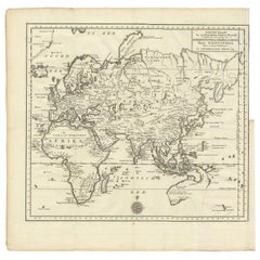
- Antique Map of the Indonesian and Philippine Archipelagos by R. de VaugondyLocated in Langweer, NLStriking and highly detailed map of the region from Sumatra and Malaca and Southern China to the Philipines, New Guinea and Northern Australia, centered on Borneo. Includes a large i...Category
Antique Mid-18th Century Maps
MaterialsPaper


You May Also Like
- California, Alaska and Mexico: 18th Century Hand-Colored Map by de VaugondyBy Didier Robert de VaugondyLocated in Alamo, CAThis an 18th century hand-colored map of the western portions of North America entitled "Carte de la Californie et des Pays Nord-Ouest separés de l'Asie par le détroit d'Anian, extra...Category
Antique 1770s French Maps
MaterialsPaper
- Old Horizontal Map of EnglandBy TassoLocated in Alessandria, PiemonteST/520 - Old rare Italian map of England, dated 1826-1827 - by Girolamo Tasso, editor in Venise, for the atlas of M.r Le-Sage.Category
Antique Early 19th Century Italian Other Prints
MaterialsPaper
- 17th Century Hand-Colored Map of Southeastern England by Mercator and HondiusBy Gerard MercatorLocated in Alamo, CAA 17th century copperplate hand-colored map entitled "The Sixt Table of England" by Gerard Mercator and Jodocus Hondius, published in Amsterdam in 1635 in 'Cosmographicall Descriptio...Category
Antique Mid-17th Century Dutch Maps
MaterialsPaper
- England, Scotland & Ireland: A Hand Colored Map of Great Britain by TirionBy Isaak TirionLocated in Alamo, CAThis is a hand-colored double page copperplate map of Great Britain entitled "Nieuwe Kaart van de Eilanden van Groot Brittannien Behelzende de Kon...Category
Antique Mid-18th Century Dutch Maps
MaterialsPaper
- Antique Map of Italy by Andriveau-Goujon, 1843By Andriveau-GoujonLocated in New York, NYAntique Map of Italy by Andriveau-Goujon, 1843. Map of Italy in two parts by Andriveau-Goujon for the Library of Prince Carini at Palazzo Carini i...Category
Antique 1840s French Maps
MaterialsLinen, Paper
- Antique Map of Principality of MonacoBy Antonio Vallardi EditoreLocated in Alessandria, PiemonteST/619 - "Old Geographical Atlas of Italy - Topographic map of ex-Principality of Monaco" - ediz Vallardi - Milano - A somewhat special edition ---Category
Antique Late 19th Century Italian Other Prints
MaterialsPaper


Recently Viewed
View AllMore Ways To Browse
Antique Canadian Furniture
Antique Furniture Canada
Canadian Antique Furniture
French Canadian Antique
Antique French Canadian Furniture
French Canadian Antique Furniture
Map Of England
Antique Map New
Antique Map England
Antique Map Of England
Antique Maps Of England
Great Lakes Antique
Used Furniture Ontario
Used Furniture Ontario Canada
New Hampshire Antique
Antique Map New England
Antique Map Of New England
Antique Maps New England