Items Similar to Antique Map of Surinam by Stedman '1813'


Want more images or videos?
Request additional images or videos from the seller
1 of 5
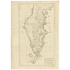
Antique Map of Surinam by Stedman '1813'
About the Item
Antique map titled 'A Map of Surinam'. Original antique map of Surinam, showing Dutch settlements, military posts, rebel Maroon camps and native villages. This map originates from 'Narrative of a five years' expedition against the revolted negroes of Surinam' by John Gabriel Stedman. Published 1813.
- Dimensions:Height: 10.24 in (26 cm)Width: 19.3 in (49 cm)Depth: 0.02 in (0.5 mm)
- Materials and Techniques:
- Period:
- Date of Manufacture:1813
- Condition:General age-related toning. Original folding lines, minor wear. Blank verso. Please study images carefully.
- Seller Location:Langweer, NL
- Reference Number:
About the Seller
5.0
Platinum Seller
These expertly vetted sellers are 1stDibs' most experienced sellers and are rated highest by our customers.
Established in 2009
1stDibs seller since 2017
1,967 sales on 1stDibs
Typical response time: <1 hour
- ShippingRetrieving quote...Ships From: Langweer, Netherlands
- Return PolicyA return for this item may be initiated within 14 days of delivery.
More From This SellerView All
- Antique Map of France by Lapie, 1842Located in Langweer, NLAntique map titled 'Carte de France'. Map of France. This map originates from 'Atlas universel de géographie ancienne et moderne (..)' by Pierre M. Lapie and Alexandre E. Lapie. Pier...Category
Antique Mid-19th Century Maps
MaterialsPaper
- Antique Map of Switzerland by Lapie, 1842Located in Langweer, NLAntique map titled 'Carte de la Suisse ou Helvetie'. Map of Switzerland. This map originates from 'Atlas universel de géographie ancienne et moderne...Category
Antique Mid-19th Century Maps
MaterialsPaper
- Antique Map of Germany by Lapie, 1842Located in Langweer, NLAntique map titled 'Carte de la Germanie Ancienne'. Map of Germany. This map originates from 'Atlas universel de géographie ancienne et moderne (..)' by...Category
Antique Mid-19th Century Maps
MaterialsPaper
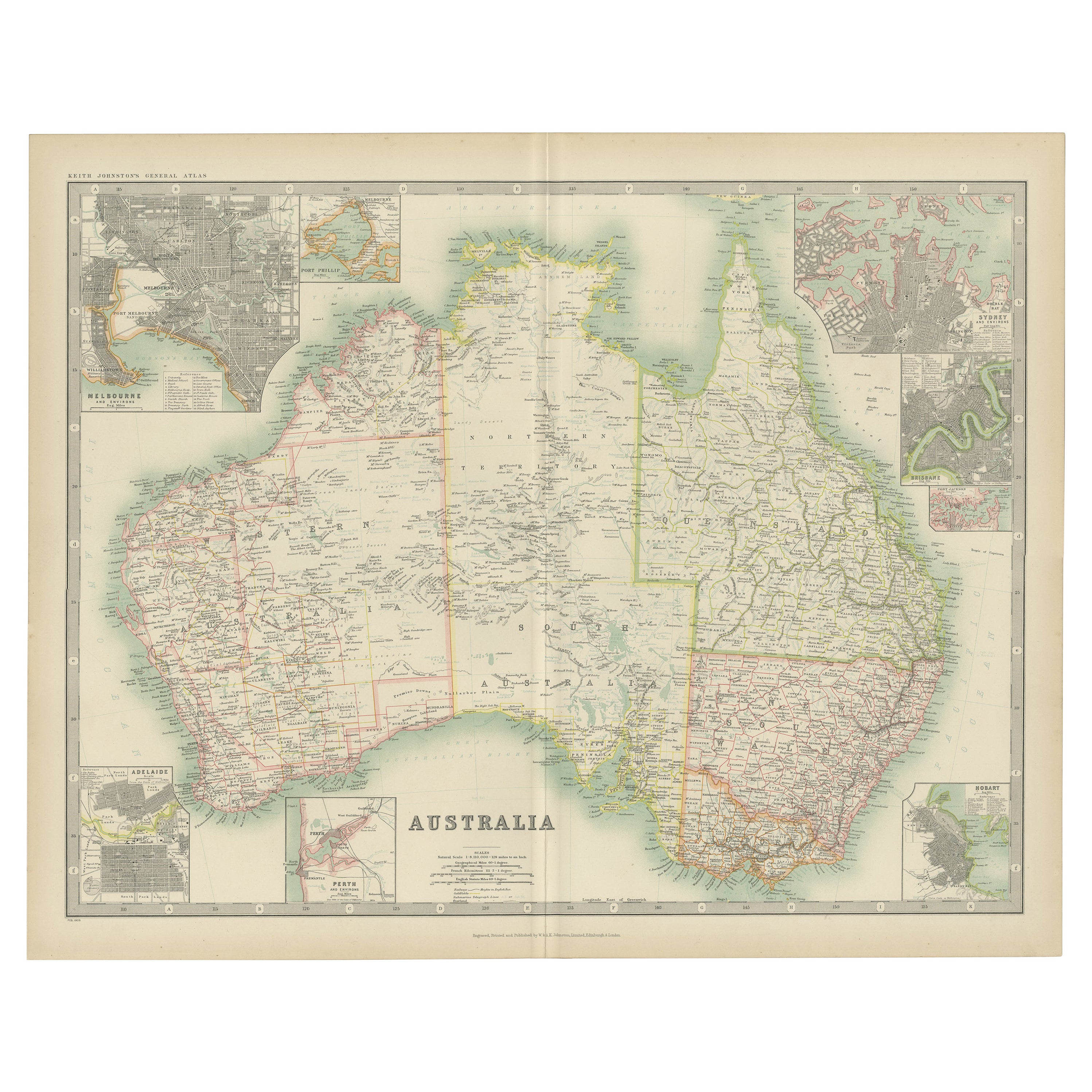
- Antique Map of Australia by Johnston '1909'Located in Langweer, NLAntique map titled 'Australia'. Original antique map of Australia. With inset maps of Melbourne, Port Phillip, Adelaide, Perth, Sydney, Brisba...Category
Early 20th Century Maps
MaterialsPaper
- Antique Map of Oceania by Levasseur, '1875'Located in Langweer, NLAntique map titled 'Carte générale de l'Océanie'. Large map of Oceania. This map originates from 'Atlas de Géographie Moderne Physique et Politique' by A. Levasseur. Published 1875.Category
Antique Late 19th Century Maps
MaterialsPaper
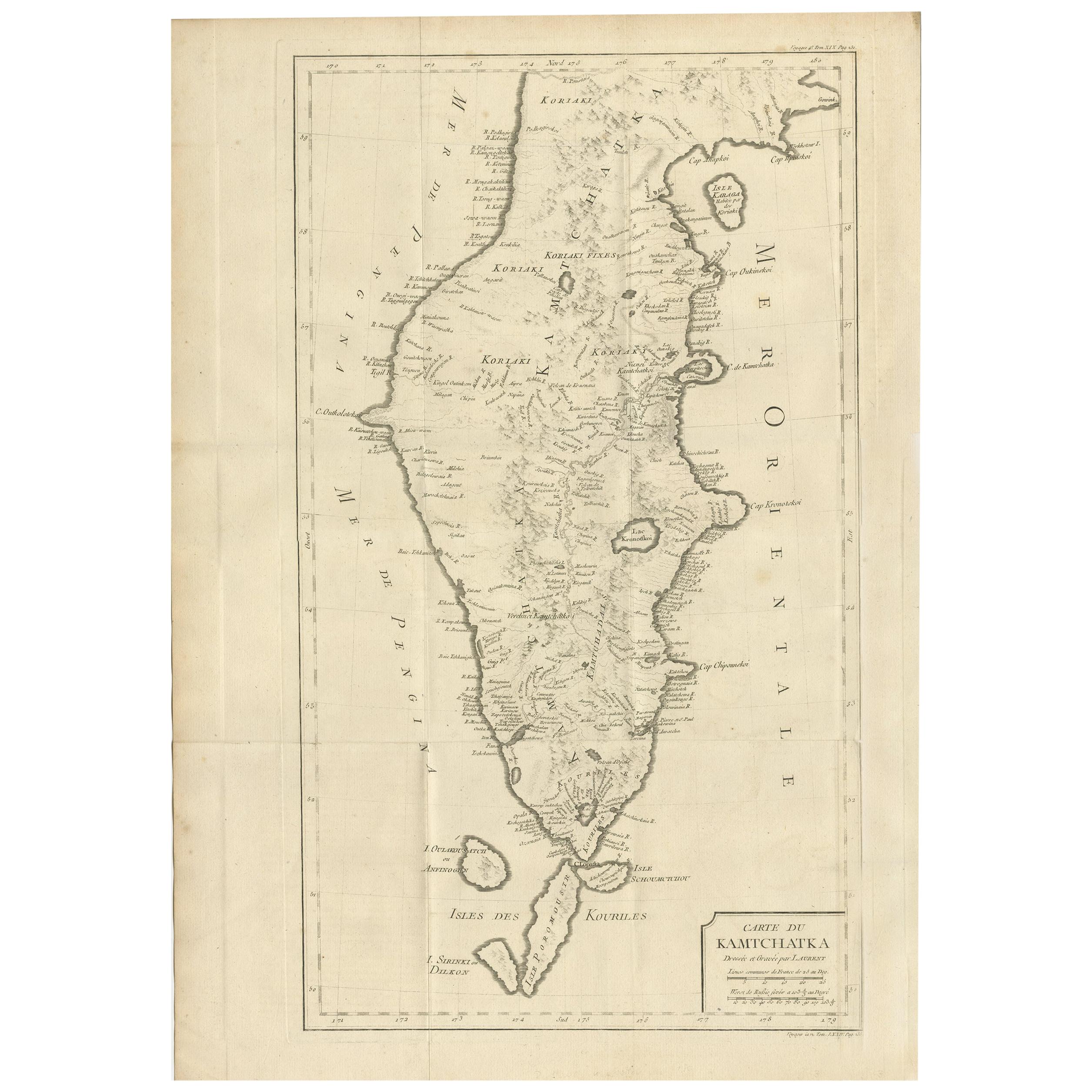
- Antique Map of Kamtchatka by Didot, '1759'Located in Langweer, NLAntique map titled 'Carte du Kamtchatka'. Antique map of the Kamchatka Peninsula. The map includes the island of Ouiakous Atch ou Anfinogen, Schoumctchou, and Sirinki ou Dilkon. Orig...Category
Antique Mid-18th Century Maps
MaterialsPaper


You May Also Like
- Antique Map of Italy by Andriveau-Goujon, 1843By Andriveau-GoujonLocated in New York, NYAntique Map of Italy by Andriveau-Goujon, 1843. Map of Italy in two parts by Andriveau-Goujon for the Library of Prince Carini at Palazzo Carini i...Category
Antique 1840s French Maps
MaterialsLinen, Paper
- Antique Map of Principality of MonacoBy Antonio Vallardi EditoreLocated in Alessandria, PiemonteST/619 - "Old Geographical Atlas of Italy - Topographic map of ex-Principality of Monaco" - ediz Vallardi - Milano - A somewhat special edition ---Category
Antique Late 19th Century Italian Other Prints
MaterialsPaper
- Original Antique Map of Russia By Arrowsmith. 1820Located in St Annes, LancashireGreat map of Russia Drawn under the direction of Arrowsmith Copper-plate engraving Published by Longman, Hurst, Rees, Orme and Brown, 1820 Unframed.Category
Antique 1820s English Maps
MaterialsPaper
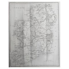
- Original Antique Map of Ireland by Hughes. C.1850Located in St Annes, LancashireGreat map of Ireland Engraved by W.Hughes Published by Virtue, C.1850 Unframed.Category
Antique 1850s Scottish Other Maps
MaterialsPaper
- Original Antique Map of Scotland by Becker. C.1850Located in St Annes, LancashireGreat map of Scotland Engraved by F.P Becker Published by Virtue, C.1850 Unframed.Category
Antique 1850s Scottish Other Maps
MaterialsPaper
- Original Antique Map of Sweden, Engraved by Barlow, 1806Located in St Annes, LancashireGreat map of Sweden Copper-plate engraving by Barlow Published by Brightly & Kinnersly, Bungay, Suffolk. 1806 Unframed.Category
Antique Early 1800s English Maps
MaterialsPaper