Items Similar to Antique Plan of Santiago, Chili, 1747


Want more images or videos?
Request additional images or videos from the seller
1 of 6
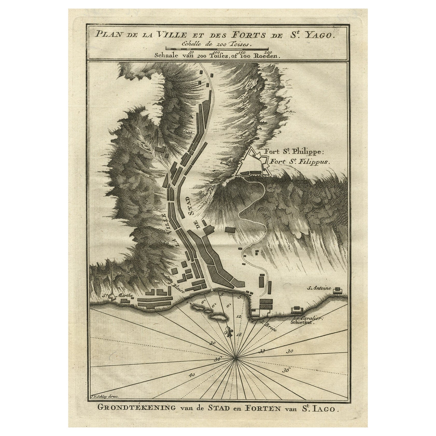
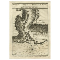
Antique Plan of Santiago, Chili, 1747
About the Item
Antique print titled 'Plan de la Ville et des Forts de St. Yago, Grondtekening van de Stad en Forten van St. Iago'. Plan of the forts and town of Santiago, the largest island of Cape Verde. This print originates from 'Historische beschryving der reizen, of Nieuwe en volkoome verzameling van de aller-waardigste en zeldsaamste Zee- en Landtogten' by P. de Hondt.
Artists and Engravers: Jakob van der Schley (1715-1779) was a Dutch draughtsman and engraver, who studied under Bernard Picart. Jacques-Nicolas Bellin (1703-1772) was a French hydrographer, geographer and member of The Philosophes. His career, spanning over 50 years, caused an enormous output in maps, particular of maritime interest.
Condition: Good, given age. General age-related toning and/or occasional minor defects from handling. Please study scan carefully.
Date: 1747
Overall size: 19.5 x 25 cm.
Image size: 14.5 x 21 cm.
We sell original antique maps to collectors, historians, educators and interior decorators all over the world. Our collection includes a wide range of authentic antique maps from the 16th to the 20th centuries. Buying and collecting antique maps is a tradition that goes back hundreds of years. Antique maps have proved a richly rewarding investment over the past decade, thanks to a growing appreciation of their unique historical appeal. Today the decorative qualities of antique maps are widely recognized by interior designers who appreciate their beauty and design flexibility. Depending on the individual map, presentation, and context, a rare or antique map can be modern, traditional, abstract, figurative, serious or whimsical. We offer a wide range of authentic antique maps for any budget.
- Creator:Jakob van der Schley (Artist)
- Dimensions:Height: 9.85 in (25 cm)Width: 7.68 in (19.5 cm)Depth: 0 in (0.01 mm)
- Materials and Techniques:
- Period:
- Date of Manufacture:1747
- Condition:Condition: Good, given age. General age-related toning and/or occasional minor defects from handling. Please study scan carefully.
- Seller Location:Langweer, NL
- Reference Number:
About the Seller
5.0
Platinum Seller
These expertly vetted sellers are 1stDibs' most experienced sellers and are rated highest by our customers.
Established in 2009
1stDibs seller since 2017
1,966 sales on 1stDibs
Typical response time: <1 hour
- ShippingRetrieving quote...Ships From: Langweer, Netherlands
- Return PolicyA return for this item may be initiated within 14 days of delivery.
More From This SellerView All
- Antique Plan of the Forts and Town of St. Yago in the Cape Verde Islands, 1747By Jakob van der SchleyLocated in Langweer, NLAntique map titled 'Plan de la Ville et des Forts de St. Yago - Grondtekening van de Stad en Forten van St. Iago'. Plan of the Forts and Town of St. Yago in the Cape Verde Islands. T...Category
Antique 18th Century Maps
MaterialsPaper
- Antique Map of Sweden by Bowen, 1747Located in Langweer, NLAntique map titled 'A New & Accurate Map of Sweden'. This map covers Sweden and Finland (shown as part of Sweden) as well as parts of modern day Estonia,...Category
Antique 18th Century Maps
MaterialsPaper
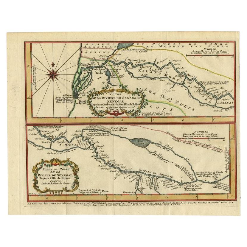
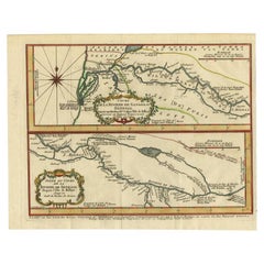
- Antique Map of the Sanaga River, Senegal, 1747Located in Langweer, NLAntique map titled 'Cours De La Riviere De Sanaga Ou Senegal (..) - Kaart van den Loop der Riviere Sanaga (..)'. Attractive double map of the Sanaga River, Senegal, Africa. This map ...Category
Antique 18th Century Maps
MaterialsPaper
- Antique Map of Moscovy 'Russia' by E. Bowen, 1747Located in Langweer, NLBeautiful map of European Russia by the English cartographer Emmanuel Bowen. It depicts the European portion of Russia extending from the Gulf of Finland to the Ural Mountains. The m...Category
Antique Mid-18th Century Maps
MaterialsPaper
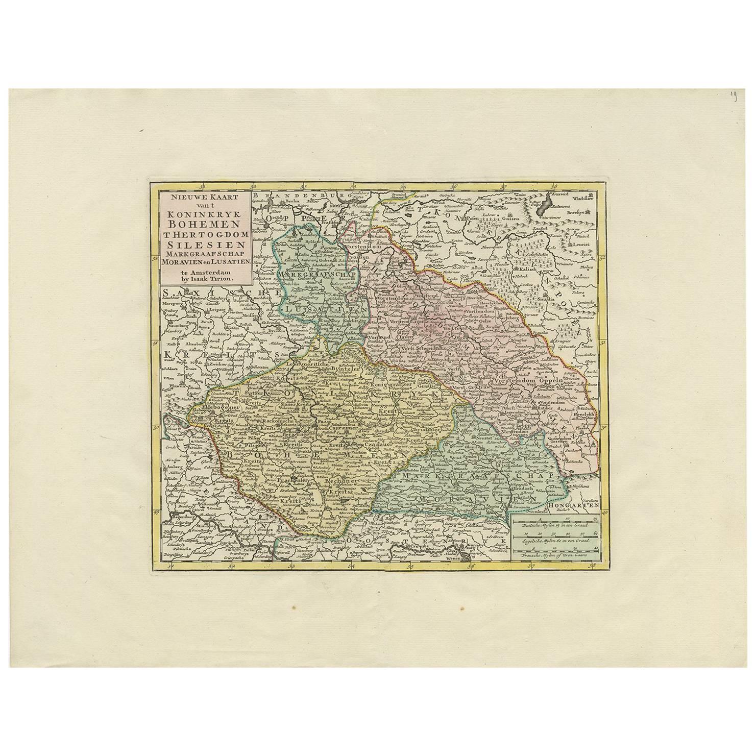
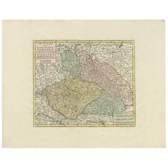
- Antique Map of Czech Republic by I. Tirion, 1747Located in Langweer, NLAntique map titled 'Nieuwe Kaart van t Koninkryk Bohemen t Hertogdom Silesien markgraafschap Moravien en Lusatien'. Including the towns of Berlin, Vienna, Regensburg.Category
Antique Mid-18th Century Maps
MaterialsPaper
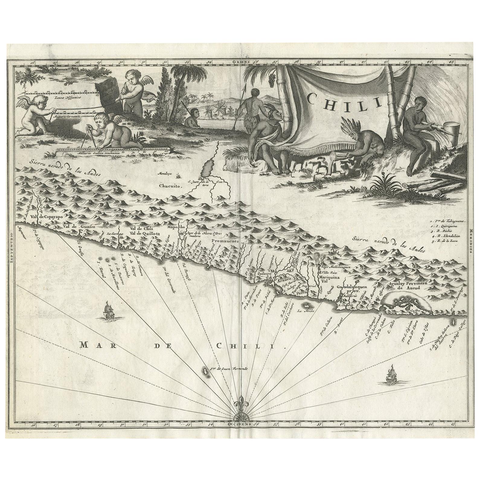
- Antique Map of Chili by Montanus, circa 1671By Arnoldus MontanusLocated in Langweer, NLAntique map titled 'Chili'. A very attractive map covering the known coastal region of Chile. The Andes are shown prominently, with two live volcanoes in the vicinity of Villarrica. ...Category
Antique Mid-17th Century Maps
MaterialsPaper


You May Also Like
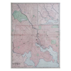
- Original Antique City Plan of Milwaukee, USA, 1894By Rand McNally & Co.Located in St Annes, LancashireFabulous colorful map of Milwaukee Original color By Rand, McNally & Co. Published, 1894 Unframed Free shipping.Category
Antique 1890s American Maps
MaterialsPaper
- Plan of Paris, France, by A. Vuillemin, Antique Map, 1845Located in Colorado Springs, COThis large and detailed plan of Paris was published by Alexandre Vuillemin in 1845. The map conveys a wonderful amount of information and is decorated throughout with pictorial vigne...Category
Antique 1840s American Maps
MaterialsPaper
- Original Antique City Plan of Kansas City, USA. 1894By Rand McNally & Co.Located in St Annes, LancashireFabulous colorful map of Kansas City Original color By Rand, McNally & Co. Published, 1894 Unframed Slightly reduced bottom margin. Free shipping.Category
Antique 1890s American Maps
MaterialsPaper
- Large Original Antique City Plan of Baltimore, USA, 1894By Rand McNally & Co.Located in St Annes, LancashireFabulous colorful map of Baltimore Original color By Rand, McNally & Co. Published, 1894 Unframed Free shipping.Category
Antique 1890s American Maps
MaterialsPaper
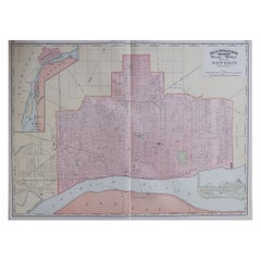
- Large Original Antique City Plan of Detroit, USA, 1894By Rand McNally & Co.Located in St Annes, LancashireFabulous colorful map of Detroit Original color By Rand, McNally & Co. Published, 1894 Unframed Free shipping.Category
Antique 1890s American Maps
MaterialsPaper
- Antique "New Plan of London" Map by John Bartholomew, 1900Located in Bridgeport, CTProduced for the W.H. Smith guide, folded in the original. The map here is unfolded and framed flat, with transportation routes shown and color details. sight 22 x 32" (original ful...Category
Antique Early 1900s English Victorian Maps
MaterialsPaper


Recently Viewed
View AllMore Ways To Browse
Cape Dutch Furniture
Van Der Zee
Cape Dutch Antique Furniture
Antique Furniture Cape Town
Antique Caribbean Maps
Antique Furniture Durham
Antique Furniture Tasmania
Antique Maps Caribbean
Large Antique Maps North America
Map Of Peru
Philippines Map
Sri Lanka Map
Victor Levasseur On Sale
Antique Map Of Caribbean
Antique Map Of The Caribbean
Colonies Map
Antique Engravings Globe
Antique Engravings Globes