Items Similar to Coat of Arms of the Netherlands, Including Coats of Arms of the Provinces, 1864
Want more images or videos?
Request additional images or videos from the seller
1 of 5
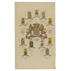
Coat of Arms of the Netherlands, Including Coats of Arms of the Provinces, 1864
About the Item
Antique print titled 'Je Mantiendrai'. Coat of arms of the Netherlands, also includes coats of arms of the individual Dutch provinces. This print originates from 'F. C. Brugsma's Atlas van het Koninkrijk der Nederlanden (..)'.
Artists and Engravers: Author: Frederik Carel Brugsma. Published by J.B. Wolters.
- Dimensions:Height: 10.04 in (25.5 cm)Width: 6.11 in (15.5 cm)Depth: 0 in (0.02 mm)
- Materials and Techniques:
- Period:
- Date of Manufacture:1864
- Condition:Wear consistent with age and use. Condition: Good, general age-related toning. Minor wear and soiling, blank verso. Please study image carefully.
- Seller Location:Langweer, NL
- Reference Number:
About the Seller
5.0
Platinum Seller
These expertly vetted sellers are 1stDibs' most experienced sellers and are rated highest by our customers.
Established in 2009
1stDibs seller since 2017
1,966 sales on 1stDibs
Typical response time: <1 hour
- ShippingRetrieving quote...Ships From: Langweer, Netherlands
- Return PolicyA return for this item may be initiated within 14 days of delivery.
More From This SellerView All
- Antique Print with Coats of Arms of The Netherlands, 1864Located in Langweer, NLAntique print titled 'Je Mantiendrai'. Coat of arms of the Netherlands, also includes coats of arms of the individual Dutch provinces. This print origi...Category
Antique 19th Century Prints
MaterialsPaper
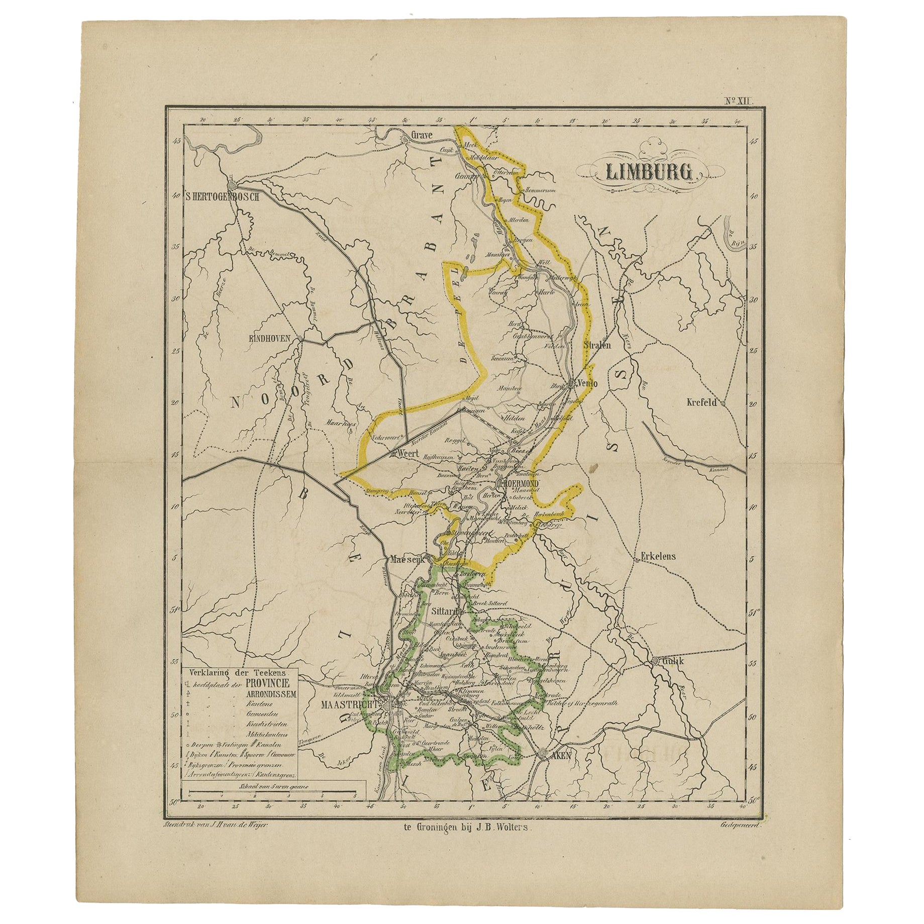
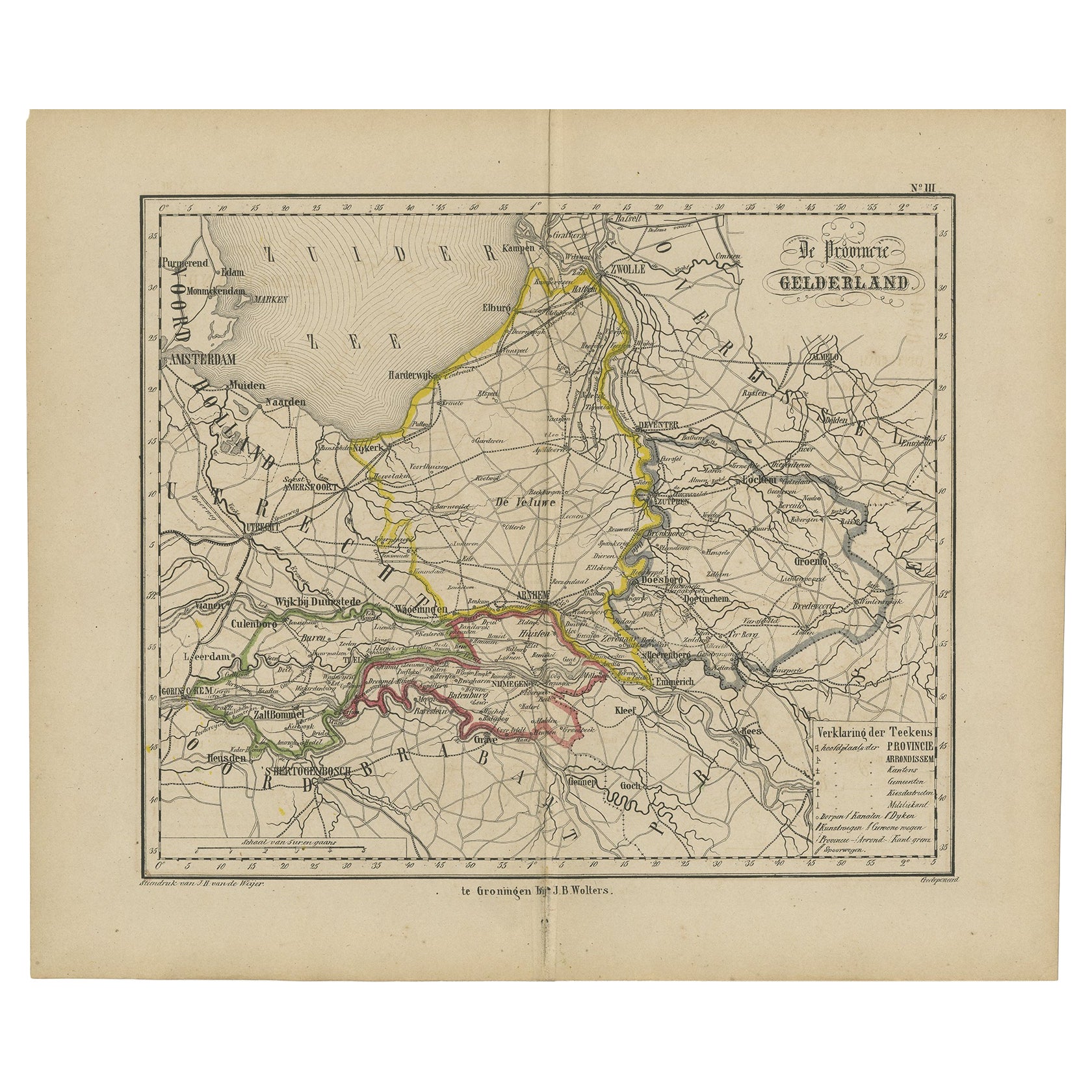
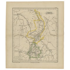
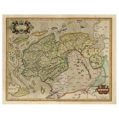
- Antique Map of the Province Limburg, The Netherlands, 1864Located in Langweer, NLAntique map titled 'De Provincie Limburg'. Map of the province of Limburg, the Netherlands. This map originates from 'F. C. Brugsma's Atlas van het Koninkrijk der Nederlanden (..)'. ...Category
Antique 19th Century Maps
MaterialsPaper
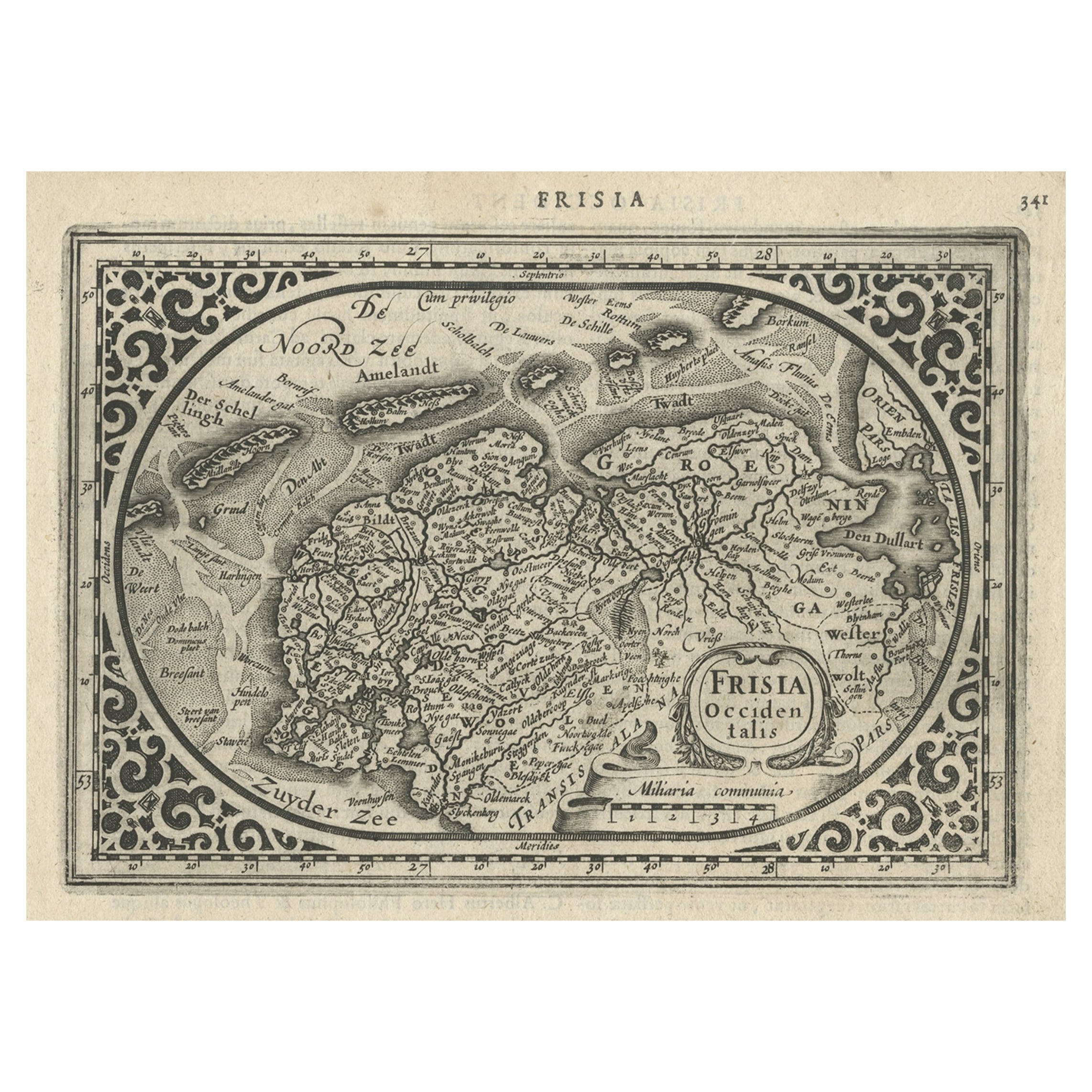
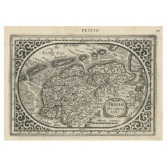
- Antique Map of Friesland and Groningen, Provinces of the Netherlands, 1628Located in Langweer, NLAntique map Friesland titled 'Frisia Occidentalis'. Small, decorative map of the province of Friesland, the Netherlands. Second state, out of three, originating from 'Atlas Minor' by...Category
Antique 17th Century Maps
MaterialsPaper
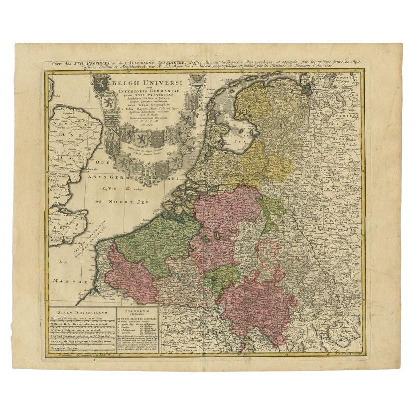
- Antique Map of the Seventeen Provinces of Netherlands, Belgium, Luxembourg, 1748By Homann HeirsLocated in Langweer, NLAntique map titled 'Belgii Universi seu Inferioris Germaniae quam XVII Provinciae (..)'. Map of the Seventeen Provinces after Tobias Meier, published by Homann's Heirs in 1748. The...Category
Antique 18th Century Maps
MaterialsPaper
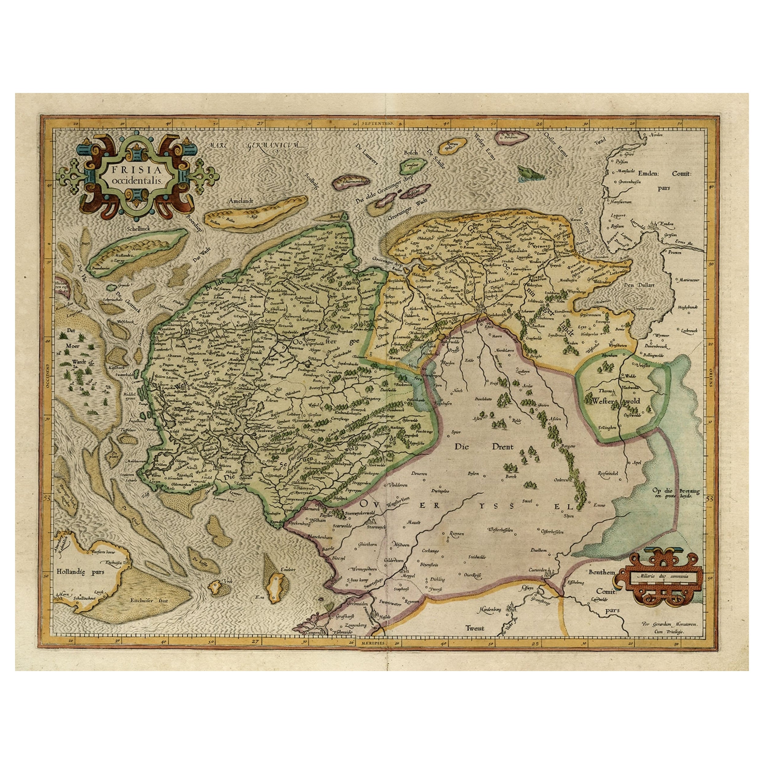
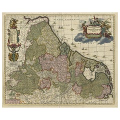
- Old Map of the Dutch Provinces of Friesland and Groningen, The Netherlands, 1604Located in Langweer, NLAntique print, titled: 'Frisiae Occidentalis.' Handsome map of the Dutch Provinces of Friesland and Groningen. Embellished with strapwork title-car...Category
Antique Early 1600s Maps
MaterialsPaper
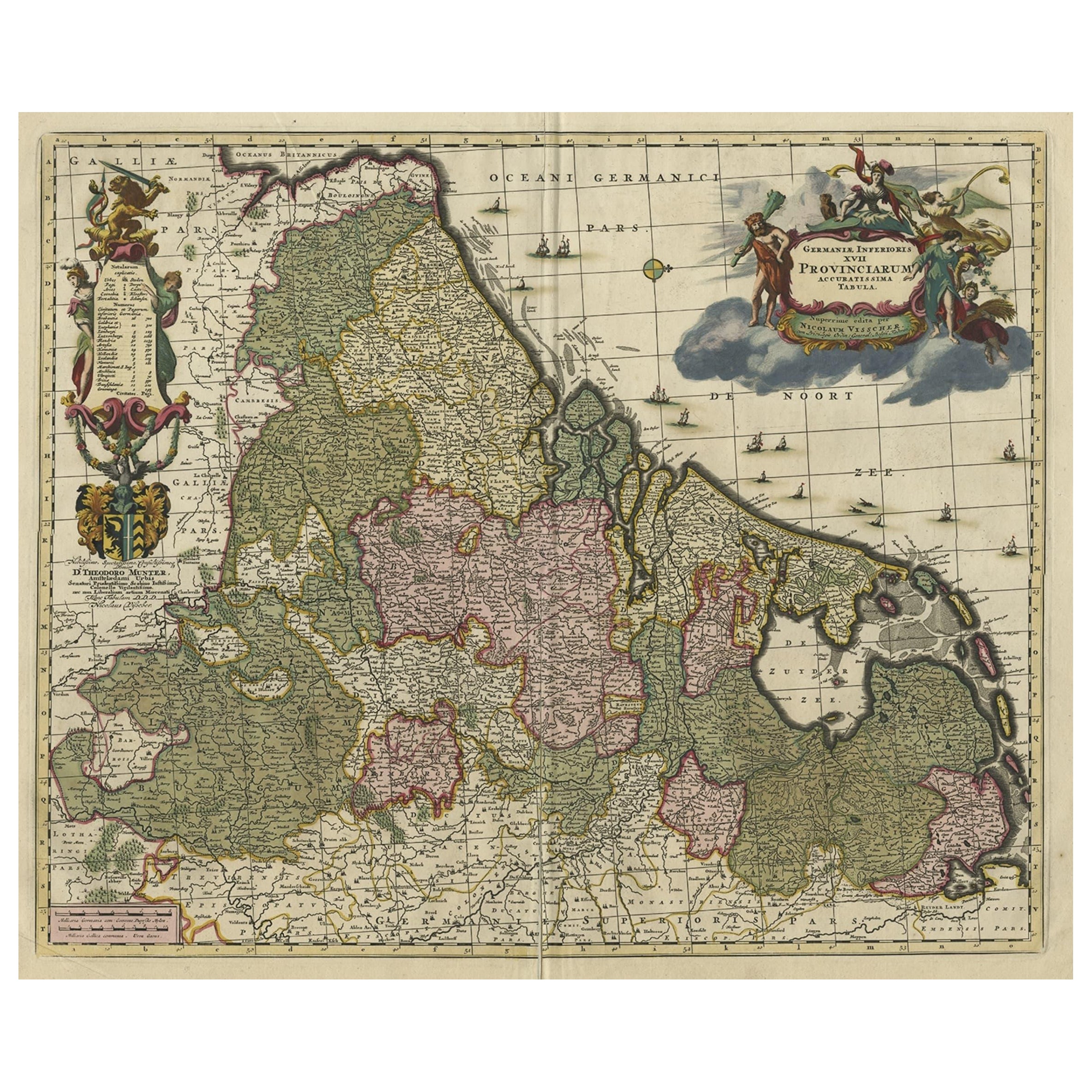
- Antique Decorative Map of the Low Countries, '17 Provinces, Netherlands', c.1680Located in Langweer, NLDescription: Antique map titled 'Germaniae Inferioris XVII Provinciarum Accuratissima Tabula.' Map of the low countries (17 provinces, Netherlands). The map is dedicated to Theod...Category
Antique 1680s Maps
MaterialsPaper

You May Also Like
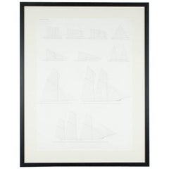
- "Balance of Sail" Print by Day & Son, Lithographers to the Queen, Dated 1864By Vincent Brooks, Day and SonsLocated in London, GBA Victorian framed print of "Balance of Sail" by Day and Son, lithographers to the Queen. The bottom of the print is inscribed: LONDON. PUBL...Category
Antique Mid-19th Century European Prints
- Hand Colored 18th Century Homann Map of Austria Including Vienna and the DanubeBy Johann Baptist HomannLocated in Alamo, CA"Archiducatus Austriae inferioris" is a hand colored map of Austria created by Johann Baptist Homann (1663-1724) and published in Nuremberg, Germany in 1728 shortly after his death. ...Category
Antique Early 18th Century German Maps
MaterialsPaper
- 1864 "Proclamation of Emancipation, " Antique Engraving by Charles ShoberLocated in Colorado Springs, COThis 1865 engraving features the Emancipation Proclamation in elaborate calligraphic text, with five patriotic vignettes and a small portrait...Category
Antique 1860s American Historical Memorabilia
MaterialsPaper
- Original Antique Map of The Netherlands, Engraved by Barlow, Dated 1807Located in St Annes, LancashireGreat map of Netherlands Copper-plate engraving by Barlow Published by Brightly & Kinnersly, Bungay, Suffolk. Dated 1807 Unframed.Category
Antique Early 1800s English Maps
MaterialsPaper
- Original Antique Map of The Netherlands, Sherwood, Neely & Jones, Dated 1809Located in St Annes, LancashireGreat map of The Netherlands Copper-plate engraving by Cooper Published by Sherwood, Neely & Jones. Dated 1809 Unframed.Category
Antique Early 1800s English Maps
MaterialsPaper
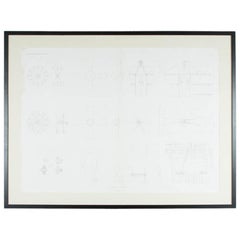
- PADDLE WHEELS & SCREW PROPELLERS by Day & Son, Lithographers to the Queen, 1864By Vincent Brooks, Day and SonsLocated in London, GBA Victorian framed print of "PADDLE WHEELS & SCREW PROPELLERS" by Day and Son, Lithographers to the Queen. Plate from The Modern System of Naval...Category
Antique Mid-19th Century English Nautical Objects
MaterialsPaper


Recently Viewed
View AllMore Ways To Browse
Large Vintage Display Cabinet
Bar Cabinet With Light
Oval Table Mirror
Red Chinese Cabinets
Very Large Display Cabinet
Vintage 1940s Accessories
Vintage 1940S Accessories
Vintage Cowboy Fashion
Vintage Faux Fur
Vintage Medallion Italy
White French Commodes
Antique Beveled Glass Doors
Antique Doors Beveled Glass
Antique French Cabinet 1800
Bed Asian Design
Black Cupboard
French Candelabra Clock
French Ormolu Display Cabinet