Items Similar to 18th Century Antique Engraving of the Southern Hemisphere by G. de L'Isle

Want more images or videos?
Request additional images or videos from the seller
1 of 7
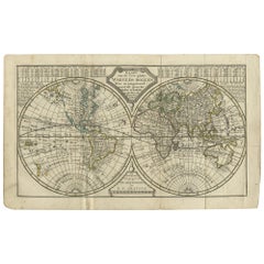
18th Century Antique Engraving of the Southern Hemisphere by G. de L'Isle
About the Item
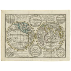
Antique map titled 'Hemisphere Meridional pour voir plus distinctement Les Terres Australes'. Hemispherical map of the southern hemisphere centered on the South Pole showing tracks of explorers, up to and including Cook's third and last voyage. Relief is shown pictorially.
Probably from a subsequent edition after 1782 after: Atlas geographiques et universel /? par Guil. de l'Isle et Phil. Buache. Paris: Dezauche.
- Creator:Guillaume De L'Isle (Artist)
- Dimensions:Height: 21.58 in (54.8 cm)Width: 29.93 in (76 cm)Depth: 0.02 in (0.5 mm)
- Materials and Techniques:Paper,Engraved
- Period:
- Date of Manufacture:circa 1783
- Condition:Wear consistent with age and use. Please study images carefully.
- Seller Location:Langweer, NL
- Reference Number:
About the Seller
5.0
Platinum Seller
These expertly vetted sellers are 1stDibs' most experienced sellers and are rated highest by our customers.
Established in 2009
1stDibs seller since 2017
1,967 sales on 1stDibs
Typical response time: <1 hour
- ShippingRetrieving quote...Ships From: Langweer, Netherlands
- Return PolicyA return for this item may be initiated within 14 days of delivery.
More From This SellerView All
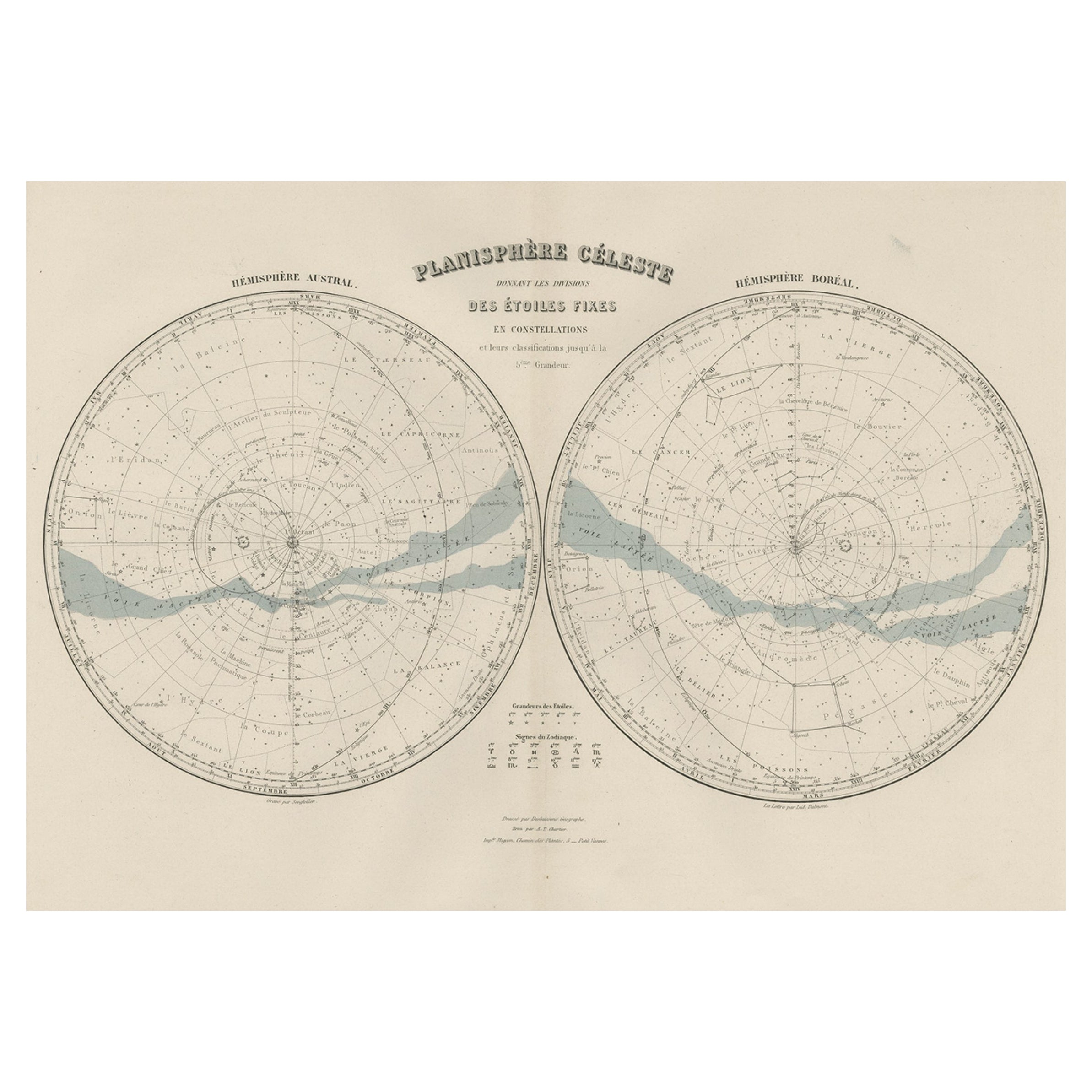
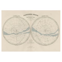
- Antique Map of the Night Skies of the Northern and Southern Hemispheres, 1880Located in Langweer, NLAntique world map titled 'Planisphère en Céleste'. This map depicts the night skies of both the northern and southern hemispheres. This map originates from 'Géographie Universell...Category
Antique 1880s Maps
MaterialsPaper
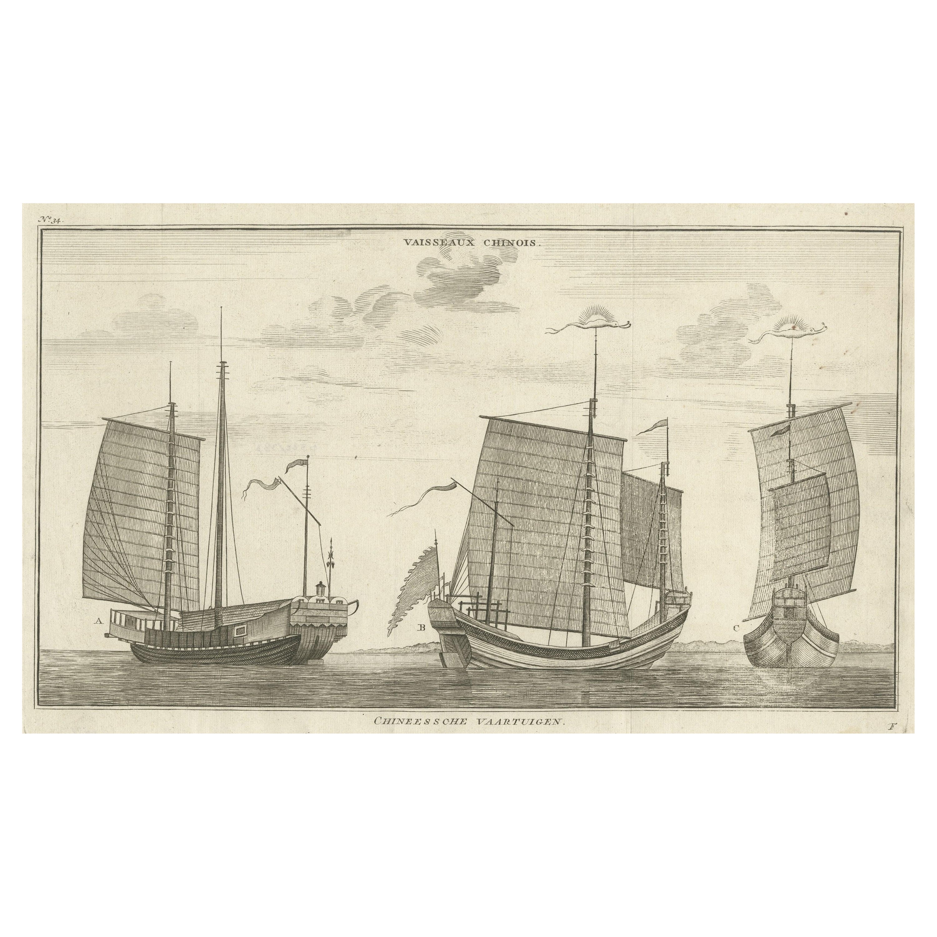
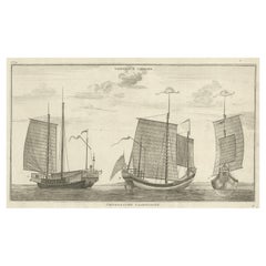
- Antique Original Engraving of Chinese Vessels in the 18th Century, 1765Located in Langweer, NLDescription: Plate no.34: 'Vaisseaux chinois.' (Chinese vessels.) This original auhentic plate originates from: 'Reize rondom de werreld, Gedaan in de jaaren 1740 tot 1744, door den ...Category
Antique 1760s Prints
MaterialsPaper
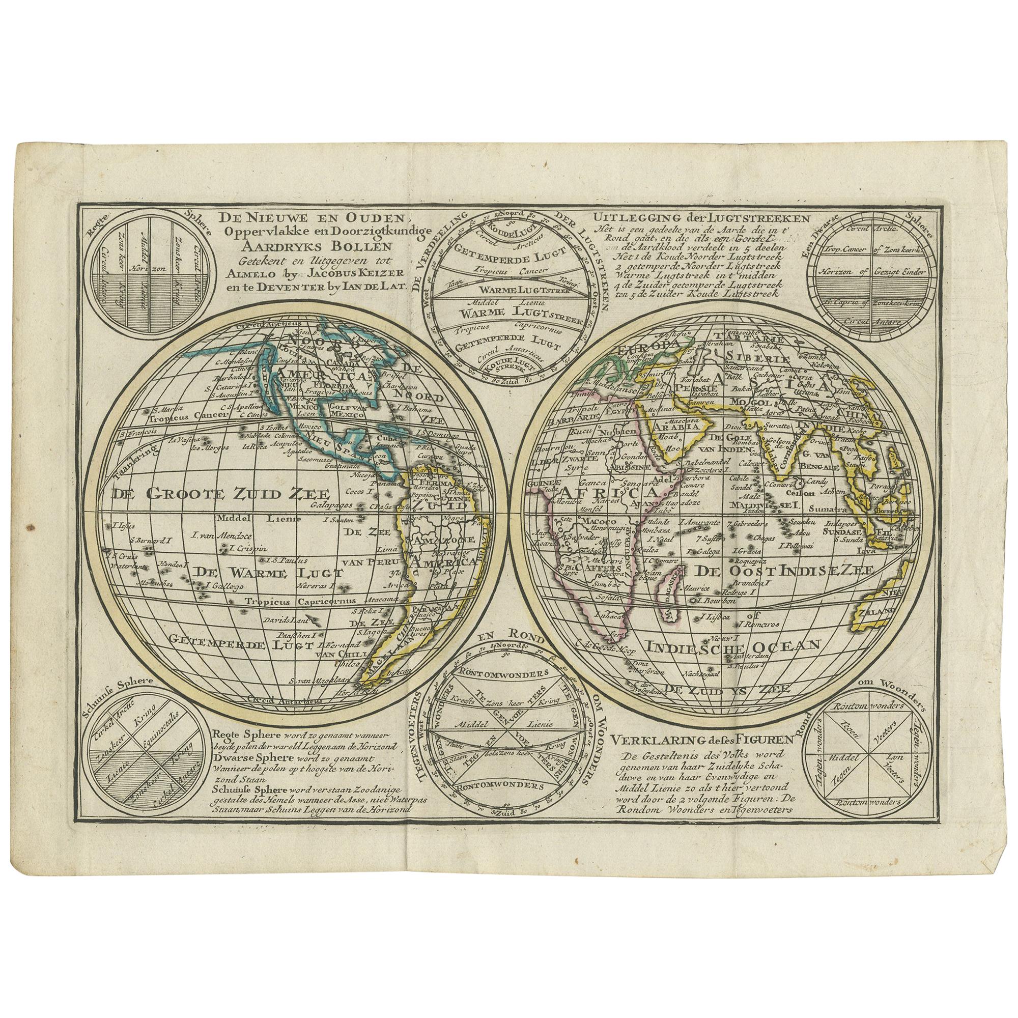
- Interesting Antique Engraving of the World in Hemispheres with 6 Diagrams, 1788Located in Langweer, NLAntique map titled 'De Nieuwe en Ouden oppervlakke en doorzigtkundige Aardrykes Bollen (..)'. Twin hemispheres surrounded by six diagrams showing various divisions of the globe. Cali...Category
Antique Late 18th Century Maps
MaterialsPaper
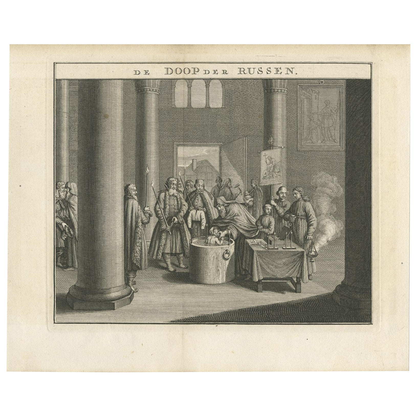
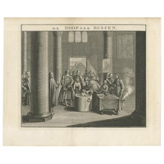
- Mid-18th Century Engraving Depicting The Baptism of Russians, 1735Located in Langweer, NLDescription: Antique print titled 'De Doop der Russen' (Dutch for 'Baptism of the Russians') Old print depicting the baptism of Russians. This print originates from 'Hedendaegsch...Category
Antique 1730s Prints
MaterialsPaper
- Antique Map of the World in Hemispheres by Keizer & de Lat, 1788Located in Langweer, NLAntique map titled 'Schuine Ronde Aard-Bolle waar van 't Middelpunt is Amsterdam (..)'. Interesting double hemisphere world map on polar projections. In North America, there is a large Island of California. Australia and New Zealand are shown with incomplete coastlines. The map contains six smaller astronomical...Category
Antique Late 18th Century Maps
MaterialsPaper
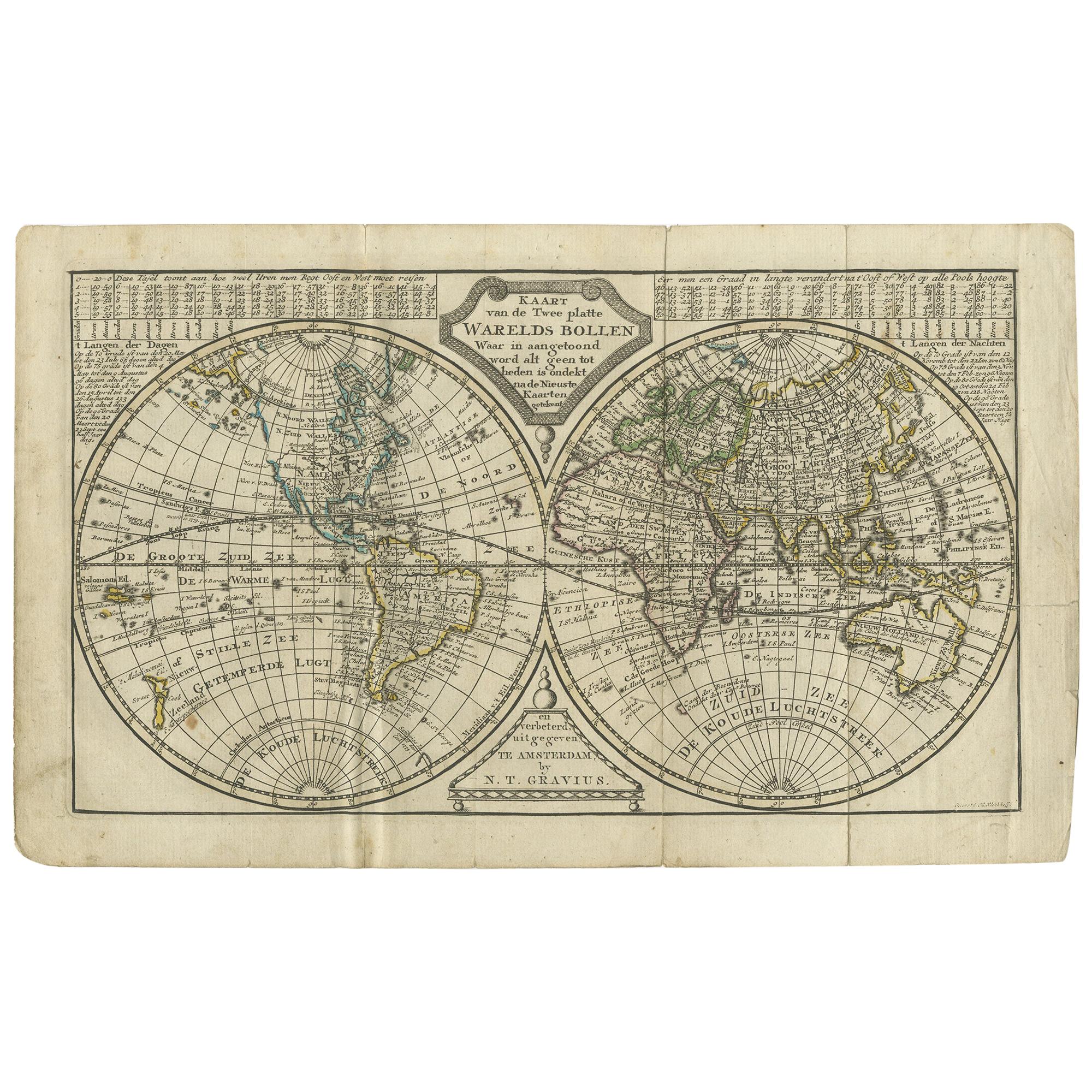
- Antique Map of the World in two Hemispheres by Keizer & de Lat, 1788Located in Langweer, NLAntique map titled 'Kaart van de Twee platte Warelds Bollen (..)'. Interesting world map in two hemispheres. California shown as a labeled island with place names and an indented nor...Category
Antique Late 18th Century Maps
MaterialsPaper

You May Also Like
- The Kingdom of Naples and Southern Italy: A Hand-Colored 18th Century Homann MapBy Johann Baptist HomannLocated in Alamo, CA"Novissima & exactissimus Totius Regni Neapolis Tabula Presentis Belli Satui Accommo Data" is a hand colored map of southern Italy and the ancient Kingdom of Naples created by Johann...Category
Antique Early 18th Century German Maps
MaterialsPaper
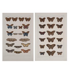
- Antique Albertus Seba Pair 18th Century Hand-Colored Engravings ButterflyBy Albertus Seba 1Located in Washington, DCRare pair of original hand-colored prints from Sir Albertus Seba's cabinet of natural curiosities. Prints come from published volumes in Amste...Category
Antique Mid-18th Century Dutch Prints
MaterialsPaper
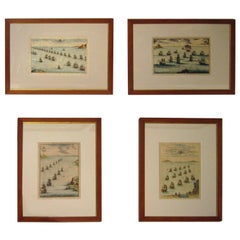
- 18th century Set Hand Colored Nautical EngravingsBy M. OgierLocated in Savannah, GASigned M. Ogier (Fecit:by), this set of four hand colored engravings is part of a larger edition of plates. These plates are numbered PL 16, 347, 365 and 386. The subject is probably...Category
Antique 18th Century Unknown Elizabethan Prints
MaterialsGlass, Wood, Paper
- Germany West of the Rhine: A Hand-colored 18th Century Map by de WitBy Frederick de WitLocated in Alamo, CAThis original 18th century hand-colored map of the county of Moers, Germany entitled "Illustrissimo Celsissmo Principi GUILIELMO HENRICO D.G. Arausionum Principi Domino suo Clementis...Category
Antique Early 18th Century Dutch Maps
MaterialsPaper
- Large 17th Century Hand Colored Map of England and the British Isles by de WitBy Frederick de WitLocated in Alamo, CAA large hand colored 17th century map of England and the British Isles by Frederick de Wit entitled "Accuratissima Angliæ Regni et Walliæ Principatus", published in Amsterdam in 1680. It is a highly detailed map of England, Scotland, the Scottish Isles...Category
Antique Late 17th Century Dutch Maps
MaterialsPaper
- Antique 18th Century Map of the Province of Pensilvania 'Pennsylvania State'Located in Philadelphia, PAA fine antique of the colony of Pennsylvania. Noted at the top of the sheet as a 'Map of the province of Pensilvania'. This undated and anonymous map is thought to be from the Gentleman's Magazine, London, circa 1775, although the general appearance could date it to the 1760's. The southern boundary reflects the Mason-Dixon survey (1768), the western boundary is placed just west of Pittsburgh, and the northern boundary is not marked. The map has a number of reference points that likely refer to companion text and appear to be connected to boundaries. The western and southern boundaries are marked Q, R, S, for example. A diagonal line runs from the Susquehanna R to the Lake Erie P. A broken line marked by many letters A, B, N, O, etc., appears in the east. There are no latitude or longitude markings, blank verso. Framed in a shaped contemporary gilt wooden frame and matted under a cream colored matte. Bearing an old Graham Arader Gallery...Category
Antique 18th Century British American Colonial Maps
MaterialsPaper


Recently Viewed
View AllMore Ways To Browse
Pictorial Map
South Pole
Antique Furniture Dundee
Antique Map Chicago
Antique Map Copenhagen
Antique Map Malta
Antique Map Of Malta
Antique Maps Of Malta
Antique Maps Of Pennsylvania
Antique Queensland
Mitchell Antique Maps
North Carolina Map
Otto Petri
Ottoman Map
Alexandria Map
Antique Bassett Furniture
Antique Furniture Furniture Nova Scotia
Antique Furniture Nova Scotia Furniture