
Want more images or videos?
Request additional images or videos from the seller
1 of 6
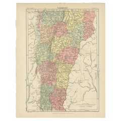
Antique Map of Arkansas
About the Item
Antique map titled 'Arkansas'. Original antique map of Arkansas, United States. This print originates from 'Encyclopaedia Britannica', Ninth Edition. Published 1875.
The Encyclopædia Britannica has been published continuously since 1768, appearing in fifteen official editions. Several editions have been amended with multi-volume "supplements" (3rd, 5th/6th), consisted of previous editions with added supplements (10th, and 12th/13th) or gone drastic re-organizations (15th). In recent years, digital versions of the Britannica have been developed, both online and on optical media. Since the early 1930s, the Britannica has developed several "spin-off" products to leverage its reputation as a reliable reference work and educational tool. The Encyclopedia as known up to 2012 was incurring unsustainable losses and the print editions were ended, but it continues on the Internet.
- Dimensions:Height: 8.27 in (21 cm)Width: 10.63 in (27 cm)Depth: 0.02 in (0.5 mm)
- Materials and Techniques:
- Period:
- Date of Manufacture:1875
- Condition:Wear consistent with age and use. General age-related toning, minor wear. Blank verso. Please study image carefully.
- Seller Location:Langweer, NL
- Reference Number:
About the Seller
5.0
Platinum Seller
These expertly vetted sellers are 1stDibs' most experienced sellers and are rated highest by our customers.
Established in 2009
1stDibs seller since 2017
1,967 sales on 1stDibs
Typical response time: <1 hour
- ShippingRetrieving quote...Ships From: Langweer, Netherlands
- Return PolicyA return for this item may be initiated within 14 days of delivery.
More From This SellerView All
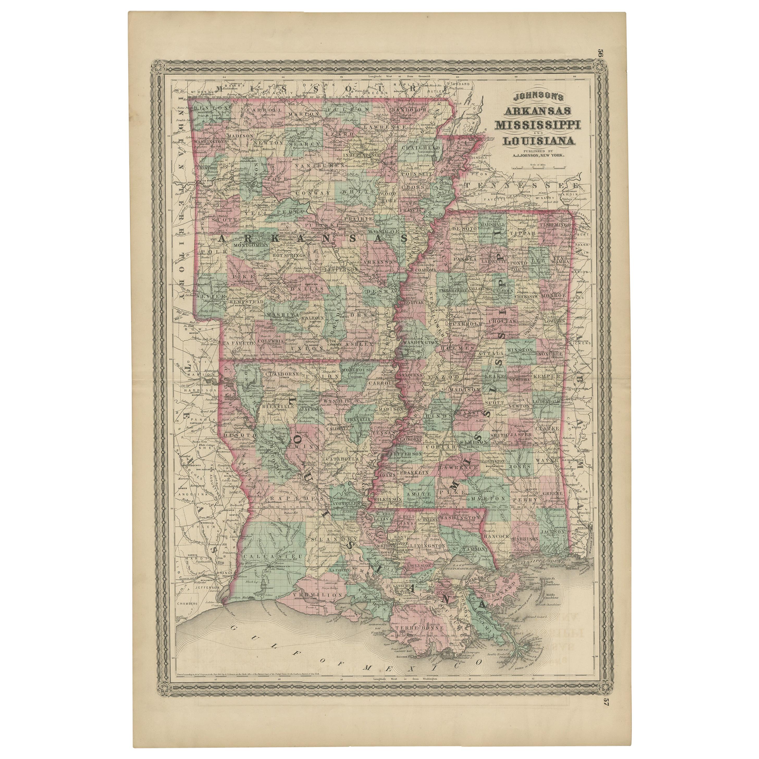
- Antique Map of Arkansas, Mississippi and Louisiana by Johnson, 1872Located in Langweer, NLAntique map titled 'Johnson's Arkansas (..)'. Original map of Arkansas, Mississippi and Louisiana. This map originates from 'Johnson's New Illustrated ...Category
Antique Late 19th Century Maps
MaterialsPaper
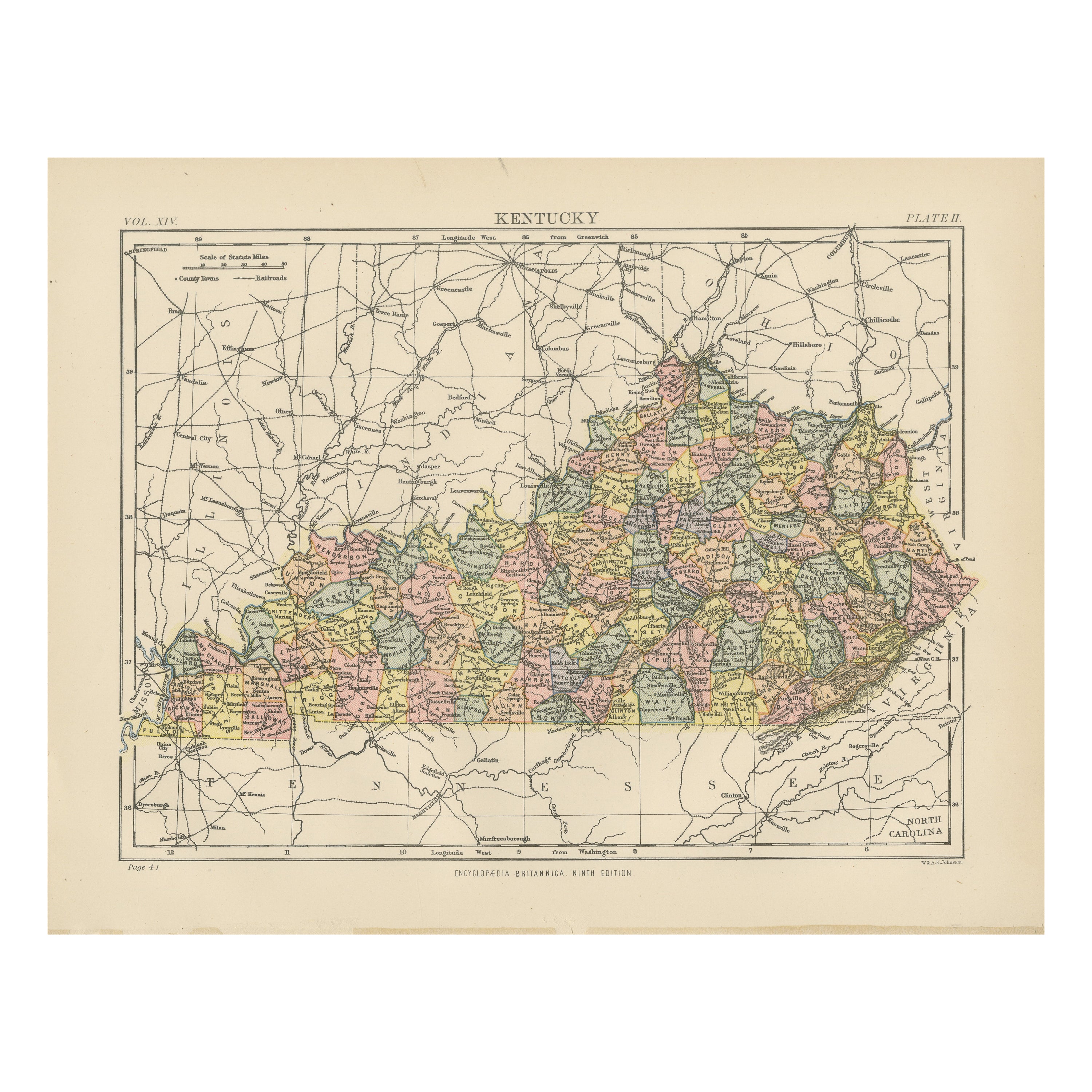
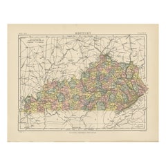
- Antique Map of KentuckyLocated in Langweer, NLAntique map titled 'Kentucky'. Original antique map of Kentucky, United States. This print originates from 'Encyclopaedia Britannica', Ninth E...Category
Antique Late 19th Century Maps
MaterialsPaper
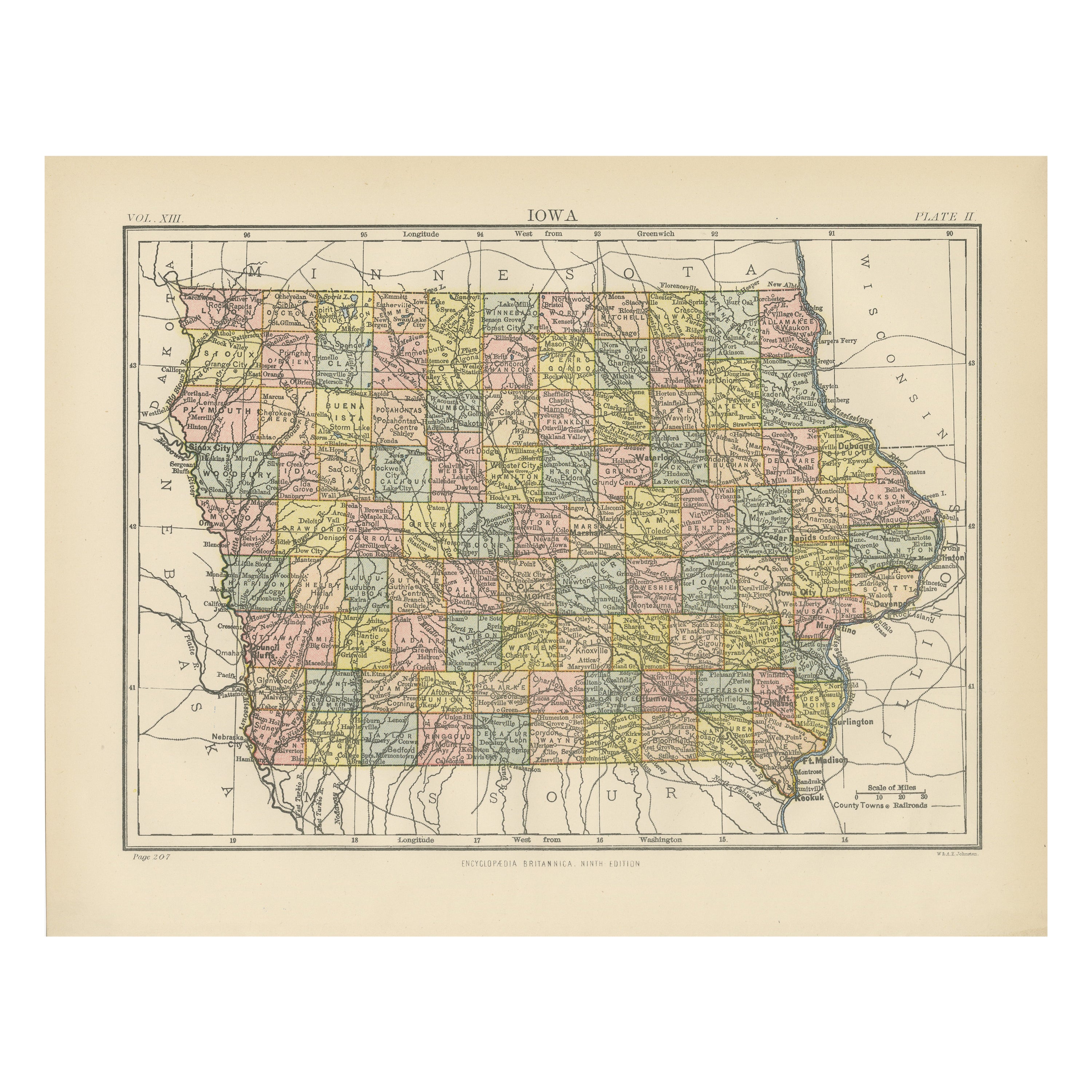
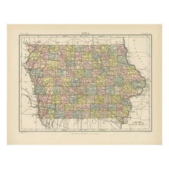
- Antique Map of IowaLocated in Langweer, NLAntique map titled 'Iowa'. Original antique map of Iowa, United States. This print originates from 'Encyclopaedia Britannica', Ninth Edition. Published 188...Category
Antique Late 19th Century Maps
MaterialsPaper
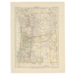
- Antique Map of OregonLocated in Langweer, NLAntique map titled 'Oregon'. Original antique map of Oregon, United States. This print originates from 'Encyclopaedia Britannica', Ninth Edition. Publish...Category
Antique Late 19th Century Maps
MaterialsPaper
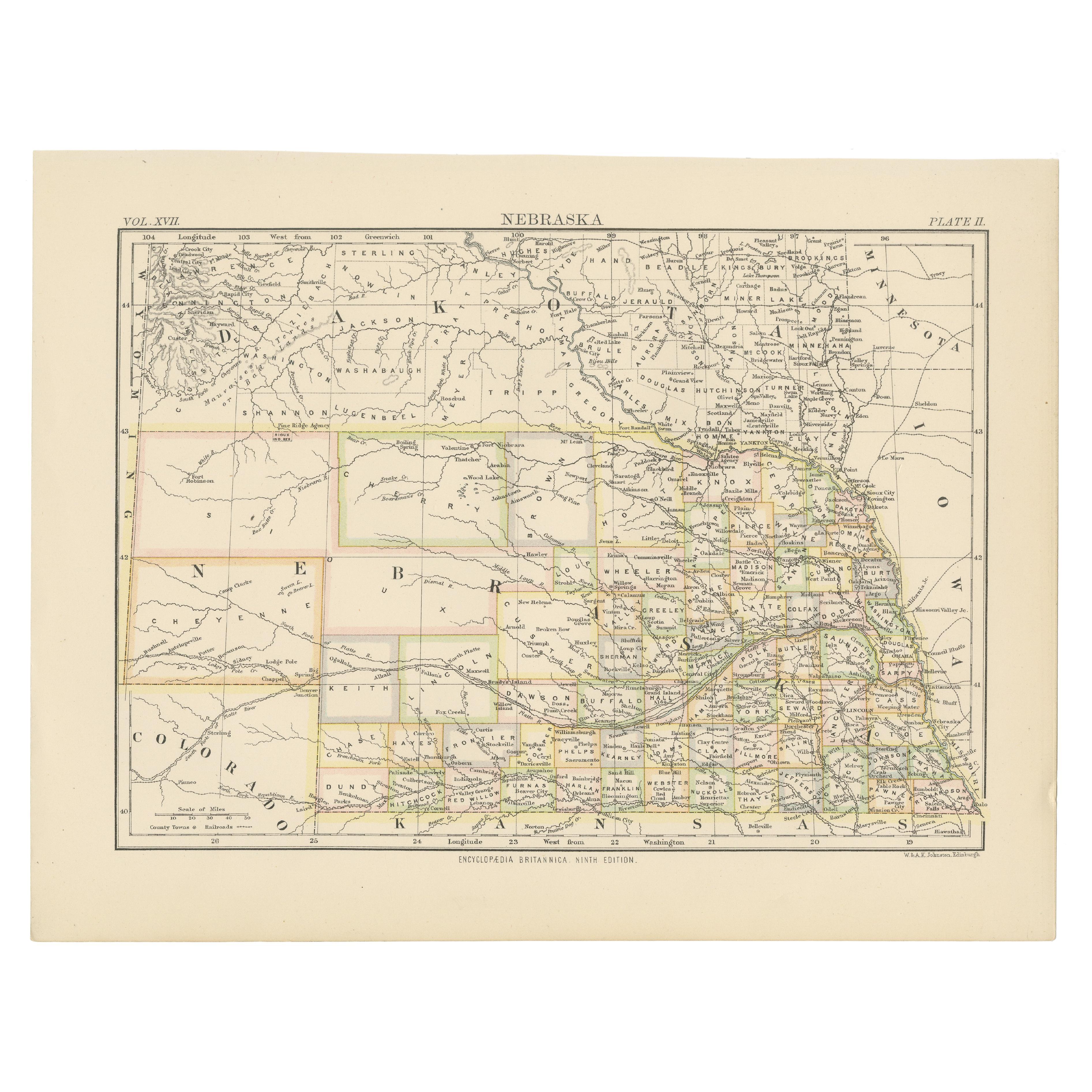
- Antique Map of NebraskaLocated in Langweer, NLAntique map titled 'Nebraska'. Original antique map of Nebraska, United States. This print originates from 'Encyclopaedia Britannica', Ninth Edition. Pu...Category
Antique Late 19th Century Maps
MaterialsPaper
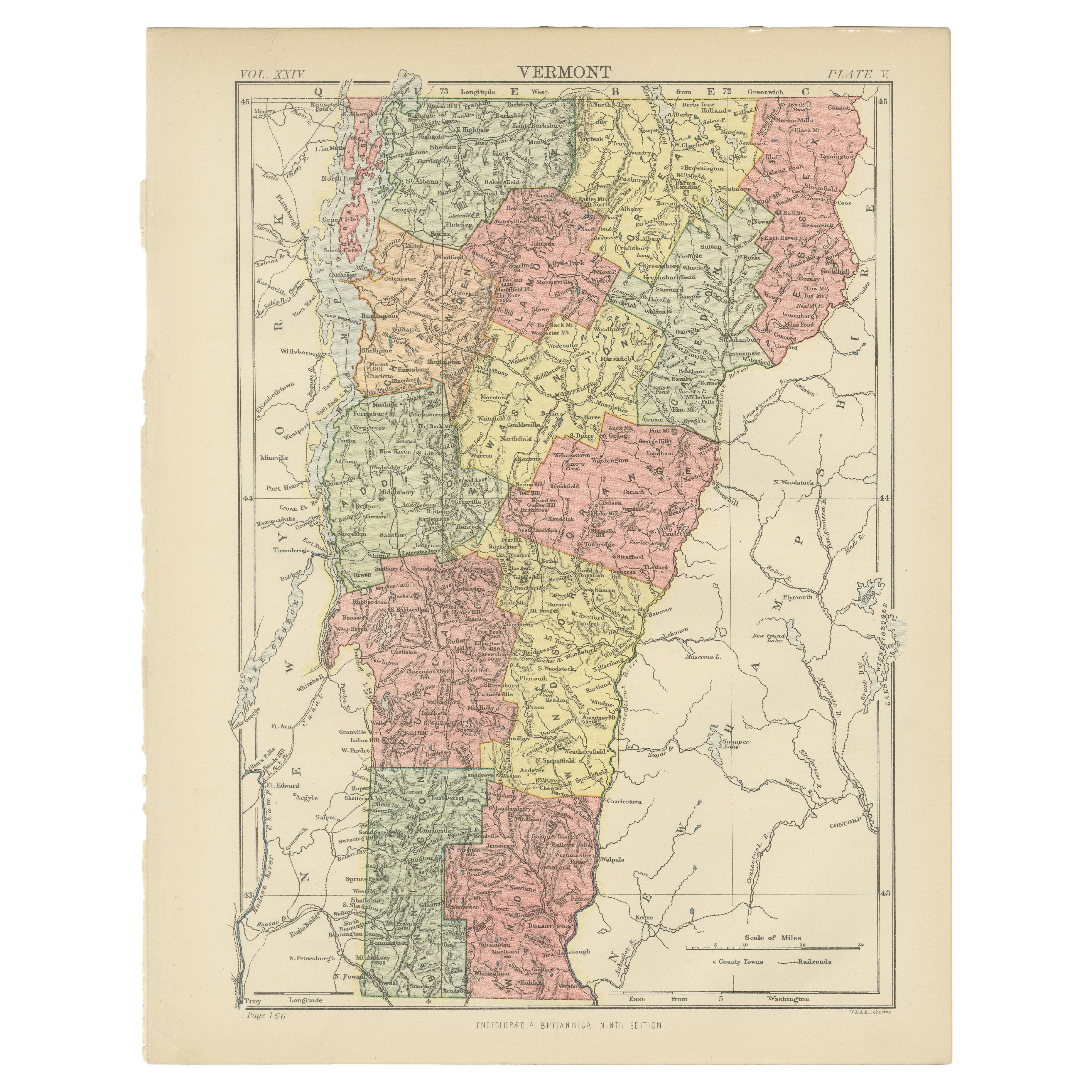
- Antique Map of VermontLocated in Langweer, NLAntique map titled 'Vermont'. Original antique map of Vermont, United States. This print originates from 'Encyclopaedia Britannica', Ninth Edition. Publ...Category
Antique Late 19th Century Maps
MaterialsPaper


You May Also Like
- Antique Map of Principality of MonacoBy Antonio Vallardi EditoreLocated in Alessandria, PiemonteST/619 - "Old Geographical Atlas of Italy - Topographic map of ex-Principality of Monaco" - ediz Vallardi - Milano - A somewhat special edition ---Category
Antique Late 19th Century Italian Other Prints
MaterialsPaper
- Original Antique Map of India. C.1780Located in St Annes, LancashireGreat map of India Copper-plate engraving Published C.1780 Three small worm holes to right side of map and one bottom left corner Unframed.Category
Antique Early 1800s English Georgian Maps
MaterialsPaper

- Original Antique Map of Asia. C.1780Located in St Annes, LancashireGreat map of Asia Copper-plate engraving Published C.1780 Two small worm holes to right side of map Unframed.Category
Antique Early 1800s English Georgian Maps
MaterialsPaper

- Original Antique Map of Italy. C.1780Located in St Annes, LancashireGreat map of Italy Copper-plate engraving Published C.1780 Unframed.Category
Antique Early 1800s English Georgian Maps
MaterialsPaper

- Large Antique 1859 Map of North AmericaLocated in Sag Harbor, NYThis Map was made by Augustus Mitchell in 1859 It is in amazing condition for being 163 years old. This price is for the rolled up easy to ship version of this piece. I will be Frami...Category
Antique Mid-19th Century American Maps
MaterialsCanvas, Paper

- Original Antique Map of China, Arrowsmith, 1820Located in St Annes, LancashireGreat map of China Drawn under the direction of Arrowsmith Copper-plate engraving Published by Longman, Hurst, Rees, Orme and Brown, 1820 Unfr...Category
Antique 1820s English Maps
MaterialsPaper


Recently Viewed
View AllMore Ways To Browse
Optical Antiques
Encyclopaedia Britannica
Used Furniture In Arkansas
Encyclopedia Britannica
Arkansas Map
Map Of Arkansas
Antique Furniture Arkansas
Sailing Charts
Antique Amazon
Antique Map Of Israel
Antique Maps Dublin
Antique Maps Of Israel
Antique Maps Of Russian Empire
Cartographer Tool
Israel Map
John Speed Antique Maps
Map Of Israel
New Mexico Maps