Items Similar to Antique Map of Baja California and parts of Alta California, Arizona and Sonora


Want more images or videos?
Request additional images or videos from the seller
1 of 6
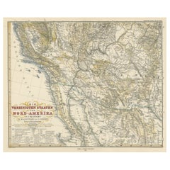
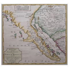
Antique Map of Baja California and parts of Alta California, Arizona and Sonora
About the Item
Antique map titled 'Kaart van het Westelyk Gedeelte van Nieuw Mexico en van California'. Beautiful map of Baja California and parts of Alta California, Arizona and Sonora. Isaac Tirion's map of Baja California is one of the best mid-18th century maps of Southern California, Baja California and parts of Arizona and Sonora. Issued 4 years prior to the establishment of the first Spanish Mission in Alta California (San Diego) and based in large part on the work of Ferdinando Consag, the map provides one of the earliest large format attempts to map this still mysterious and unsettled region north of Baja California, along with the then Jesuit regions of Baja California and Sonora. The map is one of the last to focus on the region before the expulsion of the Jesuits in 1768.
Published by I. Tirion, 1765.
- Dimensions:Height: 14.1 in (35.8 cm)Width: 14.97 in (38 cm)Depth: 0.02 in (0.5 mm)
- Materials and Techniques:
- Period:
- Date of Manufacture:1765
- Condition:Replacements made: Right margin partly extended. General age-related toning. Original folding lines. Right margin partly extended. Minor wear and soiling, blank verso. Please study image carefully.
- Seller Location:Langweer, NL
- Reference Number:
About the Seller
5.0
Platinum Seller
These expertly vetted sellers are 1stDibs' most experienced sellers and are rated highest by our customers.
Established in 2009
1stDibs seller since 2017
1,966 sales on 1stDibs
Typical response time: <1 hour
- ShippingRetrieving quote...Ships From: Langweer, Netherlands
- Return PolicyA return for this item may be initiated within 14 days of delivery.
More From This SellerView All
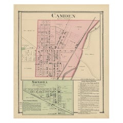
- Antique Map of Camden and Sonora, 1871Located in Langweer, NLAntique map titled 'Camden, Sonora'. Original antique map of villages and communities of Ohio. This map originates from 'Atlas of Preble County Ohio' by C.O. Titus. Published 1871.Category
Antique Late 19th Century Maps
MaterialsPaper
- Antique Map of California, Utah, Nevada, Colorado, New Mexico & Arizona '1872'Located in Langweer, NLAntique map titled 'Johnson's California (..)'. Original map of California, Utah, Nevada, Colorado, New Mexico and Arizona. This map originates from ...Category
Antique Late 19th Century Maps
MaterialsPaper
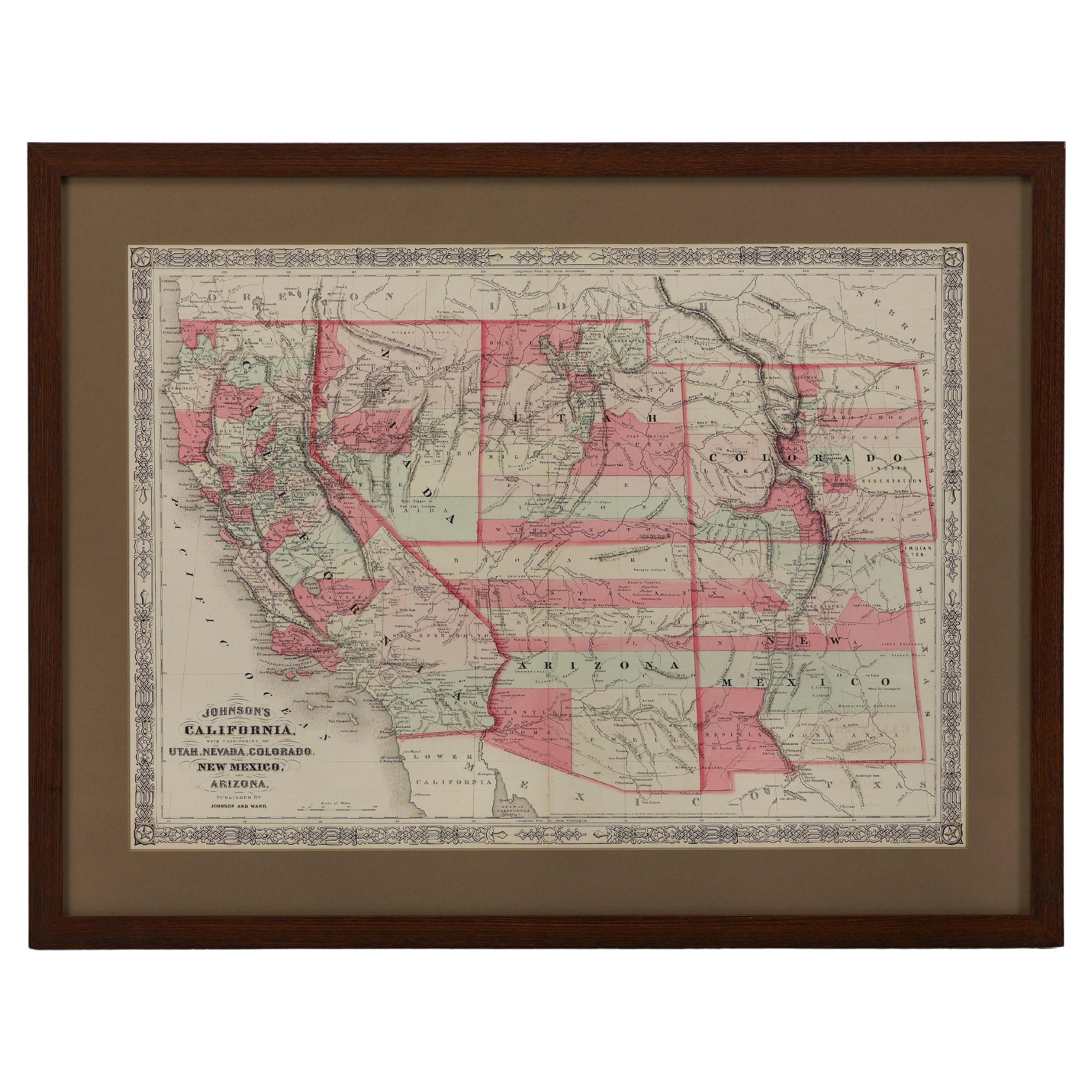
- Antique Map of Part of the United States Including Lower California & ArizonaLocated in Langweer, NLAntique map of part of the United States of America including Lower California, Arizona and part of Mexico. This map was part of a set of six individual sheets with maps of the Unite...Category
Antique Late 19th Century Maps
MaterialsPaper
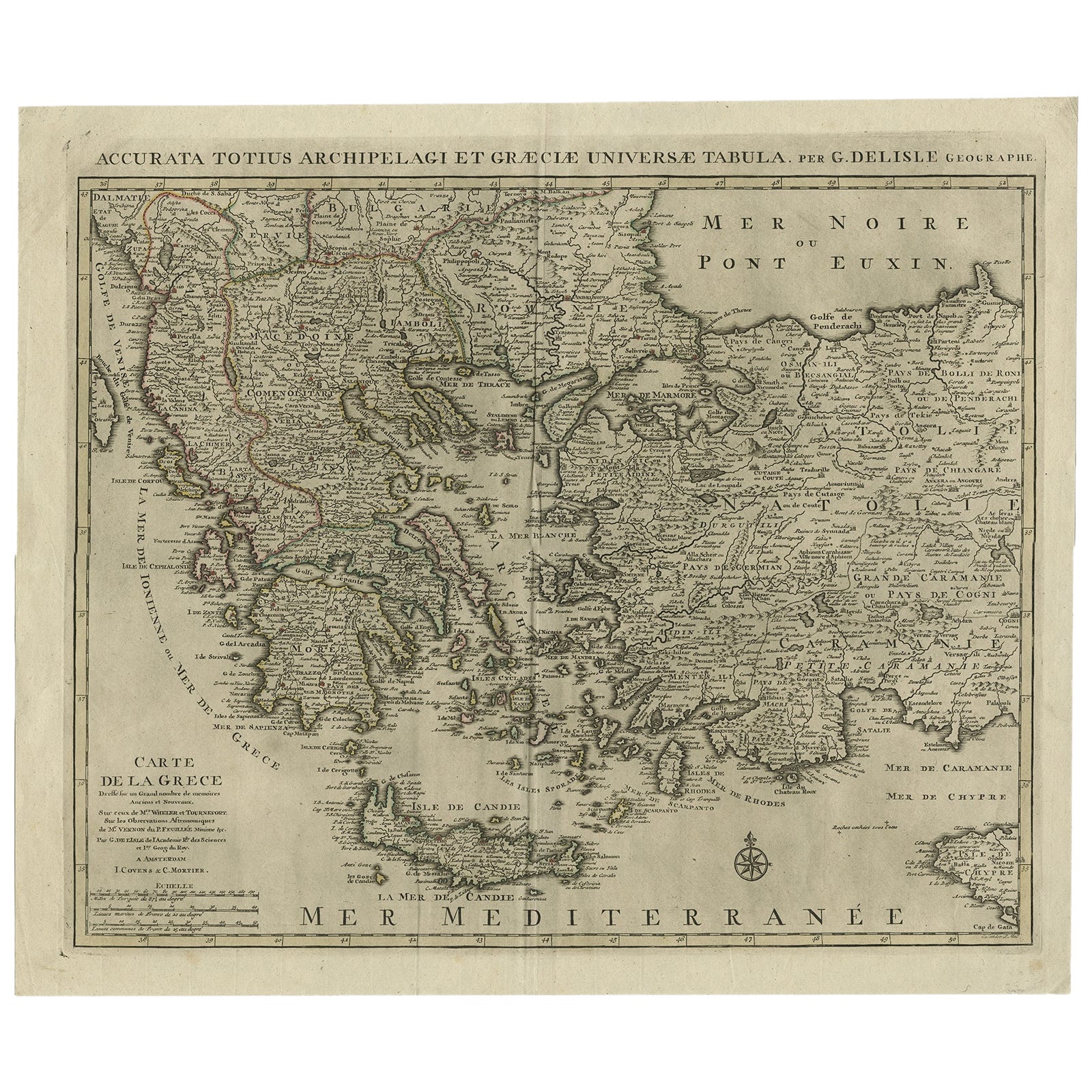
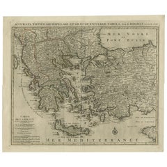
- Antique Map of Greece, Albania, Macedonia and Parts of Turkey and Cyprus, c.1745Located in Langweer, NLAntique map titled 'Accurata Totius Archipelagi Et Graeciae Universae Tabula'. Detailed map of Greece. Includes Albania, Macedonia and parts of Turkey and Cyprus. With compass rose...Category
Antique 18th Century Maps
MaterialsPaper
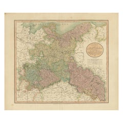
- Antique Map of the Eastern Part of Germany, with Parts of Poland and SlovakiaLocated in Langweer, NLAntique map titled 'A New Map of the Circle of Upper Saxony: with the Duchy of Silesi and Lusatia, from the latest authorities'. Clear and accurate map of what is now the eastern par...Category
Antique Early 19th Century Maps
MaterialsPaper
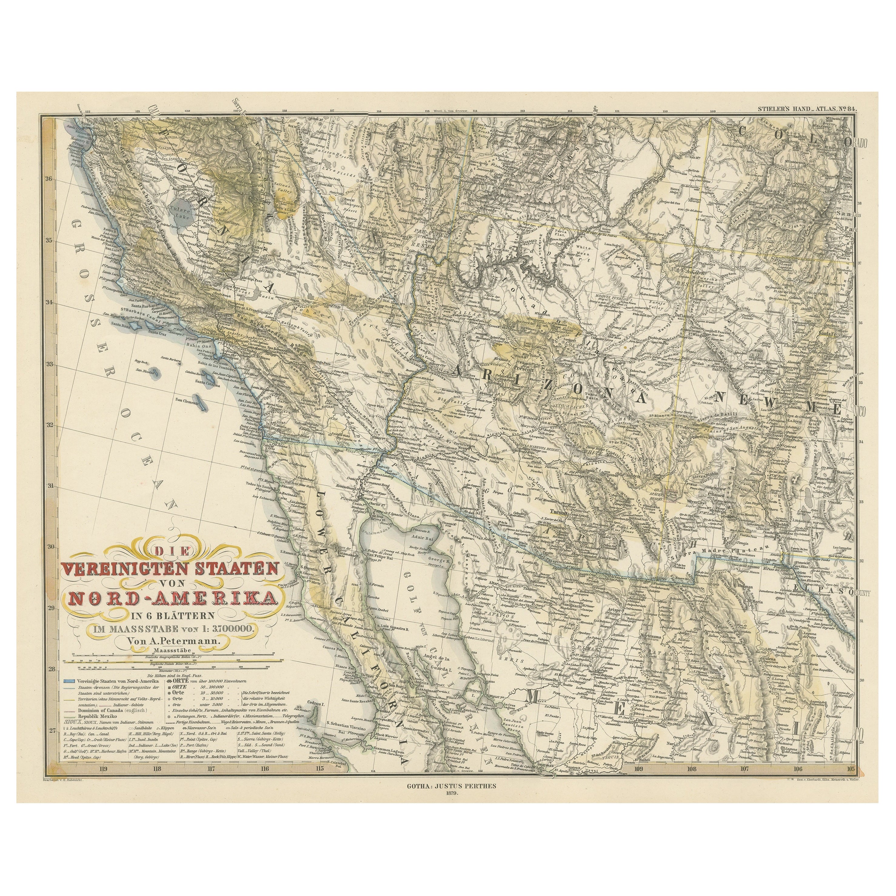
- Original Antique Map of the Western Part of NEW MEXICO & CALIFORNIALocated in Langweer, NLTitle: "Map of the Western Part of NEW MEXICO and CALIFORNIA According to the Latest Discoveries by the Jesuits and Others" Description: This exquisite original Dutch map, titled "...Category
Antique 1760s Maps
MaterialsPaper

You May Also Like
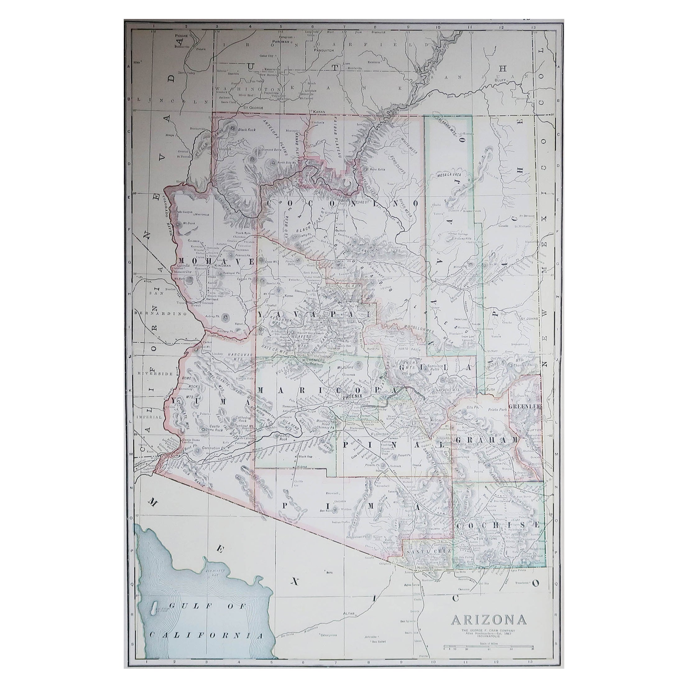
- Large Original Antique Map of Arizona, Usa, C.1900Located in St Annes, LancashireFabulous map of Arizona Original color. Engraved and printed by the George F. Cram Company, Indianapolis. Published, C.1900. Unframed. Free shipping.Category
Antique 1890s American Maps
MaterialsPaper
- 1865 "Johnson's California, Utah, Nevada, Colorado, New Mexico, Arizona" MapLocated in Colorado Springs, COPresented is an original 1865 "Johnson's California, with Territories of Utah, Nevada, Colorado, New Mexico, and Arizona” map. First published in 1864, thi...Category
Antique Mid-19th Century Maps
MaterialsPaper
- Large Original Antique Map of California, USA, circa 1900Located in St Annes, LancashireFabulous map of California Original color Engraved and printed by the George F. Cram Company, Indianapolis. Published, circa 1900 Unframed Free shipping.Category
Antique 1890s American Maps
MaterialsPaper
- 1847 Antique Map of Mexico, Texas and California by Samuel Augustus MitchellBy Samuel Augustus Mitchell 1Located in Colorado Springs, COPresented is the second edition of Samuel Augustus Mitchell's Map of Mexico, Including Yucatan & Upper California, an important map showing the progress of the Mexican-American War. ...Category
Antique 1840s American Maps
MaterialsPaper
- "San Francisco, Upper California” 1851 Antique Map of San FranciscoLocated in Colorado Springs, COThis is a pictorial lettersheet view of the city and harbor of San Francisco. This lithograph was printed on grey wove paper, across a double sheet, by famed lithographers Britton & ...Category
Antique 1850s American Prints
MaterialsPaper
- Set of 8 Antique Fishing Rods and Parts, circa 1900Located in Barcelona, BarcelonaSet of 8 antique fishing big fishing rods and parts. Made in Spain, circa 1900. In original condition, with minor wear consistent with age and use, preserving a beautiful patin...Category
Antique Early 1900s Spanish Modern Nautical Objects
MaterialsPlaster, Wood


Recently Viewed
View AllMore Ways To Browse
Spanish Mission
Antique Furniture California
Used Furniture Arizona
Used Furniture Southern California
California Map
Mexican 18th Century
Arizona Antique
Mexican 18th Century Furniture
San Diego Mid Century
Antique Furniture Arizona
Mission Mexican
California Mission Furniture
Sonora Mexico
Antique Furniture San Diego
Antique Maps San Diego
Map Baja Mexico
Charles Landseer
Hemisphere Antiques