Items Similar to Antique Map of Friesland ‘The Netherlands’ by N. Visscher, circa 1670

Want more images or videos?
Request additional images or videos from the seller
1 of 6
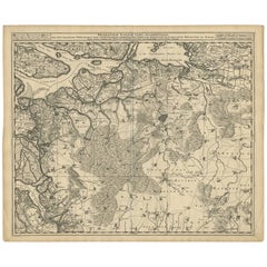
Antique Map of Friesland ‘The Netherlands’ by N. Visscher, circa 1670
About the Item
This large copper engraved map details the coastline of Friesland and Terschelling. At east is a part of Groningen. The main cities are colored in red. The very decorative cartouches displays putti and a coat of arms. At the right corner there is an inset with the isles belonging to this province. This map originates from 'Germania Inferiorsive XVII Provinciarum Geographicae Generalis uit et Particulares tabulae.' (Kaert-Boeck van de XVII Nederlandtsche Provincien.), published by Nicolaas Visscher II in Amsterdam, circa 1670.
- Creator:Nicolaes Visscher II (Artist)
- Dimensions:Height: 20.48 in (52 cm)Width: 24.02 in (61 cm)Depth: 0.02 in (0.5 mm)
- Materials and Techniques:
- Period:Late 17th Century
- Date of Manufacture:circa 1670
- Condition:Please study image carefully.
- Seller Location:Langweer, NL
- Reference Number:
About the Seller
5.0
Platinum Seller
These expertly vetted sellers are 1stDibs' most experienced sellers and are rated highest by our customers.
Established in 2009
1stDibs seller since 2017
1,967 sales on 1stDibs
Typical response time: <1 hour
- ShippingRetrieving quote...Ships From: Langweer, Netherlands
- Return PolicyA return for this item may be initiated within 14 days of delivery.
More From This SellerView All
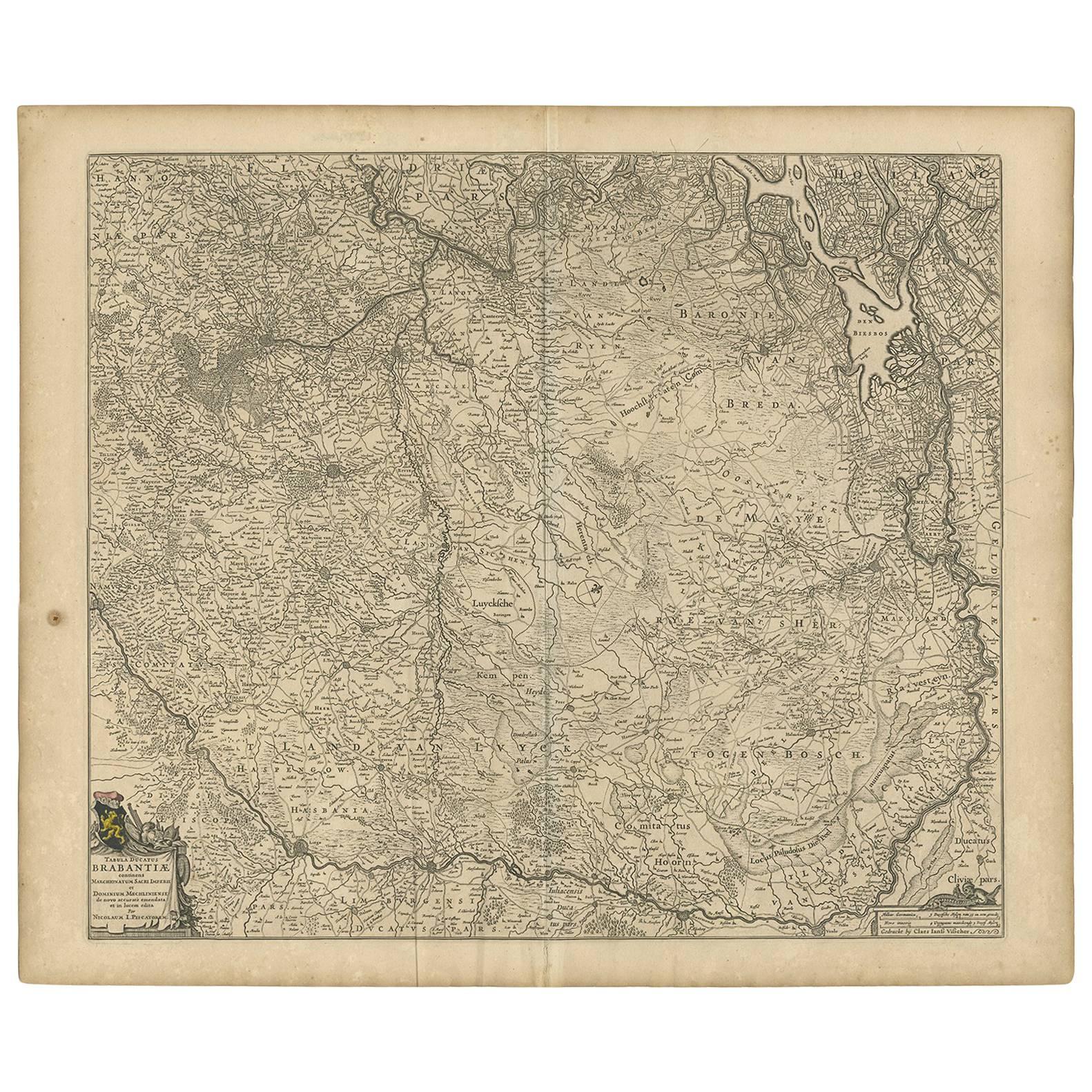
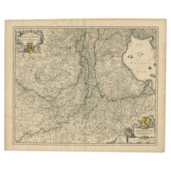
- Antique Map of Brabant 'The Netherlands' by N. Visscher, circa 1670Located in Langweer, NLDetailed map of the southern part of The Netherlands and the northern part of Belgium with Antwerp and Brussels. In the corner top left in Holland with Rotterdam partly on the map. S...Category
Antique Mid-17th Century Maps
MaterialsPaper
- Antique Map of Brabant 'The Netherlands' by N. Visscher, circa 1690Located in Langweer, NLAntique map titled 'Brabantiae Batavae pars orientalis, comprehendens Tetrarchiam sive majoratum sylvaeducensem in ejusdem subjacentes ditiones (..)'. Map of the Dutch province 'Brab...Category
Antique Mid-18th Century Maps
MaterialsPaper
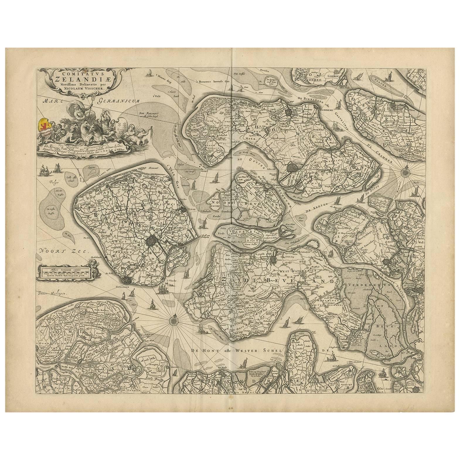
- Antique Map of Zeeland 'The Netherlands' by N. Visscher, circa 1690Located in Langweer, NLAntique map titled 'Comitatus Zelandiae (..)'. Detailed chart of the province Zeeland, The Netherlands, with details shown pictorially. Published by N. Visscher.Category
Antique Late 17th Century Maps
MaterialsPaper
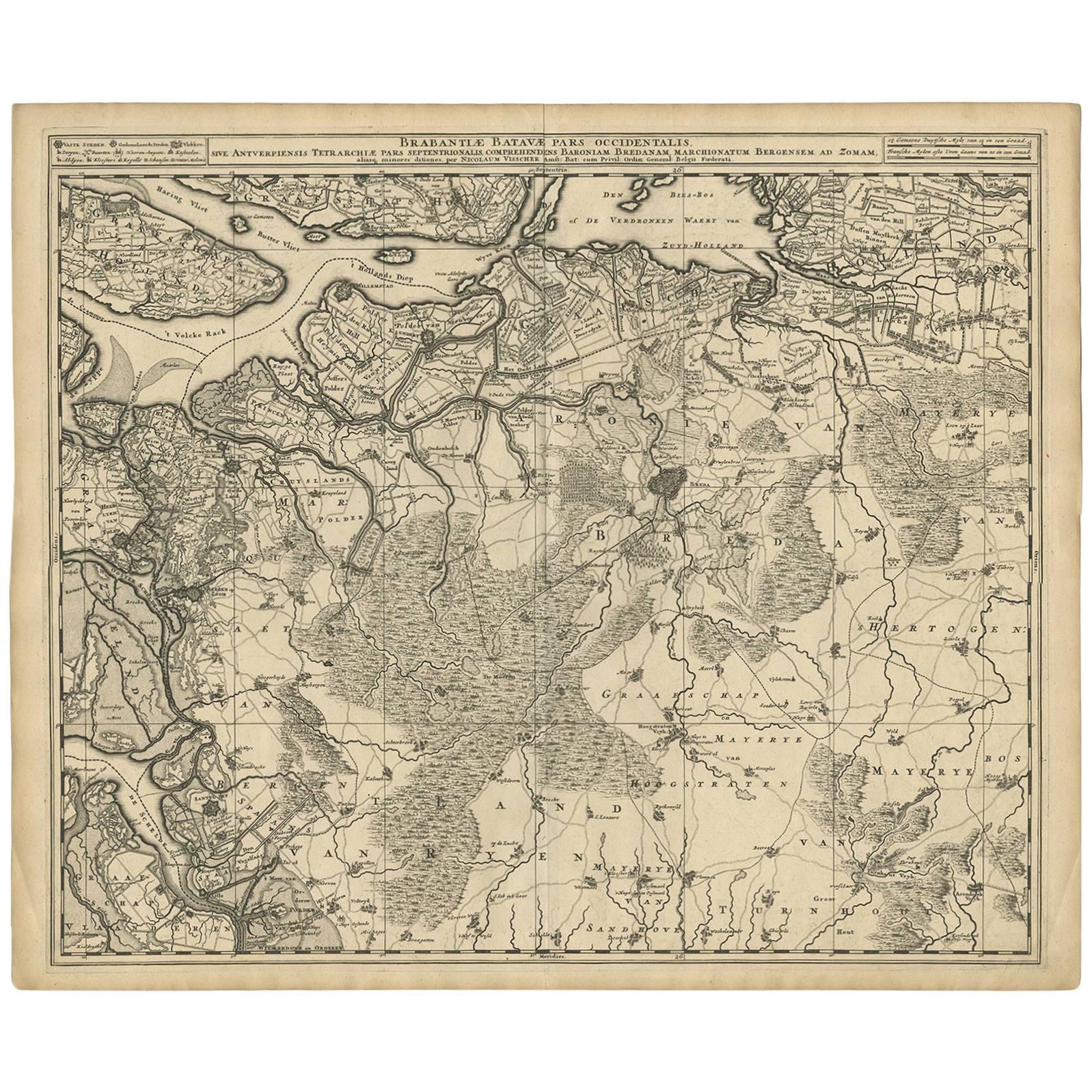
- Antique Map of Brabant 'The Netherlands' by N. Visscher, circa 1690Located in Langweer, NLAntique map titled 'Brabantiae Batavae Pars Occidentalis (..)'. Highly detailed map of the region between Bergen Op Zoom, Breda, Hoogstraten and Sandvliet, The Netherlands. Published...Category
Antique Late 17th Century Maps
MaterialsPaper
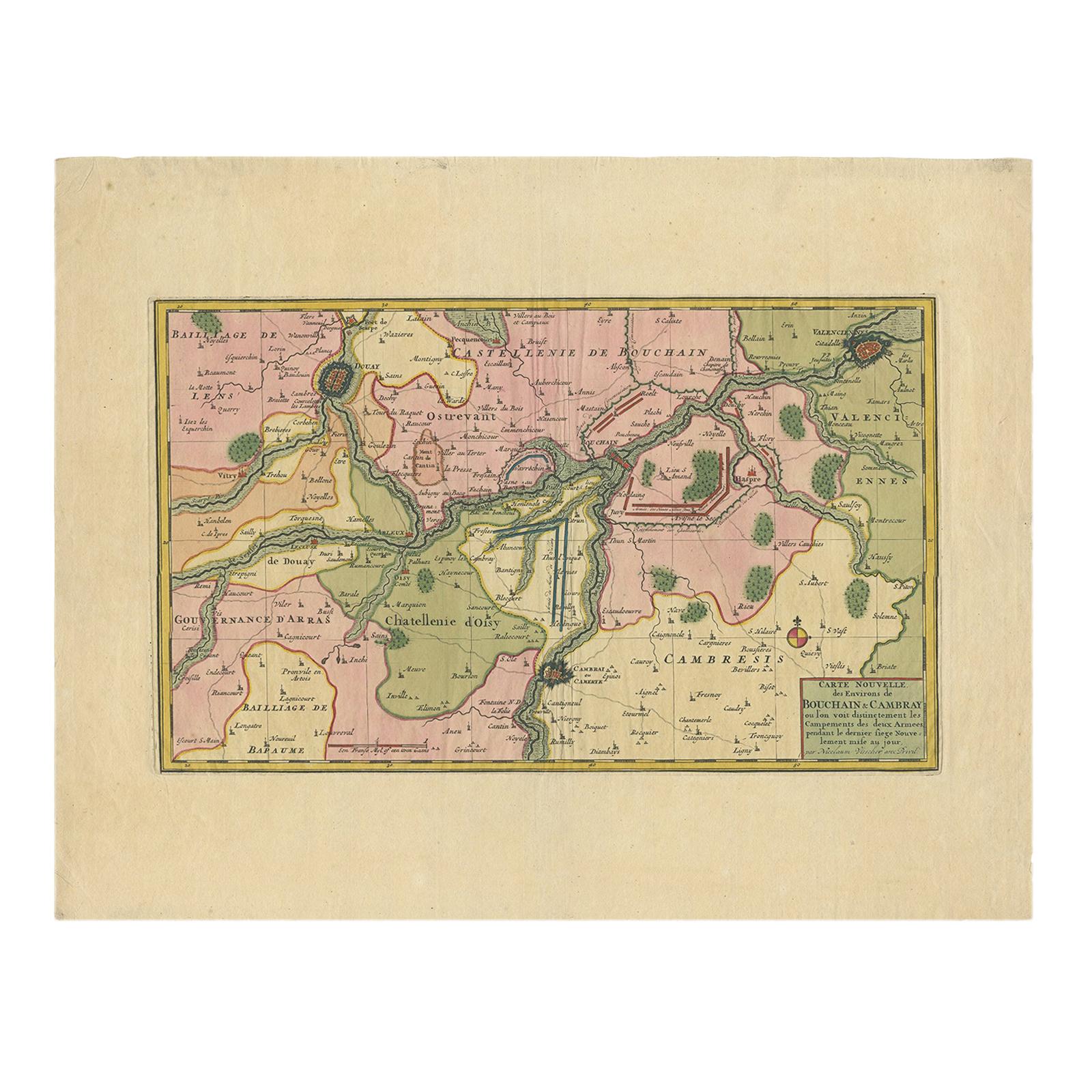
- Antique Map of the Region of Bouchain and Cambrai by Visscher 'circa 1680'By Nicolaes Visscher IILocated in Langweer, NLAntique map titled 'Carte Nouvelle des Environs de Bouchain & Cambray'. Uncommon map of the region of Bouchain and Cambrai (Cambray, France) showing the camps of two armies.Category
Antique Late 17th Century Maps
MaterialsPaper
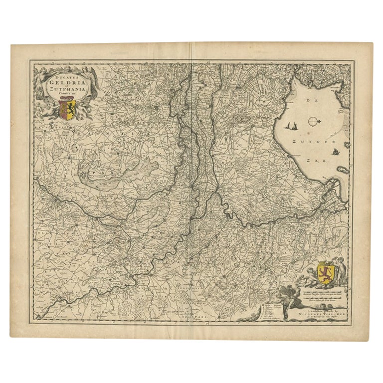
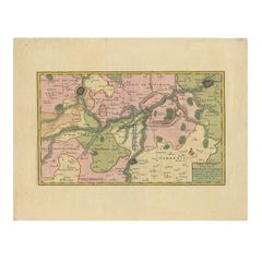
- Antique Map of the Dutch Province of Gelderland by Visscher, c.1670Located in Langweer, NLAntique map titled 'Ducatus Geldria et Zutphania Comitatus'. Map of the Duchy of Gelre (Gelderland) and the county of Zutphen, The Netherlands. Artists and Engravers: Made after the ...Category
Antique 17th Century Maps
MaterialsPaper
You May Also Like
- The Holy Land at the Time of Jesus: A 17th Century Dutch Map by VisscherBy Nicolaes Visscher IILocated in Alamo, CAThis detailed Dutch map entitled "Het Beloofe de Landt Canaan door wandelt van onsen Salichmaecker Iesu Christo, nessens syne Apostelen" by Nicolaes Visscher was published in Amsterd...Category
Antique Mid-17th Century Dutch Maps
MaterialsPaper
- 17th Century Hand Colored Map of the Liege Region in Belgium by VisscherBy Nicolaes Visscher IILocated in Alamo, CAAn original 17th century map entitled "Leodiensis Episcopatus in omnes Subjacentes Provincias distincté divisusVisscher, Leodiensis Episcopatus" by Nicolaes Visscher II, published in Amsterdam in 1688. The map is centered on Liege, Belgium, includes the area between Antwerp, Turnhout, Roermond, Cologne, Trier and Dinant. This attractive map is presented in a cream-colored mat measuring 30" wide x 27.5" high. There is a central fold, as issued. There is minimal spotting in the upper margin and a tiny spot in the right lower margin, which are under the mat. The map is otherwise in excellent condition. The Visscher family were one of the great cartographic families of the 17th century. Begun by Claes Jansz Visscher...Category
Antique Late 17th Century Dutch Maps
MaterialsPaper
- "Africae Accurata", a Hand-Colored 17th Century Map of Africa by VisscherBy Nicolaes Visscher IILocated in Alamo, CAAn 18th century hand-colored map of Africa entitled "Africae Accurata Tabula ex officina" by Nicolaes Visscher, published in Amsterdam in 1680. This beautiful, colorful and detailed map is embellished by eleven sailing ships, a whale, flying fish and multiple land animals. It includes the Mediterranean Sea and adjacent portions of Portugal, Spain, Italy, Greece and Asia Minor. The map perpetuates several long-standing errors, including the origin of the Nile River from two imaginary lakes in southern Africa, which are shown adjacent to the imaginary Lunae Montes (Mountains of the Moon...Category
Antique Late 17th Century Dutch Maps
MaterialsPaper
- 18th Century Hand Colored Map of Spain and Portugal by VisscherBy Nicolaes Visscher IILocated in Alamo, CAThis is an early 18th century map of Spain and Portugal, with attractive original hand-coloring, entitled "Hispaniae et Portugalliae Regna per Nicolaum Visscher cum Privilegio Ordinu...Category
Antique Early 18th Century Dutch Maps
MaterialsPaper
- Hand Colored 17th Century Visscher Map "Hollandiae" Southern HollandBy Nicolaes Visscher IILocated in Alamo, CAA hand colored 17th century map of the southern portions of Holland by Nicolaus (Nicolas) Visscher II entitled "Hollandiae pars Meridionalis, vulgo Zuyd-Holland", published in Amsterdam in 1678. The map shows the region between Breda, Heusden, Gornichem, Gouda, Dordrecht, and Willemstad. It includes a decorative cartouche in the lower left corner. The map is presented in an attractive maple colored wood frame with gold trim and a fabric mat. The Visscher family were one of the great cartographic families of the 17th century. Begun by Claes Jansz Visscher...Category
Antique Early 18th Century Dutch Maps
MaterialsPaper
- Original Antique Map of The Netherlands, Engraved by Barlow, Dated 1807Located in St Annes, LancashireGreat map of Netherlands Copper-plate engraving by Barlow Published by Brightly & Kinnersly, Bungay, Suffolk. Dated 1807 Unframed.Category
Antique Early 1800s English Maps
MaterialsPaper


Recently Viewed
View AllMore Ways To Browse
Antique Furniture Dundee
Antique Map Chicago
Antique Map Copenhagen
Antique Map Malta
Antique Map Of Malta
Antique Maps Of Malta
Antique Maps Of Pennsylvania
Antique Queensland
Mitchell Antique Maps
North Carolina Map
Otto Petri
Ottoman Map
Alexandria Map
Antique Bassett Furniture
Antique Furniture Furniture Nova Scotia
Antique Furniture Nova Scotia Furniture
Antique Furniture Nova Scotia
Antique Mace