Items Similar to Antique Map of Jura, a Famous Wine Area in France, 1854


Want more images or videos?
Request additional images or videos from the seller
1 of 7
Antique Map of Jura, a Famous Wine Area in France, 1854
About the Item
Antique map titled 'Dépt. du Jura'. Map of the French department Jura, France.
Jura is a department in the Bourgogne-Franche-Comté region in Eastern France. Named after the Jura Mountains, its prefecture is Lons-le-Saunier. Its subprefectures are Dole and Saint-Claude. In 2016, Jura had a population of 260,517. It has a short portion of the border of Switzerland.
The famous Jura wines are very distinctive and unusual, such as Vin Jaune, which is made by a similar process to sherry, developing under a flor of yeast. This is made from the local Savagnin grape variety. Other grapes include Poulsard, Trousseau, and Chardonnay. The whole is surrounded by elaborate decorative engravings designed to illustrate both the natural beauty and trade richness of the land.
There is a short textual history of the regions depicted on both the left and right sides of the map. This map originates from Atlas National de la France Illustré by V. Levasseur.
Published by A. Combette, Paris, 1854.
Condition: Good, general age-related toning. Some creasing, mainly in lower part of the map. Blank verso, please study image carefully.
Date: 1854.
- Dimensions:Height: 14.38 in (36.5 cm)Width: 20.87 in (53 cm)Depth: 0 in (0.01 mm)
- Materials and Techniques:
- Period:
- Date of Manufacture:1854
- Condition:Condition: Good, general age-related toning. Some creasing, mainly in lower part of the map. Blank verso, please study image carefully.
- Seller Location:Langweer, NL
- Reference Number:
About the Seller
5.0
Platinum Seller
These expertly vetted sellers are 1stDibs' most experienced sellers and are rated highest by our customers.
Established in 2009
1stDibs seller since 2017
1,965 sales on 1stDibs
Typical response time: <1 hour
- ShippingRetrieving quote...Ships From: Langweer, Netherlands
- Return PolicyA return for this item may be initiated within 14 days of delivery.
More From This SellerView All
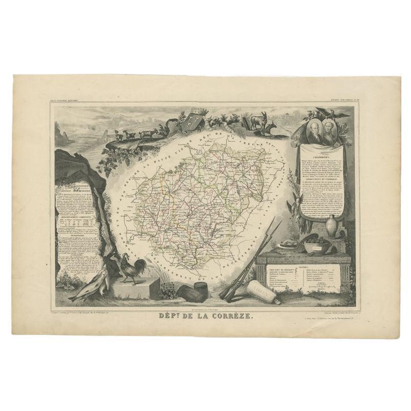
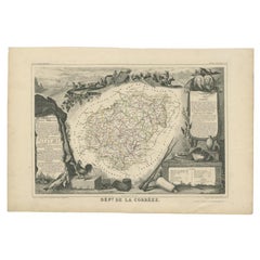
- Antique Map of the Famous French Wine Area of Correze, 1854Located in Langweer, NLAntique map titled 'Dépt. da la Corrèze'. Map of the French department of Correze, France. This area of France is known for its production of straw wine, a sweet red or white wine. T...Category
Antique 19th Century Maps
MaterialsPaper
- Antique Map of Jura ‘France’ by V. Levasseur, 1854By Victor LevasseurLocated in Langweer, NLAntique map titled 'Dépt. du Jura'. Map of the French department Jura, France. The Jura wines are very distinctive and unusual, such as Vin Jaune, which is made by a similar process ...Category
Antique Mid-19th Century Maps
MaterialsPaper
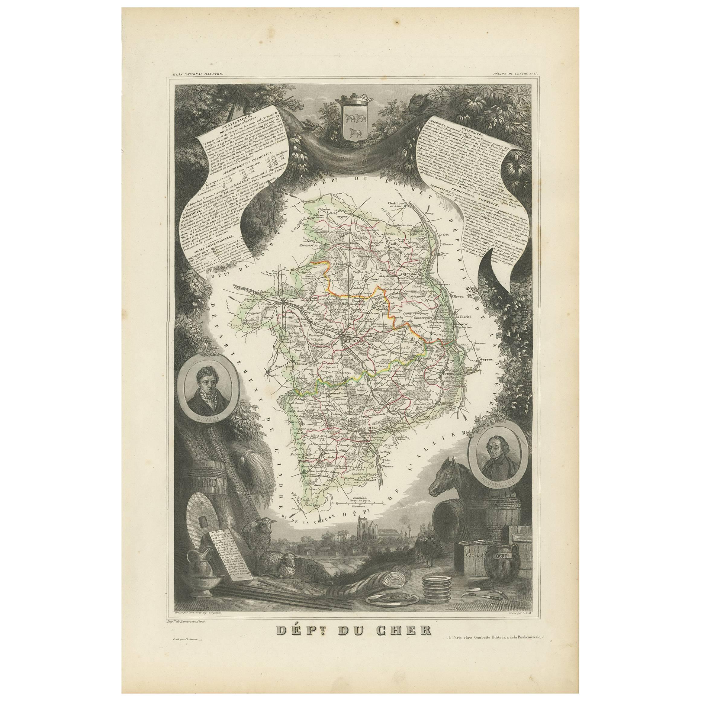
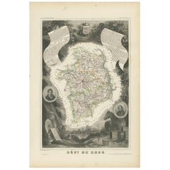
- Antique Map of Cher in France, 1854By Victor LevasseurLocated in Langweer, NLAntique map titled 'Dépt. des Bses. Pyrénées'. Map of the French department of Basses Pyrenees, France. This department includes the Jurancon wine region, famous for its production d...Category
Antique Mid-19th Century Maps
MaterialsPaper
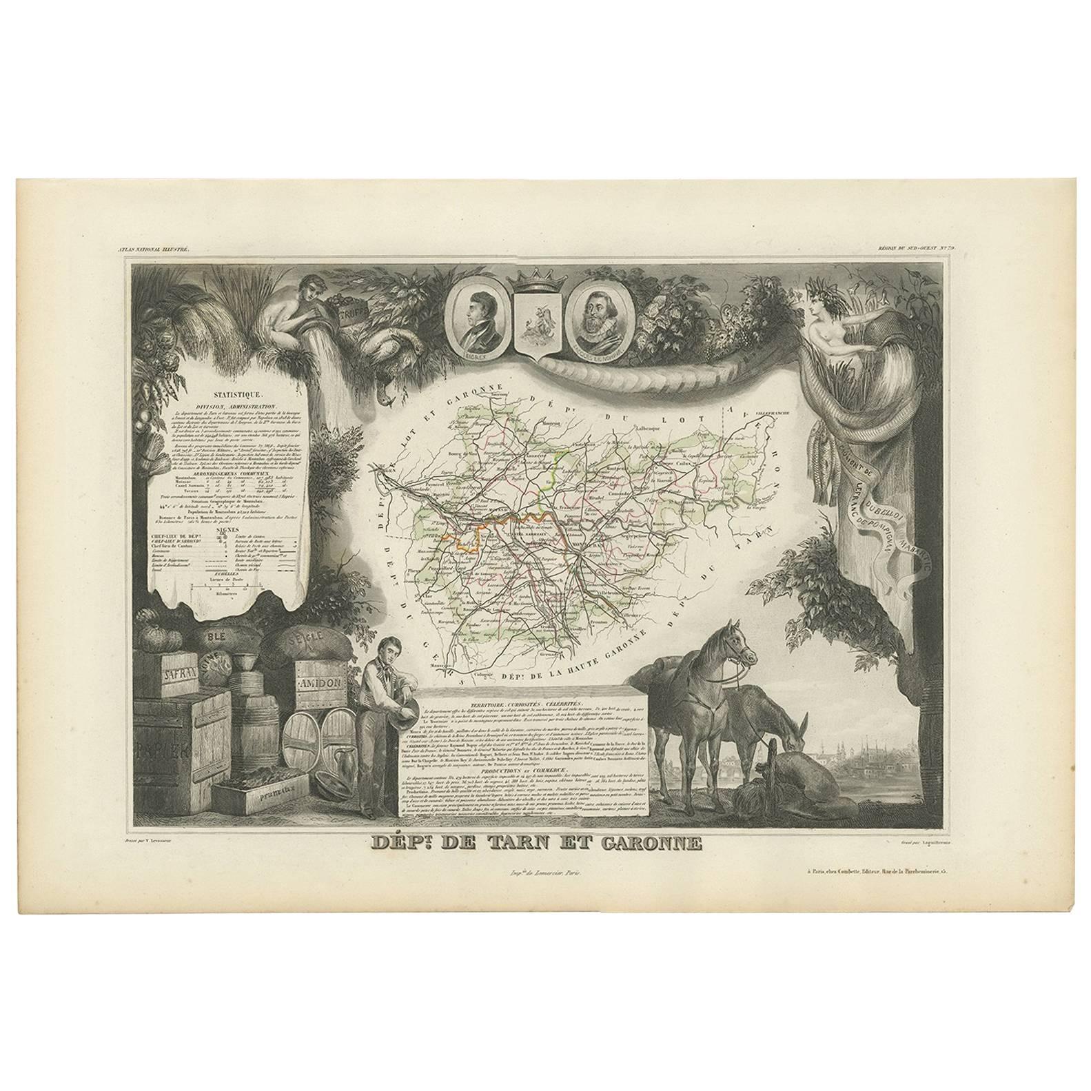
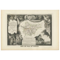
- Antique Map of Tarn and Garonne in France, 1854By Victor LevasseurLocated in Langweer, NLAntique map titled 'Dépt. de Tarn et Garonne'. Map of the French department of Tarn et Garonne, France. This map is centered around the city of Moissac, which is known for its fine d...Category
Antique Mid-19th Century Maps
MaterialsPaper
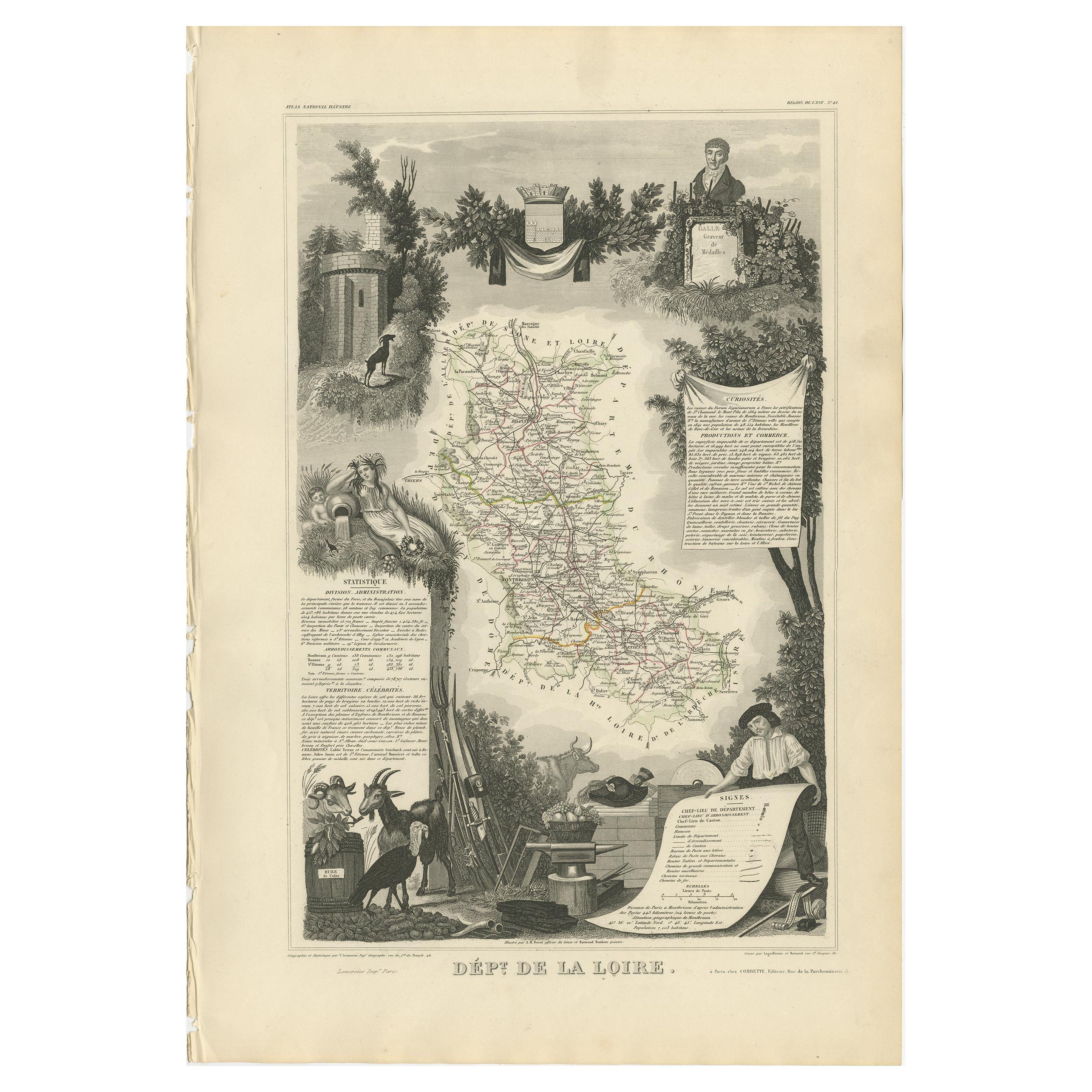
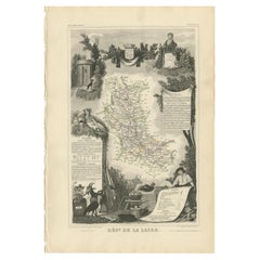
- Antique Map of Loire ‘France’ by V. Levasseur, 1854Located in Langweer, NLAntique map titled 'Dépt. de la Loire'. Map of the French department of Loire, France. This area of France is part of the Loire Valley wine growing region...Category
Antique Mid-19th Century Maps
MaterialsPaper
- Antique Map of Landes ‘France’ by V. Levasseur, 1854By Victor LevasseurLocated in Langweer, NLAntique map titled 'Dépt. des Landes'. Map of the French department Landes, France. This area is known for its production of Chalossais, a white cow cheese with a gentle, acidic edge...Category
Antique Mid-19th Century Maps
MaterialsPaper


You May Also Like
- 1854 Map of Massachusetts, Connecticut and Rhode Island, Antique Wall MapLocated in Colorado Springs, COThis striking wall map was published in 1854 by Ensign, Bridgman & Fanning and has both full original hand-coloring and original hardware. This impression is both informative and highly decorative. The states are divided into counties, outlined in red, green, and black, and subdivided into towns. Roads, canals, and railroad lines are prominently depicted, although they are not all labeled. The mapmakers also marked lighthouses, banks, churches, and prominent buildings, with a key at right. The map is an informative and comprehensive overview of the infrastructural development of New England prior to the Civil War. Physical geographies depicted include elevation, conveyed with hachure marks, rivers and lakes. The impression features an inset map of Boston...Category
Antique 19th Century American Maps
MaterialsPaper
- Gilt Framed Vintage Wine Regions of France MapLocated in Alton, GBFramed French wine region map 1973. The print has been removed to clean the glass, the frame has minor damage in places but nothing that detracts from ...Category
Vintage 1970s French Posters
MaterialsPaper
- Original Antique Map of France, Arrowsmith, 1820Located in St Annes, LancashireGreat map of France Drawn under the direction of Arrowsmith. Copper-plate engraving. Published by Longman, Hurst, Rees, Orme and Brown, 1820 Unframed.Category
Antique 1820s English Maps
MaterialsPaper
- Midcentury English Portobello Famous Wines in the World on Display CaseLocated in Vigonza, Padua1960s midcentury English Portobello "Famous wines" in the world on display case Measures cm: H 34 W 108, D 9.Category
Mid-20th Century English Historical Memorabilia
MaterialsGlass, Wood
- Plan of Paris, France, by A. Vuillemin, Antique Map, 1845Located in Colorado Springs, COThis large and detailed plan of Paris was published by Alexandre Vuillemin in 1845. The map conveys a wonderful amount of information and is decorated throughout with pictorial vigne...Category
Antique 1840s American Maps
MaterialsPaper
- Antique Map of Principality of MonacoBy Antonio Vallardi EditoreLocated in Alessandria, PiemonteST/619 - "Old Geographical Atlas of Italy - Topographic map of ex-Principality of Monaco" - ediz Vallardi - Milano - A somewhat special edition ---Category
Antique Late 19th Century Italian Other Prints
MaterialsPaper


