Items Similar to Antique Map of the Koblentz Region by Moll, 1695


Want more images or videos?
Request additional images or videos from the seller
1 of 5
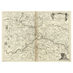
Antique Map of the Koblentz Region by Moll, 1695
About the Item
Antique map Koblentz titled 'Coblentz'. Rare antique map of the Koblentz region in Germany. On verso, an antique map of the Mont Royal fortress, Germany. Originates from 'Thesaurus Geographicus. A New Body of Geography: or a Compleat Description of the Earth 'by H. Moll.
Artists and Engravers: Herman Moll (1654 - 1732), was a London cartographer, engraver and publisher.
Condition: Very good, minor defects from handling. Please study image carefully.
Date: 1695
Overall size: 20 x 31 cm.
Image size: 13.5 x 16.5 cm.
We sell original antique maps to collectors, historians, educators and interior decorators all over the world. Our collection includes a wide range of authentic antique maps from the 16th to the 20th centuries. Buying and collecting antique maps is a tradition that goes back hundreds of years. Antique maps have proved a richly rewarding investment over the past decade, thanks to a growing appreciation of their unique historical appeal. Today the decorative qualities of antique maps are widely recognized by interior designers who appreciate their beauty and design flexibility. Depending on the individual map, presentation, and context, a rare or antique map can be modern, traditional, abstract, figurative, serious or whimsical. We offer a wide range of authentic antique maps for any budget.
- Creator:Herman Moll (Artist)
- Dimensions:Height: 12.21 in (31 cm)Width: 7.88 in (20 cm)Depth: 0 in (0.01 mm)
- Materials and Techniques:
- Period:
- Date of Manufacture:1695
- Condition:
- Seller Location:Langweer, NL
- Reference Number:

Herman Moll
Herman Moll (1654-1732) was a prominent mapmaker in London in the early eighteenth century, having moved from Germany in the late 17th century. He initially worked for English printers, but soon opened his own establishment around 1690. He was a friend of the scientist Robert Hooke, the archaeologist William Stuckley, the authors Jonathan Swift and Daniel Defoe, and the pirates William Dampier, Woodes Rogers and William Hacke. He published many atlases, as well as individual maps. He also produced book illustrations, including maps, for books by the pirate William Dampier and Jonathan Swift’s Gulliver’s Travels. Moll died in 1732.
About the Seller
5.0
Platinum Seller
These expertly vetted sellers are 1stDibs' most experienced sellers and are rated highest by our customers.
Established in 2009
1stDibs seller since 2017
1,966 sales on 1stDibs
Typical response time: <1 hour
- ShippingRetrieving quote...Ships From: Langweer, Netherlands
- Return PolicyA return for this item may be initiated within 14 days of delivery.
More From This SellerView All
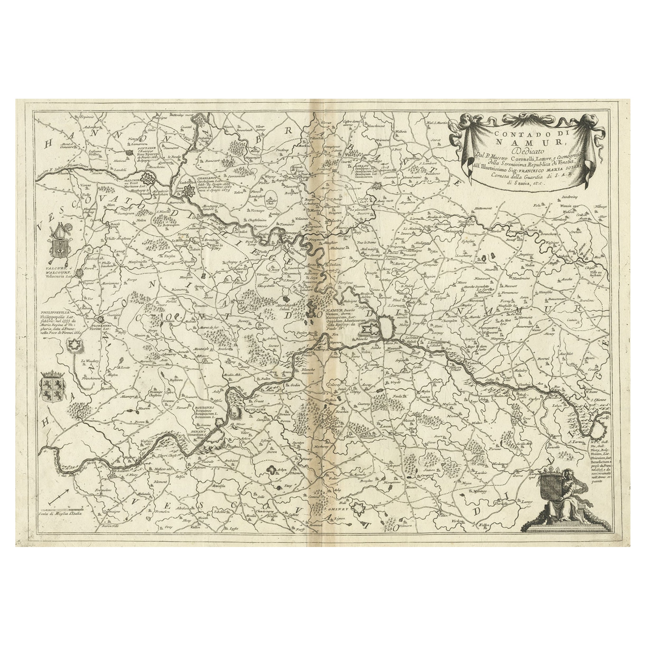
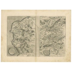
- Antique Map of the Namur Region in France by Coronelli, c.1695By Vincenzo CoronelliLocated in Langweer, NLAntique map titled 'Contado di Namur (..)'. Old map of the Namur region in central Belgium. Includes several coats of arms. Artists and Engravers: The remarkable Vincenzo Coronell...Category
Antique 17th Century Maps
MaterialsPaper
- Antique Map of Denmark by Moll 'circa 1730'By Herman MollLocated in Langweer, NLAntique map titled 'Denmark, agreeable to Modern History'. Uncommon map of Denmark by Herman Moll, published, circa 1730.Category
Antique Mid-18th Century Maps
MaterialsPaper
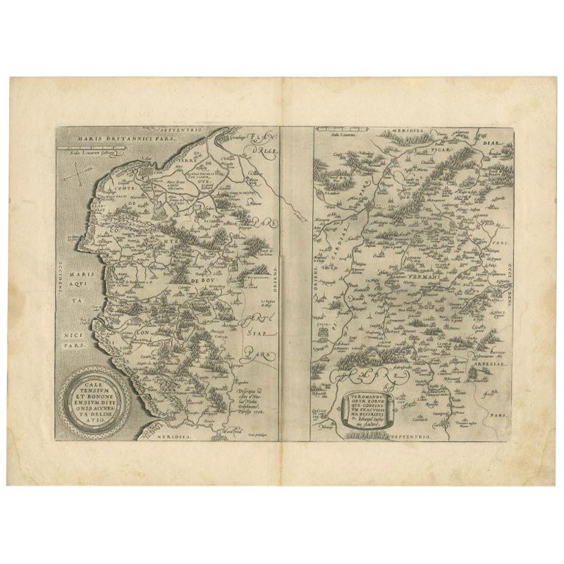
- Antique Map of the Region of Calais and The Vermandois Region by OrteliusLocated in Langweer, NLAntique map titled 'Caletensium et Bononiensium (..) - Veromandorum eorum que confinium (..)'. Two detailed regional maps by Ortelius. The first map shows Belgian and French Coastal ...Category
Antique 17th Century Maps
MaterialsPaper
- Antique Map of the Lorraine Region, c.1760Located in Langweer, NLUntitled antique map of the Lorraine region, France. A cultural and historical region in north-eastern France, now located in the administrative region of Grand Est. Lorraine's name ...Category
Antique 18th Century Maps
MaterialsPaper
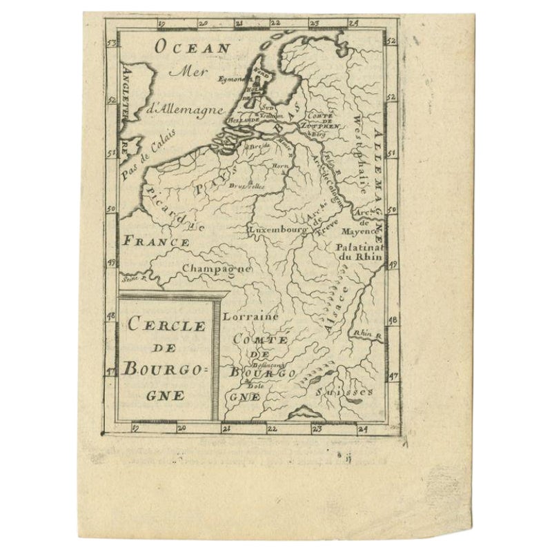
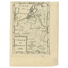
- Antique Map of the Burgundy Region by Mallet, c.1683Located in Langweer, NLAntique map titled 'Cercle de Bourgogne'. Detailed miniature map of the Burgundy region, France. Also shows the Netherlands and Belgium. Originates from Mallet's 'Description de l'Un...Category
Antique 17th Century Maps
MaterialsPaper
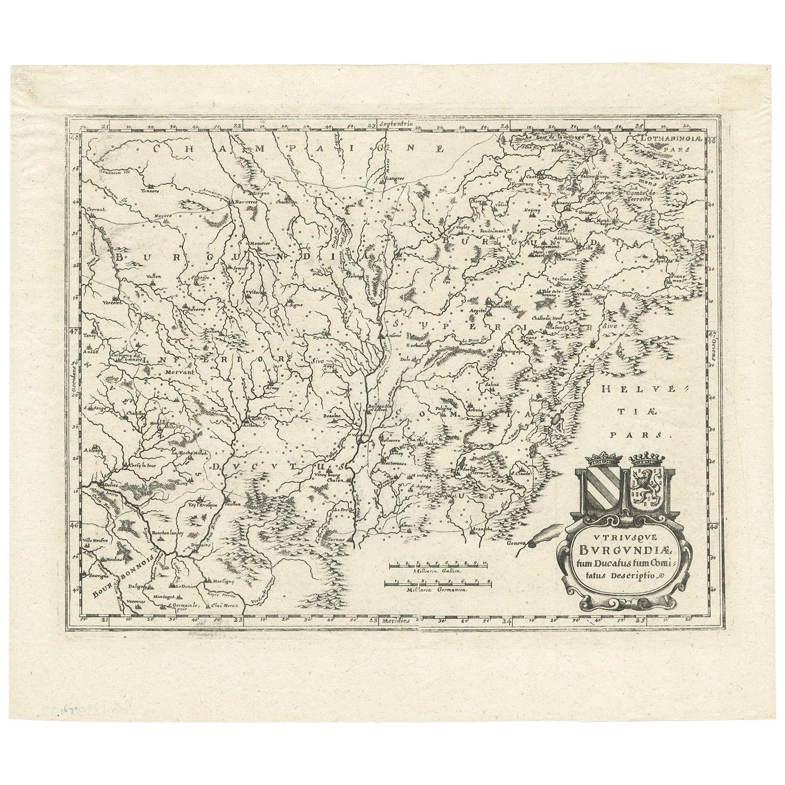
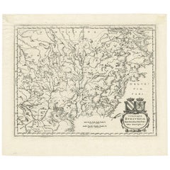
- Antique Map of the Burgundy Region by Merian '1646'Located in Langweer, NLAntique map titled 'Utriusque Burgundiae tum Ducatus tum Comitatus descriptio'. Old map of the Burgundy (Bourgogne) region of France. This map originates from 'Neuwe Archontologia co...Category
Antique Mid-17th Century Maps
MaterialsPaper


You May Also Like
- 1861 Topographical Map of the District of Columbia, by Boschke, Antique MapLocated in Colorado Springs, COPresented is an original map of Albert Boschke's extremely sought-after "Topographical Map of the District of Columbia Surveyed in the Years 1856 ...Category
Antique 1860s American Historical Memorabilia
MaterialsPaper
- 1594 Maurice Bouguereau Map of the Region Limoges, France, Ric0015Located in Norton, MA1594 Maurice Bouguereau map of the region Limoges, France, entitled "Totivs Lemovici et Confinium Pro Uinciarum Quantum ad Dioecefin Lemo Uicenfen Fpectant," Hand Colored Ric0015 Jean IV Le Clerc...Category
Antique 16th Century Dutch Maps
MaterialsPaper
- 17th Century Hand Colored Map of the Liege Region in Belgium by VisscherBy Nicolaes Visscher IILocated in Alamo, CAAn original 17th century map entitled "Leodiensis Episcopatus in omnes Subjacentes Provincias distincté divisusVisscher, Leodiensis Episcopatus" by Nicolaes Visscher II, published in Amsterdam in 1688. The map is centered on Liege, Belgium, includes the area between Antwerp, Turnhout, Roermond, Cologne, Trier and Dinant. This attractive map is presented in a cream-colored mat measuring 30" wide x 27.5" high. There is a central fold, as issued. There is minimal spotting in the upper margin and a tiny spot in the right lower margin, which are under the mat. The map is otherwise in excellent condition. The Visscher family were one of the great cartographic families of the 17th century. Begun by Claes Jansz Visscher...Category
Antique Late 17th Century Dutch Maps
MaterialsPaper
- The Normandy Region of France: A 17th C. Hand-colored Map by Sanson and JaillotBy Nicolas SansonLocated in Alamo, CAThis large hand-colored map entitled "Le Duché et Gouvernement de Normandie divisée en Haute et Basse Normandie en divers Pays; et par evêchez, avec le Gouvernement General du Havre ...Category
Antique 1690s French Maps
MaterialsPaper
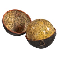
- George III Pocket Globe After Herman MollBy Herman MollLocated in Lymington, HampshireA 3 inch George III pocket globe after Herman Moll, the terrestrial globe inscribed in a cartouche ‘A correct globe with the new discoveries’ and fitted within a hinged black shagreen case, the concave interior of the case applied with the engraved celestial charts...Category
Antique 1770s English George III Globes
MaterialsWood
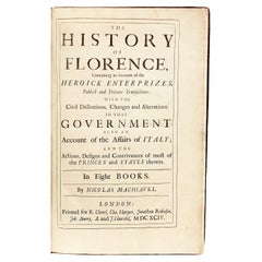
- The Works of the Famous Nicolas Machiavelli - SECOND EDITION - 1695Located in Hillsborough, NJAUTHOR: MACHIAVELLI, Nicolas TITLE: The Works of the Famous Nicolas Machiavel, Citizen and Secretary of Florence. Written originaIly [sic] in Italian, and from thence newly and fait...Category
Antique 1690s British Books
MaterialsLeather


Recently Viewed
View AllMore Ways To Browse
Antique Railroad Maps
Antique Florida Collectibles
Relief Map
West Coat Of Arms
Antique Map New York City
Antique Maps Of New York City
Antique New York City Maps
Map Of Massachusetts
Antique Tasmania
Antique Furniture Missouri
Maritime Chart
Southeast Asia Map
Biblical Maps
Church Yard
Migeon And Migeon
Migeon Migeon
1785 Maps
Antique Pamphlets