Items Similar to Antique Map of the Maluku Islands by Van der Aa, 1714


Want more images or videos?
Request additional images or videos from the seller
1 of 5
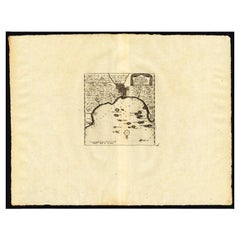
Antique Map of the Maluku Islands by Van der Aa, 1714
About the Item
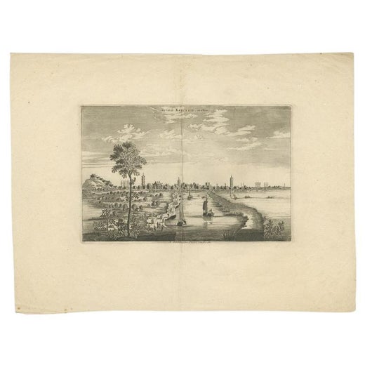
Antique Map Moluccas titled 'Les Isles Moluques'. Rare map of the Spice Islands made after a map engraved by Pieter van den Keere and published in the 1628 edition of the Mercator Atlas Minor. This edition originates from 'Atlas Soulage'. The cartouche and compass rose are revised and the title is in French.
Artists and Engravers: Pieter van der Aa (Leiden 1659-1733) was a Dutch publisher best known for preparing maps and atlases.
Condition: Very good, please study image carefully.
Date: 1714
Overall size: 23.3 x 18.5 cm.
Image size: 19.7 x 14.3 cm.
We sell original antique maps to collectors, historians, educators and interior decorators all over the world. Our collection includes a wide range of authentic antique maps from the 16th to the 20th centuries. Buying and collecting antique maps is a tradition that goes back hundreds of years. Antique maps have proved a richly rewarding investment over the past decade, thanks to a growing appreciation of their unique historical appeal. Today the decorative qualities of antique maps are widely recognized by interior designers who appreciate their beauty and design flexibility. Depending on the individual map, presentation, and context, a rare or antique map can be modern, traditional, abstract, figurative, serious or whimsical. We offer a wide range of authentic antique maps for any budget
- Creator:Pieter Van Der Aa (Artist)
- Dimensions:Height: 7.29 in (18.5 cm)Width: 9.18 in (23.3 cm)Depth: 0 in (0.01 mm)
- Materials and Techniques:
- Period:
- Date of Manufacture:1714
- Condition:
- Seller Location:Langweer, NL
- Reference Number:
Pieter Van Der Aa
Pieter van der Aa began his career at Leiden in 1683 as a Latin trade publisher, publishing classical texts about medicine and science. He was a Dutch publisher of maps and atlases active in the late 17th and early 18th centuries. During his long and impressive career, Van der Aa produced thousands of maps, including a vast 28 volume atlas containing no less than 3,000 maps.
About the Seller
5.0
Platinum Seller
These expertly vetted sellers are 1stDibs' most experienced sellers and are rated highest by our customers.
Established in 2009
1stDibs seller since 2017
1,966 sales on 1stDibs
Typical response time: <1 hour
- ShippingRetrieving quote...Ships From: Langweer, Netherlands
- Return PolicyA return for this item may be initiated within 14 days of delivery.
More From This SellerView All
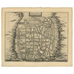
- Antique Map of the Maluku Islands by Van der Aa, 1725By Pieter Van Der AaLocated in Langweer, NLAntique map titled 'Les Iles Moluques (..).' (The Moluccan Islands, Maluku, Moluccas, Spice Islands, Indonesia.) Extremely rare in this edition. This plate originates from the very s...Category
Antique 18th Century Maps
MaterialsPaper
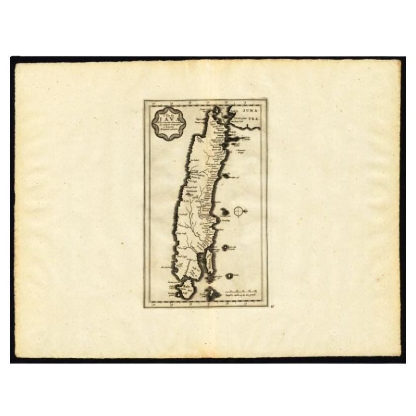
- Antique Map of the Island of Java by Van Der Aa, 1725By Pieter Van Der AaLocated in Langweer, NLAntique map titled 'Map: 'L'Ile de Java'. (The island of Java.) This map shows the Indonesian island of Java. With compass rose and scale. This plate originates from the very scarse:...Category
Antique 18th Century Maps
MaterialsPaper
- Antique Map of the Mughal Empire by Van der Aa, C.1725By Pieter Van Der AaLocated in Langweer, NLAntique map titled 'Royaume de Grand Mogol (..).' This map shows the extend of the Mughal Empire, which includes northern India, from Golconda to Afghanistan and eastwards to Bengal....Category
Antique 18th Century Maps
MaterialsPaper
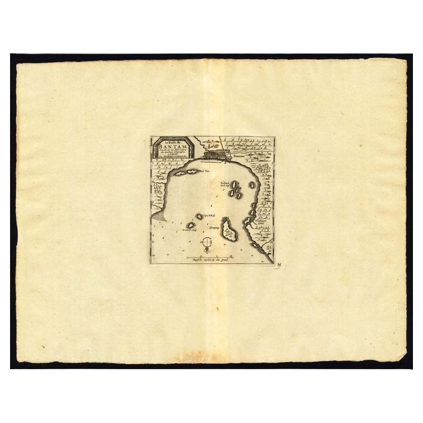
- Antique Map of the Roadstead of Bantam by Van der Aa, 1725By Pieter Van Der AaLocated in Langweer, NLAntique map titled 'La rade de Bantam'. (The roadstead of Bantam.) This map shows the Indonesian city of Banten / Bantam on Java, Indonesia and its roadstead. With compass rose and s...Category
Antique 18th Century Maps
MaterialsPaper
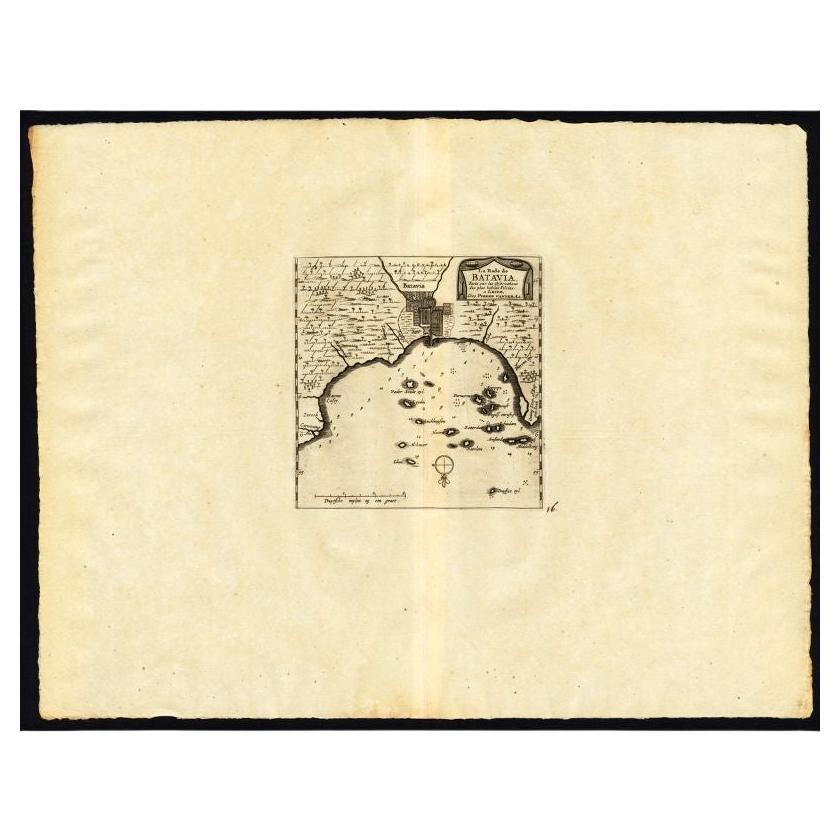
- Antique Map of the Roadstead of Batavia by Van der Aa, 1725By Pieter Van Der AaLocated in Langweer, NLAntique map titled 'La rade de Batavia'. (The roadstead of Batavia.) This map shows the roadstead before the Indonesian city of Batavia, nowadays Jakarta. This plate originates from ...Category
Antique 18th Century Maps
MaterialsPaper
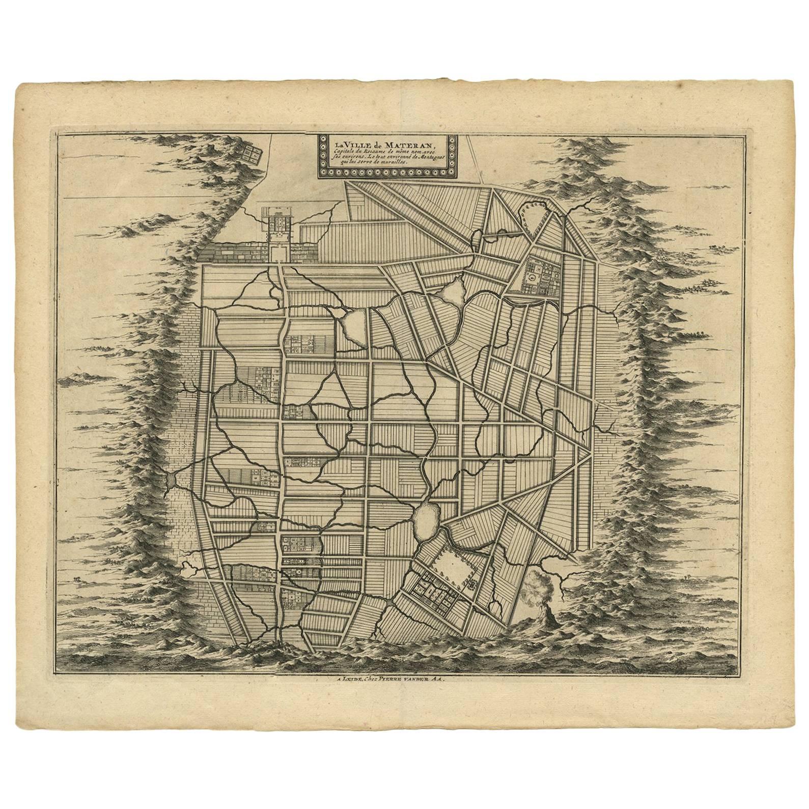
- Antique Map of the City of Materan 'Indonesia' by P. van der Aa, circa 1725By Pieter Van Der AaLocated in Langweer, NLAntique map titled 'La Ville de Materan, capitale de Roiaume de meme nom, avec ses environs. Le tout environne de Montagnes qui lui serve de murailles.' The city of Materan, capital ...Category
Antique Early 18th Century Maps
MaterialsPaper

You May Also Like
- London AA MapLocated in Alton, GBLondon AA map.Category
20th Century Maps
MaterialsPaper
- 1854 Map of Massachusetts, Connecticut and Rhode Island, Antique Wall MapLocated in Colorado Springs, COThis striking wall map was published in 1854 by Ensign, Bridgman & Fanning and has both full original hand-coloring and original hardware. This impression is both informative and highly decorative. The states are divided into counties, outlined in red, green, and black, and subdivided into towns. Roads, canals, and railroad lines are prominently depicted, although they are not all labeled. The mapmakers also marked lighthouses, banks, churches, and prominent buildings, with a key at right. The map is an informative and comprehensive overview of the infrastructural development of New England prior to the Civil War. Physical geographies depicted include elevation, conveyed with hachure marks, rivers and lakes. The impression features an inset map of Boston...Category
Antique 19th Century American Maps
MaterialsPaper
- 1861 Topographical Map of the District of Columbia, by Boschke, Antique MapLocated in Colorado Springs, COPresented is an original map of Albert Boschke's extremely sought-after "Topographical Map of the District of Columbia Surveyed in the Years 1856 ...Category
Antique 1860s American Historical Memorabilia
MaterialsPaper
- Large Original Antique Map of Rhode Island, USA, C.1900Located in St Annes, LancashireFabulous map of Rhode Island Original color Engraved and printed by the George F. Cram Company, Indianapolis. Published, C.1900 Unframed Free ...Category
Antique 1890s American Maps
MaterialsPaper
- Large Original Vintage Map of The Pacific Islands Including HawaiiLocated in St Annes, LancashireGreat map of The Pacific Islands Unframed Original color By John Bartholomew and Co. Edinburgh Geographical Institute Published, circa 1...Category
Vintage 1920s British Maps
MaterialsPaper
- 1868 Map of the Upper Part of the Island of Manhattan Above 86th StreetBy Wm. Rogers Mfg. Co.Located in San Francisco, CAThis wonderful piece of New York City history is over 150 years old. It depicts 86th street and above. It was lithographed by WC Rogers and company. It was made to show what was the Battle of Harlem during the Revolutionary war...Category
Antique 1860s American American Colonial Maps
MaterialsPaper


Recently Viewed
View AllMore Ways To Browse
Antique Compass Made In France
Antique Furniture Columbus
Bay Area Antique Furniture
Antique Framed Map Engravings
Bible Maps
John Tallis Map
Mediterranean Sea Map
Sedan Antique
Singapore Antique
Antique Map Venice
Antique Maps New Zealand
Antique Maps Venice
Antique Railroad Maps
Cape Verde
Antique Florida Collectibles
Antique Map Of New Zealand
Antique Map Of Venice
Relief Map