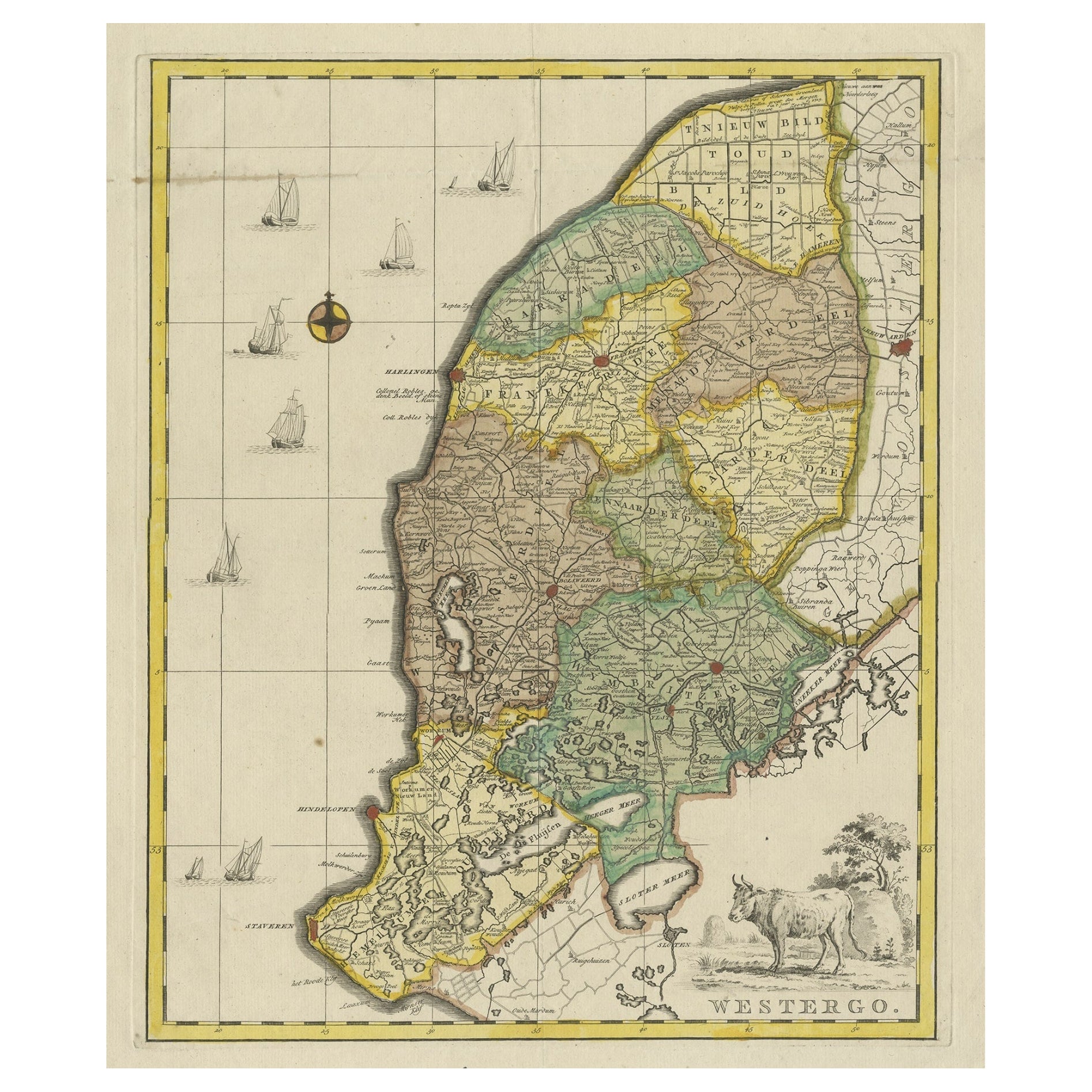
Items Similar to Antique Map of Westergo, Friesland in the the Netherlands, by Tirion, 1744
Want more images or videos?
Request additional images or videos from the seller
1 of 6
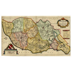
Antique Map of Westergo, Friesland in the the Netherlands, by Tirion, 1744
About the Item
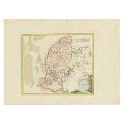
Antique map titled 'Westergo'. Original antique map of Westergo, part of the province of Friesland, the Netherlands. Published 1744.
Artists and Engravers: Isaak Tirion (1705 in Utrecht – 1765 in Amsterdam) was an 18th-century publisher from the Northern Netherlands.
Condition: Good, original/contemporary hand coloring. Original folding lines. General age-related toning, minor wear. Blank verso. Please study image carefully.
Date: 1744
Overall size: 40 x 49.5 cm.
Image size: 33 x 40.5 cm.
We sell original antique maps to collectors, historians, educators and interior decorators all over the world. Our collection includes a wide range of authentic antique maps from the 16th to the 20th centuries. Buying and collecting antique maps is a tradition that goes back hundreds of years. Antique maps have proved a richly rewarding investment over the past decade, thanks to a growing appreciation of their unique historical appeal. Today the decorative qualities of antique maps are widely recognized by interior designers who appreciate their beauty and design flexibility. Depending on the individual map, presentation, and context, a rare or antique map can be modern, traditional, abstract, figurative, serious or whimsical. We offer a wide range of authentic antique maps for any budget.
- Creator:Isaak Tirion (Artist)
- Dimensions:Height: 19.49 in (49.5 cm)Width: 15.75 in (40 cm)Depth: 0 in (0.01 mm)
- Materials and Techniques:
- Period:
- Date of Manufacture:1744
- Condition:Condition: Good, original/contemporary hand coloring. Original folding lines. General age-related toning, minor wear. Blank verso. Please study image carefully.
- Seller Location:Langweer, NL
- Reference Number:
About the Seller
5.0
Platinum Seller
These expertly vetted sellers are 1stDibs' most experienced sellers and are rated highest by our customers.
Established in 2009
1stDibs seller since 2017
1,967 sales on 1stDibs
Typical response time: <1 hour
- ShippingRetrieving quote...Ships From: Langweer, Netherlands
- Return PolicyA return for this item may be initiated within 14 days of delivery.
More From This SellerView All
- Original Copper-Engraving of Westergo, Part of Friesland, the Netherlands, 1744Located in Langweer, NLAntique map titled 'Westergo'. Original antique map of Westergo, part of the province of Friesland, the Netherlands. Published 1744. Artists and engravers: Isaak Tirion (1705 ...Category
Antique 1740s Maps
MaterialsPaper
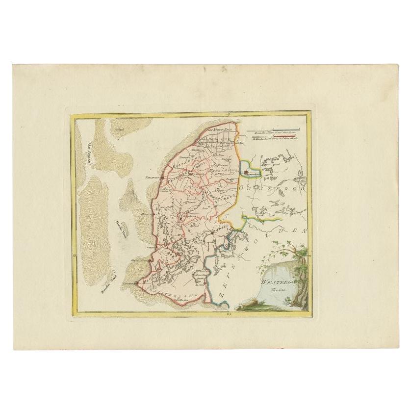
- Antique Map of Westergo in Friesland, 1791Located in Langweer, NLAntique map titled 'Westergo'. Map of the Westergo region, Friesland, the Netherlands. This map orginates from 'Schauplatz der fünf Theile der Welt'. Artists and Engravers: Franz...Category
Antique 18th Century Maps
MaterialsPaper
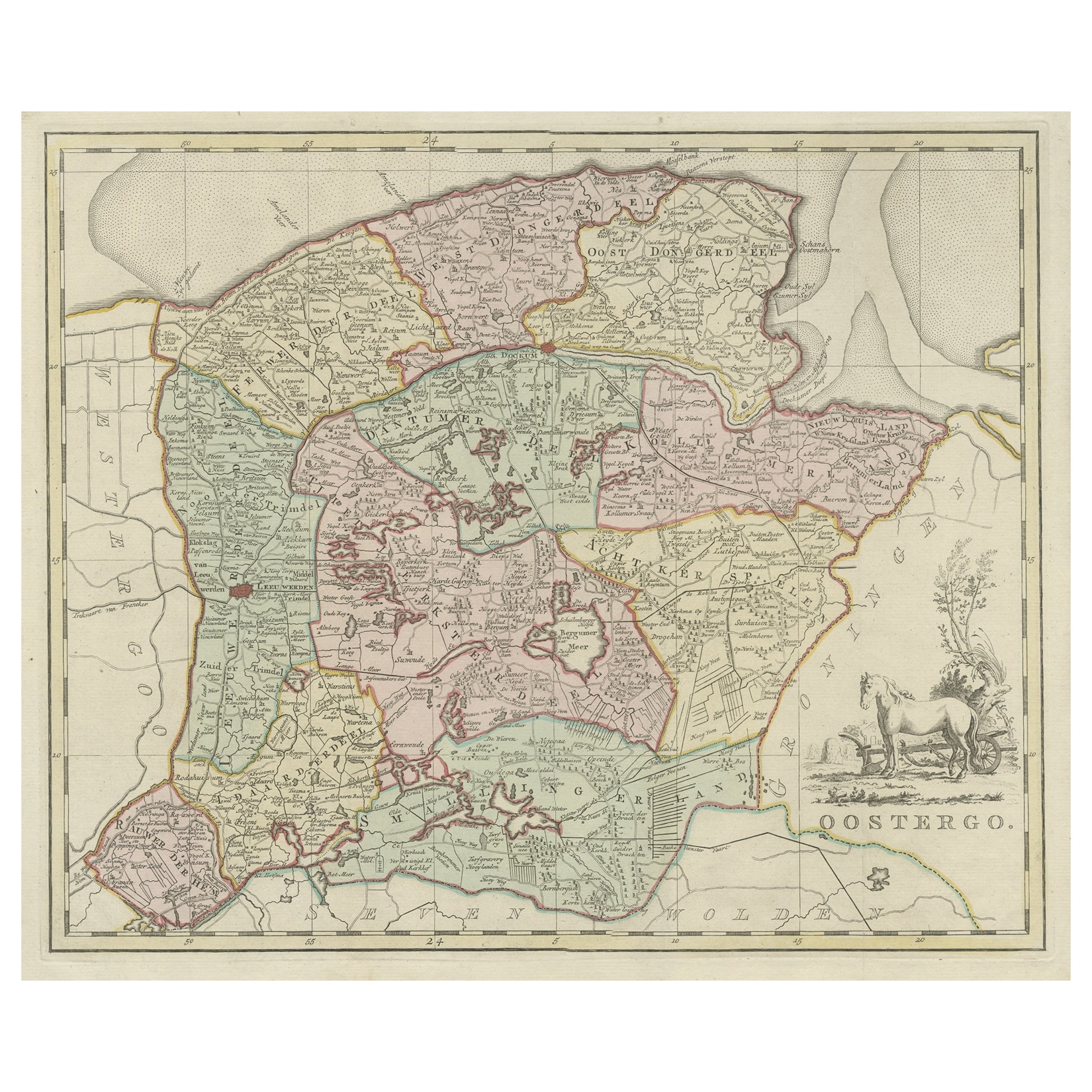
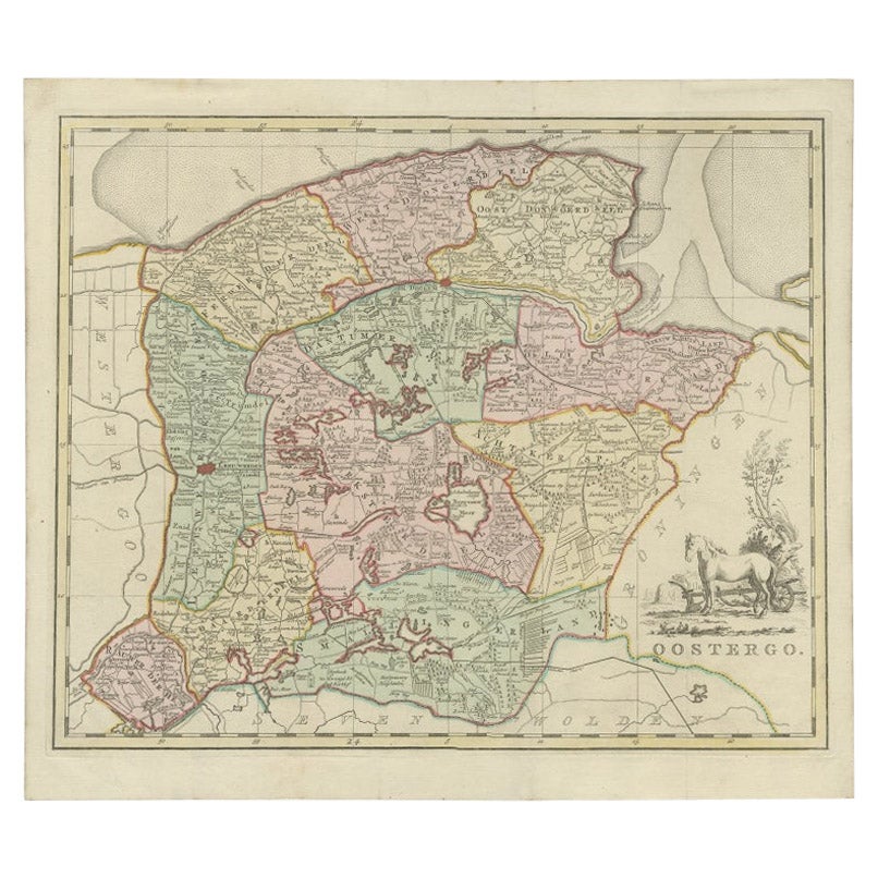
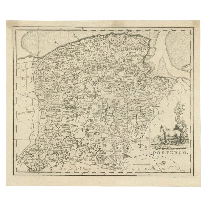
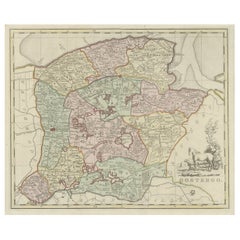
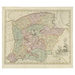
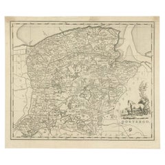
- Antique Map of Oostergo, Part of Friesland, the Netherlands. Published in 1744Located in Langweer, NLAntique map titled 'Oostergo'. Original antique map of Oostergo, part of the province of Friesland, the Netherlands. Published 1744. Artists and Engravers: Isaak Tirion (1705 in U...Category
Antique 1740s Maps
MaterialsPaper
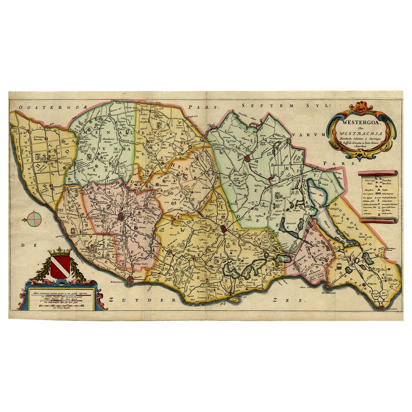
- Map of the Shire of Westergo in the Province of Friesland, the Netherlands, 1664Located in Langweer, NLAntique map titled 'Westergoa Olim Westrachia.' Map of the shire of Westergo in the province of Friesland in the Netherlands, including Stavoren, Bolswar...Category
Antique 1660s Maps
MaterialsPaper
- Antique Map of Oostergo by Tirion, 1744Located in Langweer, NLAntique map titled 'Oostergo'. Original antique map of Oostergo, part of the province of Friesland, the Netherlands. Published 1744. Artists and Engravers: Isaak Tirion (1705 in Utre...Category
Antique 18th Century Maps
MaterialsPaper
- Antique Map of Oostergo by Tirion, 1744Located in Langweer, NLAntique map titled 'Oostergo'. Original antique map of Oostergo, part of the province of Friesland, the Netherlands. Published 1744. Artists and Engravers: Isaak Tirion (1705 in Utre...Category
Antique 18th Century Maps
MaterialsPaper

You May Also Like
- England, Scotland & Ireland: A Hand Colored Map of Great Britain by TirionBy Isaak TirionLocated in Alamo, CAThis is a hand-colored double page copperplate map of Great Britain entitled "Nieuwe Kaart van de Eilanden van Groot Brittannien Behelzende de Kon...Category
Antique Mid-18th Century Dutch Maps
MaterialsPaper
- Original Antique Map of The Netherlands, Engraved by Barlow, Dated 1807Located in St Annes, LancashireGreat map of Netherlands Copper-plate engraving by Barlow Published by Brightly & Kinnersly, Bungay, Suffolk. Dated 1807 Unframed.Category
Antique Early 1800s English Maps
MaterialsPaper
- London 1744 Published Watercolour Antique Map of East Africa by Eman BowenLocated in GBWe are delighted to offer for sale this New and Accurate Map of Nubia & Abissinia, together with all the Kingdoms Tributary Thereto, and bordering upon them published in 1744 by Emanuel Bowen This is a decorative antique engraved map of East Africa...Category
Antique 1740s English George III Maps
MaterialsPaper
- Original Antique Map of The Netherlands, Sherwood, Neely & Jones, Dated 1809Located in St Annes, LancashireGreat map of The Netherlands Copper-plate engraving by Cooper Published by Sherwood, Neely & Jones. Dated 1809 Unframed.Category
Antique Early 1800s English Maps
MaterialsPaper
- 1861 Topographical Map of the District of Columbia, by Boschke, Antique MapLocated in Colorado Springs, COPresented is an original map of Albert Boschke's extremely sought-after "Topographical Map of the District of Columbia Surveyed in the Years 1856 ...Category
Antique 1860s American Historical Memorabilia
MaterialsPaper
- School Chart or Pull Down Map of Geography of the Netherlands, 1950sLocated in Hemiksem, VANA beautiful old school map of the Netherlands, painted on linen. The map shows the 3 different reliefs (low, middle, high) of the Netherlands. The beau...Category
Vintage 1950s Belgian Mid-Century Modern Maps
MaterialsLinen, Paint


Recently Viewed
View AllMore Ways To Browse
African Money
Antique Hurst
King Charles I Of England
Map Railroad
42 North Antiques
Antique German Compass
Antique Map Box
Antique Map Of Poland
Hungary Map
Antique Caribbean Maps
Antique Furniture Durham
Antique Furniture Tasmania
Antique Maps Caribbean
Large Antique Maps North America
Map Of Peru
Philippines Map
Sri Lanka Map
Victor Levasseur On Sale