Items Similar to Interesting Map of Great Britain and Northern Europe with various Illustrations


Want more images or videos?
Request additional images or videos from the seller
1 of 6
Interesting Map of Great Britain and Northern Europe with various Illustrations
About the Item
Antique map titled 'Itinera Varia Auctoris'. Very interesting map of Great Britain and Northern Europe. The map shows Edwards' journeys between 1716-1730 to study his beloved birds and other natural creatures, including Holland in 1716 and again in 1730, Norway in 1718, and France from 1719-1721. The North Sea is filled with illustrations of a beak of the Egyptian Ibis, life size male and female stag beetles from Borneo and in lower right the Least Hummingbird of Jamaica.
This fascinating map was drawn by artist, naturalist, and ornithologist George Edwards (1694-1773) and was published in his A Natural History of Uncommon Birds (1743-51), a four-volume work featuring more than 200 stunning bird engravings based on Edwards' original drawings. Edwards' publication was immediately popular, and was subsequently republished in several editions. The map shows Edwards' journeys between 1716-1730 to study his beloved birds and other natural creatures, including Holland in 1716 and again in 1730, Norway in 1718, and France from 1719-21.
- Dimensions:Height: 11.23 in (28.5 cm)Width: 8.9 in (22.6 cm)Depth: 0.02 in (0.5 mm)
- Materials and Techniques:
- Period:
- Date of Manufacture:1746
- Condition:Original/contemporary hand coloring. Minor wear and soiling. Blank verso, with two small pieces on top. Please study image carefully.
- Seller Location:Langweer, NL
- Reference Number:
About the Seller
5.0
Platinum Seller
These expertly vetted sellers are 1stDibs' most experienced sellers and are rated highest by our customers.
Established in 2009
1stDibs seller since 2017
1,965 sales on 1stDibs
Typical response time: <1 hour
- ShippingRetrieving quote...Ships From: Langweer, Netherlands
- Return PolicyA return for this item may be initiated within 14 days of delivery.
More From This SellerView All
- Antique Map of Northern Europe and European Russia, ca.1780Located in Langweer, NLAntique map titled 'Le Nord de L'Europe, Contenant Le Danemark, La Norwege; La Suede et La Laponie avec la Majeure Partie de al Russie Europeenne.' Map of Northern Europe and Eur...Category
Antique 1780s Maps
MaterialsPaper
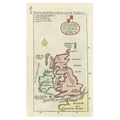
- Interesting Small Map of the British Isles with Hand ColoringLocated in Langweer, NLAntique map titled 'Insularum Britannicarum Tabula'. Interesting small map of the British Isles by Wells. This map originates from 'Oikumenes Periegesis, sive, Dionysii Geographia em...Category
Antique Early 18th Century Maps
MaterialsPaper
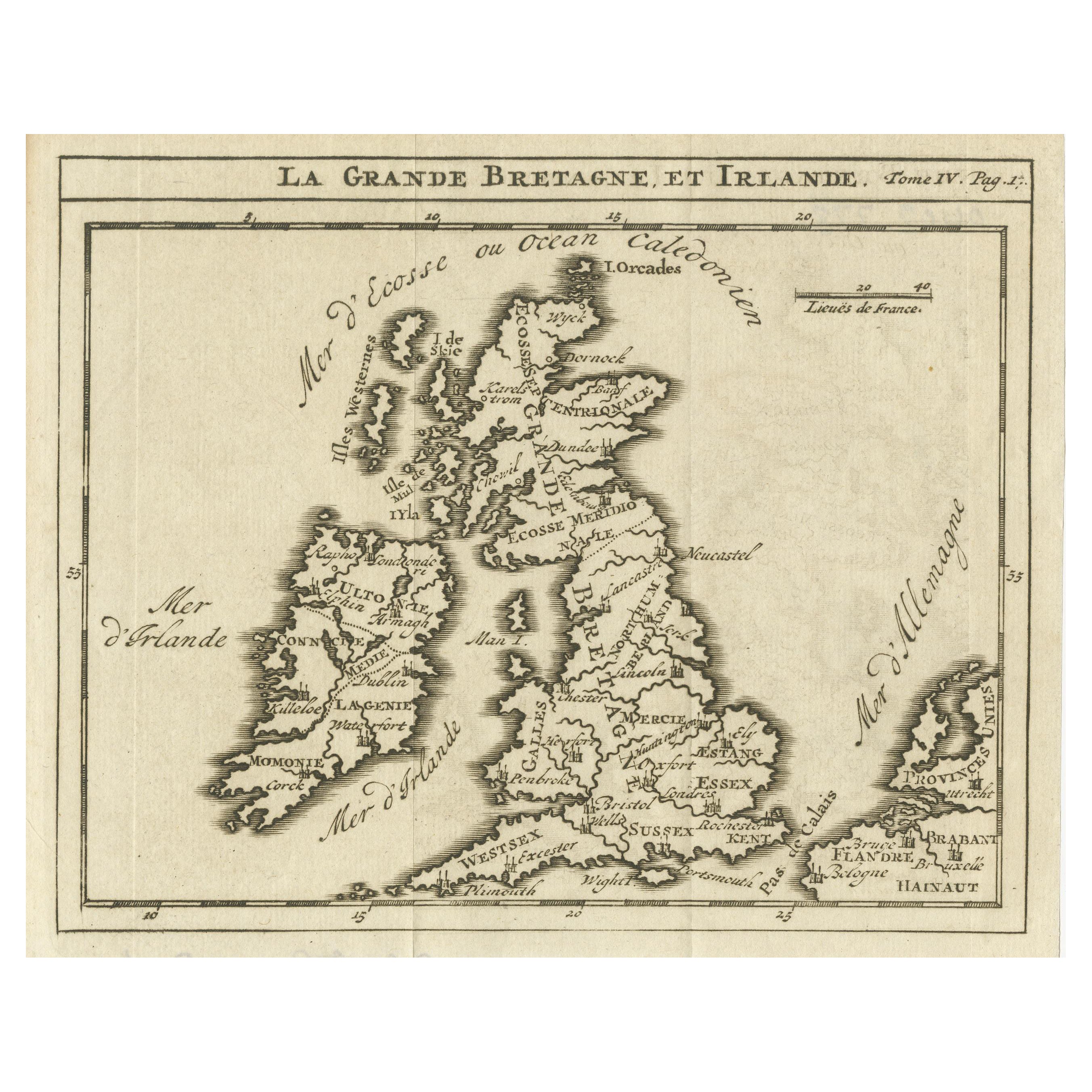
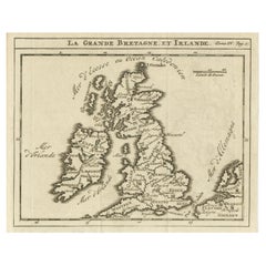
- Rare Small Antique Map of Great Britain and IrelandLocated in Langweer, NLAntique map titled 'La Grande Bretagne et Irlande'. Small antique map of Great Britain and Ireland. Source unknown, to be determined. Publ...Category
Antique Mid-18th Century Maps
MaterialsPaper
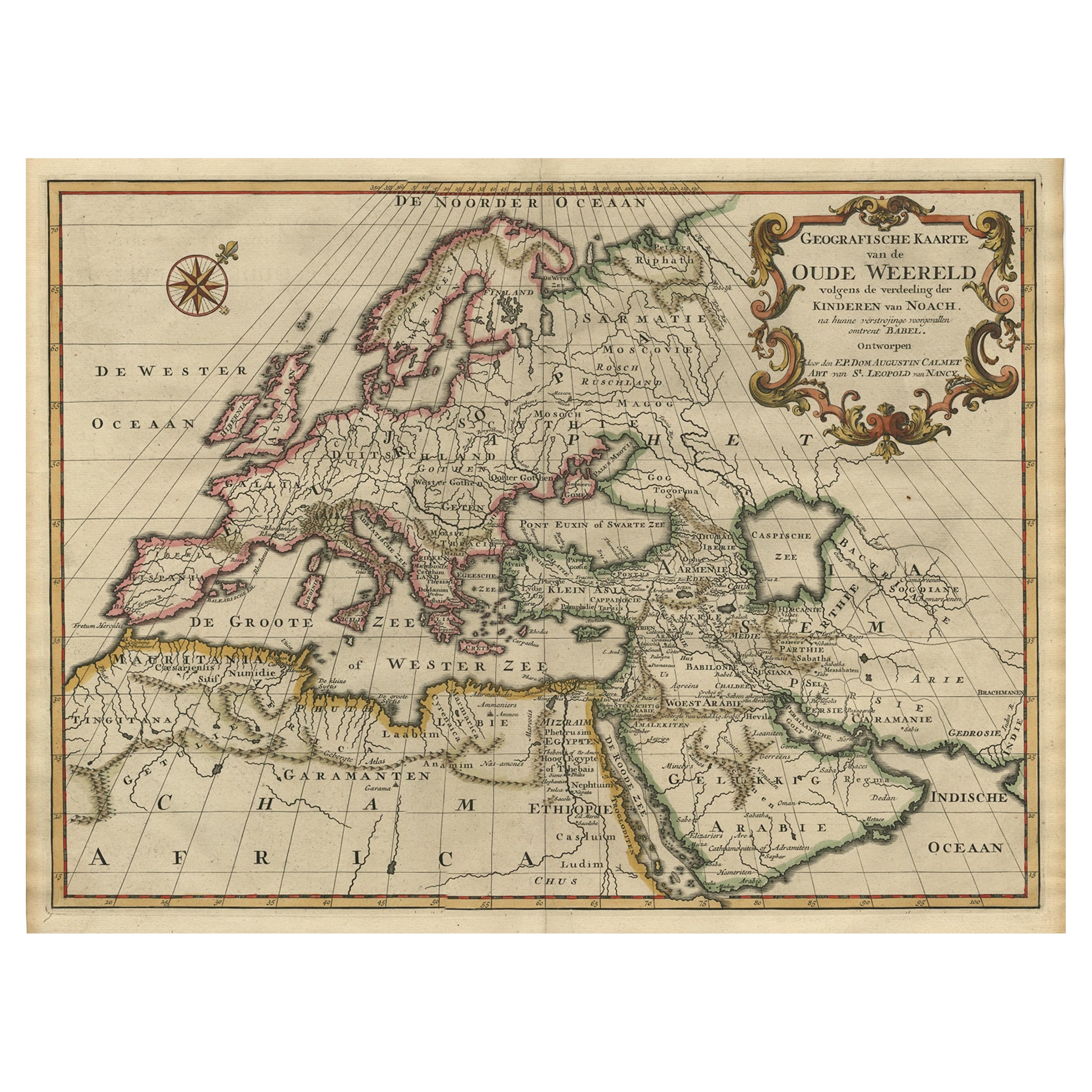
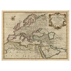
- Ancient World Map of Europe, Asia & Northern Africa with Ancient Names, 1725Located in Langweer, NLAntique map titled 'Geografische Kaarte van de Oude Weereld (..).' Original antique map of the ancient world depicting Europe, Asia, and northern Africa with ancient place names....Category
Antique 1720s Maps
MaterialsPaper
- Antique Map of the Northern Coast of Africa and Southern Europe, circa 1745By Covens & MortierLocated in Langweer, NLAntique map titled 'In Notitiam Ecclesiasticam Africae Tabula Geographica'. Very decorative hand-colored map of the northern coast of Africa, Spain, Italy and the Mediterranean with the islands of Sardinia, Corsica, Majorca, Minorca etc. Sicily features a smoking Mount Aetna. Embellished with three architectural cartouches...Category
Antique Mid-18th Century Maps
MaterialsPaper
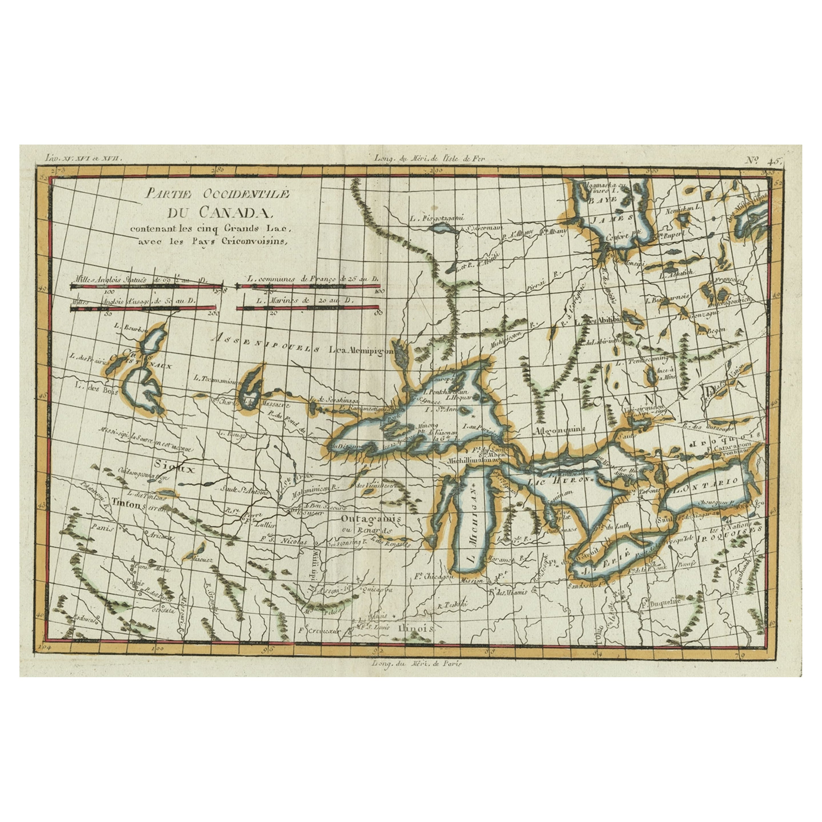
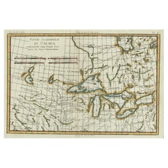
- Old Map of the Great Lakes and Upper Mississippi Valley, Northern America, c1780Located in Langweer, NLAntique map titled 'Partie Occidentale du Canada'. A fine example of Rigobert Bonne and Guilleme Raynal's 1780 map of the Great Lakes and upper Mississippi Valley. A map of c...Category
Antique 1780s Maps
MaterialsPaper


You May Also Like
- England, Scotland & Ireland: A Hand Colored Map of Great Britain by TirionBy Isaak TirionLocated in Alamo, CAThis is a hand-colored double page copperplate map of Great Britain entitled "Nieuwe Kaart van de Eilanden van Groot Brittannien Behelzende de Kon...Category
Antique Mid-18th Century Dutch Maps
MaterialsPaper
- Original Antique Map of Europe, Arrowsmith, 1820Located in St Annes, LancashireGreat map of Europe Drawn under the direction of Arrowsmith. Copper-plate engraving. Published by Longman, Hurst, Rees, Orme and Brown, 1820 ...Category
Antique 1820s English Maps
MaterialsPaper
- Northern Scotland: A 17th Century Hand-colored Map by MercatorBy Gerard MercatorLocated in Alamo, CAThis is a framed hand-colored 17th century map of Northern Scotland by Gerard Mercator entitled "Scotiae pars Septentrionalis", published in Amsterdam in 1636. It is a highly detailed map of the northern part of Scotland, with the northwest Highlands and the cities Inverness and Aberdeen, as well as the Orkney Islands and the Hebrides. There is a decorative title cartouche in the upper left corner. The map is presented in an antiqued brown wood...Category
Antique 1630s Dutch Maps
MaterialsPaper
- Northern Scotland: A 16th Century Hand-colored Map by MercatorBy Gerard MercatorLocated in Alamo, CAA framed hand-colored 16th century map of Northern Scotland by Gerard Mercator entitled "Scotiae pars Septentrionalis", published in Amsterdam in 1636. It is a highly detailed map of the northern part of Scotland, with the northwest Highlands and the cities Inverness and Aberdeen, as well as the Orkney Islands and the Hebrides. There is a decorative title cartouche in the upper left corner. The map is presented in an antiqued brown wood...Category
Antique 16th Century Dutch Maps
MaterialsPaper
- Scandinavia & Portions of Eastern Europe: 18th Century Hand-Colored Homann MapBy Johann Baptist HomannLocated in Alamo, CAAn early 18th century hand-colored copper-plate map entitled "Regni Sueciae in omnes suas Subjacentes Provincias accurate divisi Tabula Generalis" by Johann Baptist Homann (1663-1724...Category
Antique Early 18th Century German Maps
MaterialsPaper
- Large 17th Century Hand Colored Map of England and the British Isles by de WitBy Frederick de WitLocated in Alamo, CAA large hand colored 17th century map of England and the British Isles by Frederick de Wit entitled "Accuratissima Angliæ Regni et Walliæ Principatus", published in Amsterdam in 1680. It is a highly detailed map of England, Scotland, the Scottish Isles...Category
Antique Late 17th Century Dutch Maps
MaterialsPaper


Recently Viewed
View AllMore Ways To Browse
Great Northern
Norwegian Antiques
French Stag
Egyptian Beetle
Used Furniture Jamaica
Antique Hummingbird
18th Century Norwegian
Norwegian 18th
Antique Furniture Jamaica
Jamaican Antique
Stag Beetle
Ibis Egyptian
Map Of Jamaica
Antique Jamaica Map
Map Jamaica
Antique Curiosities Hummingbird
Oceanic Wood Carving
Wood Carving Ocean