Items Similar to Large Original Vintage Map of Persia / Iran, circa 1920

Want more images or videos?
Request additional images or videos from the seller
1 of 5
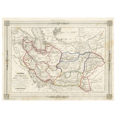
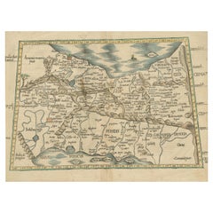
Large Original Vintage Map of Persia / Iran, circa 1920
About the Item
Great maps of Persia.
Unframed.
Original color.
By John Bartholomew and Co. Edinburgh Geographical Institute.
Published, circa 1920.
Free shipping.
- Dimensions:Height: 18 in (45.72 cm)Width: 23 in (58.42 cm)Depth: 0.07 in (1.78 mm)
- Materials and Techniques:Paper,Other
- Place of Origin:
- Period:
- Date of Manufacture:1920
- Condition:Wear consistent with age and use.
- Seller Location:St Annes, GB
- Reference Number:1stDibs: LU1836328680382
About the Seller
4.9
Platinum Seller
These expertly vetted sellers are 1stDibs' most experienced sellers and are rated highest by our customers.
1stDibs seller since 2016
2,660 sales on 1stDibs
Typical response time: <1 hour
Associations
International Confederation of Art and Antique Dealers' Associations
- ShippingRetrieving quote...Ships From: St Annes, United Kingdom
- Return PolicyA return for this item may be initiated within 3 days of delivery.
Auctions on 1stDibs
Our timed auctions are an opportunity to bid on extraordinary design. We do not charge a Buyer's Premium and shipping is facilitated by 1stDibs and/or the seller. Plus, all auction purchases are covered by our comprehensive Buyer Protection. Learn More
More From This SellerView All
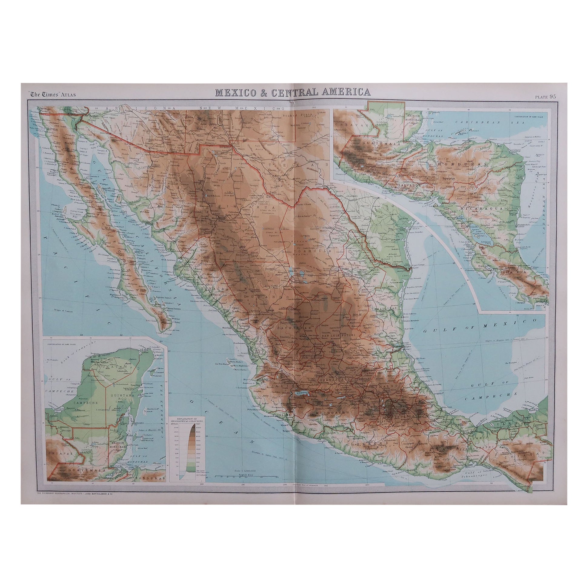
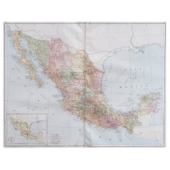
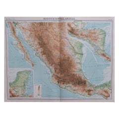
- Large Original Vintage Map of Mexico, circa 1920Located in St Annes, LancashireGreat map of Mexico Original color. Good condition Published by Alexander Gross Unframed.Category
Vintage 1920s English Edwardian Maps
MaterialsPaper
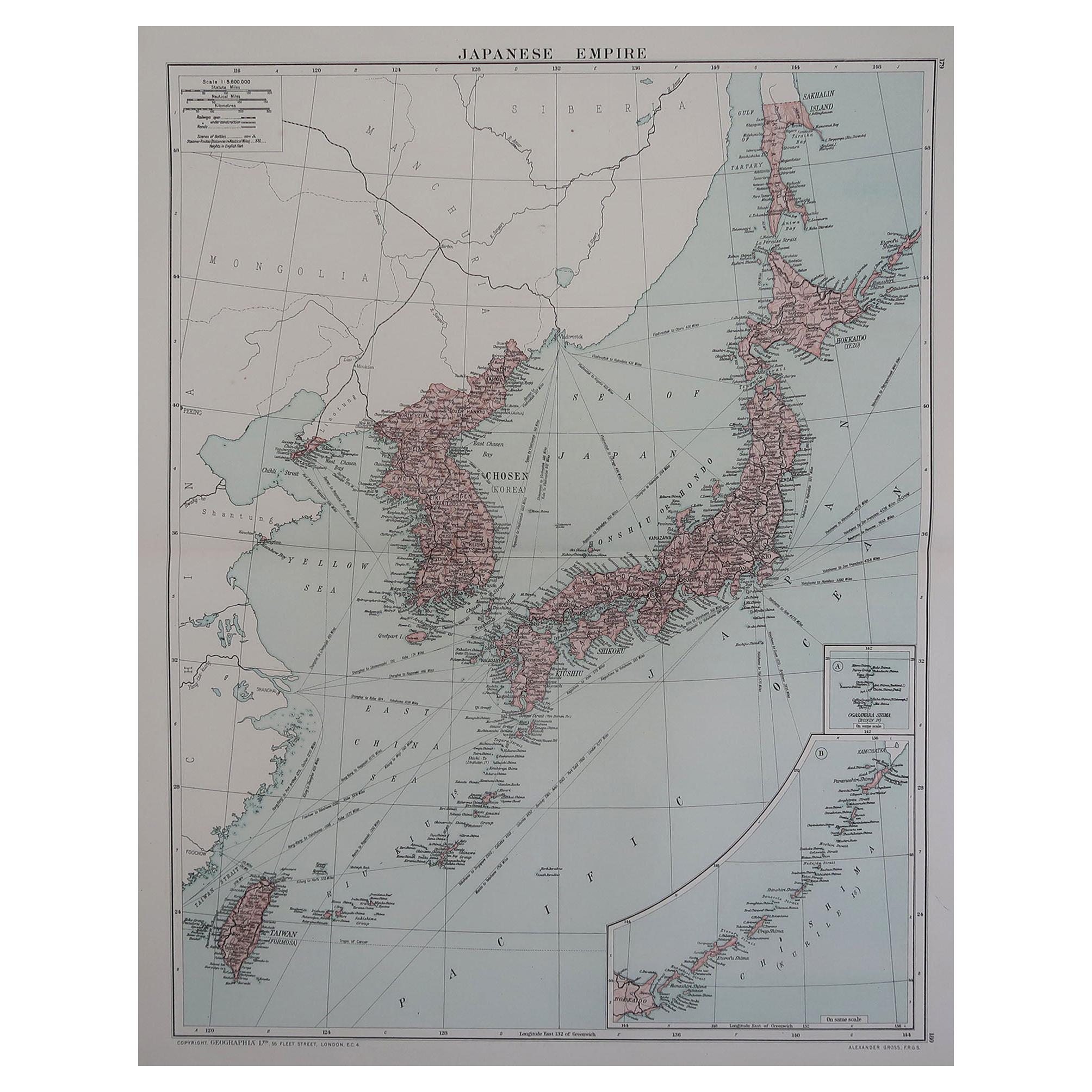
- Large Original Vintage Map of Japan, circa 1920Located in St Annes, LancashireGreat map of Japan Original color. Good condition Published by Alexander Gross Unframed.Category
Vintage 1920s English Victorian Maps
MaterialsPaper
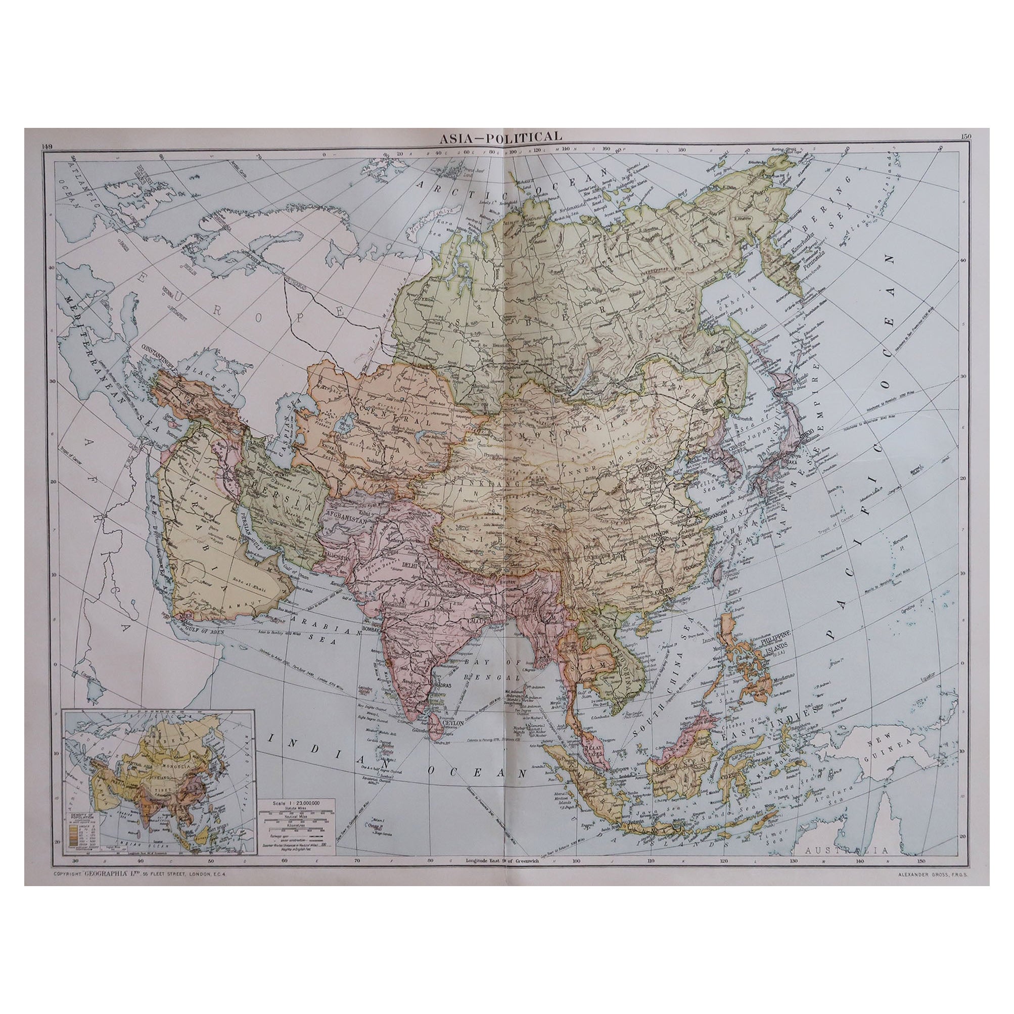
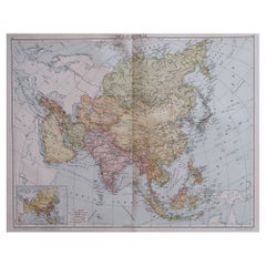
- Large Original Vintage Map of Asia, circa 1920Located in St Annes, LancashireGreat map of Asia Original color. Good condition Published by Alexander Gross Unframed.Category
Vintage 1920s English Edwardian Maps
MaterialsPaper
- Large Original Vintage Map of Mexico, circa 1920Located in St Annes, LancashireGreat maps of Mexico. Unframed. Original color. By John Bartholomew and Co. Edinburgh Geographical Institute. Published, circa 1920. Free shipping.Category
Vintage 1920s British Maps
MaterialsPaper
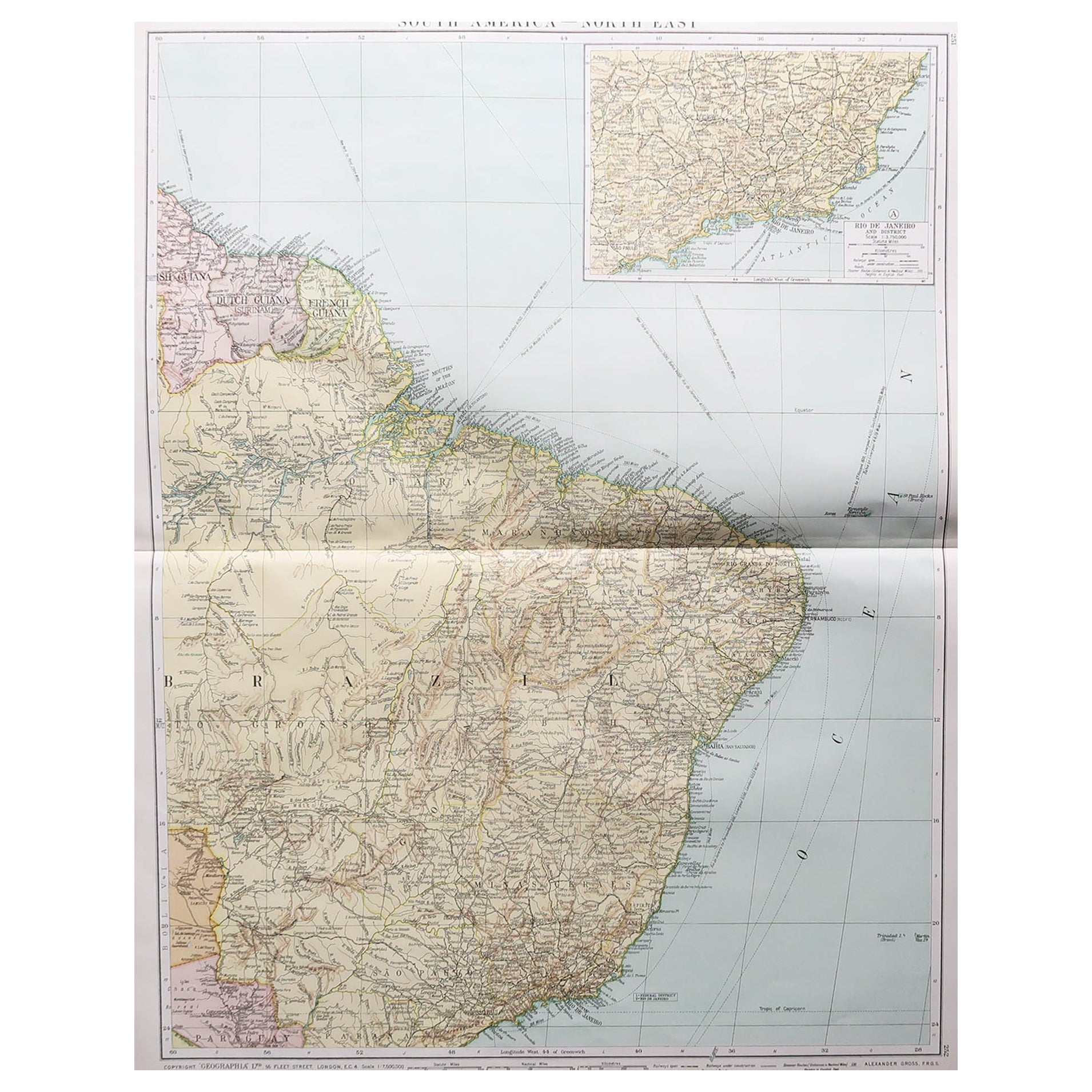
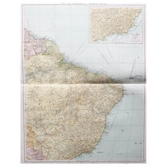
- Large Original Vintage Map of Brazil, circa 1920Located in St Annes, LancashireGreat map of Brazil Original color. Good condition Published by Alexander Gross Unframed.Category
Vintage 1920s English Edwardian Maps
MaterialsPaper
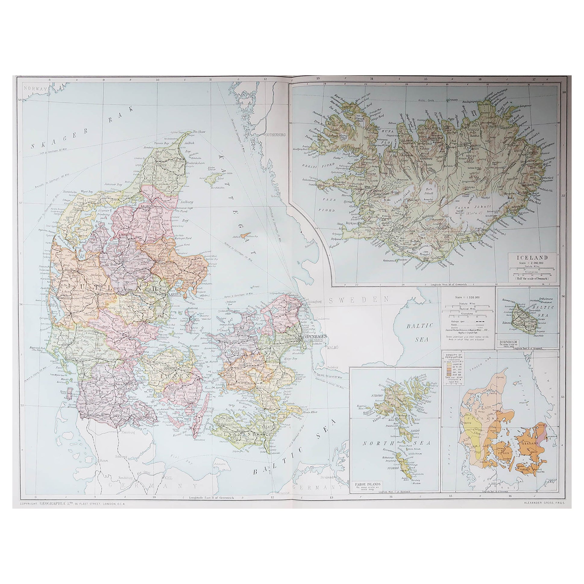
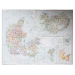
- Large Original Vintage Map of Iceland, circa 1920Located in St Annes, LancashireGreat map of Iceland Original color. Good condition Published by Alexander Gross Unframed.Category
Vintage 1920s English Victorian Maps
MaterialsPaper
You May Also Like
- Persia Unveiled: Antique Map of Iran, Afghanistan, and Beyond, 1852Located in Langweer, NLThe antique map titled 'Royaumes de Perse Herat & Kaboul' is an attractive map of Persia. Here are the key details and features of the map: 1. **Geographic Coverage**: - The map ...Category
Antique Mid-19th Century Maps
MaterialsPaper
- Original Antique Woodcut Map of PersiaLocated in Langweer, NLAntique map titled 'Tabula V Asiae'. Important early woodcut map of Persia, depicting the area of Mesopotamia, Armenia and the Gulf, to the Caspian and Carmania (Iran). Includes name...Category
Antique 16th Century Maps
MaterialsPaper
- Antique Map of Africa by Dufour, circa 1834Located in Langweer, NLAntique map titled 'Afrique'. Uncommon map of Africa. Published by or after A.H. Dufour, circa 1834. Source unknown, to be determined.Category
Antique Mid-19th Century Maps
MaterialsPaper
- Antique Map of Asia by Dufour, circa 1834Located in Langweer, NLAntique map titled 'Asie par A.H. Dufour'. Uncommon map of Asia. Published by or after A.H. Dufour, circa 1834. Source unknown, to be determined.Category
Antique Mid-19th Century Maps
MaterialsPaper
- Antique Map of Chili by Montanus, circa 1671By Arnoldus MontanusLocated in Langweer, NLAntique map titled 'Chili'. A very attractive map covering the known coastal region of Chile. The Andes are shown prominently, with two live volcanoes in the vicinity of Villarrica. ...Category
Antique Mid-17th Century Maps
MaterialsPaper
- Antique Map of Paraguay by A. Montanus, circa 1671By Arnoldus MontanusLocated in Langweer, NLAntique map titled 'Paraquaria Vulgo Paraguay Cum adjacentibus'. Antique map extending from Rio de Janiero to the Rio de la Plata basin. The map include...Category
Antique Mid-17th Century Maps
MaterialsPaper


Recently Viewed
View AllMore Ways To Browse
Antique Persia
Antique Iranian Map
Iran Antique Map
Map Of Roman Empire
Map Of Virginia
Roman Empire Map
Antique Furniture Western Australia
Caribbean Map
Greek Asia Minor
Indian Ocean Antique Map
Map Of Caribbean
Thailand Map
African Money
Antique Hurst
Antique Map Poland
King Charles I Of England
Map Railroad
42 North Antiques