Items Similar to Map of the Kingdom of Sardinia and Part of the Kingdom of Genoa, Rome

Want more images or videos?
Request additional images or videos from the seller
1 of 8
Map of the Kingdom of Sardinia and Part of the Kingdom of Genoa, Rome
About the Item
18th century map by Italian engraver Giovanni Maria Cassini (Italy 1745-1824). Map of Part of the Kingdom of Sardinia and Part of the Kingdom of Genoa: Rome. This is a hand colored and copper engraved print done in the year 1791. The third in a series of four maps of "Upper Lombardy". Mounted on board.
Title: "Alta Lombardia terzo folgio che comprende Parte Degli Stati Del Re Di Sardegna e Parte Della Repubblica di Genova. Roma, Presso la Caleograsia Camerale, 1791".
Map size: 19.5" x 14.5"
Mat size: 25.25" x 20.75".
- Creator:Giovanni Maria Cassini (Maker)
- Dimensions:Height: 20.75 in (52.71 cm)Width: 25.25 in (64.14 cm)Depth: 0.1 in (2.54 mm)
- Materials and Techniques:
- Place of Origin:
- Period:
- Date of Manufacture:1791
- Condition:Wear consistent with age and use. Selling with the matting but should be re-matted as it has some wear.
- Seller Location:Hamilton, CA
- Reference Number:1stDibs: LU1355214145771
About the Seller
5.0
Platinum Seller
These expertly vetted sellers are 1stDibs' most experienced sellers and are rated highest by our customers.
Established in 2010
1stDibs seller since 2015
1,226 sales on 1stDibs
Typical response time: 1 hour
- ShippingRetrieving quote...Ships From: Hamilton, Canada
- Return PolicyA return for this item may be initiated within 3 days of delivery.
More From This SellerView All
- 18th Century Map of the Southern Balkans by Giovanni Maria CassiniBy Giovanni Maria CassiniLocated in Hamilton, Ontario18th century map by Italian engraver Giovanni Maria Cassini (Italy 1745-1824). Map of the Southern Balkans: Rome. Hand colored and copper engraved print done in the year 1788. It in...Category
Antique 18th Century Italian Maps
MaterialsPaper
- Early 19th Century Hand Colored Map of the United States and Caribbean IslandsLocated in Hamilton, OntarioHand coloured early 19th century map by Giraldon of France titled "Etats Unis et Grandes Antilles" (United States and Greater Antilles).Category
Antique Early 19th Century French Maps
MaterialsPaper
- 17th Century Nicolas Visscher Map of Southeastern EuropeLocated in Hamilton, OntarioA beautiful, highly detailed map of southeastern Europe by Nicolas Visscher. Includes regions of Northern Italy (showing the cities Bologna, Padua, and Venice), Bohemia, Austria (sho...Category
Antique 17th Century Dutch Maps
MaterialsPaper
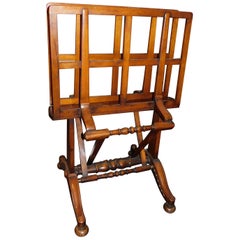
- English Mahogany Wooden Folio Stand, Map and Document Holder, circa 1820Located in Hamilton, OntarioRegency era mahogany wood folio stand rack, map, poster, document holder used in a library, office or den, circa 1820. Folds out to six positions ...Category
Antique Early 19th Century English Regency Magazine Racks and Stands
MaterialsWood
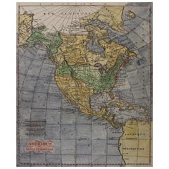
- Early 19th Century Hand Coloured Map of North America by Aaron ArrowsmithBy Aaron ArrowsmithLocated in Hamilton, OntarioHand coloured map in French by English cartographer Aaron Arrowsmith (1750–1823) titled "Amerique Septentionale" (North America). Map size: 9.5" x 8" Mat size: 20.5" x 14.25".Category
Antique Early 19th Century English Maps
MaterialsPaper
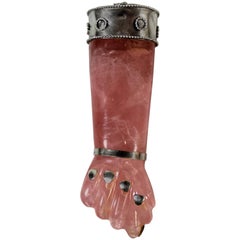
- Brazilian Rose Quartz and Silver Pendant in the Form of a FistLocated in Hamilton, OntarioBrazilian rose quartz and silver pendant in the form of a fist. Significant size and weight for a pendant.Category
Mid-20th Century Brazilian Figurative Sculptures
MaterialsSilver


You May Also Like
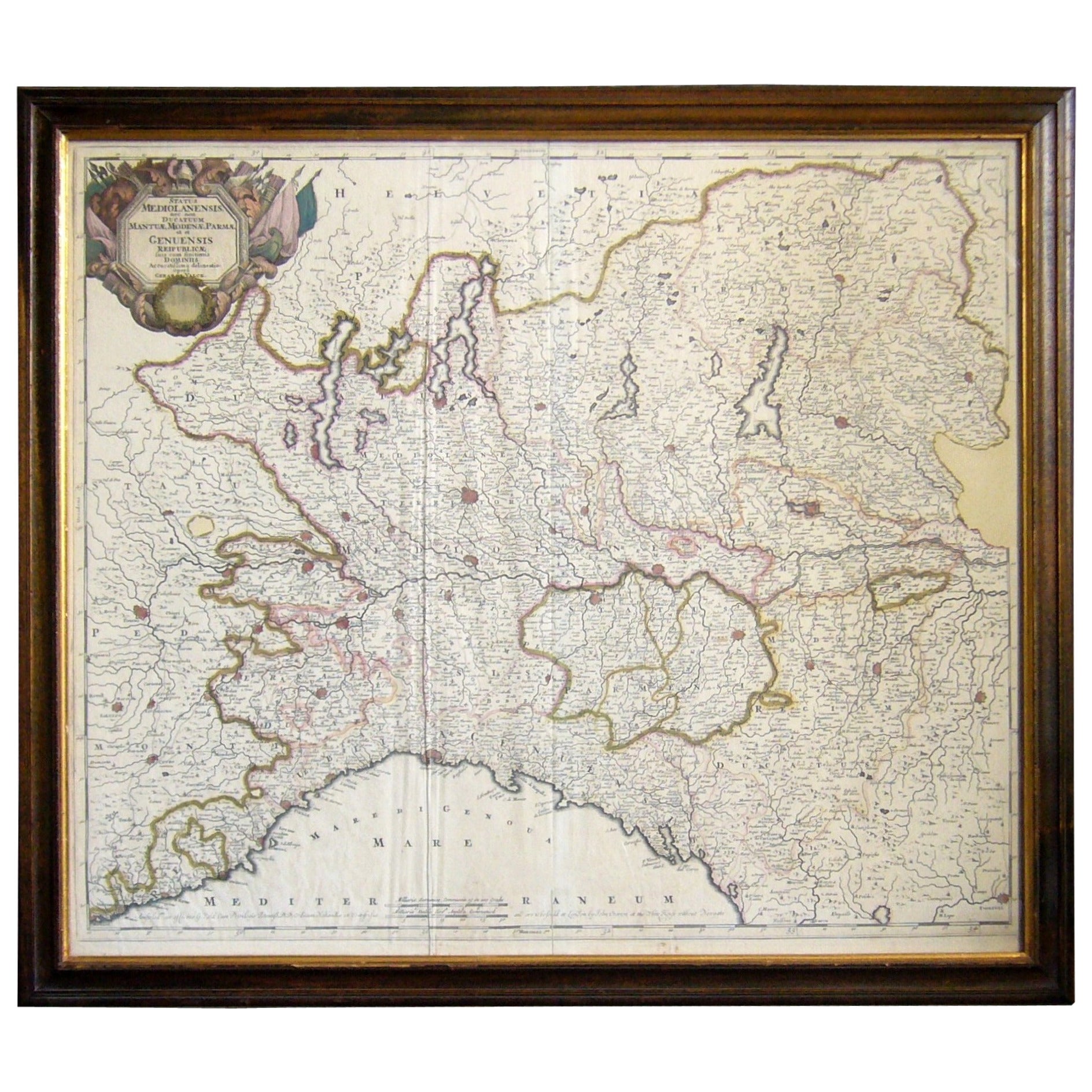
- Map of the Republic of GenoaLocated in New York, NYFramed antique hand-coloured map of the Republic of Genoa including the duchies of Mantua, Modena, and Parma. Europe, late 18th century. Dimension: 25...Category
Antique Late 18th Century European Maps
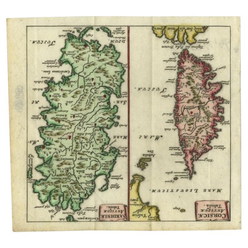
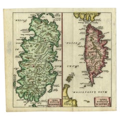
- Antique Map of the Islands of Corsica and Sardinia, 1685Located in Langweer, NLAntique map titled 'Corsicae Antiquae Tabula - Sardiniae Antiquae Tabula.' Two charming miniature maps on one sheet, showing the islands Corsica and Sardinia from the pocket atlas 'I...Category
Antique 17th Century Maps
MaterialsPaper
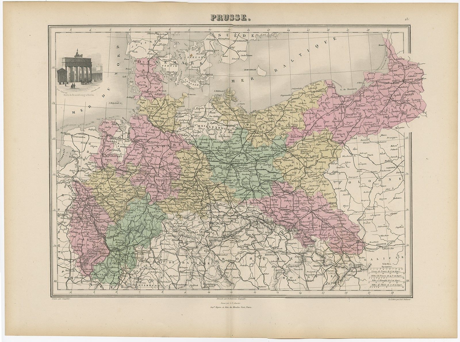
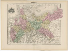
- Antique Map of the Kingdom of Prussia, 1880Located in Langweer, NLAntique map titled 'Prusse'. Old map of the Kingdom of Prussia, with a decorative vignette of the gate of Brandenburg, Berlin. This map originates from 'Géographie Universelle Atlas-...Category
Antique 19th Century Maps
MaterialsPaper
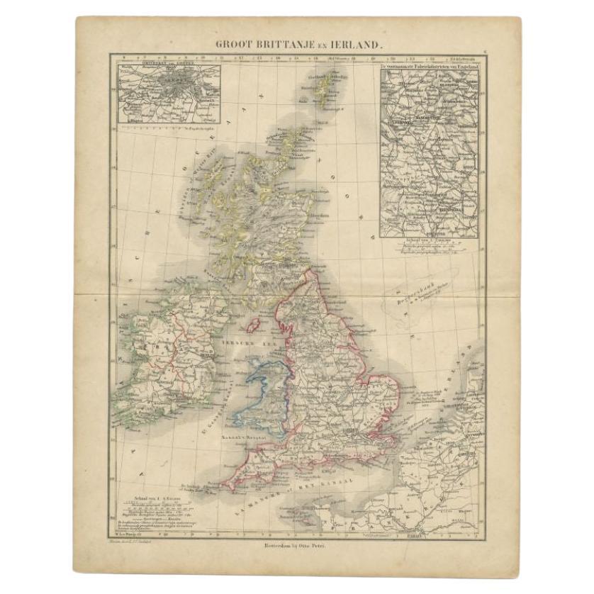
- Antique Map of the United Kingdom and Ireland, 1852Located in Langweer, NLAntique map titled 'Groot-Brittanje en Ierland'. Map of the United Kingdom and Ireland. This map originates from 'School-Atlas van alle deelen der Aarde' by Otto Petri. Artists a...Category
Antique 19th Century Maps
MaterialsPaper
- Antique Map of the United Kingdom and Ireland, c.1873Located in Langweer, NLAntique map titled 'Groot Brittanje en Ierland'. Old map depicting the United Kingdom and Ireland, with inset maps of London and factory districts of the UK. This map originates from...Category
Antique 19th Century Maps
MaterialsPaper
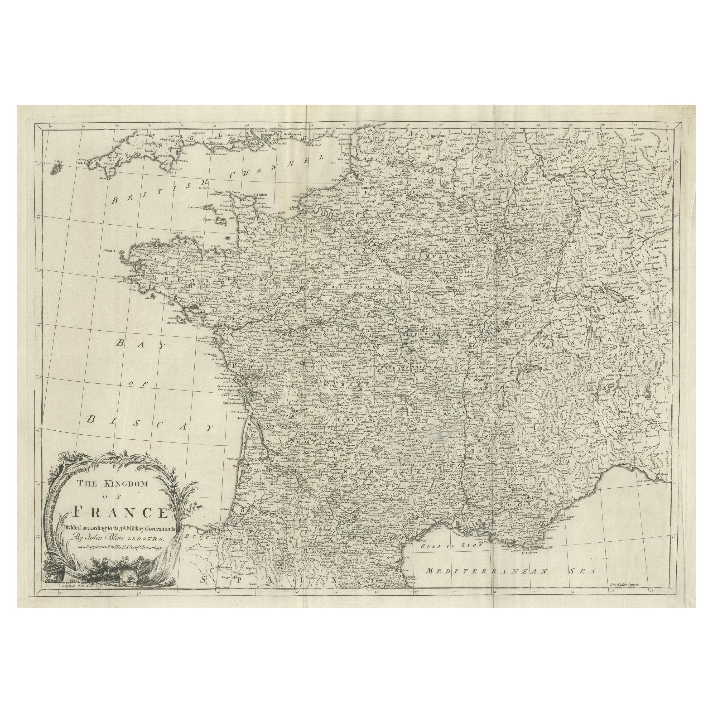
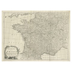
- Large Antique Map of the Kingdom of FranceLocated in Langweer, NLAntique map titled 'The Kingdom of France (..)'. Large antique map of the Kingdom of France. Engraved by T. Kitchin. Published J. Blair, circa 1779.Category
Antique Late 18th Century Maps
MaterialsPaper


Recently Viewed
View AllMore Ways To Browse
Antique Kingdom
Kingdom Italy
Antique Maps Italy
Antique Map Of Italy
Antique Maps Of Italy
Map Of Rome
Rome Maps
Antique Map Of Rome
Antique Rome Map
Rome Antique Map
Sardinia Map
Giovanni Maria Cassini On Sale
Authentic Antique Maps
Antique Rare Maps
Rare Antique Maps
Map Of Provence
16th Century World Map
Map Of France