Items Similar to Rare Handcolored Map of Isle de Juan Fernandes 'Robinson Crusoe Island', Chili


Want more images or videos?
Request additional images or videos from the seller
1 of 6
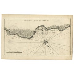
Rare Handcolored Map of Isle de Juan Fernandes 'Robinson Crusoe Island', Chili
About the Item
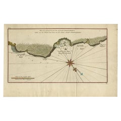
Antique map titled 'Die Insel Iuan Fernandes in der Sudsee (..)'. This map depicts Robinson Crusoe, one of the Juan Fernández Islands.
Robinson Crusoe Island, formerly known as Más a Tierra, is the second largest of the Juan Fernández Islands. From 1704 to 1709, the island was home to the marooned sailor Alexander Selkirk, who at least partially inspired novelist Daniel Defoe's fictional Robinson Crusoe in his 1719 novel, although the novel is explicitly set in the Caribbean.
This was just one of several survival stories from the period of which Defoe would have been aware. To reflect the literary lore associated with the island and attract tourists, the Chilean government renamed the place Robinson Crusoe Island in 1966. This map originates from a German edition of 'Voyage around the World' by Lord George Anson. Published 1763.
- Dimensions:Height: 8.67 in (22 cm)Width: 15.36 in (39 cm)Depth: 0.02 in (0.5 mm)
- Materials and Techniques:
- Period:
- Date of Manufacture:1763
- Condition:Repaired: Thin paper, one small split repaired. Wear consistent with age and use. Age -related toning, original folding lines. Shows wear and soiling. Few small tears, slightly affecting image. Blank verso. Please study images carefully.
- Seller Location:Langweer, NL
- Reference Number:
About the Seller
5.0
Platinum Seller
These expertly vetted sellers are 1stDibs' most experienced sellers and are rated highest by our customers.
Established in 2009
1stDibs seller since 2017
1,966 sales on 1stDibs
Typical response time: <1 hour
- ShippingRetrieving quote...Ships From: Langweer, Netherlands
- Return PolicyA return for this item may be initiated within 14 days of delivery.
More From This SellerView All
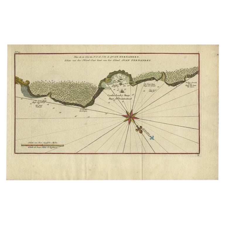
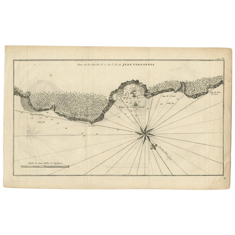
- Antique Map of Juan Fernandez Island, Chile, c.1750Located in Langweer, NLAntique map titled 'Plan de la Côte du N.E. de l 'Ile de Juan Fernandes'. Map of the northeast coast of the island of Juan Fernandez with Cumberland Bay, South America. In 1740 A...Category
Antique 18th Century Maps
MaterialsPaper
- Antique Map of Juan Fernandez Island by Anson, c.1740Located in Langweer, NLAntique map titled 'Plan de la Côte du N.E. de l 'Ile de Juan Fernandes'. Map of the northeast coast of the island of Juan Fernandez with Cumberland Bay, South America. In 1740 Ans...Category
Antique 18th Century Maps
MaterialsPaper
- Antique Map of Juan Fernandez Island by Anson '1749'Located in Langweer, NLAntique map titled 'l'Ile de Juan Fernandes dans la Mer du Sud (..) - Het Eiland Juan Fernandes in de Zuid Zee (..)'. This map depicts Juan Fernandez Island in the Southern Sea. This...Category
Antique Mid-18th Century Maps
MaterialsPaper
- Antique Map of Juan Fernandez Island and Cumberland Bay, Chile - c. '1749'Located in Langweer, NLAntique map titled 'Plan de la Côte du N.E. de l 'Ile de Juan Fernandes - Schets van den Noord-Oost kant van het eiland Juan Fernandes '. This map depicts the northeast coast of the ...Category
Antique Mid-18th Century Maps
MaterialsPaper
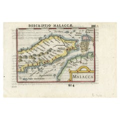
- Rare Original Handcolored Miniature Map of Malaysia and Singapore, 1600Located in Langweer, NLVery handsome original old coloured copper engraving of Malaysia and Singapore, with parts of Sumatra, inc the island of Bangka and Bintam. Title of the map 'Description Malacca'. On...Category
Antique Early 1600s Maps
MaterialsPaper
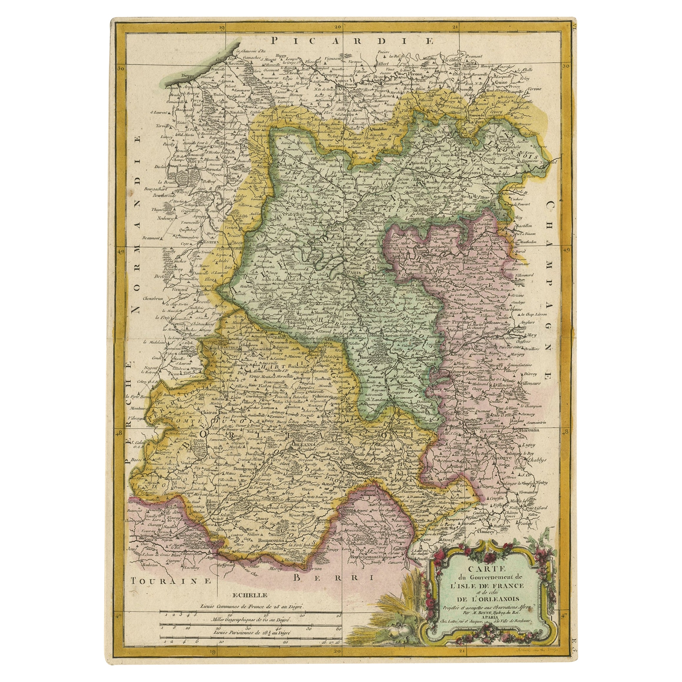
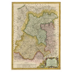
- Decorative Rare Map of the French Regions of Isle De France and Orleans, ca.1780Located in Langweer, NLAntique map titled 'Carte du Gouvernment de L'Isle de France et de edlui de L'Orleanois (..).' A fine example of Rigobert Bonne's c. 1780 decorative map of the French regions of ...Category
Antique 1780s Maps
MaterialsPaper


You May Also Like
- Large 17th Century Hand Colored Map of England and the British Isles by de WitBy Frederick de WitLocated in Alamo, CAA large hand colored 17th century map of England and the British Isles by Frederick de Wit entitled "Accuratissima Angliæ Regni et Walliæ Principatus", published in Amsterdam in 1680. It is a highly detailed map of England, Scotland, the Scottish Isles...Category
Antique Late 17th Century Dutch Maps
MaterialsPaper
- Hand-Colored 18th Century Homann Map of Denmark and Islands in the Baltic SeaBy Johann Baptist HomannLocated in Alamo, CAAn 18th century copper plate hand-colored map entitled "Insulae Danicae in Mari Balthico Sitae utpote Zeelandia, Fionia, Langelandia, Lalandia, Falstria, Fembria Mona" created by Joh...Category
Antique Early 18th Century German Maps
MaterialsPaper
- Antique Map of Paris, "Carte Routiere des Environs de Paris" 1841Located in Colorado Springs, COThis beautiful hand-colored road map of Paris was published in 1841. The map shows Paris and the surrounding area in a folding pocket map. Organized and detailed for travelers, this ...Category
Antique 1840s French Maps
MaterialsPaper
- Map of the Holy Land "Carte de la Syrie et de l'Egypte" by Pierre M. LapieBy Pierre M. LapieLocated in Alamo, CAAn early 19th century map of ancient Syria and Egypt entitled "Carte de la Syrie et de l'Egypte anciennes/dressée par M. Lapie, Colonel d'Etat Major, et...Category
Antique Early 19th Century French Maps
MaterialsPaper
- St. Christophe 'St. Kitts' Island: An 18th Century Hand-colored Map by BellinBy Jacques-Nicolas BellinLocated in Alamo, CAJacques Bellin's copper-plate map of the Caribbean island of Saint Kitts entitled "Carte De De l'Isle St. Christophe Pour servir á l'Histoire Genle. des V...Category
Antique Mid-18th Century French Maps
MaterialsPaper
- Antique Map of Principality of MonacoBy Antonio Vallardi EditoreLocated in Alessandria, PiemonteST/619 - "Old Geographical Atlas of Italy - Topographic map of ex-Principality of Monaco" - ediz Vallardi - Milano - A somewhat special edition ---Category
Antique Late 19th Century Italian Other Prints
MaterialsPaper


Recently Viewed
View AllMore Ways To Browse
Daniel Robinson
Antique Maps Caribbean Islands
Antique Map Chile
Taiwan Antique
Antique Map Of Cyprus
Antique South East Asia Map
Cyprus Antique Maps
Map Cyprus
Speed Antique Map
Antique Map New Mexico
Antique Maps Caribbean Islands
Antique Maps New Mexico
Atlas Holding
Munster Map
South Pacific Map
Antique Ecuador
Antique Maps Of Philadelphia
Antique Navigation Tools