Items Similar to Set of 5 Large Original Vintage Sea Charts, circa 1920


Want more images or videos?
Request additional images or videos from the seller
1 of 7
Set of 5 Large Original Vintage Sea Charts, circa 1920
About the Item
5 great maps or charts of the oceans
I particularly like the color of these maps
Unframed
Original color
By John Bartholomew and Co. Edinburgh Geographical Institute
Published, circa 1920
Free shipping.
- Dimensions:Height: 17.5 in (44.45 cm)Width: 22.5 in (57.15 cm)Depth: 0.07 in (1.78 mm)
- Sold As:Set of 5
- Materials and Techniques:Paper,Other
- Place of Origin:
- Period:
- Date of Manufacture:1920
- Condition:Wear consistent with age and use.
- Seller Location:St Annes, GB
- Reference Number:1stDibs: LU1836337237892
About the Seller
4.9
Platinum Seller
These expertly vetted sellers are 1stDibs' most experienced sellers and are rated highest by our customers.
1stDibs seller since 2016
2,660 sales on 1stDibs
Typical response time: <1 hour
Associations
International Confederation of Art and Antique Dealers' Associations
- ShippingRetrieving quote...Ships From: St Annes, United Kingdom
- Return PolicyA return for this item may be initiated within 3 days of delivery.
Auctions on 1stDibs
Our timed auctions are an opportunity to bid on extraordinary design. We do not charge a Buyer's Premium and shipping is facilitated by 1stDibs and/or the seller. Plus, all auction purchases are covered by our comprehensive Buyer Protection. Learn More
More From This SellerView All
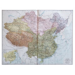
- Large Original Vintage Map of China, circa 1920Located in St Annes, LancashireGreat map of China. Original color. Good condition. Published by Alexander Gross Unframed.Category
Vintage 1920s English Edwardian Maps
MaterialsPaper
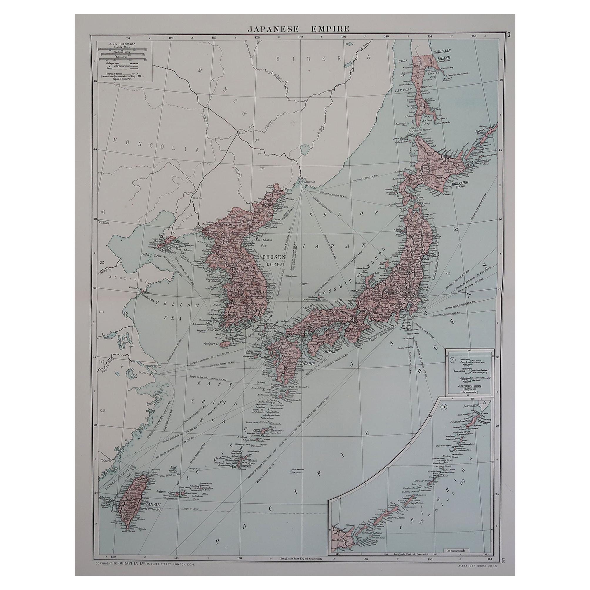
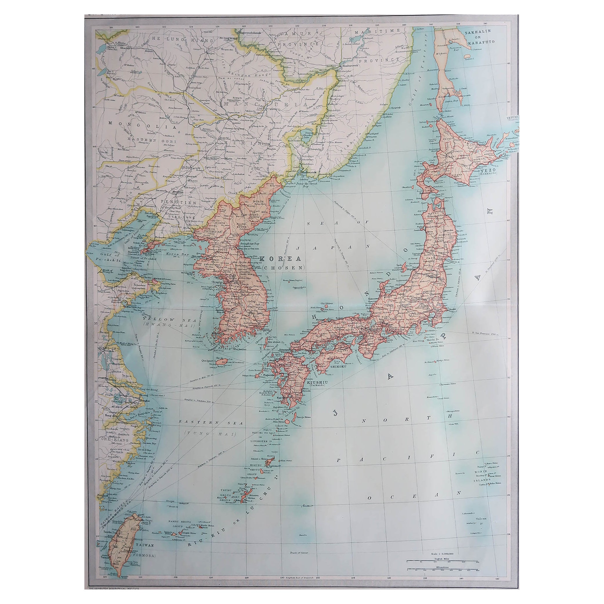
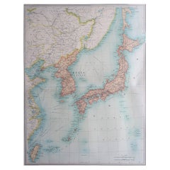
- Large Original Vintage Map of Japan, circa 1920Located in St Annes, LancashireGreat map of Japan Unframed Original color By John Bartholomew and Co. Edinburgh Geographical Institute Published, circa 1920 Free shipping.Category
Vintage 1920s British Maps
MaterialsPaper
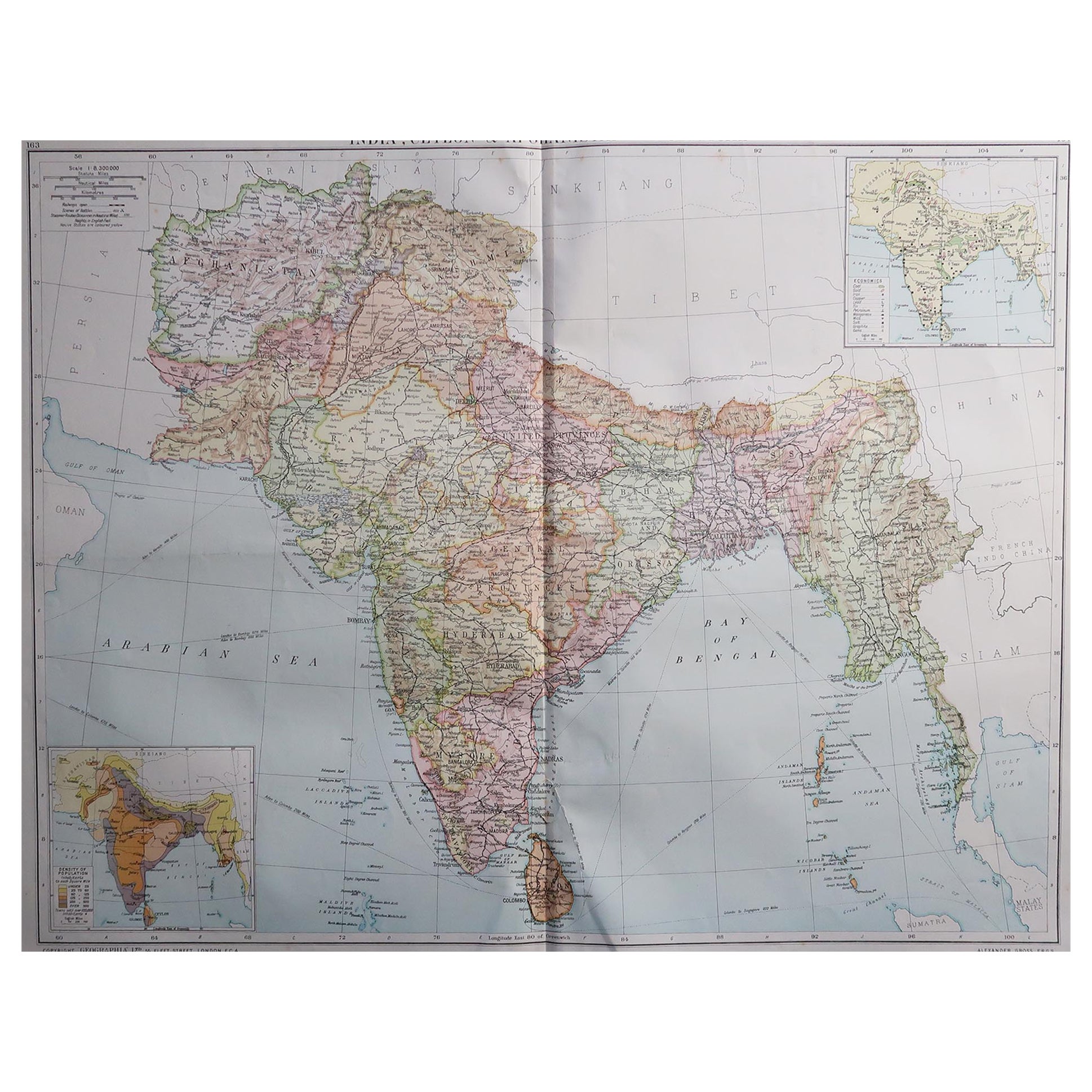
- Large Original Vintage Map of India, circa 1920Located in St Annes, LancashireGreat map of India Original color. Good condition / repair to some minor damage just above Sri Lanka. Shown in the last image. Published by Alexander Gross Unframed.Category
Vintage 1920s English Maps
MaterialsPaper
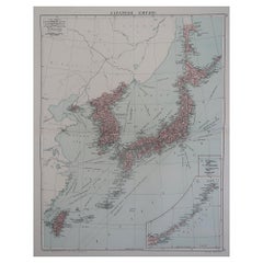
- Large Original Vintage Map of Japan, circa 1920Located in St Annes, LancashireGreat map of Japan Original color. Good condition Published by Alexander Gross Unframed.Category
Vintage 1920s English Victorian Maps
MaterialsPaper
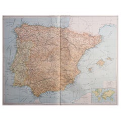
- Large Original Vintage Map of Spain, circa 1920Located in St Annes, LancashireGreat map of Spain Original color. Good condition Published by Alexander Gross Unframed.Category
Vintage 1920s English Maps
MaterialsPaper
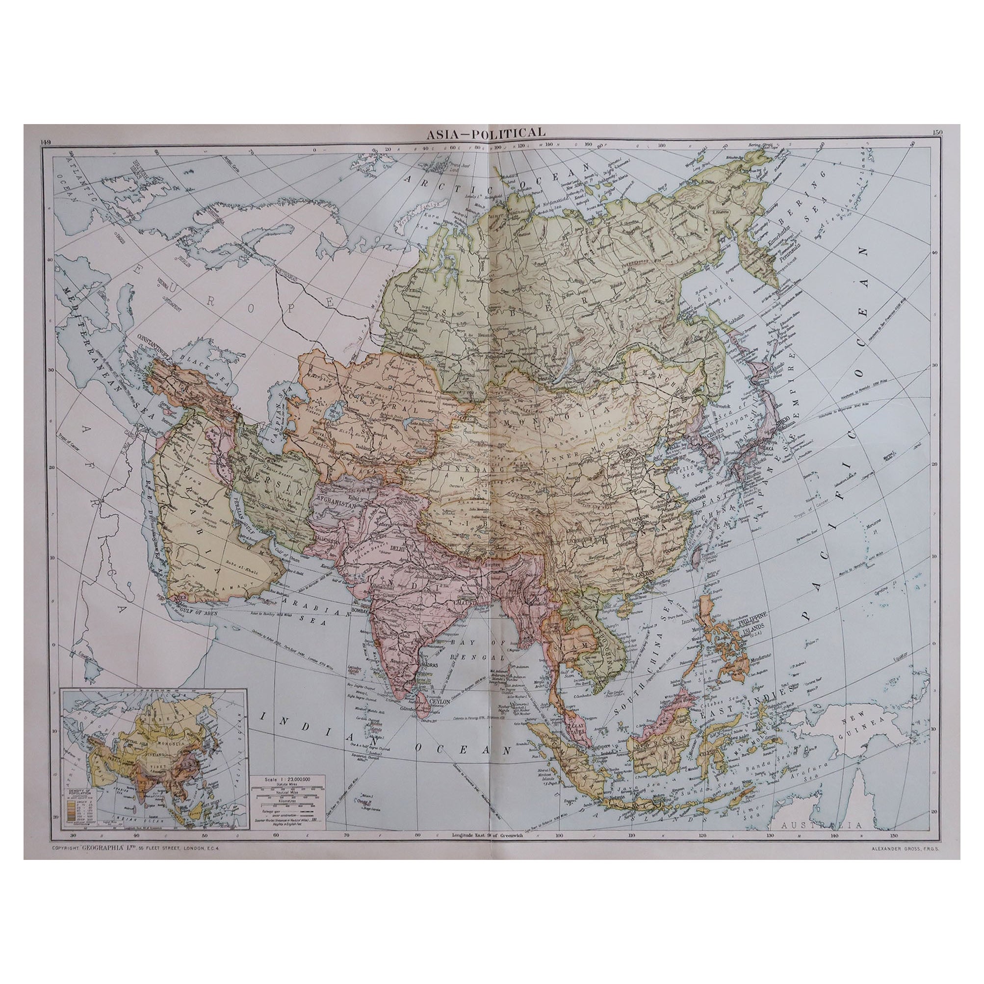
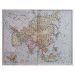
- Large Original Vintage Map of Asia, circa 1920Located in St Annes, LancashireGreat map of Asia Original color. Good condition Published by Alexander Gross Unframed.Category
Vintage 1920s English Edwardian Maps
MaterialsPaper

You May Also Like
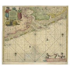
- Old Decorative & Highly Detailed Sea Chart of the North Dutch-German Coast, 1681Located in Langweer, NLAntique map titled 'Paskaart van een gedeelte van Vriesland, Groeninger, en Emderland. Met zyn onderhoorige Eylanden; Strekkende van't Eylant der Schelling'. Decorative and highl...Category
Antique 1680s Maps
MaterialsPaper
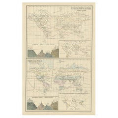
- Antique Zoological Chart of the World, 1854Located in Langweer, NLAntique map titled 'Zoological Chart of the World'. Total of six maps and insets. Insets of the distribution of Animals in a vertical direction, Chart o...Category
Antique 19th Century Maps
MaterialsPaper
- Vintage Large Scale "Kodak Film" Advertisement, circa 1950Located in San Francisco, CAVintage large scale "Kodak Film" advertisement, circa 1950 A young couple below a sky of clouds - A great vintage photo by Kodak Dimensions: 29.25" wi...Category
Mid-20th Century American Decorative Art
MaterialsPaper
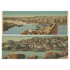
- Set of Two Large Panoramic Vintage Postcards of Algeria, 'circa 1920'Located in Langweer, NLSet of two large panoramic postcards, circa 1920. It shows Béjaïa (former Bougie) and Algiers. Published by Lévy.Category
20th Century Prints
MaterialsPaper
- Large Sea Chart of the British Islands, 1918Located in Langweer, NLAntique map titled 'The British Islands'. Large sea chart of the British Islands. It shows Ireland, Scotland, England, the Shetland Islands and part of Fra...Category
Vintage 1910s Maps
MaterialsPaper
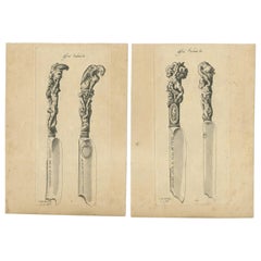
- Set of 2 Antique Prints of Decorated Knives, circa 1840Located in Langweer, NLSet of two antique prints. Plate 11 and 12 depicting decorated antique knives. Source unknown, to determined.Category
Antique Mid-19th Century Arms, Armor and Weapons
MaterialsPaper


Recently Viewed
View AllMore Ways To Browse
Antique Charts
Charles Landseer
Hemisphere Antiques
Map Of Burgundy
Map Of Madagascar
Antique Maps Finland
Antique Pennsylvania Map
Croatia Antique Map
French School Map
Kentucky Antiques
Map Of Alps
Antique Furniture Western Cape
Antique Map New Jersey
Antique Maps Essex
Antique Physics
Antique Puerto Rico
Antique Vineyard Map
Atlas Map Relief