Items Similar to 1898 Chart of Boston Bay
Want more images or videos?
Request additional images or videos from the seller
1 of 9
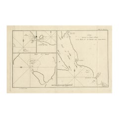
1898 Chart of Boston Bay
About the Item
Original 1898 chart showing Massachusetts Bay with the coast from Cape Ann to Cape Cod. This is a U.S. Navy Geodetic survey chart. All towns are noted along the coast. Framed with glass. Weight is 17 pounds. 36" H x 44.
- Dimensions:Height: 36 in (91.44 cm)Width: 44 in (111.76 cm)Depth: 3 in (7.62 cm)
- Materials and Techniques:
- Period:
- Date of Manufacture:1898
- Condition:
- Seller Location:Norwell, MA
- Reference Number:
About the Seller
5.0
Vetted Seller
These experienced sellers undergo a comprehensive evaluation by our team of in-house experts.
Established in 1967
1stDibs seller since 2015
348 sales on 1stDibs
Typical response time: 2 hours
- ShippingRetrieving quote...Ships From: Norwell, MA
- Return PolicyThis item cannot be returned.
More From This SellerView All
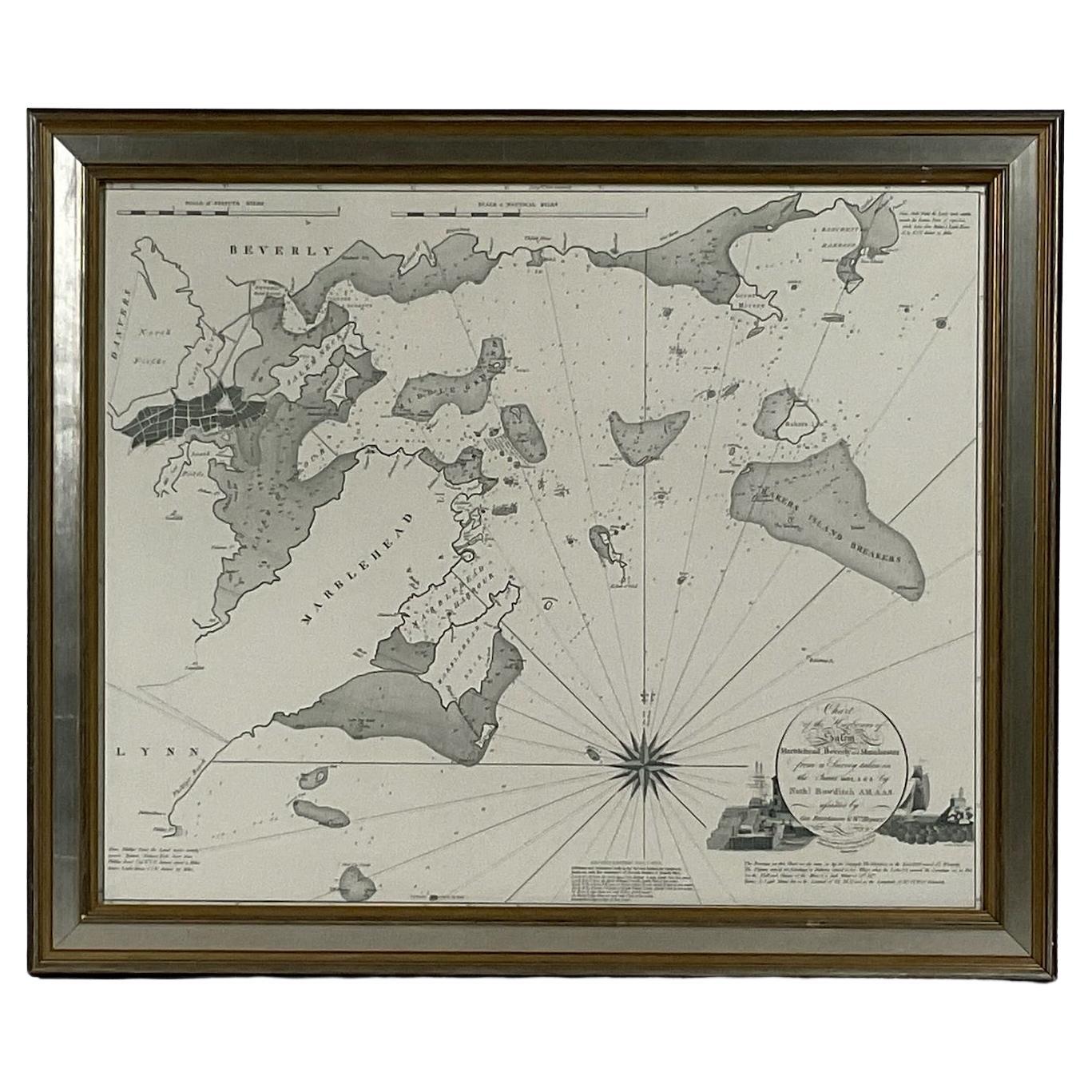
- Chart of Boston's North ShoreLocated in Norwell, MARarely found restrike of an 1804 chart by Nathanael Bowditch of the Harbors of Salem, Marblehead, Beverly, and Manchester. Showing the Islands of Great Misery, Satan, Cuney, Winter,...Category
Vintage 1980s North American Maps
MaterialsPaper
- Ocean Chart Of Massachusetts BayLocated in Norwell, MACape Cod Bay chart from 1907 by George W. Eldridge. This is chart "D" Massachusetts Bay and the coast from Chatham to Boston. Showing plotted courses, depths, lighthouses, ports, etc.. Excellent graphics. Ports include Barnstable, Sandwich, Duxbury, Plymouth, Cohasset, Hingham, Quincy, Boston, Marblehead, Lynn. Manchester by the Sea...Category
Antique Early 1900s North American Prints
MaterialsPaper
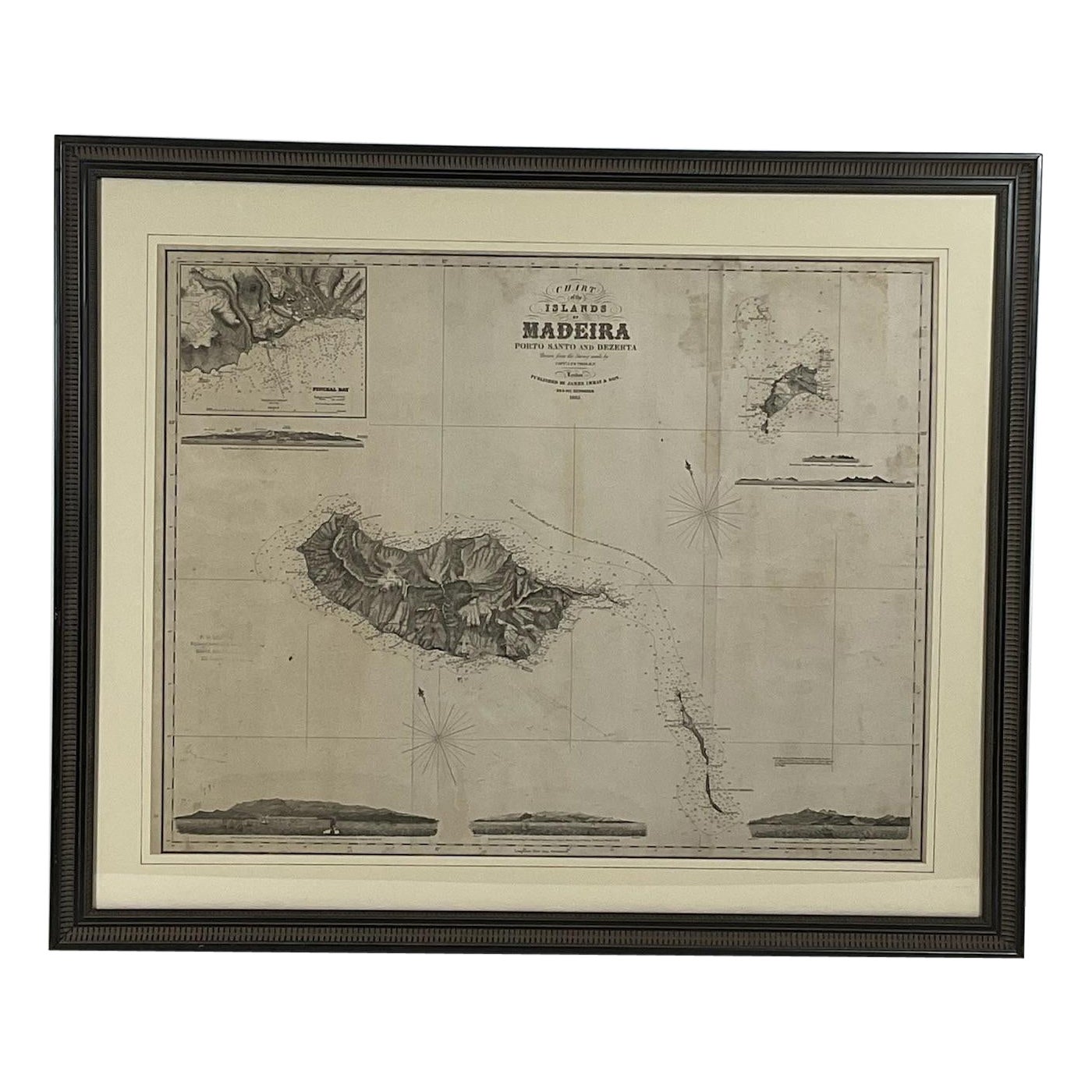
- 1865 Chart of the Islands of MadeiraLocated in Norwell, MARare James Imray chart from 1865 titled "Chart of the Islands of Madeira, Porto Santo and Dezerea" drawn from the survey made by Captain Ate Vidal Royal Navy, London. Published by Ja...Category
Antique 1860s European Maps
MaterialsPaper
- Thaxter of Boston Yacht BinnacleBy Samuel ThaxterLocated in Norwell, MASolid brass yacht binnacle with highly polished case and compass, sidelight, and carry ring. Maker is Samuel Thaxter of Boston. Overall Dimensions: 10"H x 6"D x 9"L. 5 pounds.Category
Antique Early 1900s Nautical Objects
MaterialsBrass
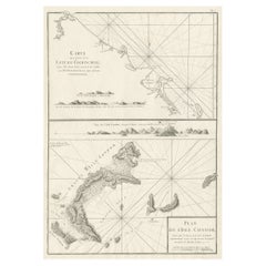
- 19th Century Nautical Chart of MartiniqueLocated in Norwell, MAOriginal map of Martinique from 1887 with chartered waters around the island. Prepared from a French survey, completed in 1825, showing town, ports, rivers and tributaries. Published...Category
Antique 19th Century Nautical Objects
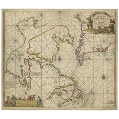
- Original Imray & Son Chart of North Atlantic, 1876Located in Norwell, MANautical chart of the North Atlantic showing the Eastern United States coast, Caribbean Islands, South America (Venezuela and ), British Possessions (Canada - Gulf of Lawrence, Newfo...Category
Antique 1870s Nautical Objects
MaterialsPaper


You May Also Like
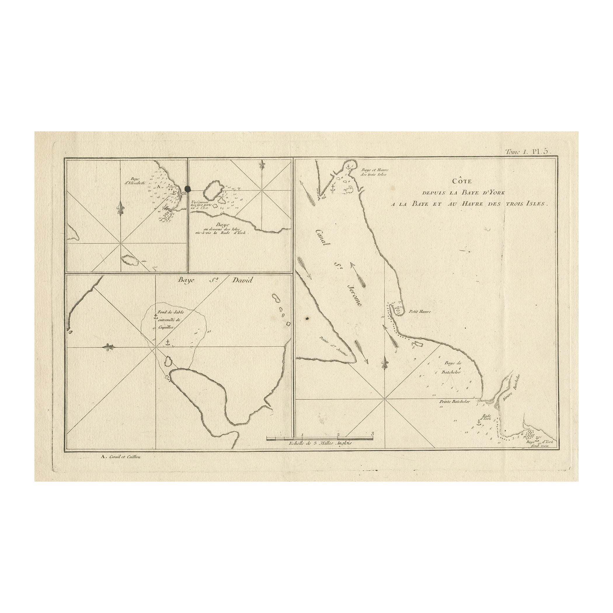
- Antique Print with Charts of York's Bay and SurroundingsLocated in Langweer, NLAntique map titled 'Côte depuis la Baye d'York (..)'. Charts of York's Bay, Haven of the Three Islands, St. David's Bay, and Elizabeth's Bay. Published in an edition of John Hawk...Category
Antique Late 18th Century Maps
MaterialsPaper
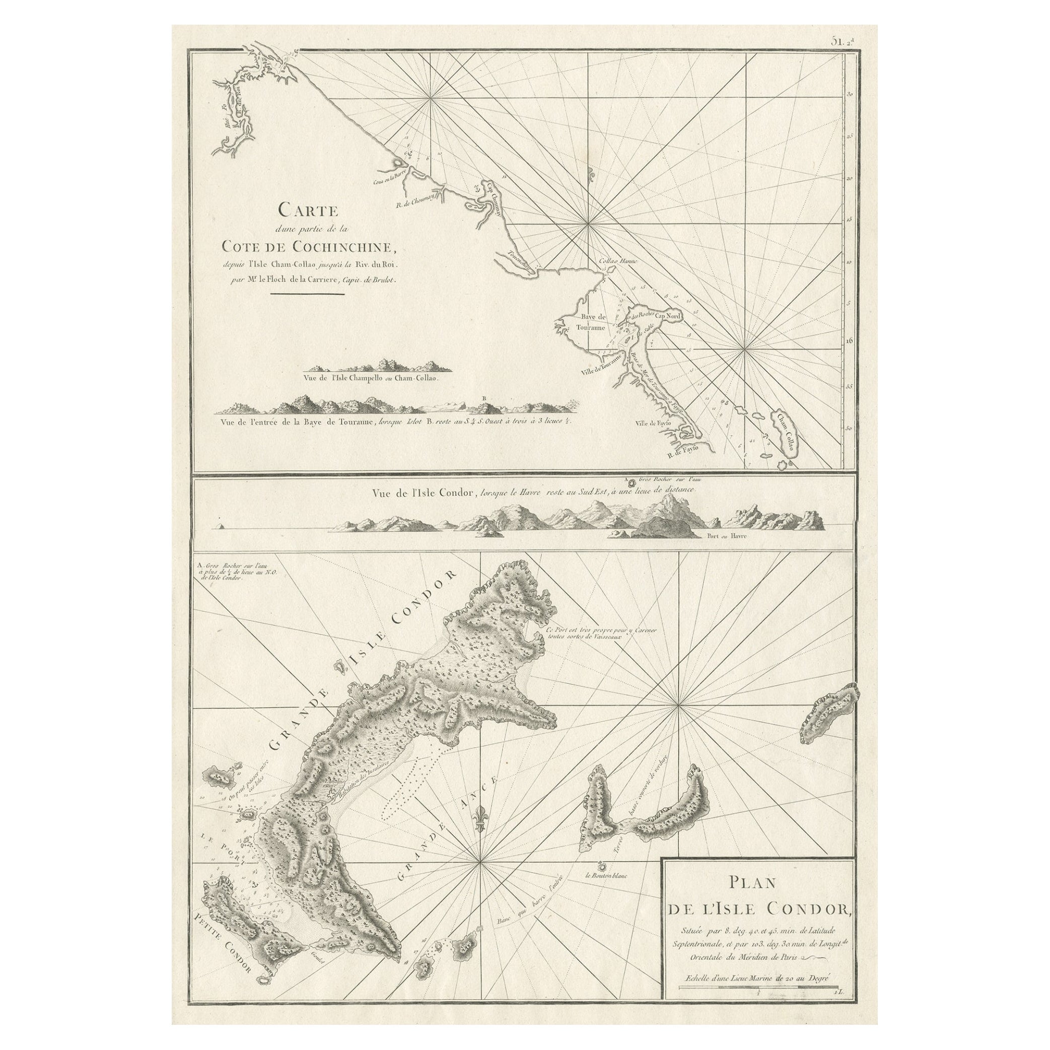
- Old Sea Charts of Tourane Bay & the Con Dao Islands 'Pulo Condor', Vietnam, 1780Located in Langweer, NLDescription: Two maps on one sheet titled 'Carte d'une partie de la Cote de Cochinchine [and] Plan de l'Isle Condor'. Sea charts of the coast of Vietnam around the Tourane Bay an...Category
Antique 1780s Maps
MaterialsPaper
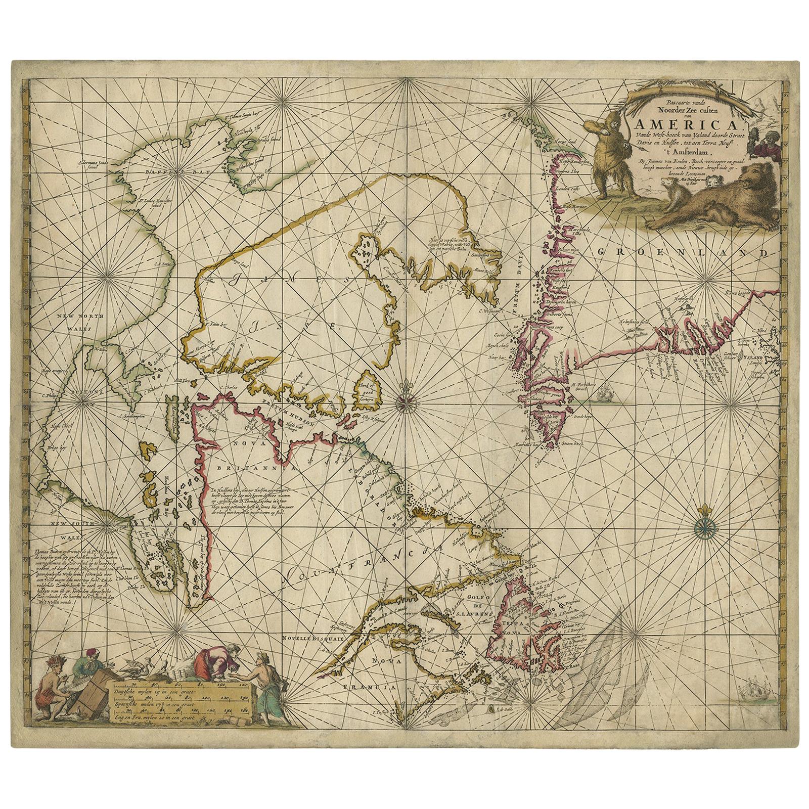
- Antique Sea Chart of Hudson Bay and Arctic Canada by Van Keulen, circa 1681Located in Langweer, NLAntique map titled 'Pascaarte vande Noorderzee Custen van America (..)'. Sea chart of Hudson Bay and Arctic Canada. Compass roses, loxodromic lines, and ships decorate the oceans and...Category
Antique Late 17th Century Maps
MaterialsPaper
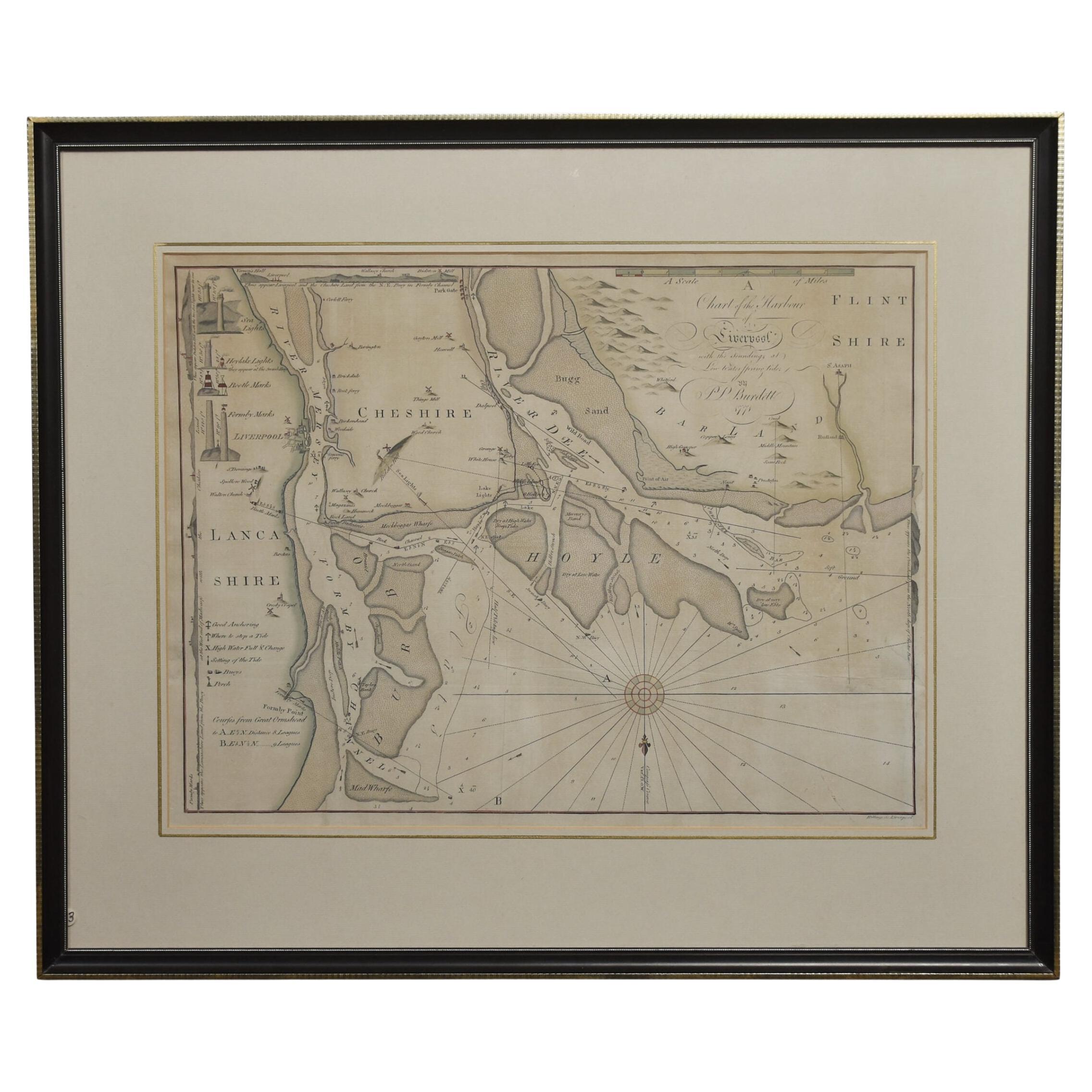
- Chart of the Harbour of LiverpoolLocated in Cheshire, GBPL Burdett A Chart of the Harbour of Liverpool hand coloured. Encased in an ebonised frame. Dimensions Height 23.5 Inches Width 28 Inches Depth 1 InchesCategory
Early 20th Century British Maps
MaterialsPaper
- 19th Century Chart of NantucketLocated in Nantucket, MAExtremely Rare 19th Century Chart of Nantucket. circa 1850, with details of Nantucket Island, Eastern Martha's Vineyard, Monomoy Island and surrounding shoals. This is a unique, unpu...Category
Antique Mid-19th Century American Federal Maps
MaterialsPaper
- 1898-1899 The Works of Henry FieldingBy Henry FieldingLocated in Bath, GBA beautifully bound, limited edition of this complete set of twelve collected works of Henry Fielding, with an introduction by Edmund Gosse. A Limited Edition set, one of only seven...Category
Antique 1890s British Books
MaterialsPaper

Recently Viewed
View AllMore Ways To Browse
Antique Furniture Boston
Boston Antique Furniture
Cape Beige
Antique Charts
Antique Survey
Antique Surveying
Bay Antique Furniture
Navy Antiques
Used Furniture Cape Cod
Used Nautical Charts
Framed Chart
Nautical Charts
Antique Nautical Charts
Cape Cod Antique
Antique Glass Paper Weight
Antique Furniture Cape Cod
Antique Furniture Cape Town
Hand Carved Wood Boat