Items Similar to Antique Plan of the Residence of the Mayor of Amsterdam by H. de Leth circa 1732


Want more images or videos?
Request additional images or videos from the seller
1 of 5
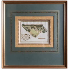
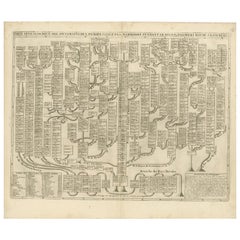
Antique Plan of the Residence of the Mayor of Amsterdam by H. de Leth circa 1732
About the Item
Antique print titled 'Plattegrond van de Hofstede en het huis te Spyk. Behorende de Edelen van Grootambacht. Heere en Mr. Ian van de Poll Burgermeester der stad Amsterdam'. Rare plan of the Residence of the Mayor of Amsterdam (the Netherlands). Dutch and French text in cartouche.
- Dimensions:Height: 18.63 in (47.3 cm)Width: 19.1 in (48.5 cm)Depth: 0.79 in (2 cm)
- Materials and Techniques:
- Period:
- Date of Manufacture:1732
- Condition:Great condition, unique frame included. Please study image carefully.
- Seller Location:Langweer, NL
- Reference Number:1stDibs: LU3054310287603
About the Seller
5.0
Platinum Seller
These expertly vetted sellers are 1stDibs' most experienced sellers and are rated highest by our customers.
Established in 2009
1stDibs seller since 2017
1,966 sales on 1stDibs
Typical response time: <1 hour
- ShippingRetrieving quote...Ships From: Langweer, Netherlands
- Return PolicyA return for this item may be initiated within 14 days of delivery.
Auctions on 1stDibs
Our timed auctions are an opportunity to bid on extraordinary design. We do not charge a Buyer's Premium and shipping is facilitated by 1stDibs and/or the seller. Plus, all auction purchases are covered by our comprehensive Buyer Protection. Learn More
More From This SellerView All
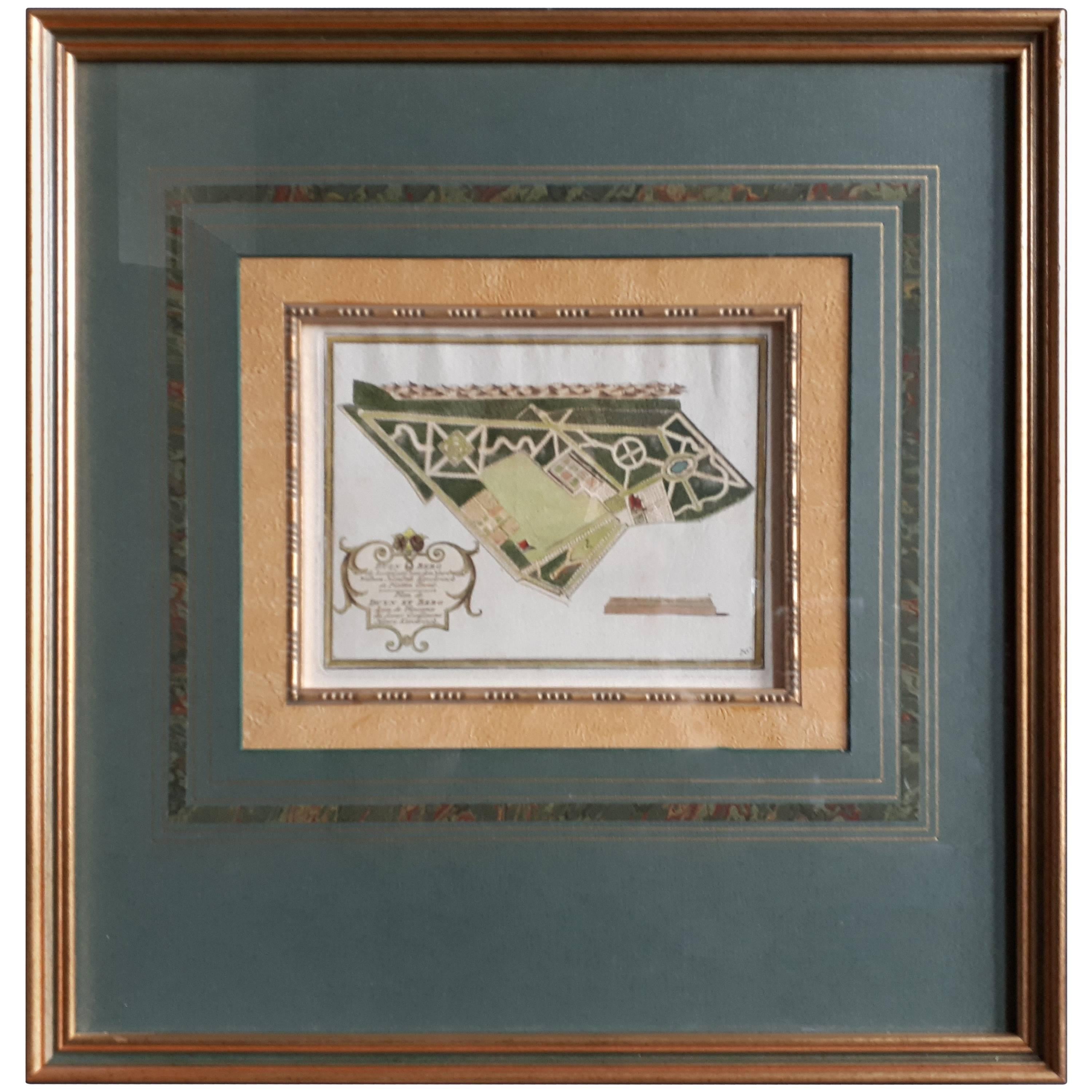
- Antique Plan of Duin en Berg 'the Netherlands' by H. de Leth circa 1732Located in Langweer, NLAntique plan titled 'Beschrijving Duin en Berg, de Lustplaets van den Heere Wilhem Hendrik Kerckrinck in Platten Gront'. Decorative cartouche with Dutch and French text. This plan or...Category
Antique Mid-18th Century Prints
MaterialsPaper
- Antique Print of the Residence of Mr. Albertus Schuit by De Leth, c.1730Located in Langweer, NLAntique print titled 'Het Huis en de Hofstede De Vlotter, nu Jagerlust hernoemt, in den banne van Heemskerk, behoort den Heere Albertus Schuit, Commissaris te Amsterdam'. Old print w...Category
Antique 18th Century Prints
MaterialsPaper
- Antique Print of the Residence of Mr. Joachim Rensdorp by De Leth, c.1730Located in Langweer, NLAntique print titled 't Adelijke Huis Marquette in Kennemerlant, tusschen de Dorpen Kastrikum en Heemskerk, behorende den Hr. en Mr. Joachim Bendorp zoo als het zich tegenwoordig ver...Category
Antique 18th Century Prints
MaterialsPaper
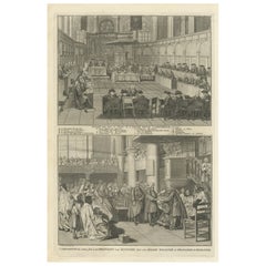
- Engraving of a Meeting of the Dutch Synode in Amsterdam, The Netherlands, 1732Located in Langweer, NLAntique print titled 'Synode tenu dans le Choeur (..)'. Old print of a meeting of the Dutch Synode in 'De Nieuwe Kerk' in Amsterdam, The Netherlands in 1730. Also depicted the accept...Category
Antique 18th Century Prints
MaterialsPaper
- Antique Genealogy Chart of the Leaders of Europe by Chatelain, 1732Located in Langweer, NLAntique print titled 'Carte Genealogique des Souverains de l'Europe (..)'. Chart of the royal line of the great Frankish major, Aega. As early as the 14th century the Hapsburgs attem...Category
Antique 18th Century Prints
MaterialsPaper
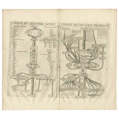
- Antique Print of a Timeline of the Biblical History, 1732Located in Langweer, NLAntique print titled 'Chaine de l'Histoire Sacrée (..)'. Old print with two timelines, one of the Biblical history and another of the worldly governments. This print orginates from '...Category
Antique 18th Century Prints
MaterialsPaper
You May Also Like
- Map of the Holy Land "Carte de la Syrie et de l'Egypte" by Pierre M. LapieBy Pierre M. LapieLocated in Alamo, CAAn early 19th century map of ancient Syria and Egypt entitled "Carte de la Syrie et de l'Egypte anciennes/dressée par M. Lapie, Colonel d'Etat Major, et...Category
Antique Early 19th Century French Maps
MaterialsPaper
- Germany West of the Rhine: A Hand-colored 18th Century Map by de WitBy Frederick de WitLocated in Alamo, CAThis original 18th century hand-colored map of the county of Moers, Germany entitled "Illustrissimo Celsissmo Principi GUILIELMO HENRICO D.G. Arausionum Principi Domino suo Clementis...Category
Antique Early 18th Century Dutch Maps
MaterialsPaper
- Large 17th Century Hand Colored Map of England and the British Isles by de WitBy Frederick de WitLocated in Alamo, CAA large hand colored 17th century map of England and the British Isles by Frederick de Wit entitled "Accuratissima Angliæ Regni et Walliæ Principatus", published in Amsterdam in 1680. It is a highly detailed map of England, Scotland, the Scottish Isles...Category
Antique Late 17th Century Dutch Maps
MaterialsPaper
- "Army of the Potomac" by John Bachelder, Civil War Era Lithograph, circa 1863Located in Colorado Springs, COFully-entitled: Army of the Potomac. The Wagon Trains of the Army of the Potomac en Route from Chickahominy to James River VA. During the Seven...Category
Antique 19th Century American Prints
MaterialsPaper
- Catalogue of Engraved Views, Plans, Etc., Of New York City, 1st EdLocated in valatie, NYA catalogue of engraved views, plans, etc., Of New York City, (The Collection of Percy R. Pyne II). Privately Printed by The De Vinne Press, New York, 1912. Limited to 100 copies. Gr...Category
Early 20th Century American Books
MaterialsPaper
- Antique Map of Paris, "Carte Routiere des Environs de Paris" 1841Located in Colorado Springs, COThis beautiful hand-colored road map of Paris was published in 1841. The map shows Paris and the surrounding area in a folding pocket map. Organized and detailed for travelers, this ...Category
Antique 1840s French Maps
MaterialsPaper


Recently Viewed
View AllMore Ways To Browse
Te De Te
Antique Te
Old Chinese Print
Architectural Dutch Prints
Dutch Print Traditional
Racinet Antique Print
Prints By Racinet
Mid 19th Century Costume Prints
Antique Print 1847
Antique Encyclopedias
Encyclopedia Antique
19th Century Botanical Prints
East Indies Furniture
East Indies
Expedition Furniture
Magnus Print
Antique Indian Prints
Antique Prints Indian