Items Similar to West Africa: A 17th Century Hand-Colored Map by Mercator/Hondius


Want more images or videos?
Request additional images or videos from the seller
1 of 9
Gerard MercatorWest Africa: A 17th Century Hand-Colored Map by Mercator/Hondius1635
1635
About the Item
A 17th century hand-colored map entitled "Guineae Nova Descriptio" by Gerard Mercator and Jodocus Hondius, published in their 'Atlas Minor' in Amsterdam in 1635. It is focused on the modern day African countries of Guinea, Sierra Leone, Liberia, Ivory Coast, Ghana, Togo and Benin. A sea monster is seen in the Ethiopicus Ocean (the Gulf of Guinea). A large inset map in the left corner depicts the Island of Isle of Thomae (modern day São Tomé and Príncipe) in detail, which includes the Citadel marked in red. A decorative strapwork cartouche in the lower portion of the map includes the map title.
The map is presented in an archival heather green colored mat. The mat measures 14" wide x 12" high and the map measures 11.25" wide x 7" high. There is English text on the verso. There is mild chipping about the edges, but the map is otherwise in very good condition.
Gerard Mercator (1512-1594) is one of the most famous cartographers of all time. He was born in Flanders and moved to Duisburg from Leuven in the Netherlands, where he lived and worked for the rest of his life. In addition to producing important maps and globes, he invented a projection on maps that presented all parallels and meridians at right angles to each other, with the distance between the parallels extending towards the poles, allowing accurate latitude and longitude calculation and navigational routes to be drawn using straight lines. This was an important technological advance for navigation at sea, as this allowed seafarers to plot their course without having to adjust their course based on frequent compass readings. This has become know as Mercator projection on maps produced by subsequent cartographers to this day. He is also the first to use the term “atlas”, which was first used to describe his collection of maps gathered in one volume. The Mercator atlas was published in 1595, a year after Mercator’s death by his heirs.
Jodocus Hondius (1563-1612) was a prominent globe maker and map engraver from Ghent (Flanders). After spending some time in London, he established his business in Amsterdam in 1593. Hondius bought the plates of Gerard Mercator in 1604 and added around 40 of his own maps in an atlas that he first published in 1606, preserving Mercator's name. After his death in 1612 in Amsterdam, the business was continued by his sons Jodocus II and Henricus, who published the English edition of the Mercator and Hondius Atlas Minor in 1635 that contained this map.
- Creator:Gerard Mercator (1512 - 1594, Flemish, German)
- Creation Year:1635
- Dimensions:Height: 12 in (30.48 cm)Width: 14 in (35.56 cm)
- Medium:
- Period:1630-1639
- Framing:Framing Options Available
- Condition:
- Gallery Location:Alamo, CA
- Reference Number:
Gerard Mercator
Gerard Mercator (1512-1594) was one of the most famous cartographers of the 16th century and, in fact, of all time. Mercator was known for his strict adherence to scientific methods of the day. He was responsible for advancing the technology of map making. For example his method of representing land masses in a cylindrical projection with north up and south down, first described in 1569, became the standard map projection for navigation. It is still referred to as The Mercator projection.
About the Seller
5.0
Gold Seller
These expertly vetted sellers are highly rated and consistently exceed customer expectations.
Established in 2011
1stDibs seller since 2019
242 sales on 1stDibs
Typical response time: 1 hour
- ShippingRetrieving quote...Ships From: Alamo, CA
- Return PolicyA return for this item may be initiated within 7 days of delivery.
More From This SellerView All
- L'Isle de France: A Hand-colored 17th Century Map by De WitBy Frederick de WitLocated in Alamo, CAThis colorful and detailed 17th century hand-colored copperplate map by Frederick De Wit was published in Amsterdam between 1666 and 1760. The map depicts the Île-de-France, which is one of the ancient provinces of France. Paris is located in the center of the map, with Versailles to the southwest The map extends from Rouen in the west to Reims in the east. The area around Paris, the Véxin Français, was the original domain of the king of France. Other areas were ruled by French feudal lords. For example, the Véxin Normand area was the domain of the Duke of Normandy...Category
Early 18th Century Old Masters More Prints
MaterialsEngraving
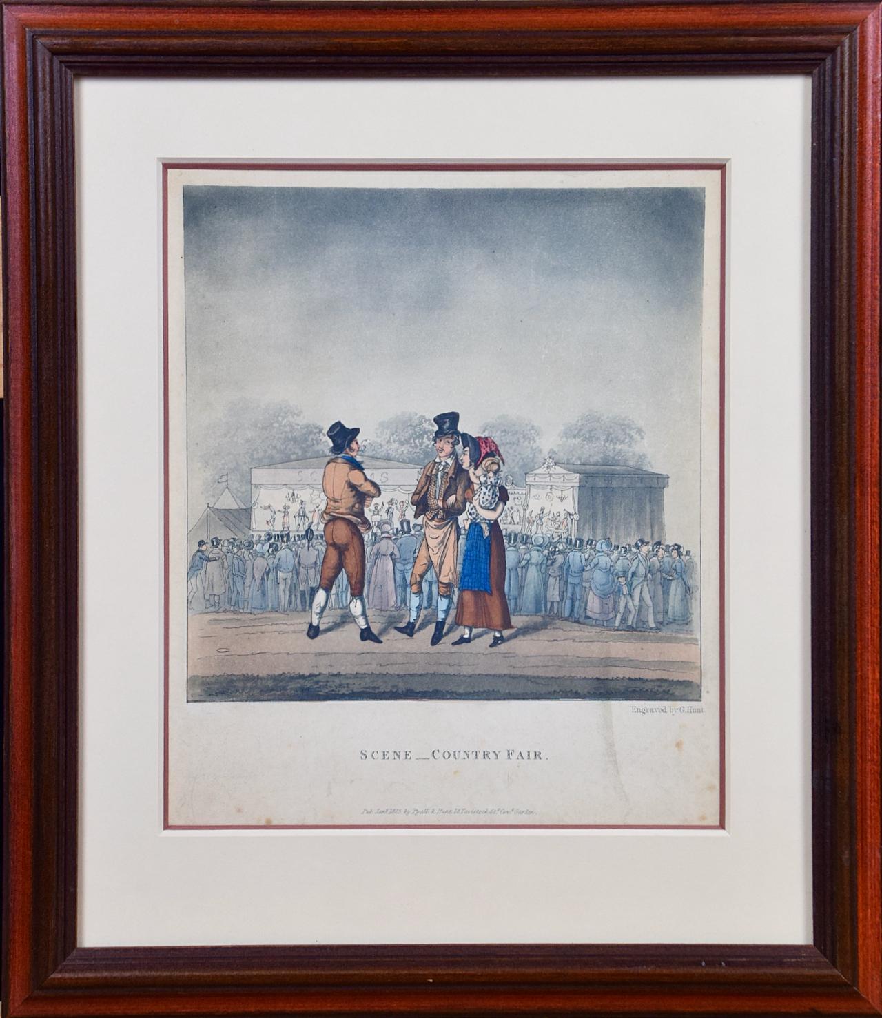
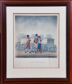
- "Scene _ Country Fair": A Framed Early 19th Century Engraving by George HuntBy George HuntLocated in Alamo, CAThis is a framed colored engraving entitled "Scene _ Country Fair" by George Hunt, published in London in 1825. It depicts a gathering of people at an early 19th century county fair, presumably in England. A majority of the crowd are turned away, watching a performance on a stage in the background. In the foreground a man is in conversation with a couple. The man wears a top hat and the woman is holding a baby. They are dressed in the typical attire of the middle class at that time. The engraving is presented in a brown wood frame and a double mat, with a cream-colored outer mat and a light cranberry...Category
Early 19th Century Landscape Prints
MaterialsEngraving
- View of Seravalle, Italy: A 16th Century Hand-colored Map by Braun & HogenbergBy Franz HogenbergLocated in Alamo, CAThis is an original 16th century copperplate originally hand-colored engraved map of View of Seravalle, Italy entitled "Seravallum Celeberrimum Marchiae Tarvisiniae in Agro Foro Juliensi Opp. - Seravalli, quam vides, Spectator, iconem, operi huic nostro suis sumptib. . . ." by Georg Braun & Franz Hogenberg, from their famous city atlas "Civitates Orbis Terrarum", published in Augsberg, Germany in 1575. The map depicts a view of Seravalle, now Vittorio Veneto, in San Marino, Italy, north of Venice, in a topographically accurate bird's-eye view from the south. A water-filled moat is seen to the south of the city walls and farmland to the east. Two men are depicted standing on a hill in the lower right in conversation next to grain sacks and a grazing horse, while a younger man behind them to the right herds a mule carrying presumably pigs. A very colorful and ornate title cartouche is in the upper center and coat-of-arms are in the right and left upper corners. Serravalle lies in an idyllic setting in the foothills and surrounded by orchards. St Mary's Cathedral with its tall bell tower is prominent in the center of the town. The marketplace and town hall with a bell tower in the square are depicted. Houses and shops are around the main square. Serravalle's importance as an agricultural centre is emphasized by the figures in the foreground. In 1337 Serravalle was conquered by the Republic of Venice. In 1866 the town was united with neighbouring Ceneda to form the town of Vittorio Veneto. The following is an English translation of an excerpt from the French description of the city on the back of the map: "Serravalle, a market town renowned for cloth, wine and grain, is in such a beautiful situation that the number of its inhabitants, attracted by the loveliness of the place, has grown so much at times that the wall encircling it has had to be enlarged for the third time. The city with the surrounding town once belonged to the Church in Ceneda as an imperial fief. It subsequently became the seat of the Da Camino family (a princely house that at that time was one of the five most noble in all Italy). Now the city is under the sway of the Venetians but is prudently governed by them. For they send only one city councillor with instructions to ensure that justice prevails and to collect duties. In all else, power lies in the hands of the noble families." This is a translation of the Latin in the title cartouche on the front: "The picture of the town of Serravalle, which you see, viewer, has been contributed to our work entirely at his own expense by Minutius, son of Hieronymus Minutius, a noble gentleman and one renowned for the far-reaching competence of his jurisdiction. We saw him sojourning in Cologne, where he was on business for Gregory XIII; while our good wishes accompany him, we should also like to accompany him on his way with this remembrance, even though it might be against his will, so that even those who have not seen him may learn of his excellence. However, those who do not yet know him will also see his excellence if God the Almighthy does not summon erring souls too soon back to the eternal seat of the Blessed." References: Van der Krogt 4, 4728, State 1; Taschen, Braun and Hogenberg, p.331; Fauser, #14960 This striking hand-colored city view is printed on laid, chain-linked paper with wide margins. The sheet measures 16" high by 21" wide. There is a central vertical fold as issued and French text on the verso, with Latin on the front. There is some discoloration in the upper and right margins which may represent some watercolor paint from the time of the original hand-coloring of the map. There is a small hole to the right of the upper portion of the vertical fold, which is only visible when held up to light and an area of reinforcement on the verso of the lower vertical fold. The map is otherwise in very good to excellent condition. Braun and Hogenberg's 'The Civitates Orbis Terrarum' was the second atlas of maps ever published and the first atlas of cities and towns of the world. It is one of the most important books published in the 16th century. Most of the maps in the atlas were engraved by Franz Hogenberg and the text, with its descriptions of the history and additional factual information of the cities, was written by a team of writers and edited by Georg Braun. The work contained 546 bird-eye views and map views of cities and towns from all over the world. It gave graphic representation of the main features of the illustrated cities and towns, including the buildings and streets. Although the ordinary buildings are stylized, the principal buildings are reproduced from actual drawings created on location. The principal landmarks and streets can still be recognized today. In addition, the maps often include the heraldic arms of the city, the nature of the surrounding countryside, the important rivers, streams and harbors, even depicting stone bridges, wooden pontoons, flat-bottomed ferries, ships and working boats, wharves and jetties, as well as land-based activities, including horsemen, pedestrians, wagons, coaches, and palanquins. Small vignettes are often included which illustrate the trade, occupations and habits of the local inhabitants, such as agriculture, paper-making and textiles, as well as local forms of punishment, such as gibbets, wheels, floggings etc. Large figures dressed in their local costume are often presented out of proportion in the foreground. The aim of the authors was to give as much information as possible in a pleasing visual form. They succeeded in creating maps that were both informative and decorative works of art. The atlas is a wonderful glimpse of life in medieval Europe. Georg Braun (1541-1622) was German Catholic...Category
16th Century Old Masters Landscape Prints
MaterialsEngraving
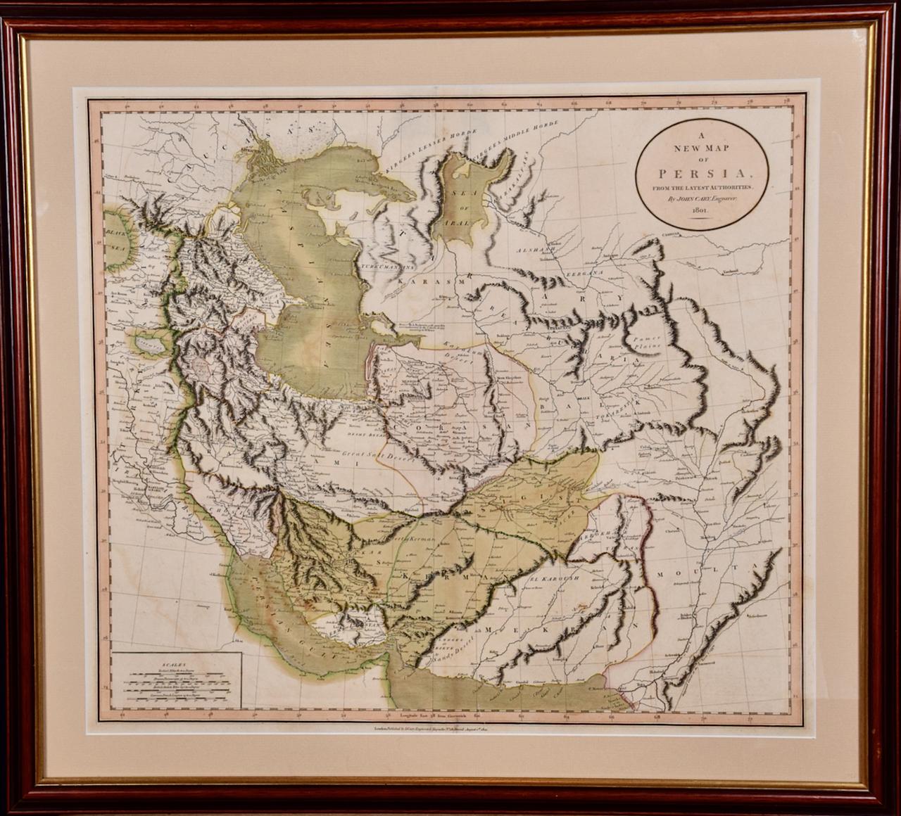
- Persia & Afghanistan: A Framed Hand-colored 17th Century Map by John CaryBy John CaryLocated in Alamo, CAThis colorful and detailed early 18th century copperplate map by John Cary entitled "A New Map of Persia from the Latest Authorities" was published in London in 1801. It depicts Persia, the region of modern day Afghanistan, the Caspian Sea, the Sea of Aral, the Persian Gulf...Category
Early 19th Century Old Masters More Prints
MaterialsEngraving
- View of Pisaro, Italy: A 16th Century Hand-colored Map by Braun & HogenbergBy Franz HogenbergLocated in Alamo, CAThis is a 16th century original hand-colored copperplate engraved map of View of Pezaro (Pisaro), Italy entitled "Pisaurum vulgo Pezaro" by Georg Braun & Franz Hogenberg, from their famous city atlas "Civitates Orbis Terrarum", published in Augsberg, Germany in 1575. The map depicts a view of Pesaro, Italy from the west looking over the town to the Adriatic Sea. The River Foglia flows into the Adriatic in the foreground. The only identifiable building is the cathedral of San Domenico, which rises above the other roofs with its tall spire. Two women, dressed in styles of the 16th century are in conversation on a hill in the foreground on the left. Pesaro is in the province of Pesaro and Urbino and lies on the Adriatic and east of Florence. The city, which was founded by the Etruscans and named Pisaurum by the Romans, belonged from AD 754 onwards to the Papal States, and after 1285 was controlled by the princely families of Malatesta, Sforza and della Rovere. Today it is the capital of the province of Pesaro and Urbino and has a population of about 92,000. Pesaro's most famous resident, composer Gioacchino Rossini, was born here in 1792. The following is an English translation of an excerpt from Braun's description of the city: "We believe that the astonishingly short life of the inhabitants of Pesaro comes not only from the insalubrious air, but also from the great quantity of delectable and delicious fruits which they consume to excess. For this causes the production in their bodies of evil humours, which then lead to incurably fatal diseases. The area around the city is most charming and well planted with vineyards, fig trees, olive trees and other fruit-bearing trees." References: Van der Krogt 4, 3369, state 1; Taschen, Braun and Hogenberg...Category
16th Century Old Masters Landscape Prints
MaterialsEngraving
- View of Meissen, Germany: A 16th Century Hand-colored Map by Braun & HogenbergBy Franz HogenbergLocated in Alamo, CAThis is a 16th century original hand-colored copperplate engraved map of View of View of Meissen, Germany entitled "Misena Hermun Duvorum Urbs" by Georg Braun & Franz Hogenberg, from their famous city atlas "Civitates Orbis Terrarum", published in Cologne, Germany in 1575. The map depicts a side view and bird's-eye view, looking across the Elbe River (labelled Albis Fluvius on the map; White River in Latin) from the northeast. In the foreground are three women in conversation on a hill above the city, along with a man and a woman in conversation by a road, all dressed in contemporary costumes of the upper class. A coat-of-arms is present in each upper corner. A great castle sits atop a hill in the background on the left. Meissen grew up around Albrechtsburg castle, built by Emperor Henry I around AD 929, and was granted a municipal charter at the end of the 12th century. From 1471 onwards, the castle complex was reconstructed as the residence of the Saxon electors on the northeast corner of the Domberg (Cathedral Hill). Meissen cathedral is a Gothic hall church begun c. 1270; in 1413 a bolt of lightning destroyed its west towers, which were replaced only in the 20th century. Meissen lies to the northwest of Dresden, Germany in Saxony. Meissen is famous for its Meissen porcelain and the Albrechtsburg castle The following is an English translation of an excerpt from Braun's description of the city: "This city is surrounded by very many rivers, to the east flows the Elbe, to the south the Triebisch, to the west are the mountains, to the north the Meisse, after which the city is said to be named. The city is well-situated in its surroundings, the navigable rivers, the mountains and the healthy air. Around the city there is a good land to grow grain, fertile vineyards on the hillsides and without doubt the mountains are not without ore, for one mile away, up the Elbe, is Scharfenberg, where silver and lead ore are mined.." References: Van der Krogt 4, 2684; Taschen, Braun and Hogenberg...Category
16th Century Old Masters Landscape Prints
MaterialsEngraving


You May Also Like
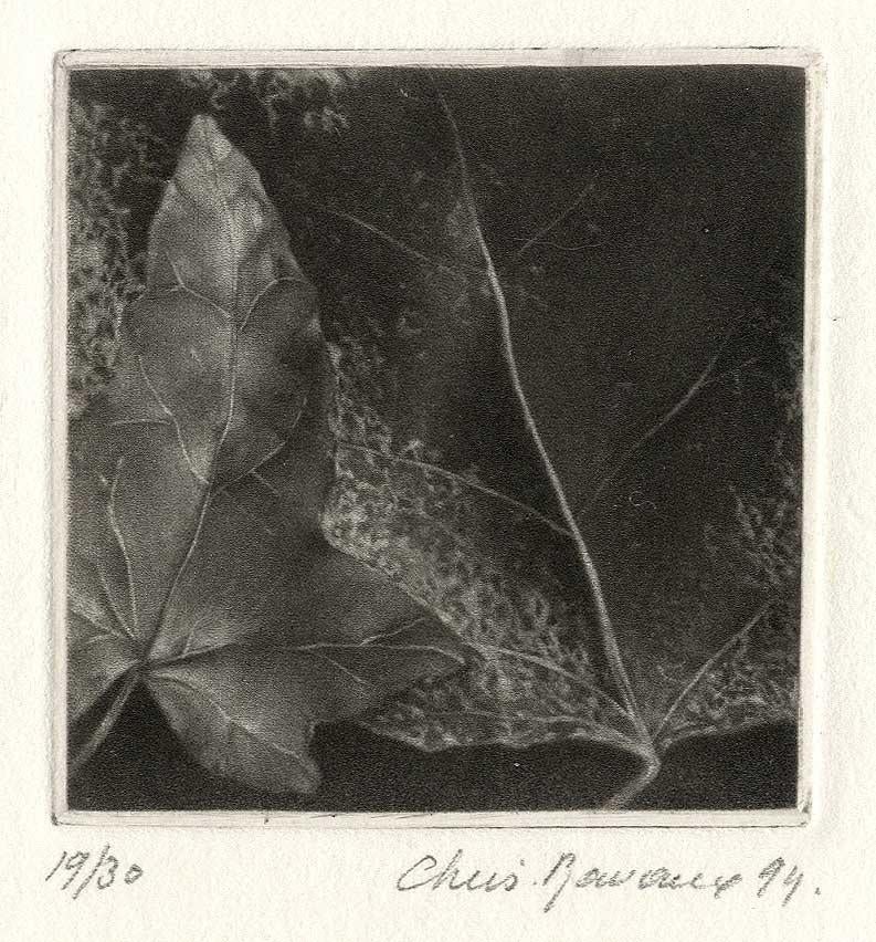
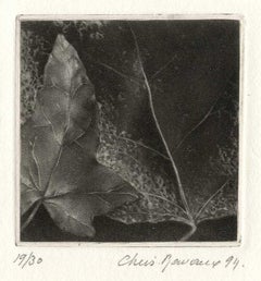
- LeavesBy Christine RavauxLocated in New Orleans, LAThis impression is #19 out of an edition 30 Born in 1961 in Charleroi, Belgium, Ravaux is an artist who mirrors her surroundings in the mezzotints she creates. She has portrayed see...Category
1990s American Modern Landscape Prints
MaterialsMezzotint
- Persiae, Armeniae, Natoliae et Arabiae Descriptio per Frederick deWit 1666 mapLocated in Paonia, COMap of Persiae, Armeniae, Natoliae et Arabiae Descriptio per F de Wit 1688 engraving from: Atlas Contractus Orbis Terrarum Praecipuas ac Novissimas Complectens Tabulas. Amsterdam, N. Visscher, 1656-77. (Koeman III, Vis5-8) This highly decorative map of the Middle East is by the Dutch engraver, publisher, and map seller...Category
1660s Realist Landscape Prints
MaterialsEngraving
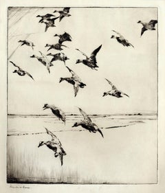
- Here They Come !By Frank W. BensonLocated in New York, NYThis impression of "Here They Come !" is from the fourth state of eight. There are six known impressions of the fourth state. Edition 150 (final state). It is signed in pencil in the lower left and inscribed "D-1". The image size 13 7/8 x 11 3/4" (34.6 x 28.8 cm) and sheet size 16 3/4 x 14 5/8" (42.8 x 37.1 cm). FRANK W. BENSON (1862-1951) Frank Weston Benson, well known for his American impressionist paintings, also produced an incredible body of prints - etchings, drypoints, and a few lithographs. Born and raised on the North Shore of Massachusetts, Benson, a natural outdoorsman, grew up sailing, fishing, and hunting. From a young age, he was fascinated with drawing and birding – this keen interest continued throughout his life. His first art instruction was with Otto Grundman at the Museum of Fine Arts in Boston, and then in 1883 in Paris at the Academie Julian where he studied the rigorous ‘ecole des beaux arts’ approach to drawing and painting for two years. During the early 1880’s Seymour Haden visited Boston giving a series of lectures on etching. This introduction to the European etching...Category
1920s American Impressionist More Prints
MaterialsDrypoint
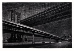
- CrossingsBy Frederick MershimerLocated in New York, NYCROSSINGS Contemporary artist Frederick Mershimer created the mezzotint engraving entitled "Crossings" in 1998. This impression is signed, titled, and dated in pencil. The printed ...Category
Late 20th Century American Realist Landscape Prints
MaterialsMezzotint
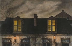
- Lafitte's Blacksmith House (a bar named for a pirate on Bourbon St, New Orleans)By Frederick MershimerLocated in New Orleans, LALafitte's Blacksmith Shop is a New Orleans landmark at 941 Bourbon St. Like most New Orleans legends, history of Lafitte's Blacksmith Shop is a gumbo of tru...Category
Early 2000s Contemporary Landscape Prints
MaterialsMezzotint, Aquatint
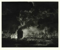
- Clairton (night view of US Steel Clairton coke plant, largest in America)By Craig McPhersonLocated in New Orleans, LAMcPherson's night view of the Clairton steelworks is printed on light green laid paper referenced as Hartley M1. It is signed, titled and dated in pencil. Marked ed 75 and "imp" in...Category
1990s American Modern Landscape Prints
MaterialsMezzotint

Recently Viewed
View AllMore Ways To Browse
Hand Colored Map
Green Map
Hand Compass
Antique Hand Router
Antique London Map Print
Mercator Map
Mercator Antique
Ivory 17th
African Art Ghana
17th Century Colored Engraving
Antique Sea Life Prints
Hand Drawn Map
Sea Monster
West Africa Map
Large Map Of The Netherlands
Antique African Ivory
Latitude Longitude
Globe Compass