Items Similar to 1885 America's Cup Sailing Yachts: Set of 3 Original 19th C. Engravings
Want more images or videos?
Request additional images or videos from the seller
1 of 20
Unknown1885 America's Cup Sailing Yachts: Set of 3 Original 19th C. Engravings1885
1885
About the Item
This is a set of three woodcut engravings produced in 1885 to commemorate the sailing yacht trials competition to determine the team to represent the United States in the America's Cup races off the New Jersey coast in that same year.
These three beautiful woodcut engravings are part of a group of six equally attractive prints, all framed identically in gold scrolled frames with pleasing light grey French mats each with a medium grey band. Each frame measures 16.13" x 17.25" x 0.5". See Item Reference #LU117325094852 to view the other three images. These may be purchased individually for $1,075/each, as a set of three for $2,875/3 or as a set of six for $5,575/6. Any number of these engravings would make for a striking display grouping.
Three American racing yachts, the Puritan, the Priscilla and the Bedouin, participating in the 1885 America’s Cup trials off the coast of New Jersey are shown in their qualifying races. The Puritan, owned by several members of the Eastern Yacht Club in Boston, was the eventual winner in two of the three qualifying races and was selected to represent America in the America’s Cup against its British rival Genesta. The race and the rivalry with Britain captured the attention of the country, with Harper’s Weekly stating "There has been nothing in the history of yachting in this country more important than the present race between the Boston sloop Puritan and the British cutter Genesta”. Despite substantial coverage in the American press, a brief news item noted that London was more interested in reports on the death of Jumbo the Elephant, which P. T. Barnum had previously purchased from a London zoo. The Puritan was eventually victorious over Genesta in the 1885 America’s Cup.
- Creation Year:1885
- Dimensions:Height: 16.13 in (40.98 cm)Width: 17.25 in (43.82 cm)Depth: 0.5 in (1.27 cm)
- Medium:
- Period:
- Condition:
- Gallery Location:Alamo, CA
- Reference Number:
About the Seller
5.0
Vetted Seller
These experienced sellers undergo a comprehensive evaluation by our team of in-house experts.
Established in 2011
1stDibs seller since 2019
239 sales on 1stDibs
Typical response time: 1 hour
- ShippingRetrieving quote...Ships From: Alamo, CA
- Return PolicyA return for this item may be initiated within 7 days of delivery.
More From This SellerView All
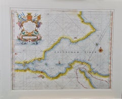
- Edinburgh, Scotland: An Original 17th C. Hand-Colored Engraved Sea ChartBy Captain Greenvile CollinsLocated in Alamo, CAThis hand-colored sea chart is entitled "Edinburgh Firth" from "Great Britain's Coasting Pilot. Being a New and Exact Survey of the Sea-Coast of England" by Captain Greenville Collin...Category
Late 17th Century Landscape Prints
MaterialsEngraving
- Danube River, Italy, Greece and Croatia: A Hand-colored 18th C. Homann MapBy Johann Baptist HomannLocated in Alamo, CA"Fluviorum in Europa principis Danubii" is a hand-colored map of the region about the Danube river created by Johann Baptist Homann (1663-1724) in his 'Atlas Novus Terrarum', publish...Category
Early 18th Century Old Masters Landscape Prints
MaterialsEngraving
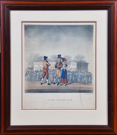
- "Scene _ Country Fair": A Framed Early 19th Century Engraving by George HuntBy George HuntLocated in Alamo, CAThis is a framed colored engraving entitled "Scene _ Country Fair" by George Hunt, published in London in 1825. It depicts a gathering of people at an early 19th century county fair, presumably in England. A majority of the crowd are turned away, watching a performance on a stage in the background. In the foreground a man is in conversation with a couple. The man wears a top hat and the woman is holding a baby. They are dressed in the typical attire of the middle class at that time. The engraving is presented in a brown wood frame and a double mat, with a cream-colored outer mat and a light cranberry...Category
Early 19th Century Landscape Prints
MaterialsEngraving
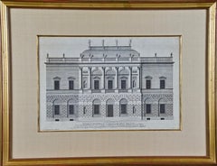
- 18th C. Architectural Engraving from "Vitruvius Britannicus" by Colen CampbellBy Colen CampbellLocated in Alamo, CA"The Elevation of a New Design of my Own Invention in the Style of Inigo Jones, Is most humbly Inscribed to his Grace the Duke of Argyle & Knight of the most Noble Order of the Garter", plate 20 from Colen Campbell's first edition of "Vitruvius Britannicus...Category
1710s Other Art Style Landscape Prints
MaterialsEngraving
- Northern Italy: A 16th Century Hand-colored Map by Abraham OrteliusBy Abraham OrteliusLocated in Alamo, CAThis is a framed 16th century hand-colored copperplate map of northern Italy entitled "Veronae Urbis Territorium a Bernardo Bragnolo Descriptium" by Abraham Ortelius from his atlas "Theatrum Orbis Terrarum", which was the first modern atlas of the world, with the first volume published in 1570. This map was part of a subsequent volume, published in Antwerp in 1584. It was based on an earlier map by Bernardo Brognoli. This beautiful map of northern Italy is focussed on Verona and its environs, including Mantua. Lake Garda and the South Tyrol mountains are prominently depicted. There is a very large striking cartouche in the upper left and a decorative distance scale in the lower right. This striking hand-colored map of northern Italy is presented in a gold-colored wood frame and an olive green-colored mat. It is glazed with UV conservation glass. All mounting materials used are archival. The frame measures 21.5" high by 28" wide by 0.75" deep. There is a central vertical fold, as issued, with slight separation of the lower portion of the fold. There are faint spots in the upper and right margins, but the map is otherwise in very good condition. Abraham Ortelius (also known as Ortels, Orthellius, and Wortels) (1527-1598) was a Dutch cartographer, geographer, and cosmographer. He began his career as a map colorist. In 1547 he entered the Antwerp guild of St Luke as an "illuminator of maps". He had an affinity for business from an early age and most of his journeys before 1560, were for business. He was a dealer in antiques, coins, maps, and books. His business income allowed him to acquire an extensive collection of medals, coins, and antiques, as well as a large library of books...Category
16th Century Old Masters Landscape Prints
MaterialsEngraving
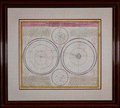
- Theories of Planetary Motion: An 18th C. Framed Celestial Map by DoppelmayrBy Johann Gabriel Doppelmayr 1Located in Alamo, CAThis 18th century hand-colored copperplate celestial map by Johann Doppelmayr entitled "Theoria Planetarum Primariorum In qua ipsorum motus in Copernican...Category
Early 18th Century Landscape Prints
MaterialsEngraving


You May Also Like
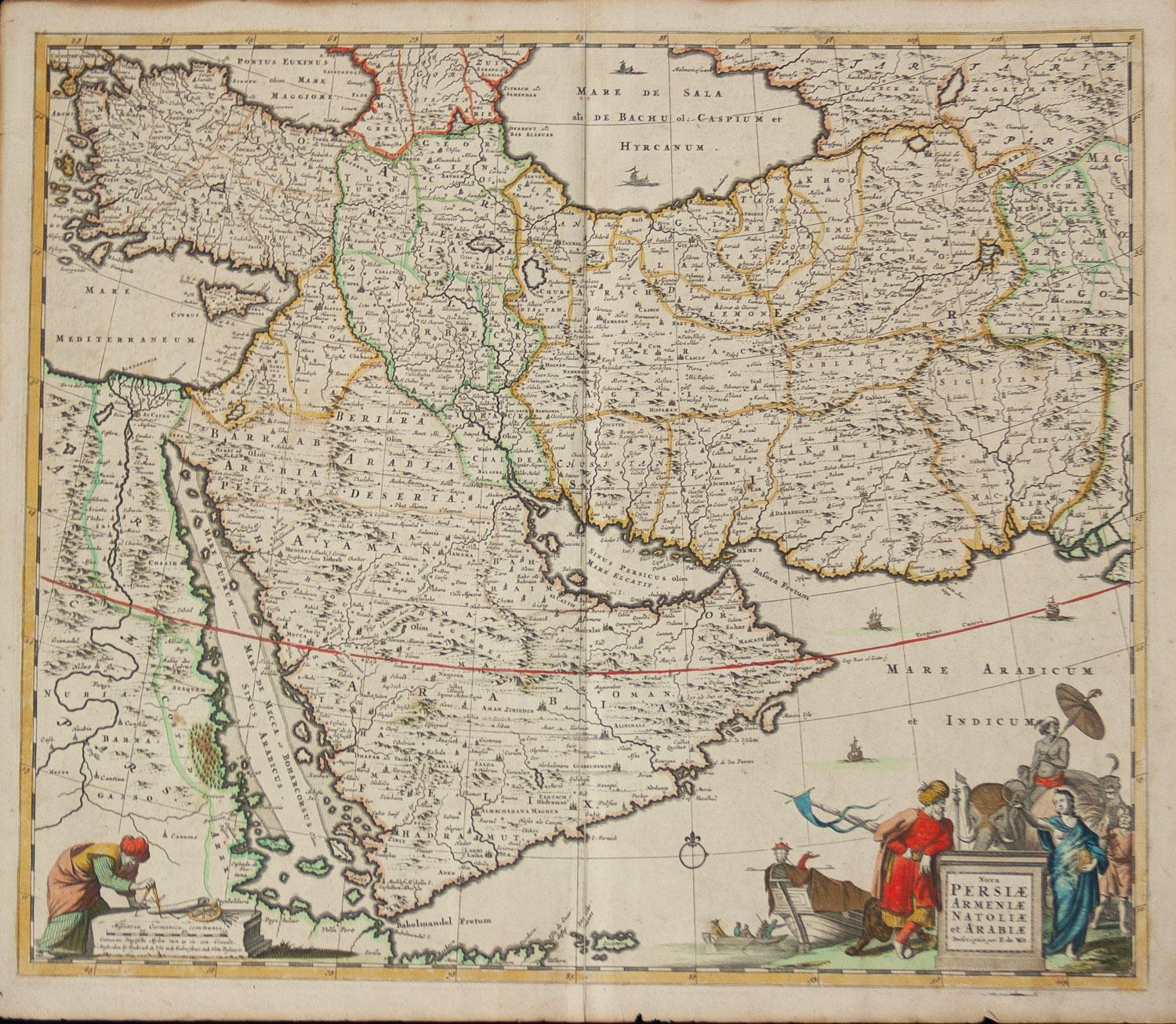
- Persiae, Armeniae, Natoliae et Arabiae Descriptio per Frederick deWit 1666 mapLocated in Paonia, COMap of Persiae, Armeniae, Natoliae et Arabiae Descriptio per F de Wit 1688 engraving from: Atlas Contractus Orbis Terrarum Praecipuas ac Novissimas Complectens Tabulas. Amsterdam, N. Visscher, 1656-77. (Koeman III, Vis5-8) This highly decorative map of the Middle East is by the Dutch engraver, publisher, and map seller...Category
1660s Realist Landscape Prints
MaterialsEngraving
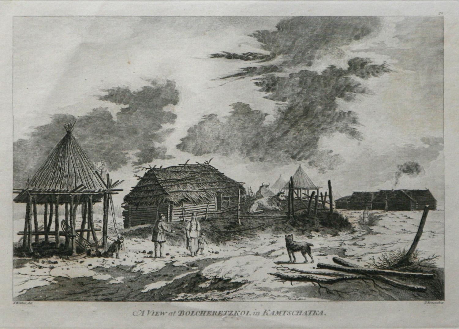
- A View at Bolcheretzko (Russia) 1784 Captains Cook Final Voyage by John WebberBy John WebberLocated in Paonia, COA View at Bolcheretzko (Russia) is from the 1784 First Edition Atlas Accompanying Capt. James Cook and King; Third and Final Voyage of Captain James Cook.John Webber (1752-1793) was ...Category
1780s Realist Landscape Prints
MaterialsEngraving
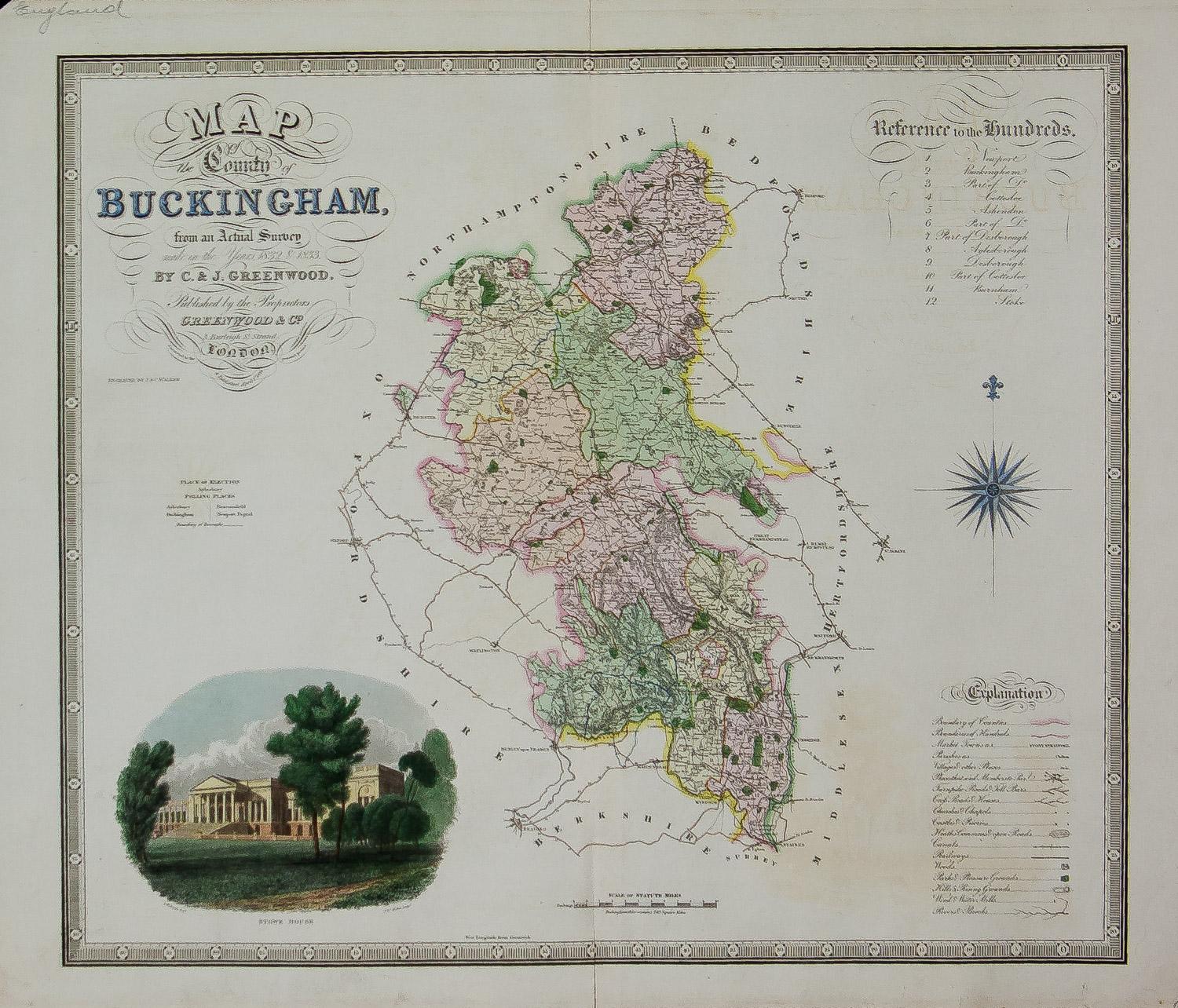
- Map of the County of Buckingham From an Actual SurveyLocated in Paonia, COCartographers Christopher (1786-1855) and John (1791-1867) Greenwood were surveyors from Yorkshire, who undertook an ambitious project to produce a series of large-scale maps of the counties of England, Wales and Scotland.The maps represent a remarkable and impressive surveying achievement forming an important record of the counties depicted. In the years 1817-1832 the Greenwood brothers published the Atlas of The Counties of England from an Actual Survey. This Atlas was finely drafted and engraved and decorated with large vignettes of prominent buildings of the county. This map of Buckingham County is beautifully hand colored and is in very good condition. There is a vignette of Stowe House...Category
19th Century Other Art Style More Prints
MaterialsEngraving
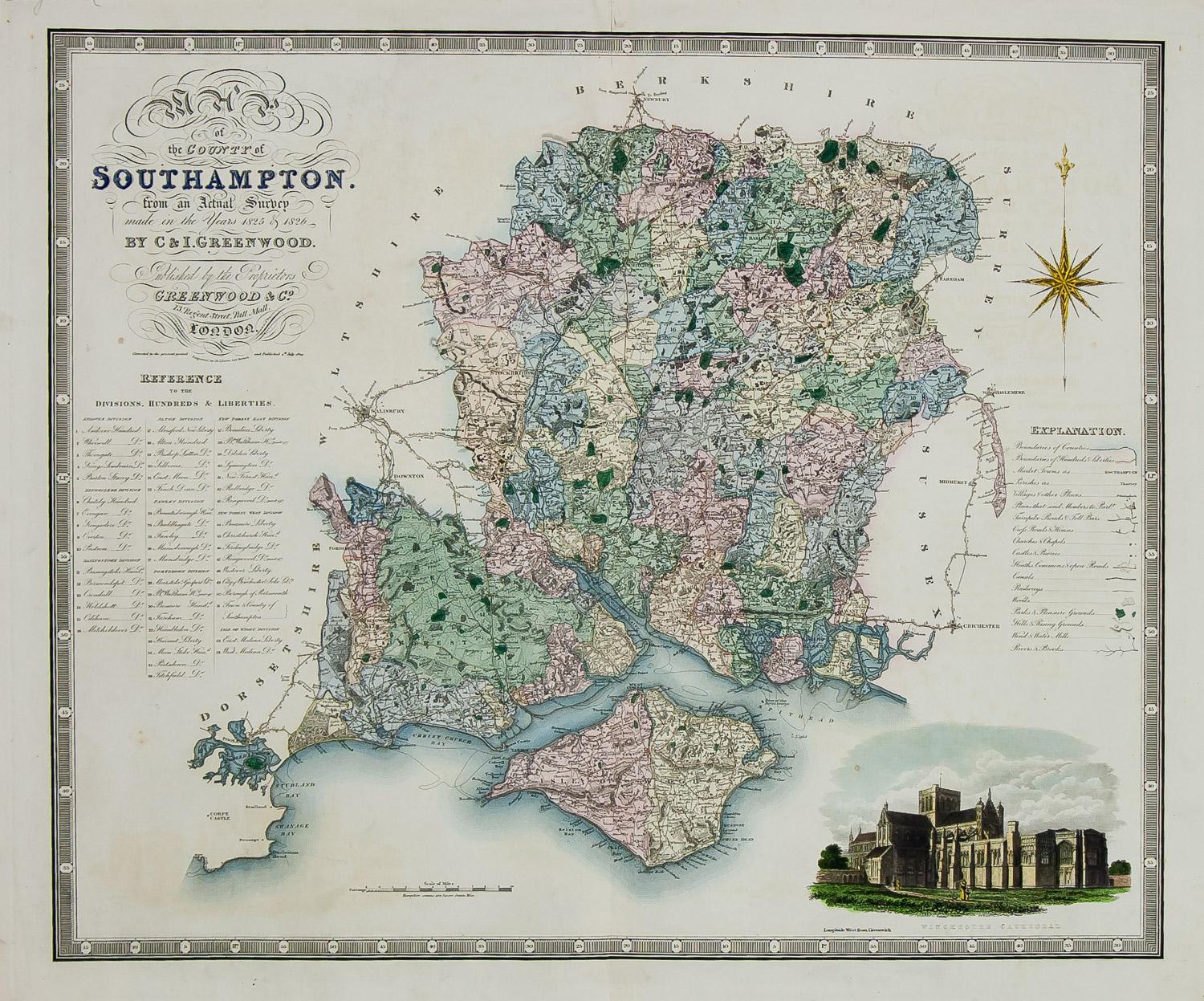
- England Map of the County of Southampton from an Actual SurveyLocated in Paonia, COCartographers Christopher (1786-1855) and John (1791-1867) Greenwood were surveyors from Yorkshire, who undertook an ambitious project to produce a series of large-scale maps of the counties of England, Wales and Scotland.The maps represent a remarkable and impressive surveying achievement forming an important record of the counties depicted. In the years 1817-1832 the Greenwood brothers published the Atlas of The Counties of England from an Actual Survey. This Atlas was finely drafted and engraved and decorated with large vignettes of prominent buildings of the county. This map of Southampton County is beautifully hand colored and is in very good condition. There is a vignette of Winchester Cathedral...Category
19th Century Other Art Style Landscape Prints
MaterialsEngraving
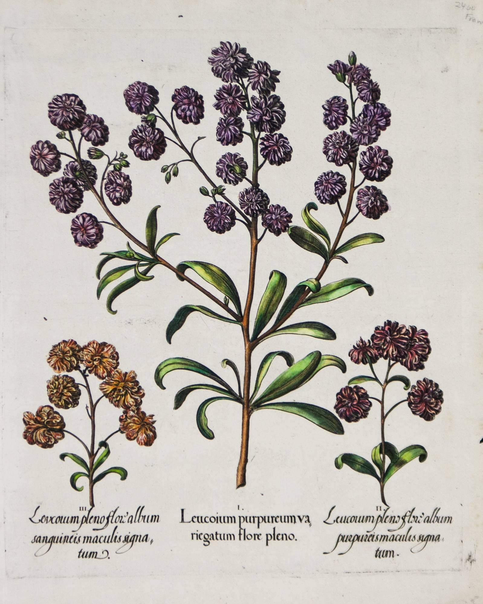
- Three Varieties of Leucoium , Hortus Eystettensis, ( after ) BeslerBy (After) Basilius BeslerLocated in Paonia, COThree Varieties of Leucoium (I. Leucoium purpureum variegatum flore pleno. II Leucoium pleno flor album purpureis maculis signatum. III. Leucoium pleno flor album sanguine maculis signatum), from B. Besler, Hortus Eystettensis possibly (after) Basil Besler...Category
Early 17th Century Landscape Prints
MaterialsEngraving
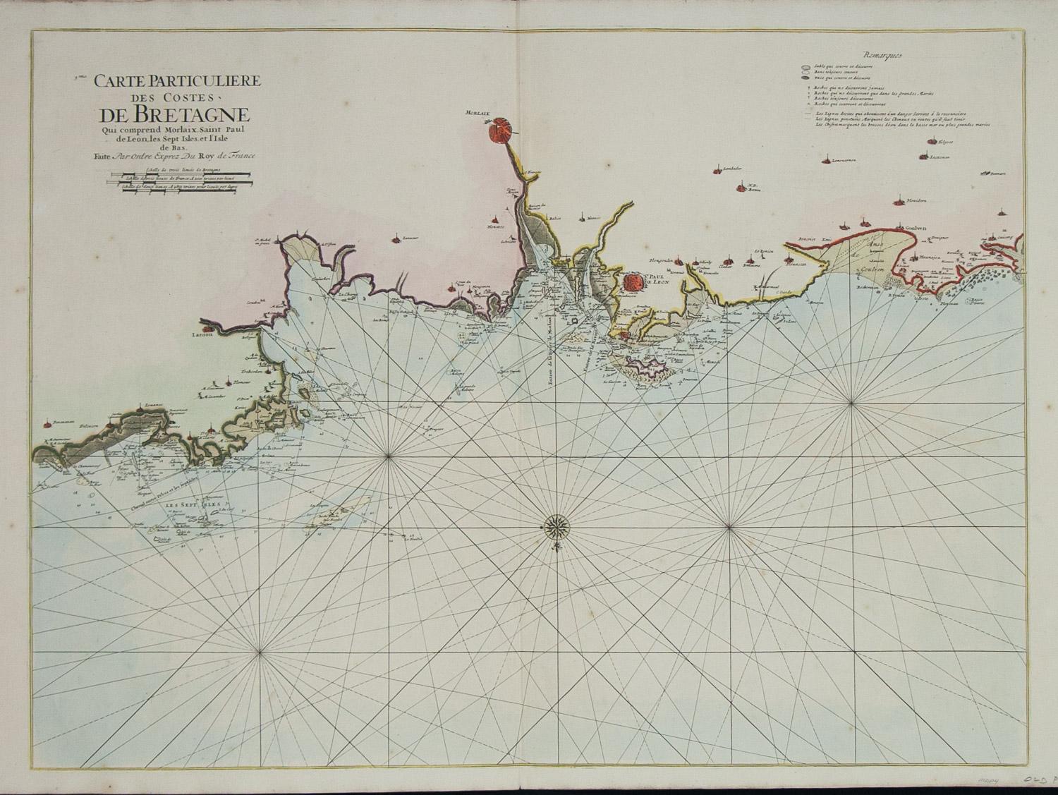
- Carte Particuliere Des Coste De Bretagne qui Comprend MorlaixBy Pierre MortierLocated in Paonia, COCarte Particuliere Des Costes De Bretagne qui Comprend Morlaix, Saint Paul de Leon, les Sept Isles, et L’Isle. Faite par ordre Exprez Du Roy de France is from the collection of ch...Category
1690s Landscape Prints
MaterialsEngraving


Recently Viewed
View AllMore Ways To Browse
Engravings Set
Set Of Engravings
Antique Engravings Set
Set Of Antique Engravings
Antique Gold Engraving
Scroll Art Set
Americas Cup
Antique Sailing
Set Of Antique Prints Framed
Framed Antique French Engravings
Antique Measuring Cups
Antique Print Club
Antique Print Set London
Yacht America
Yacht American
The Puritan
Antique Race
Yachts Of America