Antique Maps Of South Carolina
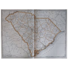
Large Original Antique Map of South Carolina, USA, 1894
By Rand McNally & Co.
Located in St Annes, Lancashire
Fabulous map of South Carolina
Original color
By Rand, McNally & Co.
Published, 1894
Category
1890s American Antique Maps Of South Carolina
Materials
Paper
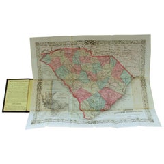
Antique Engraved Hand Colored Colton & Co. Pocket Book Map of South Carolina
By G.W. & C.B. Colton
Located in Charleston, SC
paper of South Carolina, 1874
Published at 172 William Street, New York
Below date of "1874" says
Category
Late 19th Century American Antique Maps Of South Carolina
Materials
Paper
H 13.75 in W 16.5 in D 0.25 in
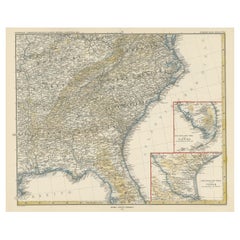
Antique Map of the Region of Georgia with Inset Maps of Florida and Texas
Located in Langweer, NL
Antique map of part of the United States showing Alabama, Georgia, North Carolina, South Carolina
Category
Late 19th Century Antique Maps Of South Carolina
Materials
Paper
H 15.04 in W 18.63 in D 0.02 in
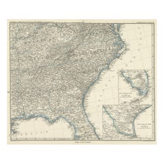
Antique Map of Tennessee, Kentucky, Virginia, Alabama, Georgia and Surroundings
Located in Langweer, NL
Antique map of part of the United States showing Alabama, Georgia, North Carolina, South Carolina
Category
Mid-19th Century Antique Maps Of South Carolina
Materials
Paper
Free Shipping
H 15.16 in W 18.71 in D 0.02 in
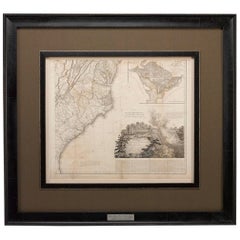
1812 United States Map, by Pierre Tardieu, Antique French Map Depicting the U.S.
By Pierre François Tardieu
Located in Colorado Springs, CO
South Carolina. Additionally, Ellicott’s plan for the City of Washington D.C. is included at the top
Category
1810s French Antique Maps Of South Carolina
Materials
Paper
H 43.5 in W 48 in D 2.25 in
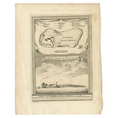
Antique Print of Bunce Island an Island in the Sierra Leone River, 1748
By Jakob van der Schley
Located in Langweer, NL
Island was the departure point for thousands of slaves for the North American colonies of South Carolina
Category
18th Century Antique Maps Of South Carolina
Materials
Paper
Satyr and Pan, Life Magazine Cover
By B. Cory Kilvert
Located in Fort Washington, PA
several mural-sized pictorial maps, including one for the Pinehurst Country Club in North Carolina
Category
1920s Other Art Style Antique Maps Of South Carolina
Materials
Board, Oil
Kellogg's Corn Flakes Advertisement
By B. Cory Kilvert
Located in Fort Washington, PA
maps, including one for the Pinehurst Country Club in North Carolina.
Kilvert complemented his
Category
1910s Other Art Style Antique Maps Of South Carolina
Materials
Gouache, Board, Watercolor
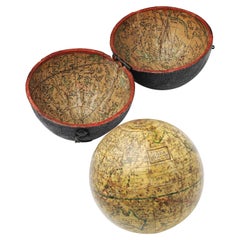
English Pocket Globe, London, Circa 1775-1798
By Herman Moll
Located in Milano, IT
region in his 1727 map. (Encyclopaedia Britannica, ed. 1902, under "States of Central Africa"); Tartary
Category
Late 18th Century English George III Antique Maps Of South Carolina
Materials
Shagreen, Paper
Portrait Painting Oil on Canvas by Joseph Badger
Located in Rome, IT
Charleston, South Carolina, shortly after their father’s death in 1765, the brothers announced that they had
Category
18th Century Academic Antique Maps Of South Carolina
Materials
Oil
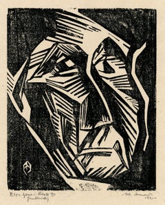
Ecce Homo Plate X
By Werner Drewes
Located in Fairlawn, OH
portraits. While in San Francisco he set up a shop from which he sold prints he had made in Spain and South
Category
1920s Bauhaus Antique Maps Of South Carolina
Materials
Woodcut
Ecce Homo VII
By Werner Drewes
Located in Fairlawn, OH
portraits. While in San Francisco he set up a shop from which he sold prints he had made in Spain and South
Category
1920s Expressionist Antique Maps Of South Carolina
Materials
Woodcut
Portrait Painting Oil on Canvas by Joseph Badger
Located in Rome, IT
Charleston, South Carolina, shortly after their father’s death in 1765, the brothers announced that they had
Category
18th Century Academic Antique Maps Of South Carolina
Materials
Oil
People Also Browsed
Portrait of a Yawning Dachshund - Animal 1915 art oil painting
Located in London, GB
Is there anything more cute than a dog yawning? Especially a gorgeous little Dachshund? I think not. Painted in 1915 and signed G A C, this super little painting is a profile view o...
Category
1910s Realist Antique Maps Of South Carolina
Materials
Oil
19th Century Oil Painting of Reclining Spaniels in Interior Signed by Armfield
By Edward Armfield
Located in Atlanta, GA
This 19th century oil painting, framed in a rectangular giltwood molded and carved frame, depicts two reclining spaniels in an interior. Resting in front of the fireplace, both dogs ...
Category
19th Century English Antique Maps Of South Carolina
Materials
Paint, Giltwood
H 25 in W 21 in D 2 in
Antique Oval Regency Flame Mahogany Dining Table 19th C
Located in London, GB
This is a beautiful antique Regency flame mahogany and Satinwood banded tilt top oval dining table dating from Circa 1820.
The fabulous 5ft flame mahogany tilt top table can sea...
Category
1820s English Regency Antique Maps Of South Carolina
Materials
Mahogany
Louis XVI Style Trumeau Panel with Trompe L'oeil Mirror Panel
Located in Nashville, TN
Possibly late 18th century but most likely 19th century painted arched painted panel. Either a panel intended for a trumeau or to be inset into wall boiserie as a trumeau. The upper ...
Category
1830s French Louis XVI Antique Maps Of South Carolina
Materials
Canvas, Paint
19th Century landscape genre oil painting of farmworkers with horses & a dog
By George Cole
Located in Nr Broadway, Worcestershire
George Cole
British, (1810-1883)
Rick Making, Lunchtime
Oil on canvas, signed & dated 1883
Image size: 23.5 inches x 35.5 inches
Size including frame: 30.5 inches x 42.5 inches
Prove...
Category
19th Century Victorian Antique Maps Of South Carolina
Materials
Canvas, Oil
H 30.5 in W 42.5 in D 3.25 in
19th Century English Dog Portrait Painting
Located in San Francisco, CA
An English late 19th century portrait painting of a dog.
Expressive detailed face, beautifully painted.
Oil paint on a heavy wood panel. Shows some old craquelure to the varnish.
...
Category
Late 19th Century English Antique Maps Of South Carolina
Materials
Wood
Art Nouveau Cameo Vase with Sweet Pea Decor, Émile Gallé, Nancy, France, 1903/04
By Émile Gallé
Located in Vienna, AT
Flush foot, raised, widening body with a shoulder-shaped narrowing at the top, with a short, wide neck and flared, rounded mouth rim. Burgundy red overlay on the outside, etched leaf...
Category
Early 1900s French Art Nouveau Antique Maps Of South Carolina
Materials
Glass
H 4.64 in Dm 3.34 in
American Steam Schooner Meets British Frigates Crossing the English Channel
By James Edward Buttersworth
Located in Costa Mesa, CA
Three ships - an American Three-Masted Steam Schooner, a British Sailing Royal Navy Frigate and a British Sidewheel Steam Naval Frigate - are all challenged by a tempestuous sea in t...
Category
1830s Antique Maps Of South Carolina
Materials
Canvas, Oil
Early 20th Century Louis XV Style Marble Top Console
Located in Winter Park, FL
An early 20th century French Louis XV style giltwood console with carved foliate details and warm gold painted patina. Original Rouge Royale marble top. Minor chips and some paint lo...
Category
Early 20th Century French Louis XV Antique Maps Of South Carolina
Materials
Marble
Rare Japanese antique pottery jar/13th century/Kamakura period/Excavated pottery
Located in Sammu-shi, Chiba
We would like to introduce you to some fascinating pots excavated in Japan.
This is a pot fired in an ancient Japanese kiln called Tokoname ware.
Tokoname is a kiln located in Aichi...
Category
15th Century and Earlier Japanese Other Antique Maps Of South Carolina
Materials
Pottery
H 15.08 in Dm 14.81 in
Art Déco Czech Blue Art Glass Vase from the 'Ingrid' Collection by C. Schlevogt
By Curt Schlevogt
Located in North Miami, FL
Art Déco czech Blue art glass vase decorated with nude figures from the 'Ingrid' collection by Curt Schlevogt
By: Curt Schlevogt
Material: art glass, glass
Technique: molded
Dimensi...
Category
Early 20th Century Czech Art Deco Antique Maps Of South Carolina
Materials
Glass, Art Glass
Original Antique World War One Humoros Wap Map Of The World WWI Japan Caricature
Located in London, GB
Original antique World War One satirical map of Europe and Asia portraying the outbreak of WWI featuring colourful caricatures and illustrations of the countries including Germany as...
Category
1910s Japanese Antique Maps Of South Carolina
Materials
Paper
H 18.51 in W 24.81 in D 0.04 in
Oil on Canvas by Harry Leith-Ross Hunter and Dog
By Harry Leith-Ross
Located in Toledo, OH
Harry Leith-Ross (1886-1973), is a renowned landscape artist born in Mauritius in 1886 and died in Pennsylvania in 1973. He had a long term association with the Bucks County artists'...
Category
Early 20th Century Antique Maps Of South Carolina
Materials
Canvas
First Period Dr. Wall Worcester Porcelain Teapot Stand Fisherman Ptn, Circa 1775
By 1st Period Worcester Dr. Wall
Located in Lincoln, Lincolnshire
This is a very good 18th century, First period (Dr. Wall), Worcester porcelain teapot stand, printed in cobalt blue with the "Fisherman" pattern and with a mock oriental or painters ...
Category
18th Century British George III Antique Maps Of South Carolina
Materials
Porcelain
H 0.75 in W 5.75 in D 5.25 in
Antique Map of New Hampshire
Located in Langweer, NL
Antique map titled 'New Hampshire'. Original antique map of New Hampshire, United States. This print originates from 'Encyclopaedia Britannica', Ninth Edition. Published 1884.
Th...
Category
Late 19th Century Antique Maps Of South Carolina
Materials
Paper
Antique Bible World Map by R. & J. Wetstein, 1743
Located in Langweer, NL
Antique world map titled 'De Werelt Caart'.
A scarce and richly detailed double hemisphere world map that was probably based on an earlier work by Cornelis Dankerts. This map has t...
Category
Mid-18th Century Antique Maps Of South Carolina
Materials
Paper
Recent Sales
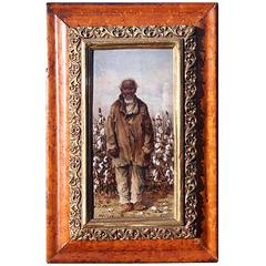
Painting of a Cotton Picker by William Aiken Walker
By William Aiken Walker
Located in Alexandria, VA
of several monographs.
William Aiken Walker was born in Charleston, South Carolina, on March 11
Category
1870s American Antique Maps Of South Carolina
Materials
Composition
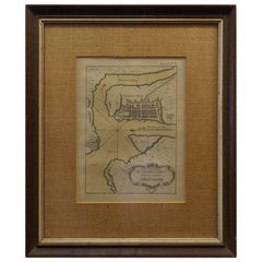
Rare Charleston, South Carolina Engraved Map "Town & Harbor, " Circa 1700
Located in Hollywood, SC
French engraved map of Charleston, South Carolina town and harbor depicting the Ashley & Cooper
Category
Early 1700s French Louis XIV Antique Maps Of South Carolina
Map of Appomattox Court House, Antique Map from Surveys, 1867
Located in Colorado Springs, CO
. This extensively surveyed and informative map extends south to Evergreen Station and north to the Bent
Category
1860s American Antique Maps Of South Carolina
Materials
Paper
Florida and Virginia: A 17th Century Hand-colored Map by Hondius after Mercator
By Gerard Mercator
Located in Alamo, CA
from the Chesapeake Bay south to St. Augustine, including present day North and South Carolina and
Category
Early 17th Century Dutch Antique Maps Of South Carolina
Materials
Paper
H 6.75 in W 8.63 in D 0.13 in
1833 Map of Eastern North & South Carolina, Printed in 1844
Located in Chapel Hill, NC
1833 Map of Eastern North & South Carolina, printed in 1844 by Baldwin & Cradock, London. This
Category
Mid-19th Century English Georgian Antique Maps Of South Carolina
Materials
Paper
An Early Map of Florida and the Carolinas by Seligmann
Located in Downingtown, PA
An Early Map after Mark Catesby by Johann Michael Seligmann of South Eastern North America
Category
18th Century and Earlier German Antique Maps Of South Carolina
"Battle of Gettysburg, Repulse of Longstreet's Assault" John B. Bachelder, 1876
Located in Colorado Springs, CO
of remarkable maps and prints.
In the late 1860s Bachelder commissioned painter James Walker to
Category
1870s American Antique Maps Of South Carolina
H 20 in W 40 in D 2.5 in
"Southern Gentleman" Unusal White Subject. Known for his African American
By William Aiken Walker
Located in San Antonio, TX
Charleston, South Carolina in 1838.
Walker completed his first painting at twelve and painted until his
Category
1870s Realist Antique Maps Of South Carolina
Materials
Oil
Large Original Antique Map of South Carolina by Rand McNally, circa 1900
By Rand McNally & Co.
Located in St Annes, Lancashire
Fabulous monochrome map with red outline color
Original color
By Rand, McNally & Co
Category
Early 1900s American Edwardian Antique Maps Of South Carolina
Materials
Paper
No Reserve
H 20.5 in W 27.5 in D 0.07 in
Original Antique Map of The American State of South Carolina, 1889
Located in St Annes, Lancashire
Great map of South Carolina
Drawn and Engraved by W. & A.K. Johnston
Published By A & C Black
Category
1880s Scottish Victorian Antique Maps Of South Carolina
Materials
Paper
No Reserve
H 8 in W 11 in D 0.07 in
Antique Map of North Carolina and South Carolina by Johnson, 1872
Located in Langweer, NL
Antique map titled 'Johnson's North Carolina and South Carolina'. Original map of North Carolina
Category
Late 19th Century Antique Maps Of South Carolina
Materials
Paper
Rare Charleston, South Carolina Engraved Map "Town and Harbor, " Circa 1747
By Bowen
Located in Hollywood, SC
Charleston, South Carolina engraved map of "The Town and Harbor of Charles town" in wood frame by
Category
1740s American American Colonial Antique Maps Of South Carolina
Antique Map of the United States of North America ‘East’ by A.K. Johnston, 1865
Located in Langweer, NL
, Alabama, Florida, Virginia, North Carolina, South Carolina, Tennessee, Kentucky, Ohio and more. This map
Category
Mid-19th Century Antique Maps Of South Carolina
Materials
Paper
H 24.41 in W 19.1 in D 0.02 in
A Rare French Engraved Map of The Southeastern United States. R.Bonne Circa 1780
By Rigobert Bonne
Located in Hollywood, SC
, North Carolina, South Carolina, and Georgia. Rigobert Bonne, Paris Circa 1780. Plate measures 8.75
Category
1780s French Louis XVI Antique Maps Of South Carolina
Materials
Paper, Wood
H 16.5 in W 21 in D 1 in
Florida and Virginia: A 17th Century Hand-colored Map by Hondius after Mercator
By Gerard Mercator
Located in Alamo, CA
from the Chesapeake Bay south to St. Augustine, including present day North and South Carolina and
Category
Early 17th Century Antique Maps Of South Carolina
Materials
Engraving
The Atlantic Ocean, Americas, Africa and Europe: Hand-colored 18th C. Bowen Map
Located in Alamo, CA
referring to English claim on the Carolinas: "The south boundary of Carolina according to King Charles II'ds
Category
Mid-18th Century Old Masters Antique Maps Of South Carolina
Materials
Engraving
A Cotton Picker - Realist Figurative Oil Painting by William Aiken Walker
By William Aiken Walker
Located in Marlow, Buckinghamshire
work depicts an African American South Carolina lady smoking a pipe while she picks cotton in a field
Category
Early 20th Century American Realist Antique Maps Of South Carolina
Materials
Board, Oil
A Cotton Picker - Realist Figurative Oil Painting by William Aiken Walker
By William Aiken Walker
Located in Marlow, Buckinghamshire
work depicts an African American South Carolina gentleman smoking a pipe while she picks cotton in a
Category
Early 20th Century American Realist Antique Maps Of South Carolina
Materials
Board, Oil
Pensacola - Original Etching 1769
By Dominic Serres
Located in Roma, IT
Pensacola in the late XVIII century, described the Floridian city in his "Travels Through North and South
Category
1790s Old Masters Antique Maps Of South Carolina
Materials
Etching
Engraved Map of South Carolina from John Payne's Book, circa 1799
By John Payne
Located in Atlanta, GA
Engraved map of the state of South Carolina from John Payne's "New & Complete Universal Geography
Category
1790s American Antique Maps Of South Carolina
Materials
Paper
Lewis' the State of South Carolina, 1795 Map
Located in Atlanta, GA
Lewis' the State of South Carolina, 1795 map.
Category
1790s Antique Maps Of South Carolina
1778 Map of Plans of Cities and Harbours. including Havana, Cuba."
By Thomas Conder
Located in New York, NY
the River Delaware from Chester to Philadelphia", "Plan of the Harbour of Charles Town, South Carolina
Category
1770s Realist Antique Maps Of South Carolina
Materials
Engraving
Get Updated with New Arrivals
Save "Antique Maps Of South Carolina", and we’ll notify you when there are new listings in this category.
Antique Maps Of South Carolina For Sale on 1stDibs
With a vast inventory of beautiful furniture at 1stDibs, we’ve got just the antique maps of south carolina you’re looking for. An antique maps of south carolina — often made from paper, animal skin and shagreen — can elevate any home. You’ve searched high and low for the perfect antique maps of south carolina — we have versions that date back to the 18th Century alongside those produced as recently as the 19th Century are available. Each antique maps of south carolina bearing Georgian hallmarks is very popular. A well-made antique maps of south carolina has long been a part of the offerings for many furniture designers and manufacturers, but those produced by G.W. & C.B. Colton, Herman Moll and Pierre François Tardieu are consistently popular.
How Much is a Antique Maps Of South Carolina?
The average selling price for an antique maps of south carolina at 1stDibs is $3,028, while they’re typically $75 on the low end and $10,116 for the highest priced.
More Ways To Browse
Chesapeake Bay Art
Peru Blanket
Used Furniture Brookline
West African Antiques
Western Union Sign
18th Century Japanese Wood Block
Antique 7 Up Bottles
Antique Cuba Map
Antique Jamaica Map
Antique Map Brooklyn
Antique Map Of Brooklyn
Antique Map Of Cuba
Antique Maps Of Cuba
Antique Music Machine
Antique Tobacco Cards
Arabia Plaque
Asian Prints And Paintings Antiques
Battle Of Gettysburg
