Copper Map Plate

90
to
29
235
94
160
135
97
80
36
36
34
32
31
27
26
26
19
18
16
14
12
9
8
8
8
8
7
7
5
5
5
5
5
4
4
3
3
3
3
3
3
2
2
2
2
2
2
1
1
1
1
1
1
1
1
1
14
8
7
6
6
Sort By
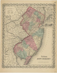
Antique Map of New Jersey
Located in Langweer, NL
Antique map titled 'Colton's New Jersey'. This rare hand colored map of New Jersey is a copper
Category

Antique Mid-19th Century Maps

Materials

Paper

Antique Map of New Jersey
H 17.52 in W 13.59 in D 0.02 in
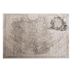
Original Antique Map of Asia. C.1780
Located in St Annes, Lancashire
Great map of Asia Copper-plate engraving Published C.1780 Two small worm holes to right side of
Category

Antique Early 1800s English Georgian Maps

Materials

Paper

Original Antique Map of Asia. C.1780
No Reserve
H 8.75 in W 12.25 in D 0.07 in
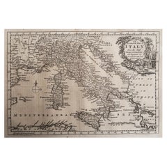
Original Antique Map of Italy. C.1780
Located in St Annes, Lancashire
Great map of Italy Copper-plate engraving Published C.1780 Unframed.
Category

Antique Early 1800s English Georgian Maps

Materials

Paper

Original Antique Map of Italy. C.1780
No Reserve
H 8.25 in W 12 in D 0.07 in
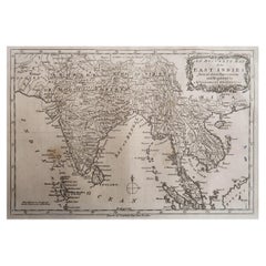
Original Antique Map of India. C.1780
Located in St Annes, Lancashire
Great map of India Copper-plate engraving Published C.1780 Three small worm holes to right
Category

Antique Early 1800s English Georgian Maps

Materials

Paper

Original Antique Map of India. C.1780
No Reserve
H 8.75 in W 12.5 in D 0.07 in
Original Antique Map of Hungary, Arrowsmith, 1820
Located in St Annes, Lancashire
Great map of Hungary Drawn under the direction of Arrowsmith. Copper-plate engraving. Published
Category

Antique 1820s English Maps

Materials

Paper

Original Antique Map of Hungary, Arrowsmith, 1820
No Reserve
H 10.5 in W 16 in D 0.07 in
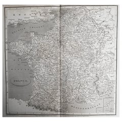
Original Antique Map of France, Arrowsmith, 1820
Located in St Annes, Lancashire
Great map of France Drawn under the direction of Arrowsmith. Copper-plate engraving
Category

Antique 1820s English Maps

Materials

Paper

Original Antique Map of France, Arrowsmith, 1820
No Reserve
H 10.5 in W 16 in D 0.07 in
Original Antique Map of Europe, Arrowsmith, 1820
Located in St Annes, Lancashire
Great map of Europe Drawn under the direction of Arrowsmith. Copper-plate engraving
Category

Antique 1820s English Maps

Materials

Paper

Original Antique Map of Europe, Arrowsmith, 1820
No Reserve
H 10.5 in W 16 in D 0.07 in
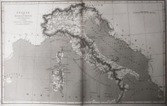
Original Antique Map of Italy. Arrowsmith. 1820
Located in St Annes, Lancashire
Great map of Italy Drawn under the direction of Arrowsmith Copper-plate engraving Published by
Category

Antique 1820s English Maps

Materials

Paper

Original Antique Map of Italy. Arrowsmith. 1820
No Reserve
H 10.5 in W 16 in D 0.07 in
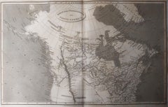
Original Antique Map of Canada, Arrowsmith, 1820
Located in St Annes, Lancashire
Great map of Canada. Drawn under the direction of Arrowsmith. Copper-plate engraving
Category

Antique 1820s English Maps

Materials

Paper

Original Antique Map of Canada, Arrowsmith, 1820
No Reserve
H 10.5 in W 16 in D 0.07 in
Original Antique Map of China, Arrowsmith, 1820
Located in St Annes, Lancashire
Great map of China Drawn under the direction of Arrowsmith Copper-plate engraving
Category

Antique 1820s English Maps

Materials

Paper

Original Antique Map of China, Arrowsmith, 1820
No Reserve
H 10.5 in W 16 in D 0.07 in
1875 "North America" Map by J. Bartholomew
Located in Colorado Springs, CO
, as opposed to limiting illustrations to separate copper plate engravings. Although this technology
Category

Antique 1870s Scottish Maps

Materials

Paper

German Antique Map of Southeastern Australia, 1904
Located in Langweer, NL
chromolithography, rather than copper plate engraving, but reproducing the maps from zinc plates that were etched in
Category

20th Century Maps

Materials

Paper

Original Antique Map of South America. C.1780
Located in St Annes, Lancashire
Great map of South America Copper-plate engraving Published C.1780 Two small worm holes to left
Category

Antique Early 1800s English Georgian Maps

Materials

Paper

Original Antique Map of South America. C.1780
No Reserve
H 8.75 in W 12.75 in D 0.07 in
Original Antique Map of Russia By Arrowsmith. 1820
Located in St Annes, Lancashire
Great map of Russia Drawn under the direction of Arrowsmith Copper-plate engraving Published by
Category

Antique 1820s English Maps

Materials

Paper

Original Antique Map of Russia By Arrowsmith. 1820
No Reserve
H 10.5 in W 16 in D 0.07 in
Original Antique Map of South Africa, Arrowsmith, 1820
Located in St Annes, Lancashire
Great map of South Africa. Drawn under the direction of Arrowsmith. Copper-plate engraving
Category

Antique 1820s English Maps

Materials

Paper

Original Antique Map of South Africa, Arrowsmith, 1820
No Reserve
H 10.5 in W 16 in D 0.07 in
Original Antique Map of South America, circa 1830
Located in St Annes, Lancashire
Great map of South America Copper plate engraving Published by Butterworth, Livesey & Co
Category

Antique Early 1800s English Other Maps

Materials

Paper

Original Antique Map of South America, circa 1830
No Reserve
H 10 in W 8 in D 0.07 in
Antique Map of Central Asia and India, 1904
Located in Langweer, NL
plate engraving, but reproducing the maps from zinc plates that were etched in relief (just like
Category

20th Century Maps

Materials

Paper

Antique Map of Central Asia and India, 1904
H 22.09 in W 17.45 in D 0.01 in
Antique Map of New Zealand and Tasmania, 1904
Located in Langweer, NL
chromolithography, rather than copper plate engraving, but reproducing the maps from zinc plates that were etched in
Category

20th Century Maps

Materials

Paper

Antique Map of Southern India by Andree, 1904
Located in Langweer, NL
Velhagen & Klasing, Bielefeld and Leipzig, Germany. By using chromolithography, rather than copper plate
Category

20th Century Maps

Materials

Paper

Antique Map of France with Decorative Border, 1766
Located in Langweer, NL
Antique map titled 'La France, divisée en ses quarante Gouvernemens Généraux.' Attractive map of
Category

Antique 18th Century Maps

Materials

Paper

Original Antique Map of Sweden, Engraved by Barlow, 1806
Located in St Annes, Lancashire
Great map of Sweden Copper-plate engraving by Barlow Published by Brightly & Kinnersly
Category

Antique Early 1800s English Maps

Materials

Paper

Original Antique Map of Central America / Florida, Arrowsmith, 1820
Located in St Annes, Lancashire
Great map of Central America. Drawn under the direction of Arrowsmith. Copper-plate engraving
Category

Antique 1820s English Maps

Materials

Paper

Original Antique Map of South East Asia, Arrowsmith, 1820
Located in St Annes, Lancashire
Great map of South East Asia Drawn under the direction of Arrowsmith Copper-plate engraving
Category

Antique 1820s English Maps

Materials

Paper

Original Antique Map of Spain and Portugal, circa 1790
Located in St Annes, Lancashire
Super map of Spain and Portugal Copper plate engraving by A. Bell Published, circa 1790
Category

Antique 1790s English Other Maps

Materials

Paper

Original Antique Map of Spain and Portugal, circa 1790
No Reserve
H 8.25 in W 11 in D 0.07 in
Original Antique Map of China by Thomas Clerk, 1817
Located in St Annes, Lancashire
Great map of China Copper-plate engraving Drawn and engraved by Thomas Clerk, Edinburgh
Category

Antique 1810s English Maps

Materials

Paper

Original Antique Map of China by Thomas Clerk, 1817
No Reserve
H 8.25 in W 10.25 in D 0.07 in
Original Antique Map of Ancient Greece- Boeotia, Thebes, 1787
Located in St Annes, Lancashire
. Barbie Du Bocage Copper plate engraving by P.F Tardieu Original hand color outline. Published
Category

Antique 1780s French Other Maps

Materials

Paper

Original Antique Map of Ancient Greece, Achaia, Corinth, 1786
Located in St Annes, Lancashire
J.D. Barbie Du Bocage Copper plate engraving by P.F Tardieu Original hand color outline
Category

Antique 1780s French Other Maps

Materials

Paper

Antique Map of the Low Countries by Brué, 1822
Located in Langweer, NL
on the copper of the plate, creating what he called encyprotypes. He is best known for the 'Atlas
Category

Antique 19th Century Maps

Materials

Paper

1590 Mercator Map Entitled "France Picardie Champaigne, Ric.0001
Located in Norton, MA
Picardie and Champagne.) Copper engraved map of the french provinces of Picardie and Champagne, showing the
Category

Antique 16th Century Dutch Maps

Materials

Paper

Original Antique Map of France, Sherwood, Neely & Jones, Dated 1809
Located in St Annes, Lancashire
Great map of France Copper-plate engraving by Cooper Published by Sherwood, Neely & Jones
Category

Antique Early 1800s English Maps

Materials

Paper

Original Antique Map of Switzerland, Engraved By Barlow, Dated 1807
Located in St Annes, Lancashire
Great map of Switzerland Copper-plate engraving by Barlow Published by Brightly & Kinnersly
Category

Antique Early 1800s English Maps

Materials

Paper

Original Antique Map of South America by Thomas Clerk, 1817
Located in St Annes, Lancashire
Great map of South America Copper-plate engraving Drawn and engraved by Thomas Clerk
Category

Antique 1810s English Maps

Materials

Paper

Original Antique Map of South America by Thomas Clerk, 1817
No Reserve
H 10.25 in W 8.25 in D 0.07 in
Large Scale Antique Scroll Map of Lincolnshire, England, Dated 1778
Located in St Annes, Lancashire
Wonderful scroll map of Lincolnshire By Captain Armstrong, 1778 Copper plate engraving on
Category

Antique 1770s English Georgian Maps

Materials

Wood, Paper

Road Map, John Ogilby, No 54, London, Yarmouth, Britannia
By John Ogilby
Located in BUNGAY, SUFFOLK
, no further volumes were to appear, and the existing printing plates were sold to other London map
Category

Antique 1670s English Baroque Maps

Materials

Paper

Original Antique Map of The World by Thomas Clerk, 1817
Located in St Annes, Lancashire
Great map of The Eastern and Western Hemispheres On 2 sheets Copper-plate engraving Drawn
Category

Antique 1810s English Maps

Materials

Paper

Original Antique Map of The World by Thomas Clerk, 1817
No Reserve
H 10.25 in W 8.25 in D 0.07 in
Original Antique Map of The Netherlands, Engraved by Barlow, Dated 1807
Located in St Annes, Lancashire
Great map of Netherlands Copper-plate engraving by Barlow Published by Brightly & Kinnersly
Category

Antique Early 1800s English Maps

Materials

Paper

Antique Map of Vlaams-Brabant by Homann Heirs, c.1720
By Homann Heirs
Located in Langweer, NL
Antique map titled 'Ducatus Brabantiae Nova Tabula in qua (..).' Fully engraved copper plate map
Category

Antique 18th Century Maps

Materials

Paper

Stunning Decorative Antique Map of Venice in Italy, ca.1787
Located in Langweer, NL
made by: Marco Sebastiano Giampiccoli After: Matthäus Merian I Two copper engraved sheets joined
Category

Antique Late 18th Century Maps

Materials

Paper

Stunning Decorative Antique Map of Venice in Italy, ca.1787
Free Shipping
H 12.6 in W 28.75 in D 0 in
Antique Map of Drenthe, a Province in The Netherlands, 1658
Located in Langweer, NL
Antique map titled 'Drentia comitatus (..)'. Copper engraved contemp. hand coloured map of Drenthe
Category

Antique 17th Century Maps

Materials

Paper

Original Antique Map of The Netherlands, Sherwood, Neely & Jones, Dated 1809
Located in St Annes, Lancashire
Great map of The Netherlands Copper-plate engraving by Cooper Published by Sherwood, Neely
Category

Antique Early 1800s English Maps

Materials

Paper

Original Antique Map of Spain and Portugal, Engraved By Barlow, 1806
Located in St Annes, Lancashire
Great map of Spain And Portugal Copper-plate engraving by Barlow Published by Brightly
Category

Antique Early 1800s English Maps

Materials

Paper

Original Antique Map of South East Asia by Thomas Clerk, 1817
Located in St Annes, Lancashire
Great map of South East Asia Copper-plate engraving Drawn and engraved by Thomas Clerk
Category

Antique 1810s English Maps

Materials

Paper

Original Antique Map of Spain and Portugal by Thomas Clerk, 1817
Located in St Annes, Lancashire
Great map of Spain and Portugal Copper-plate engraving Drawn and engraved by Thomas Clerk
Category

Antique 1810s English Maps

Materials

Paper

Antique Map of the Kanton Luzerne 'Switzerland' by Homann Heirs, 1763
Located in Langweer, NL
Antique map titled 'Canton Lucern (..)'. Fine decorative copper plate engraved antique map of the
Category

Antique Mid-18th Century Maps

Materials

Paper

Cartographic Elegance of Touraine: A 17th-Century Map Showing French Heritage
Located in Langweer, NL
of copperplate engraving, a technique where an artist etches a design onto a smooth copper plate
Category

Antique 1630s Maps

Materials

Paper

Original Antique Map of Ancient Greece, Phocis, Gulf of Corinth, 1787
Located in St Annes, Lancashire
by J.D. Barbie Du Bocage Copper plate engraving by P.F Tardieu Original hand color outline
Category

Antique 1780s French Other Maps

Materials

Paper

Antique Map of Burma and the Malayan Peninsula by Andree, 1904
Located in Langweer, NL
, rather than copper plate engraving, but reproducing the maps from zinc plates that were etched in relief
Category

20th Century Maps

Materials

Paper

Antique Original Map of the City of Deventer, the Netherlands, 1588
Located in Langweer, NL
Antique map titled 'Liberae et Hanseaticae urbis Daventriensis delineatio'. Original bird's eye
Category

Antique 16th Century Maps

Materials

Paper

Scandinavia & Portions of Eastern Europe: 18th Century Hand-Colored Homann Map
By Johann Baptist Homann
Located in Alamo, CA
An early 18th century hand-colored copper-plate map entitled "Regni Sueciae in omnes suas
Category

Antique Early 18th Century German Maps

Materials

Paper

18th Century Hand Colored Map of Spain and Portugal by Visscher
By Nicolaes Visscher II
Located in Alamo, CA
Visscher's original copper plate by Peter Schenk, Junior in Amsterdam in 1725. The cartouche in the right
Category

Antique Early 18th Century Dutch Maps

Materials

Paper

Antique Map of the City of Hindeloopen by Braun & Hogenberg, c.1598
Located in Langweer, NL
Antique map titled 'Hindelopia'. Original antique map of the city of Hindeloopen, Friesland, the
Category

Antique 16th Century Maps

Materials

Paper

Cartographic Elegance: The Art and Science of 17th-Century Asian Maps, ca.1681
Located in Langweer, NL
the map onto a copper plate, which is then used to print the image onto paper. The addition of color
Category

Antique 1680s Maps

Materials

Paper

West Africa Entitled "Guinea Propria": An 18th Century Hand Colored Homann Map
By Johann Baptist Homann
Located in Alamo, CA
This is a scarce richly hand colored copper plate engraved map of Africa entitled "Guinea Propria
Category

Antique Mid-18th Century German Maps

Materials

Paper

1850 Old French Map Depicting the Entire Earth's Surface Divided into Two Parts
Located in Milan, IT
. Print on etching paper on copper plate, Coeval coloring. Table n. 8, French manufacture from the mid
Category

Antique Mid-19th Century French Maps

Materials

Glass, Wood, Paper

Map Road Strip Britannia Sheet 2 John Ogilby London Aberistwith Islip Bramyard
By John Ogilby
Located in BUNGAY, SUFFOLK
of England and Wales. Strip map Islip to Bramyard, on a scale of approximately one inch to the mile
Category

Antique 17th Century English Baroque Maps

Materials

Paper

Road Map John Ogilby No 75 Kings Lyn Harwich, Britannia Framed Wallhanging
By John Ogilby
Located in BUNGAY, SUFFOLK
, no further volumes were to appear, and the existing printing plates were sold to other London map
Category

Antique 1670s European Baroque Maps

Materials

Paper

Map Road John Ogilby Britannia No 74 Ipswich to Norwich Cromer Framed
By John Ogilby
Located in BUNGAY, SUFFOLK
plates were sold to other London map-publishers, bringing to an end one of the most ambitious and
Category

Antique 1670s English Baroque Maps

Materials

Paper

Captain Cook's Exploration of Tahiti 18th C. Hand-Colored Map by Bellin
By Jacques-Nicolas Bellin
Located in Alamo, CA
This beautiful 18th century hand-colored copper plate engraved map is entitled "Carte de l'Isle de
Category

Antique Mid-18th Century French Maps

Materials

Paper

1850 Old French Map Depicting the Entire Earth's Surface Divided into Two Parts
Located in Milan, IT
explanation in French. Printed on paper by engraving on copper plate, coeval coloring. Table n. 3, French
Category

Antique Mid-19th Century French Maps

Materials

Glass, Wood, Paper

Antique Map of the City of Bolsward, Friesland in The Netherlands, c.1598
Located in Langweer, NL
Cologne/Germany. He was a prolific copper engraver and etching artist of maps and town views. In
Category

Antique 16th Century Maps

Materials

Paper

  • 1
Get Updated with New Arrivals
Save "Copper Map Plate", and we’ll notify you when there are new listings in this category.

Copper Map Plate For Sale on 1stDibs

With a vast inventory of beautiful furniture at 1stDibs, we’ve got just the copper map plate you’re looking for. A copper map plate — often made from paper, wood and brass — can elevate any home. Whether you’re looking for an older or newer copper map plate, there are earlier versions available from the 18th Century and newer variations made as recently as the 20th Century. A copper map plate is a generally popular piece of furniture, but those created in Baroque and Georgian styles are sought with frequency. A well-made copper map plate has long been a part of the offerings for many furniture designers and manufacturers, but those produced by Antoine Roux, Johann Baptist Homann and Jacques-Nicolas Bellin are consistently popular.

How Much is a Copper Map Plate?

Prices for a copper map plate start at $30 and top out at $238,935 with the average selling for $679.
Questions About Copper Map Plate
  • 1stDibs ExpertApril 5, 2022
    Copper plates are often preferred by chefs as the cookware of choice because copper is an excellent heat conductor. For dinnerware, the aesthetics are a bonus, with the copper of the plate giving off a rustic, earthy appeal. You can shop a selection of copper dinnerware from some of the world’s top sellers on 1stDibs.

Read More

Pamela Shamshiri Shares the Secrets behind Her First-Ever Book and Its Effortlessly Cool Interiors

The sought-after designer worked with the team at Hoffman Creative to produce a monograph that beautifully showcases some of Studio Shamshiri's most inspiring projects.

Moroccan Artworks and Objects Take Center Stage in an Extraordinary Villa in Tangier

Italian writer and collector Umberto Pasti opens the doors to his remarkable cave of wonders in North Africa.

Montecito Has Drawn Royalty and Celebrities, and These Homes Are Proof of Its Allure

Hollywood A-listers, ex-pat aristocrats and art collectors and style setters of all stripes appreciate the allure of the coastal California hamlet — much on our minds after recent winter floods.

Whaam! Blam! Pow! — a New Book on Pop Art Packs a Punch

Publishing house Assouline and writer Julie Belcove have teamed up to trace the history of the genre, from Roy Lichtenstein, Andy Warhol and Yayoi Kusama to Mickalene Thomas and Jeff Koons.

The Sparkling Legacy of Tiffany & Co. Explained, One Jewel at a Time

A gorgeous new book celebrates — and memorializes — the iconic jeweler’s rich heritage.

What Makes a Gem-Encrusted Chess Set Worth $4 Million?

The world’s most opulent chess set, weighing in at 513 carats, is literally fit for a king and queen.

Tauba Auerbach’s Geometric Pop-Up Book Is Mighty Rare, Thanks to a Hurricane

This sculptural art book has an epic backstory of its own.

Step inside the Storied Mansions of Palm Beach’s Most Effervescent Architect

From Spanish-style courtyards to fanciful fountains, these acclaimed structures abound in surprising and elegant details.