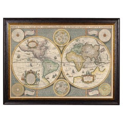
Double Hemisphere Map
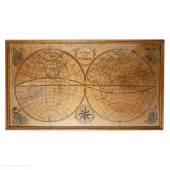
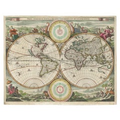
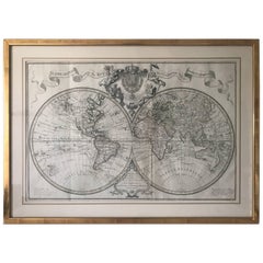
Framed World Map print showing double hemisphere dating to 1642 originally, New
Located in Lincoln, Lincolnshire
original 1642 double hemisphere map of the world. It includes pictorial relief illustrations and detailed
Category
2010s British Charles II Prints
Materials
Glass, Wood, Paper
H 19.69 in W 27.56 in D 1.58 in
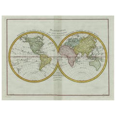
Original Engraved Antique Map of the World, Colorful and Decorative, C.1780
By Pierre François Tardieu
Located in Langweer, NL
' - This handsome double hemisphere map presents a view of the physical world with particularly nice detail
Category
Antique 18th Century Maps
Materials
Paper
H 15.6 in W 20.32 in D 0 in
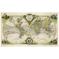
Rare Original Double Hemisphere World Map with Allegorical Figures, 1785
Located in Langweer, NL
Antique map titled 'Nieuwe en Naukeurige Kaart der Gantsche bekende Werreld.'
A double
Category
Antique 1780s Maps
Materials
Paper
H 17.05 in W 23.23 in D 0 in
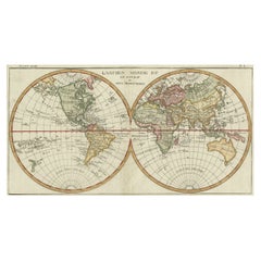
Very Decorative Original Antique Map of the World, Published in France in c.1780
By Rigobert Bonne
Located in Langweer, NL
Antique map titled 'L'Ancien Monde Et Le Nouveau en Deux Hemispheres' - Double hemisphere map of
Category
Antique 18th Century Maps
Materials
Paper
H 10.24 in W 17.6 in D 0 in
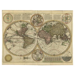
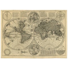
Antique Double Hemisphere World Map with California as an Island, 1710
Located in Langweer, NL
Description: Antique map titled 'De Werelt Caart'. First state (out of three) antique double
Category
Antique 1710s Maps
Materials
Paper
Antique Map of the World in Hemispheres by Keizer & de Lat, 1788
Located in Langweer, NL
double hemisphere world map on polar projections. In North America, there is a large Island of California
Category
Antique Late 18th Century Maps
Materials
Paper
Map Silk Embroidered Western Eastern Hemisphere New Old World Asia America Afri
Located in BUNGAY, SUFFOLK
A rare, late-18th century, silk, embroidered, double hemisphere, world map, blackwork, sampler
Category
Antique 18th Century British Georgian Maps
Materials
Silk
H 0.4 in W 0.4 in D 0.4 in
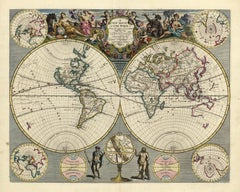
A NEW MAP OF THE WORLD from the Latest Observations.
By John Senex
Located in New York, NY
.”
A fine British produced double hemisphere world map. On this map, California is shown as an island
Category
18th Century Other Art Style More Prints
Materials
Watercolor, Engraving
H 20.75 in W 23.75 in D 0.94 in
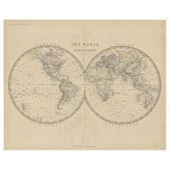
Antique World Map by Johnston, 1882
Located in Langweer, NL
Antique map titled 'The World in Hemispheres'. Old double-hemisphere world map. This map originates
Category
Antique 19th Century Maps
Materials
Paper
Antique Map of the World by Stoopendaal, c.1714
Located in Langweer, NL
double hemisphere world map. Illustrated with numerous exotic animals and four female allegorical
Category
Antique 18th Century Maps
Materials
Paper
Antique Bible World Map by R. & J. Wetstein, 1743
Located in Langweer, NL
Antique world map titled 'De Werelt Caart'.
A scarce and richly detailed double hemisphere world
Category
Antique Mid-18th Century Maps
Materials
Paper
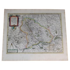
1633 Map Entitled "Beauvaisis Comitatus Belova Cium, Ric.0002
Located in Norton, MA
and French * 1617-18 World Map: double hemisphere The first map to show Tierra del Fuego as an island
Category
Antique 17th Century Dutch Maps
Materials
Paper
Small Antique World Map in Decorative Old Hand-Colouring, circa 1840
Located in Langweer, NL
Antique map titled 'Wereld Kaart'. Small and very decorative double hemisphere world map. Source
Category
Antique 19th Century Maps
Materials
Paper
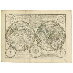
Antique Map of the World with Polar Projections by Keizer & de Lat, 1788
Located in Langweer, NL
Antique map titled 'Schuine Ronde Aard-Klooten (..)'. Interesting double hemisphere world map with
Category
Antique Late 18th Century Maps
Materials
Paper
H 8.08 in W 11.03 in D 0.02 in
Double Hemisphere Old World Map Print, Matted & Framed
Located in Plainview, NY
A double hemisphere old world map print. The map is a reproduction of the original of the 1788 Mapa
Category
20th Century Landscape Prints
Materials
Paper
Late 20th Century Gold Foil World Map Double Hemisphere
Located in Chula Vista, CA
Late 20th Century Gold Foil Ancient World Map Double Hemisphere
Gold Foil Old World Framed Map
Category
Late 20th Century English Mid-Century Modern Prints
Materials
Gold
Planiglobii Terrestris Mappa Universalis / Mappe Monde
By Homann Heirs
Located in New York, NY
inches (46.3 x 55.2 cm) plus margins.
An attractive double hemisphere map of the world by the famous
Category
18th Century Other Art Style More Prints
Materials
Engraving
H 20.13 in W 23.88 in D 0.94 in
Triple Extending Fire Screen of Northern Hemisphere Map
Located in Chillerton, Isle of Wight
A triple extending fire screen of Northern Hemisphere Map
A wonderful piece the screen has 3
Category
Antique 19th Century Adam Style Screens and Room Dividers
Materials
Silk
WORLD MAP - Planisphaerium Terrestre Sive Terrarum Orbis... 1696
By Carel Allard
Located in Santa Monica, CA
(Shirley 578)
Engraving, 20 ½ x 23 ½”, sheet 21 x 24 1/8". A stunning double hemisphere World Map
Category
17th Century Old Masters Landscape Prints
Materials
Engraving
19th Century Embroidered Silk Panel Map Of The World
Located in Forney, TX
-crafted in Continental Europe in the 19th century, depicting map of the world, double hemisphere, having a
Category
Antique 19th Century European Victorian Decorative Art
Materials
Silk, Thread
4 Vintage Culver, Terrarum Orbis Geographica Double Rocks Glasses
By Culver Ltd.
Located in Nantucket, MA
background, the open fields decorated with old world maps of the eastern and western hemispheres. The sides
Category
Vintage 1970s American Mid-Century Modern Barware
Materials
Glass
"The World" Published by Cummings & Hilliard, No. 1, Cornhill, Boston
Located in Soquel, CA
double hemisphere Atlas Map, titled "The World." Hand colored original outlines. Published by Cummings
Category
1820s American Realist Landscape Prints
Materials
Paper, Printer's Ink, Etching
H 20 in W 24 in D 0.5 in
Magellan 1521 NH Watch, Stainless steel, Automatic With Box & Papers
Located in Antwerp, BE
Luxury Magellan 1521 Wristwatch 3D Northern Hemisphere, Stainless steel, Automatic
The Magellan
Category
21st Century and Contemporary Swiss Modern Wrist Watches
Materials
Stainless Steel, Steel
Free Shipping
H 0.79 in Dm 1.74 in
People Also Browsed
21st Century Contemporary Minimal White Velvet Bench With Black Lacquered Base
Located in Porto, PT
Fifih Bench is a luxury bench upholstered in velvet and wood base. A contemporary design bench is perfect for minimalist and modern interior architecture projects.
Materials: Uphols...
Category
21st Century and Contemporary Portuguese Modern Benches
Materials
Fabric, Velvet, Lacquer, Wood
H 18.51 in W 63 in D 19.69 in
Three Arm Chandelier Yellow Metal, Opaline Glass Cones and Brass, 1950's
By Arlus, Arredoluce, Stilnovo
Located in London, GB
Extraordinary rare three arm 1950's French chandelier featuring a double conical shade made in two parts, the bottom part in opal glass and the cone shape reflector spun in lemon yel...
Category
Vintage 1950s French Mid-Century Modern Chandeliers and Pendants
Materials
Metal, Brass
Antique Map of Japan, the Kurile Islands and Liu Kiu Islands, 1886
Located in Langweer, NL
The map is an exquisite piece, showcasing Japan's vibrant geography. Engraved by J. Bartholomew and published by George Philip & Son in London & Liverpool, it presents a detailed and...
Category
Antique Late 19th Century Maps
Materials
Paper
Old Map of the Pacific, Incl Australia, Polynesia, Melanesia and Malaysia, 1872
Located in Langweer, NL
Antique map Oceania titled 'Map of Oceanica exhibiting its various divisions, island groups & c'.
Map of the Pacific, including Australia, Polynesia, Melanesia and Malaysia. Covers...
Category
Antique 1870s Maps
Materials
Paper
H 12.21 in W 15.16 in D 0 in
The Art of Home
By Rizzoli International Publications
Located in New York, NY
The first book from designer Sara Story, who combines a global bohemian sensibility with a passion for art to curate clean but striking rooms that balance style with adventure.
With...
Category
21st Century and Contemporary Books
Materials
Paper
Antique World Map by P. Schenk '1706'
By Peter Schenk
Located in Langweer, NL
Antique map titled 'Diversa Orbis Terrae. Visu Incedente per Coluros Tropicorum, Ambos Ejus Polos, et Parciularis Sphaerae Zenith, in Planum Orthographica Projectio (..) Plat Ontwerp...
Category
Antique Early 18th Century Maps
Materials
Paper
Antique Map Depicting Burma, Siam, Annam (Vietnam) and Japan, 1882
Located in Langweer, NL
The image shows two maps side by side from the 1882 atlas by Blackie & Son. On the left, the map is titled "BURMAH SIAM AND ANAM," while the one on the right is labeled "JAPAN."
**B...
Category
Antique 1880s Maps
Materials
Paper
Free Shipping
H 14.97 in W 22.45 in D 0 in
Map of the Hawaiian Islands with a Large Inset of Karakakooa Bay, 1803
Located in Langweer, NL
Antique map titled 'Kaart van de Sandwich Eilanden'.
Map of the Hawaiian Islands with a large inset of Karakakooa Bay, including soundings and anchorages. Originates from 'Reizen R...
Category
Antique Early 1800s Maps
Materials
Paper
Free Shipping
H 11.82 in W 19.1 in D 0 in
Antique Chart of the Passage of Comets in the Southern Sky, circa 1740
Located in Langweer, NL
Antique map titled 'Motus Comtarum in Hemispaerio Australi (..)'. This uncommon chart depicts the passage of comets in the southern sky between the years 1530-1704. Centered on the e...
Category
Antique Mid-18th Century Maps
Materials
Paper
H 20.87 in W 24.69 in D 0.02 in
Antique Student Writing Map Japanese Lacquer Ware Writing Meiji Period
Located in Amsterdam, Noord Holland
Antique Student Writing Map Japanese Lacquer Ware Writing Meiji Period Japan
Some damage
Additional information:
Material: Lacquer
Region of Origin: Japan
Period: 19th century
Ori...
Category
Antique 19th Century Japanese Paintings
Materials
Lacquer
Free Shipping
H 11.03 in W 13.78 in D 0.04 in
Antique Lithograph of a Japanese Junk, a Type of Sailing Ship, 1856
Located in Langweer, NL
Antique print titled ‘Japanese Junk'.
Lithograph of a Japanese junk, a type of sailing ship. This print originates from 'Narrative of the expedition of an American squadron to th...
Category
Antique 1850s Maps
Materials
Paper
Old Map Showing the Tracks of Cook Between North America and Asia's Coast, 1803
Located in Langweer, NL
Description: Antique map titled 'Kaart van de Noord-West kust van Amerika en de Noord-Oost kust van Asia'.
Antique chart depicting America's northwest coast and Asia's northeast ...
Category
Antique Early 1800s Maps
Materials
Paper
H 20.87 in W 29.14 in D 0 in
17th Century Italian Baroque Lacquered Spruce Religious Furniture 1600
Located in Roma, RM
This monumental piece of furniture, of Veneto-Alto Veneto provenance, made entirely of lacquered fir wood. Full seventeenth century (ca. 1650) is presented as an imposing double-bodi...
Category
Antique 17th Century Italian Baroque Bookcases
Materials
Spruce
Free Shipping
H 88.59 in W 145.67 in D 39.38 in
Four Reproduction Vintage Panels of Air France World Map
Located in Los Angeles, CA
Reproduction of a beautiful green and blue mid-century Air France world map on four individual panels. The charming illustrations evoke an era of international jet-set style. May be ...
Category
21st Century and Contemporary French Prints
Materials
Wood, Paper
Tramp Art Photo Frame With Gilt Elements & Velvet , Austria ca. 1890
Located in Lichtenberg, AT
Extrordinary Tramp Art photo frame from the period in Austria around 1890. Elaborately hand carved out of bass this antique rustic photo frame impresses with an unusual doubled frame...
Category
Antique Late 19th Century Austrian Rustic Picture Frames
Materials
Velvet, Softwood, Blown Glass
LaChapelle Land Photographs by David LaChapelle (Book)
Located in North Yorkshire, GB
The marriage of LaChapelle's vivid, high-octane images with graphic artist Tadanori Yokoo's supersaturated designs make for an astonishing physical object. 'There's a tradition of ce...
Category
20th Century Books
Materials
Paper
Recent Sales
Extremely Rare Mappemonde a l'usage World Map Delisle, Guillaume Buache, 1730
Located in Drottningholm, SE
Géographe de S.M. Amsterdam (Covens - Mortier), circa 1730.
Engraved large double-hemisphere map with
Category
Antique 1730s Dutch Maps
Materials
Paper
H 22.45 in W 31.5 in D 0.79 in
Mercator's Double Hemisphere World Map
By Gerard Mercator
Located in New York, NY
Gerard (1512 - 1594) and Rumold (1545 - 1599) Mercator
Orbis Terrae Compendiosa Descriptio. . .
Engraving with original hand-color
from Strabonis Rerum Geographicarum
15 1/2 x 2...
Category
Antique 18th Century and Earlier Prints
Large Scale Double-Hemisphere World Map; Wall Map
By Herman Moll
Located in New York, NY
Herman Moll
A New and Correct Map of the World...
Published, London c. 1709
Engraving with
Category
Antique 18th Century and Earlier British Prints
c. 1750 Double-Hemisphere World Map showing California as an Island
Located in New York, NY
c. 1750 beautifully hand-colored engraved double hemisphere world map, showing California as an
Category
1750s Realist Landscape Prints
Materials
Engraving
Rare 1790s Russian Map of the World
Located in La Jolla, CA
Rare set of Eastern Hemisphere and Western Hemisphere maps, with place names in Cyrillic, likely
Category
Antique 1790s Russian Prints
Materials
Paper
Highly Decorative Italian Wall Map of the World
By Paolo Petrini
Located in La Jolla, CA
.
This large-scale double-hemisphere world map represents the high point of geographic printing in Naples
Category
Antique Early 1700s Italian Baroque Prints
Materials
Paper
Antique world map - Mappe Monde by Lowitz - Handcoloured engraving - 18th c.
Located in Zeeland, Noord-Brabant
, titled: 'Planiglobii Terrestris. Mappe-Monde.' - Double hemisphere world map. Several small insep maps
Category
1740s Old Masters More Prints
Materials
Engraving
Mappe Monde.
By Valentine Francoise Dumont
Located in Zeeland, Noord-Brabant
Pen and ink drawing, handcoloured, on vellin paper.
Manuscript double hemisphere world map, with
Category
1860s Landscape Drawings and Watercolors
Materials
Ink, Pen
Planiglobii Terrestris.
By Johann Baptist Homann
Located in Zeeland, Noord-Brabant
Original handcoloured etching/engraving on laid paper.
Double hemisphere world map. Several small
Category
1740s More Prints
Materials
Engraving, Etching
TAI Original Airline Travel Map 1950’s, Bayle
Located in Bath, Somerset
Transport Aeriens Intercontinentaux decorative double hemisphere map by Luc Marie Bayle. The
Category
20th Century French Posters
Materials
Linen, Paper
1857 Wall Map of the United States by Fanning, Bridgman & Ensign
By Thayer, Bridgman and Fanning
Located in Colorado Springs, CO
double hemispheric projection and the Lesser Antilles.
The focus of the map is the westward Expansion
Category
Antique 1850s American Maps
Materials
Paper
1847 “World at One View” Antique Hand-Colored Wall Map of the World
Located in Colorado Springs, CO
and Thayer, New York.
This pictorial map was printed as a broadside and features a beautiful double
Category
Antique 19th Century American Maps
Materials
Paper
The Dardanelles Strait: A Strategic Passage in a Colored Lithograph, 1853
Located in Langweer, NL
contains 16 lithographic maps and views, some double page. They depict the solar system, the Figure of the
Category
Antique 1850s Prints
Materials
Paper
Free Shipping
H 18.39 in W 6.7 in D 0 in
Antique World Map by A.K. Johnston, 1854
By Alexander Keith Johnston
Located in Langweer, NL
Decorative double hemisphere map of the world, showing the comparative heights of mountains of the
Category
Antique Mid-19th Century Maps
Materials
Paper
Antique World Map by Stoopendaal, circa 1680
Located in Langweer, NL
Antique map of the world titled 'Werelt Caert'. Double-hemisphere map of the world, with California
Category
Antique Late 17th Century Maps
"Orbis Terrarum Typus" Cluver 17th C Hand-colored World Map, CA as an Island
By Philipp Clüver
Located in Alamo, CA
A hand-colored double hemisphere map of the world entitled "Orbis Terrarum Typus", which appears to
Category
Antique 17th Century German Maps
Materials
Paper
H 7.5 in W 11 in D 0.07 in
Double Hemisphere World Map on Polar Projections & California Island, 1788
Located in Langweer, NL
(..)'.
Interesting double hemisphere world map on polar projections. In North America, there is a large Island of
Category
Antique 1780s Maps
Materials
Paper
H 8.08 in W 10.83 in D 0 in
Antique Double Hemisphere Celestial Chart by Lotter, 'circa 1770'
Located in Langweer, NL
Antique map titled 'Planisphaerium Coeleste'. A very decorative double hemisphere celestial chart
Category
Antique Late 18th Century Maps
Materials
Paper
French Map of the World Dated 1798 by J.A. Dezauche
Located in San Francisco, CA
An impressive large double hemisphere hand-colored copper engraved world map with the title in
Category
Antique Mid-18th Century French Louis XVI Maps
Original Hand-Colored Antique Map Illustrating Routes of Naval Explorers, C.1740
Located in Langweer, NL
Sciences. Nova Orbis Tabula ad Usum Serenissimi Burgundiae Ducis.'
Double hemisphere world map
Category
Antique 1740s Maps
Materials
Paper
Free Shipping
H 21.15 in W 26.3 in D 0 in
Planiglobii Terrestris Mappa Universalis
By Homann Heirs
Located in Florham Park, NJ
geographies of prominent world religions. It is one of the finest double hemisphere maps produced by the
Category
18th Century and Earlier Academic Prints and Multiples
Materials
Engraving
EARLY MAP OF THE MOON - Foundation map
By Johann Baptist Homann
Located in Santa Monica, CA
edition. Beautiful and historically important double hemisphere image of the moon. It
is based
Category
Early 1700s Old Masters Landscape Prints
Materials
Engraving
Atlas geographique contenant la Mappemonde, avec les differents etats d'Europe
By Giovanni Antonio Rizzi-Zannoni
Located in New York, NY
two hemispheric maps, one of Asia and Europe and the other of the Americas followed by maps of the
Category
1760s Prints and Multiples
Materials
Leather, Engraving
Planiglobii Terrestris
Located in Florham Park, NJ
example, when the Atlas novus was reissued in 1720, it included a hemispheric map depicting the Americas
Category
Antique 18th Century and Earlier Prints
Untitled
By Rafał Olbiński
Located in Manhattan, NY
landscape of scientific reality, but rather maps the interiors of the mind. Like Dali and Magritte before
Category
1960s Surrealist Figurative Paintings
Materials
Watercolor
1700 World Map
Located in New York, NY
Original 1700 hand-colored engraving of a double hemisphere map of the world. Designed by Denis
Category
Early 1700s Realist Landscape Prints
Materials
Engraving
1706 de La Feuille Map of the World
Located in New York, NY
Original hand-colored 1706 double hemisphere map. Features the island of California, a large
Category
Early 1700s Realist Landscape Prints
Materials
Engraving
1729 French World Map showing California as an Island
By Jacques Chiquet
Located in New York, NY
Beautifully hand-colored 1729 engraving of a double-hemisphere French world map, titled "Le Globe
Category
1720s Realist Landscape Prints
Materials
Engraving
Get Updated with New Arrivals
Save "Double Hemisphere Map", and we’ll notify you when there are new listings in this category.
Double Hemisphere Map For Sale on 1stDibs
At 1stDibs, there are many versions of the ideal double hemisphere map for your home. Each double hemisphere map for sale was constructed with extraordinary care, often using paper, fabric and glass. If you’re shopping for a double hemisphere map, we have 18 options in-stock, while there are 1 modern editions to choose from as well. Whether you’re looking for an older or newer double hemisphere map, there are earlier versions available from the 18th Century and newer variations made as recently as the 21st Century. When you’re browsing for the right double hemisphere map, those designed in mid-century modern, Georgian and Victorian styles are of considerable interest. Many designers have produced at least one well-made double hemisphere map over the years, but those crafted by Culver Ltd. and Pierre François Tardieu are often thought to be among the most beautiful.
How Much is a Double Hemisphere Map?
Prices for a double hemisphere map can differ depending upon size, time period and other attributes — at 1stDibs, they begin at $244 and can go as high as $8,099, while the average can fetch as much as $1,194.
More Ways To Browse
Alberta Poster
Roy Lichtenstein Horses
P Schulz
Tierra Del Fuego
Andy Warhol Goethe
Carmen Opera
Peter Max Spring
Swan Lake Landscape Oil Painting
Picasso Flute
Playboy Retro Poster
Small Painting Peter Max Gold Frame
Vintage Fair Rides
1990s Festival Posters
Art Glass Swan Bird
Circus Big Top
Dali Lip Sofa
Forth Bridge
Helen Winder
