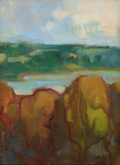
Seneca Lake
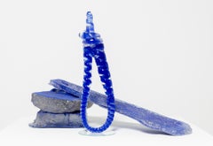
"Drowned from the Unknown", Blown Glass, Sand-Casted Glass, Historical objects
Located in Philadelphia, PA
- Oscarville, Delta Park, Black Wall Street, and Seneca Village, to name a few. Many lives were lost, homes and
Category
21st Century and Contemporary Contemporary Abstract Sculptures
Materials
Glass
HOMANN, Johann Baptist (1663-1724) Nova Anglia. Septentrionali Americæ implantat
Located in Bristol, CT
Lake Seneca is creatively shown to be a massive sea that drains into the Hudson Valley. To the north
Category
1740s Prints and Multiples
Materials
Paper
People Also Browsed
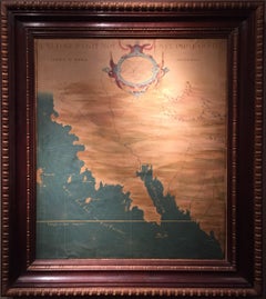
The 1564 Medici Danti Map of California
By Fra Egnazio Danti
Located in New York, NY
Florentine, Probably Seventeenth Century
Titled
L’ultime parti note nel Indie occidentali
Dated on the edge of the cartouche: “M.D. LXIII. M.AG” [1564…the month of August]
In the ...
Category
17th Century Old Masters Drawings and Watercolor Paintings
Materials
Canvas, Pen, Gouache, Watercolor, Ink, Paper
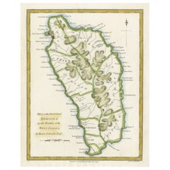
Original Antique Map of the Island of Dominica in the West Indies, 1794
Located in Langweer, NL
MAP OF THE ISLAND OF DOMINICA for the History of the West Indies, by Bryan Edwards. Esq.
Dominica, an island renowned for its lucrative exports of sugar, cocoa, and coffee, operated...
Category
Antique 1790s Maps
Materials
Paper
Original Antique Map of the West Indies by J. Arrowsmith, 1842
Located in Langweer, NL
Title: "J. Arrowsmith's 19th Century Map of the West Indies"
This original antique map, crafted by J. Arrowsmith, details the West Indies with a focus on the Caribbean Sea and its s...
Category
Antique Early 19th Century Maps
Materials
Paper
Free Shipping
H 20.87 in W 27.17 in D 0 in
Authentique Map by Pilon of The French Colonies in The West Indies, 1876
Located in Langweer, NL
The 1876 map titled "Carte des Colonies Françaises aux Antilles" represents a significant contribution to cartography within the "Grand Atlas Départemental de la France de L'Algérie ...
Category
Antique Late 19th Century Maps
Materials
Paper
H 14.38 in W 16.54 in D 0 in
Hand-coloured set of Buffon’s Histoire naturelle in its most luxurious form
By Georges-Louis Leclerc, Comte de Buffon
Located in ZWIJNDRECHT, NL
Publisher: Buffon, Georges-Louis Leclerc de
Place / Date: Dordrecht, Abraham Blussé, 1766-1799
Size: 38 parts in 21 volumes.
Large 4to. With more than 1100 hand-coloured engraved ...
Category
Antique Late 18th Century Dutch Dutch Colonial Books
Materials
Paint, Paper
Free Shipping
H 9.85 in W 1.19 in D 7.09 in
Plan of Paris, France, by A. Vuillemin, Antique Map, 1845
Located in Colorado Springs, CO
This large and detailed plan of Paris was published by Alexandre Vuillemin in 1845. The map conveys a wonderful amount of information and is decorated throughout with pictorial vigne...
Category
Antique 1840s American Maps
Materials
Paper
Seminal guide to the East and West Indies, with 42 coloured maps and plates
By Jan Huygen van Linschoten
Located in ZWIJNDRECHT, NL
Seminal guide to the East and West Indies, with 42 double-page and folding plates, including 6 maps, all engravings beautifully coloured by a contemporary hand
LINSCHOTEN, Jan Huygh...
Category
Antique Early 17th Century Dutch Dutch Colonial Books
Materials
Paper
Free Shipping
H 12.6 in W 8.27 in D 1.58 in
Original Steel Engraved Map of French Colonies in America, 1854
Located in Langweer, NL
Antique map titled 'Colonies Francaises (en Amerique)'. Detailed map bordered by vignettes showing local animals, produce and activities of the various French Colonies in America. Th...
Category
Antique Mid-19th Century Maps
Materials
Paper
Free Shipping
H 13.12 in W 18.71 in D 0.02 in
Copper Engraved Grenada Map by John Thompson Published in 1810
Located in Langweer, NL
John Thomson's original antique map of Grenada, dating back to 1810 and hailing from Edinburgh, stands as a testament to meticulous cartography. This historical piece, adorned with o...
Category
Antique Early 19th Century Maps
Materials
Paper
Antique Map of Mexico, Central America and West Indies by A & C. Black, 1870
Located in Langweer, NL
Antique map titled 'Mexico, Central America and West Indies'. Original antique map of Mexico, Central America and West Indies with inset map of Panama railway. This map originates fr...
Category
Antique Late 19th Century Maps
Materials
Paper
H 13 in W 17.52 in D 0.02 in
Ornate Cartography of Colonial Grandeur: The West India Islands around 1851
Located in Langweer, NL
This map is a part of John Tallis's series of maps, known for their detailed and ornamental style. John Tallis & Company, mentioned in the caption, was an English cartographic publis...
Category
Antique 1850s Maps
Materials
Paper
No Reserve
H 10.71 in W 14.26 in D 0 in
Antique Map of the Spice Islands 'Moluccas', Indonesia by W. Blaeu, circa 1640
By Willem Blaeu
Located in Langweer, NL
Antique map titled 'Moluccae Insulae Celeberrimae'. Highly decorative antique map of the Spice Islands (Moluccas) published by W. Blaeu (circa 1640). This map features a large inset ...
Category
Antique Mid-17th Century Maps
Materials
Paper
H 19.69 in W 23.04 in D 0.02 in
Large Antique Map of Guadeloupe and Antigua with Adjacent Isles, 19th Century
Located in Langweer, NL
Title: "Antique Map of Guadeloupe and Antigua with Adjacent Isles, 19th Century"
Source: New General Atlas (circa 1817), published in Edinburgh
Description: This detailed antique m...
Category
Antique Early 19th Century Maps
Materials
Paper
Free Shipping
H 21.07 in W 29.34 in D 0 in
"Clason's Guide Map of Montana" by The Clason Map Company, Circa 1920s
Located in Colorado Springs, CO
Presented is “Clason's Guide Map of Montana,” published in the early 1920s by the Clason Map Company. Issued as a folding map, this map identifies county boundaries, county seats, Na...
Category
Vintage 1920s American Art Deco Maps
Materials
Paper
H 23.13 in W 33.88 in D 1.5 in
Roseaux, St. Lucia Island Map by BELLIN, Handcolored Engraving, 1763
Located in Langweer, NL
Dating back to around 1763, this antique hand-colored print, a creation by Jacques Nicolas Bellin, unveils a meticulously detailed "Plan du Cul de Sac des Roseaux dans l'Isle de Ste....
Category
Antique 1760s Maps
Materials
Paper
1840 Map of the City of Washington Published by William M. Morrison
Located in Colorado Springs, CO
This map, printed in 1840, is a detailed representation of Washington, D.C. in the mid-19th century. The map shows block numbers, wards, and government buildings as well as details o...
Category
Antique 1840s American Federal Maps
Materials
Paper
Recent Sales
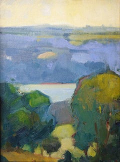
View of Seneca Lake
By Robert Glisson
Located in Corning, NY
'View of Seneca Lake' depicts a lake nestled between the hills and fields of upstate New York
Category
2010s Contemporary Landscape Paintings
Materials
Canvas, Oil
Seneca Lake Beyond the Trees
By Robert Glisson
Located in Corning, NY
Seneca Lake Beyond the Trees, by Robert Glisson captures the beauty of the Finger Lakes. The
Category
2010s Contemporary Landscape Paintings
Materials
Canvas, Oil
American Folk Painting of a Regatta on Lake Seneca, New York
Located in Litchfield, CT
Painted by Rev. Henry W. Parker from Aurora, New York, 1848. The larger schooner is the "Peterford Nymph". Mounted on a wood panel with an old letter with the local history attached...
Category
Antique 19th Century American Folk Art Paintings
Materials
Canvas
"Study of Landscape With Cliff and Trees" Graphite/Paper American PreRaphaelite
By John Henry Hill
Located in Dallas, TX
revival in America.2
In 1875 a guidebook by Seneca Ray Stoddard, Lake George: A Book of Today, was
Category
Late 19th Century Drawings and Watercolor Paintings
Materials
Paper, Graphite
Map of Lake George.
By Seneca Ray Stoddard
Located in New York, NY
but retains original hard bound covers.
A scarce and highly decorative map of Lake George. Insets
Category
19th Century American Realist Prints and Multiples
Materials
Lithograph
From the Rooftops (New York City Urban Fire Drawing on Paper)
By Paul Chojnowski
Located in Hudson, NY
Art Magazine, Summer 1999 (reproduction).
Rolph, Peter, “So Many Moods-Artistic Impressions of Seneca
Category
2010s Contemporary Figurative Paintings
Materials
Archival Paper
H 18 in W 25 in D 1.5 in
American Antique Landscape Painting of a Mountain Range by James Hamilton
Located in Shippensburg, PA
their brilliant emerald grasses at the base along the still waters of the lake. It is signed in his
Category
Antique 19th Century American Paintings
Materials
Canvas, Paint
H 27.63 in W 39.88 in D 1.25 in
Boat Landing, Lake Seneca
By André Gisson
Located in Sutton Poyntz, Dorset
."
This beautiful landscape scene depicts the shore of Lake Seneca in New York state, with three ladies
Category
Late 20th Century Impressionist Landscape Paintings
Materials
Canvas, Oil
Waterfall Near Albany
By James Hope
Located in Wiscasset, ME
gorge at Watkins Glen just south of Seneca Lake in New York. In 1872, he set up a studio and gallery at
Category
1870s Hudson River School Landscape Paintings
Materials
Canvas, Oil
View of Seneca Lake
By Robert Glisson
Located in Corning, NY
View of Seneca Lake by Robert Glisson captures the beauty of the Finger Lakes Region of New York
Category
21st Century and Contemporary Contemporary Landscape Paintings
Materials
Oil
Along Seneca Lake
By Robert Glisson
Located in Corning, NY
"Along Seneca Lake" depicts the picturesque topography of New York's Finger Lakes Region a
Category
21st Century and Contemporary Contemporary Landscape Paintings
Materials
Oil
Get Updated with New Arrivals
Save "Seneca Lake", and we’ll notify you when there are new listings in this category.
