Willem Blaeu
9
to
3
8
1
9
9
9
9
9
1
1
1
2
1
7
5,467
4,000
2,464
2,233
Creator: Willem Blaeu
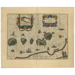
Antique Map of the Spice Islands 'Moluccas', Indonesia by W. Blaeu, circa 1640
By Willem Blaeu
Located in Langweer, NL
Antique map titled 'Moluccae Insulae Celeberrimae'. Highly decorative antique map of the Spice Islands (Moluccas) published by W. Blaeu (circa 1640). This map features a large inset ...
Category
Mid-17th Century Antique Willem Blaeu
Materials
Paper
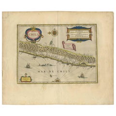
Orignal Hand-Colored Antique Map of Chili by W. Blaeu, 1658
By Willem Blaeu
Located in Langweer, NL
Very decorative antique map of Chili published by W. Blaeu, 1658. This map depicts Chile from Copiapo southward to the island of Chiloé with ships and sea monsters adorning the sea. ...
Category
Mid-17th Century Antique Willem Blaeu
Materials
Paper
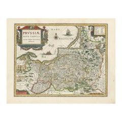
Antique Map of Prussia by Blaeu, circa 1635
By Willem Blaeu
Located in Langweer, NL
Antique map titled 'Prussiae Nova Tabula'. Rare early edition of Blaeu's map of Prussia, embellished with a gorgeous large format cartouche, compass ros...
Category
Mid-17th Century Antique Willem Blaeu
Materials
Paper
An exceptional pair of BLAEU table globes
By Willem Blaeu
Located in ZWIJNDRECHT, NL
A very rare set of globes, 9 inch / 23cm, with an overall height of 38 cm, Amsterdam, dated 1602, but published after 1621. In their original stands with circular wooden horizon rings, covered with printed paper, supported by four legs and brass meridian rings supported by a single column.
The terrestrial and celestial globe are made up of a set of 12 engraved gores, heightened in gold and Arctic ice caps, printed on paper and mounted on a plaster sphere of papier maché. Each sphere is mounted in a graduated brass meridian ring with the production number stamped at the back of the ring. Both globes are mounted on four-legged ebonized oak Dutch stands, which support the horizon ring. The legs are connected by two crossbeams which support a circular base plate with central support for the meridian ring. The horizon rings are covered with printed paper. With usual defects: paper equinoctial tables present gaps that are filled and restored; small splits along gores; several partially deleted entries; on the globe, the date 1602 and the text of the cartouche in America, are illegible ; small scattered spots but in general in good condition for such an early globe pair of which presently only 19 pair are recorded.
These 9-inch globes are among the rarest since very few copies of them are known to exist, in comparison with the smaller or larger globes of Blaeu (4, 6, 13.5, and 26 inches). Blaeu's terrestrial globes were highly valued and were much in demand, because of the care with which they had been prepared, because of the efforts to give the latest information on discoveries, and because of the loxodromic lines that made them of special value to navigators.
His celestial globes were appreciated for the fact that he had been the pupil of Tycho Brahe, who was himself known to be the greatest astronomer of his time.
Willem Janszoon Blaeu (1571–1638), originally trained in astronomy, he quickly became a leading maker of maps, atlases and instruments. Blaeu’s globes were luxury items for wealthy and intellectual merchants and nobility who benefited from Blaeu’s access through the Dutch East India Company to the latest navigational discoveries and geographical information.
Willem Jansz Blaeu collected information that Dutch mariners gathered from around world and brought back to Amsterdam. Crews were instructed to record information about the lands they visited and the skies they saw. Blaeu incorporated these observations in maps and globes. Through his web of contacts and thanks to assiduous research, he was also able to obtain the most recent information about the latest discoveries in the western hemisphere and the South Pacific, where Dutch explorers were particularly active at the time.
Since the globe was published after 1618, Blaeu was able to include the discoveries made by Henry Hudson in his attempt to find a passage to the East Indies. He also included recent Pacific discoveries of the celebrated voyages of Willem Cornelis Schouten and Jacob Le Maire, who both traversed the South Pacific and the Atlantic. The findings of Schouten and Le Maire in the Tierra del Fuego region are also incorporated.
The Strait of Le Maire is drawn and the hypothetical southern continent is labelled “Terra Australis Incognita Magalanica”. Olivier van Noort’s track is drawn and labelled. His route is indicated with a broken line and the words: “Navigationis Olivierij ductus” (several times). There are various decorative features, such as animals on the different continents, many ships on the high seas and allegorical and mythical figures around the cartouches.
The nine-inch globe is not just a smaller version of the one published in 1599. Drawings of animals and people do often correspond to those on the earlier globe, but Blaeu made several significant changes.
- The west coast of North America is drawn differently and the river system of Brazil is altered.
- The hypothetical southern continent is labelled: Terra Australis Incognita Magallanica.
- There are nine ocean names in handsome curling letters: Mare Congelatum, Mare Atlanticum, Oceanus Aethiopicus, Mare Arabicum et Indicum, Mare di India, Oceanus Chinensis, Mar del Zur, Mare Pacificum, Mar del Nort.
- Willem Blaeu...
Category
17th Century European Dutch Colonial Antique Willem Blaeu
Materials
Other
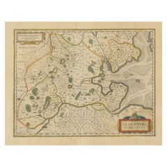
Antique Map of the Region of Oldenburg, Germany
By Willem Blaeu
Located in Langweer, NL
Antique map titled 'Oldenburg Comitatus'. Detailed old map of Oldenburg, Germany. The map also shows Bremen and the Jade Bight. Published by W. Blaeu, circa 1640. Willem Jansz. Blaeu...
Category
Mid-17th Century Antique Willem Blaeu
Materials
Paper
Original Antique Map of the Duchy of Holstein
By Willem Blaeu
Located in Langweer, NL
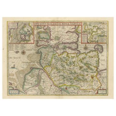
Antique map titled 'Ducatus Holsatiae Nova Tabula'. Original old map of the Duchy of Holstein, the northernmost territory of the Holy Roman Empire, from the mid-17th Century. To the ...
Category
Mid-17th Century Antique Willem Blaeu
Materials
Paper
Old Color Engraving of Blaeu's first Map of Brazil, North Oriented to the Right
By Willem Blaeu
Located in Langweer, NL
Antique map titled 'Novus Brasiliae Typus'. Fine old color example of Blaeu's first map of Brazil, with north oriented to the right. Includes inset map of Baya de todos Santos, elaborate cartouche, 2 compass roses and richly embellished vignettes of native Brazilian life and animals.
The interior of the map includes vignettes of indigenous animals and native scenes, including cannibalism. Inset within a decorative border is a small map of "Baya de todos Sanctos". In the sea are monsters, a galleon and two compass roses. The large title cartouche features a male and female Brazilian, both of whom are shown naked.
Willem Janszoon Blaeu (1571-1638) was a prominent Dutch geographer and publisher. Born the son of a herring merchant, Blaeu chose not fish but mathematics and astronomy for his focus. He studied with the famous Danish astronomer Tycho Brahe...
Category
Mid-17th Century Antique Willem Blaeu
Materials
Paper
1640 Willem Blaeu Map Entitled "Contado di molise et principato vltra, " Ric.a003
By Willem Blaeu
Located in Norton, MA
1640 Willem Blaeu map entitled
"Contado di molise et principato vltra,"
Colored
Ric. a003
Measures: 38 x 49.6 cm and wide margins
DBLAEU.
Cou...
Category
17th Century Dutch Antique Willem Blaeu
Materials
Paper
Antique Map of the Region of Le Mans 'France' by Blaeu, circa 1640
By Willem Blaeu
Located in Langweer, NL
Antique map titled 'Cenomanorum Galliae regionis typus vulgo le Mans'. This lovely map of the historical province of Maine is centered on the famous city of Le Mans. This region witn...
Category
Mid-17th Century Antique Willem Blaeu
Materials
Paper
Related Items
Original Antique Map of South East Asia, Arrowsmith, 1820
Located in St Annes, Lancashire
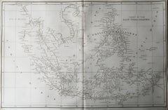
Great map of South East Asia
Drawn under the direction of Arrowsmith
Copper-plate engraving
Published by Longman, Hurst, Rees, Orme and Brown, 1820
Unframed.
Category
1820s English Antique Willem Blaeu
Materials
Paper
Pair of Italian "Old World" Style Globe Bookends on Wood Bases
Located in San Diego, CA
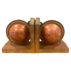
Classic pair of Italian old world style globe bookends on wood "L" shaped bases wrapped in brass, circa 1970s. The bookends are in very good vintage ...
Category
Late 20th Century Italian Willem Blaeu
Materials
Brass
Antique Map of Principality of Monaco
By Antonio Vallardi Editore
Located in Alessandria, Piemonte
ST/619 - "Old Geographical Atlas of Italy - Topographic map of ex-Principality of Monaco" -
ediz Vallardi - Milano -
A somewhat special edition ---
Category
Late 19th Century Italian Other Antique Willem Blaeu
Materials
Paper
Substantial Pair of Etched Crystal Globe Bookends by Nicole Miller
By Nicole Miller
Located in San Diego, CA
Substantial pair of etched crystal globe bookends by Nicole Miller, circa 2000s. The bookends are in very good vintage condition with no chips or cracks and measure 9.5"W x 4.75"D x ...
Category
21st Century and Contemporary American Modern Willem Blaeu
Materials
Crystal
Vintage "View of the Center of Paris Taken from the Air" Lithograph Map
Located in San Diego, CA
A very stylish "View of the Center of Paris Taken from the Air" lithograph map published by the Paris Ministry of Tourism, circa early 1950s. The piece measures 27" x 43" and shows...
Category
20th Century French Mid-Century Modern Willem Blaeu
Materials
Paper
Map "Estuary- Mouth of the Thames"
Located in Alessandria, Piemonte
ST/426 - Antique French Map of the estuary of the Thames, map dated 1769 -
"Mape of the entrance of the Thames. Designed by filing of Navy cards fo...
Category
Mid-18th Century French Other Antique Willem Blaeu
Materials
Paper
Pair Italian World Globe Bookends
Located in Douglas Manor, NY
3-455, pair Italian revolving globe bookends.
Category
1970s Vintage Willem Blaeu
Materials
Fruitwood
17th Century Hand-Colored Map of West Africa by Mercator/Hondius
Located in Alamo, CA
A 17th century hand-colored map entitled "Guineae Nova Descriptio" by Gerard Mercator and Jodocus Hondius, published in their 'Atlas Minor' in Amsterdam in 1635. It is focused on the...
Category
Mid-17th Century Dutch Antique Willem Blaeu
Materials
Paper
Fine Pair of Floor Globes by J & G Cary, Dated 1820 and 1833
By George & John Cary
Located in Lymington, Hampshire
A fine pair of 15 inch floor globes by J & G Cary, dated 1820 and 1833, each set into a mahogany stand with a vase shaped support and three legs centred on a compass, one with a labe...
Category
Early 19th Century English Regency Antique Willem Blaeu
Materials
Mahogany
Original Antique Map of India. C.1780
Located in St Annes, Lancashire
Great map of India
Copper-plate engraving
Published C.1780
Three small worm holes to right side of map and one bottom left corner
Unframed.
Category
Early 1800s English Georgian Antique Willem Blaeu
Materials
Paper
Original Antique Map of Italy. C.1780
Located in St Annes, Lancashire
Great map of Italy
Copper-plate engraving
Published C.1780
Unframed.
Category
Early 1800s English Georgian Antique Willem Blaeu
Materials
Paper
Original Antique Map of Spain and Portugal, circa 1790
Located in St Annes, Lancashire
Super map of Spain and Portugal
Copper plate engraving by A. Bell
Published, circa 1790.
Unframed.
Category
1790s English Other Antique Willem Blaeu
Materials
Paper
Willem Blaeu furniture for sale on 1stDibs.
Willem Blaeu furniture are available for sale on 1stDibs. These distinctive items are frequently made of paper and are designed with extraordinary care. There are many options to choose from in our collection of Willem Blaeu furniture, although beige editions of this piece are particularly popular. Prices for Willem Blaeu furniture can differ depending upon size, time period and other attributes — on 1stDibs, these items begin at $488 and can go as high as $555,872, while a piece like these, on average, fetch $708.
