Items Similar to 1726 Valentyn's Map of Bali and Lombok, Original Engraving

Want more images or videos?
Request additional images or videos from the seller
1 of 6
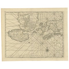
1726 Valentyn's Map of Bali and Lombok, Original Engraving
About the Item
This antique map is a detailed 18th-century chart of the island of Bali, one of the many islands of Indonesia, with an inset of the neighboring island Lombok, attributed to François Valentyn or Valentijn. He was a Dutch minister and author who worked for the Dutch East India Company, and his maps are well-regarded for their detail and accuracy.
The map includes intricate details of Bali's coastline, mountainous regions. It also features depth soundings around the coast, suggesting it was used for navigation. The presence of the compass rose indicates the orientations. The map is in good condition with visible fold lines, common in maps designed to be used or stored in atlases. The hand coloring has done recently.
François Valentyn was a prominent Dutch minister and historian known for his detailed works about the East Indies, compiled through his time with the Dutch East India Company. His notable work includes the comprehensive "Oud en Nieuw Oost-Indiën" which included descriptions and maps of the Dutch colonial territories. J. van Braam and Gerard onder de Linden were publishers based in the Dutch city of Dordrecht and Amsterdam, respectively. They were involved in printing and distributing Valentyn's works, contributing to the dissemination of geographical knowledge during the Dutch Golden Age of exploration and cartography. Their collaboration resulted in works that combined accurate cartographic detail with the rich descriptions of the regions, valuable for both navigation and general knowledge.
- Dimensions:Height: 21.66 in (55 cm)Width: 24.41 in (62 cm)Depth: 0 in (0.02 mm)
- Materials and Techniques:Paper,Engraved
- Period:
- Date of Manufacture:1726
- Condition:The map is in good condition with visible fold lines, common in maps designed to be used or stored in atlases. The hand coloring is vibrant, but of later date. A bit rough around the edges due to age and handling. Study the image carefully.
- Seller Location:Langweer, NL
- Reference Number:
About the Seller
5.0
Platinum Seller
These expertly vetted sellers are 1stDibs' most experienced sellers and are rated highest by our customers.
Established in 2009
1stDibs seller since 2017
1,974 sales on 1stDibs
Typical response time: <1 hour
- ShippingRetrieving quote...Ships From: Langweer, Netherlands
- Return PolicyA return for this item may be initiated within 14 days of delivery.
More From This SellerView All
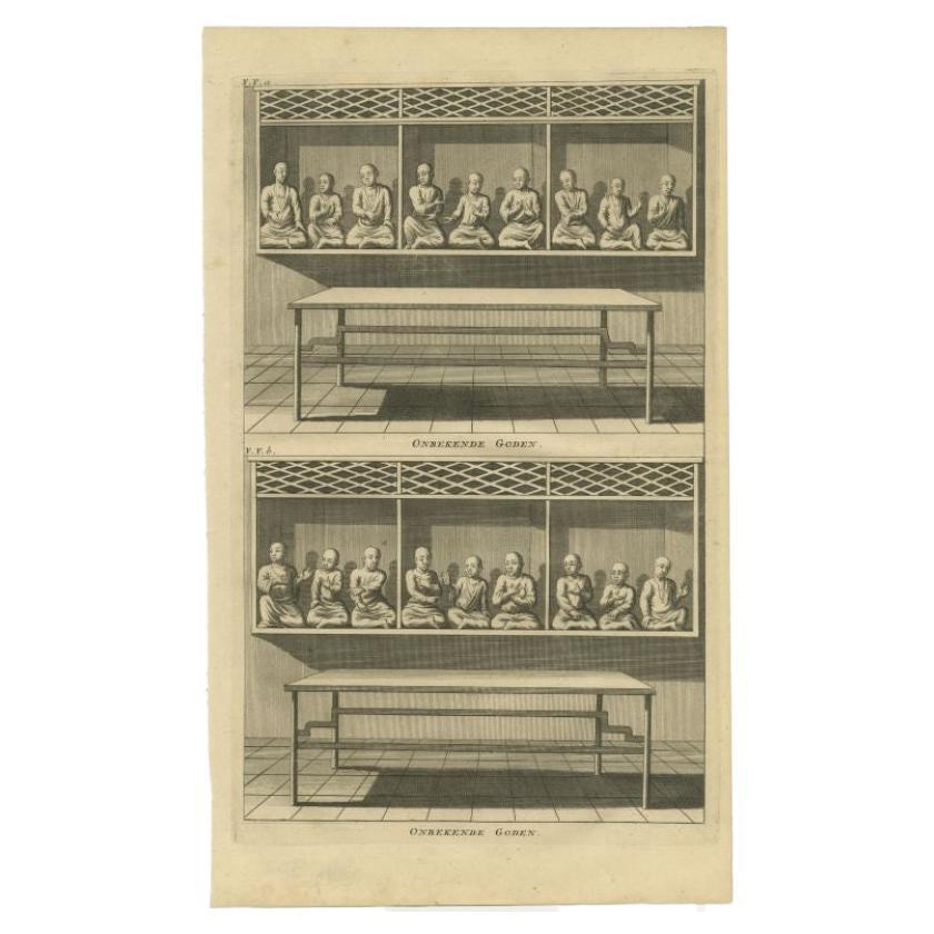
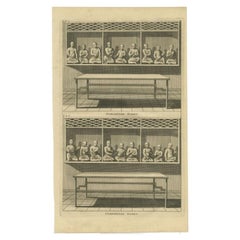
- Original Antique Engraving of Various Chinese Gods, 1726Located in Langweer, NLAntique print titled 'Onbekende Goden - Onbekende Goden'. Copper engraving of various Chinese Gods in Batavia, Indonesia. This print originates from 'Oud ...Category
Antique 18th Century Prints
MaterialsPaper
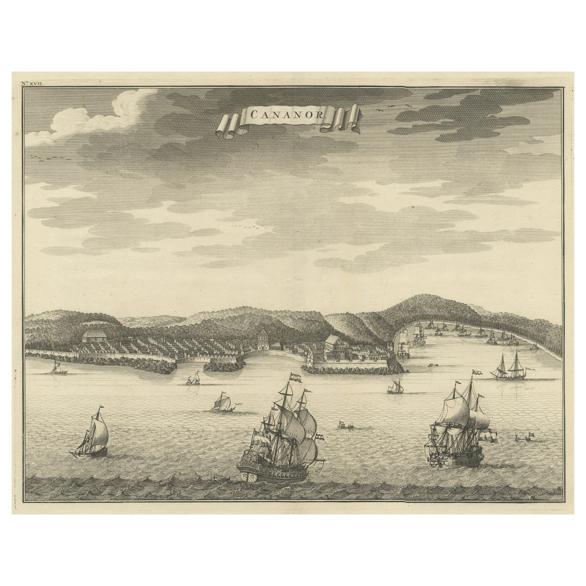
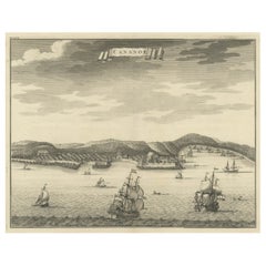
- Original Antique Engraving of Kannur 'or Cannanore', Kerala, India, 1726Located in Langweer, NLAntique print, titled: 'Cananor' - This is a print of a view of Kannur (or Cannanore), Kerala, India. From the monumental: "Oud en Nieuw Oost-Indiën ..." by François Valentyn / Valen...Category
Antique 1720s Maps
MaterialsPaper
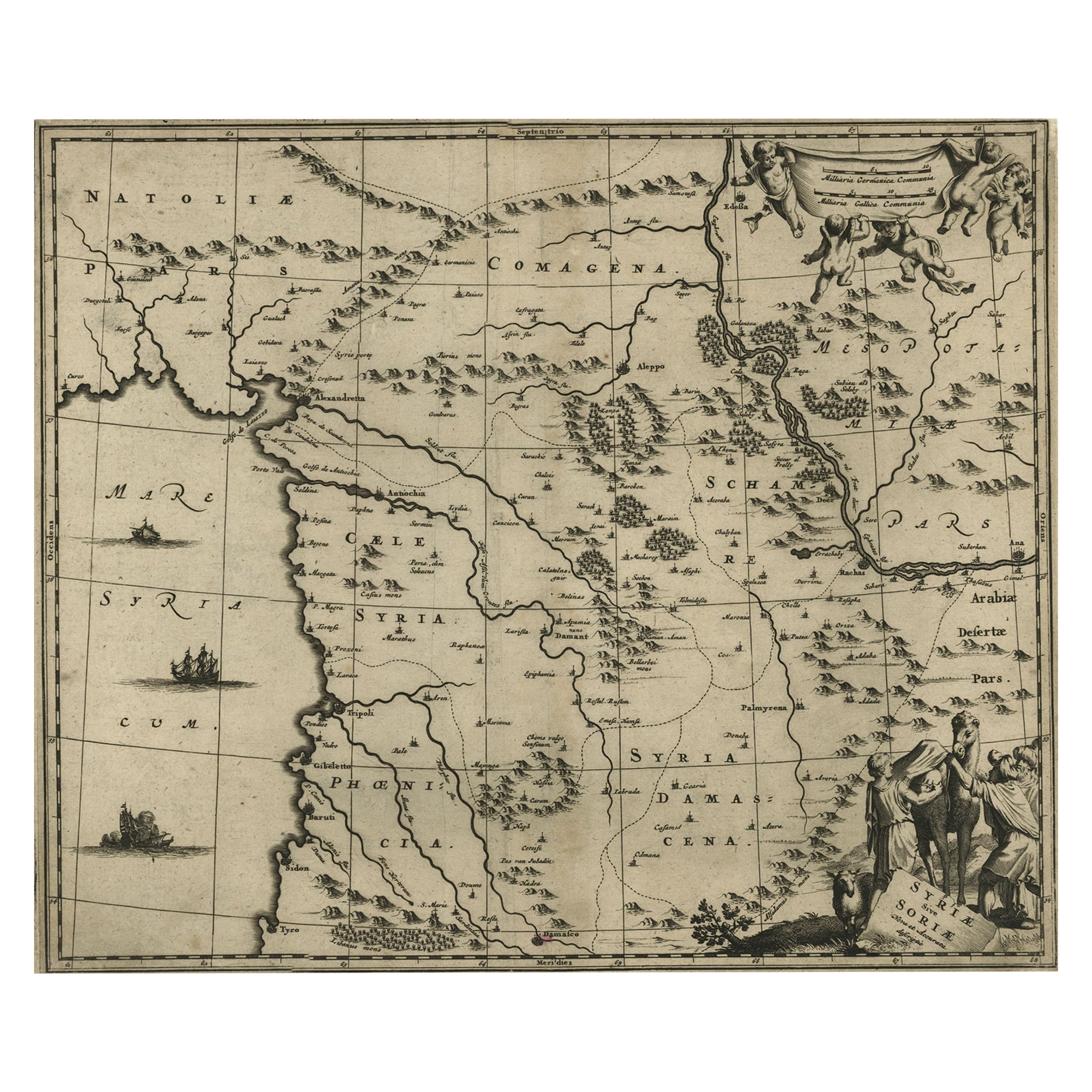
- Original Copper Engraving of a Map of Syria and Lebanon, 1698Located in Langweer, NLAntique map titled 'Syriae, sive Soriae, Nova et Accurata Descriptio.' Map of Syria and Lebanon, fully engraved with mountain ranges, forests and citi...Category
Antique 1690s Maps
MaterialsPaper
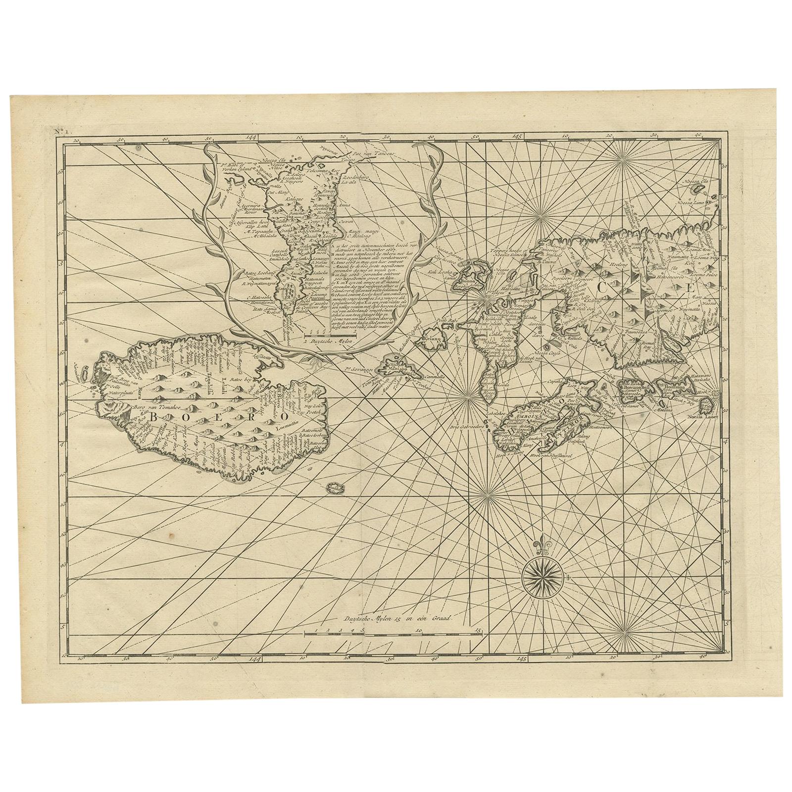
- Antique Map of Ambon and Boero by Valentijn, 1726By F. ValentijnLocated in Langweer, NLUntitled map of the western part of the island Amboina with Boero, Indonesia. This print originates from 'Oud en Nieuw Oost-Indiën' by F. Valentijn.Category
Antique Early 18th Century Dutch Maps
MaterialsPaper
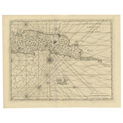
- Antique Map of Ambon and Surroundings by Valentijn '1726'By F. ValentijnLocated in Langweer, NLAntique map titled 'De landvoogdy van Amboina met de elf onderhoorige Eylanden'. Decorative map of the eastern tip of the islands of Ambon, Indonesia. This print originates from 'Oud...Category
Antique Early 18th Century Dutch Maps
MaterialsPaper
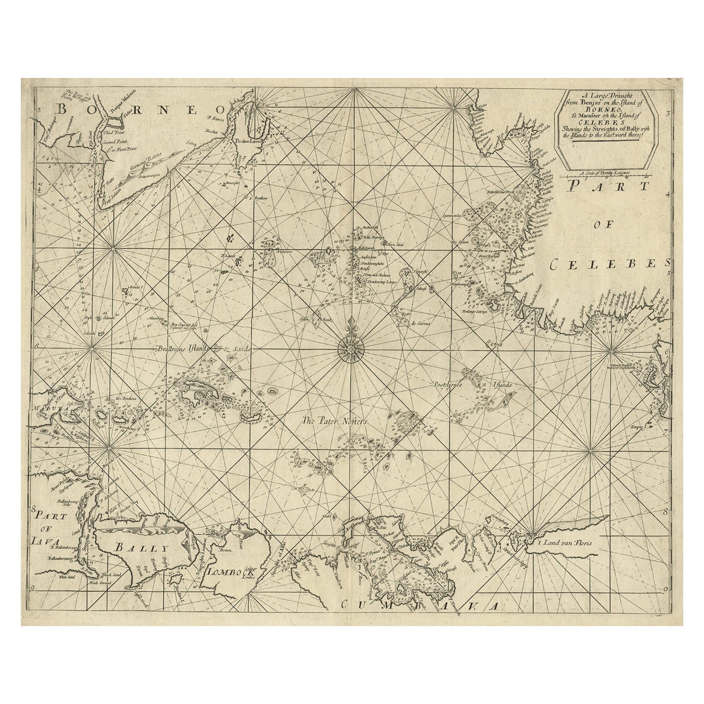
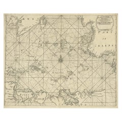
- Rare Antique English SeaChart of Bali, Lombok, Floris, Borneo, Celebes etc, 1711Located in Langweer, NLAntique map titled 'A Large Draught from Benjar on the Island of Borneo To Macasser on the Island of Celebes Shewing the Streight of Bally with the Islands to the Eastward thereof.' ...Category
Antique 1710s Maps
MaterialsPaper
You May Also Like
- Engraving Depicting 16th Century Map of Terra SanctaLocated in Buchanan, MIAbraham Ortelius (Flemish, 1527-1598) Terra Sancta. Engraving depicting 16th century map of Terra Sancta. Site 15" x 19.5.Category
Antique 18th Century and Earlier Maps
MaterialsPaper
- Matthaus Seutter, Framed 1730 Color Engraving Map of "Belgium Fonderatum"Located in Bridgeport, CTLabel on verso. From Grosser Atlas. The name Belgium comes from the ancient designation "Gallis Belgica". Figural decoration upper left. M. Seutter was a famed German mapmaker in the...Category
Antique 18th Century European Renaissance Maps
MaterialsBrass
- Antique Lithography Map, Isle of Wight, English, Framed, Engraving, CartographyLocated in Hele, Devon, GBThis is an antique lithography map of the Isle of Wight. An English, framed atlas engraving of cartographic interest, dating to the early 19th century and later. Superb lithography ...Category
Antique Early 19th Century British Regency Maps
MaterialsWood
- Original Antique Map of India. C.1780Located in St Annes, LancashireGreat map of India Copper-plate engraving Published C.1780 Three small worm holes to right side of map and one bottom left corner Unframed.Category
Antique Early 1800s English Georgian Maps
MaterialsPaper

- Original Antique Map of Asia. C.1780Located in St Annes, LancashireGreat map of Asia Copper-plate engraving Published C.1780 Two small worm holes to right side of map Unframed.Category
Antique Early 1800s English Georgian Maps
MaterialsPaper

- Original Antique Map of Italy. C.1780Located in St Annes, LancashireGreat map of Italy Copper-plate engraving Published C.1780 Unframed.Category
Antique Early 1800s English Georgian Maps
MaterialsPaper


Recently Viewed
View AllMore Ways To Browse
Antique Knowledge
Bali Furniture
Dutch East India Company
Dutch East India
Bali Antique
Indonesian Colonial
Antique General Store
Dutch Colonial Indonesian
Indonesian Dutch Colonial
Antique Bali Furniture
Francois Gerard
Nieuw Amsterdam
Gerard De Rose
Antique Navigation Compass
Van Braam
Antique Vineyard Map
Atlas Map Relief
Bohemia Map