Items Similar to Antique Map of Central Europe Showing The Railways and The Political Bounderies

Want more images or videos?
Request additional images or videos from the seller
1 of 6
Antique Map of Central Europe Showing The Railways and The Political Bounderies
About the Item
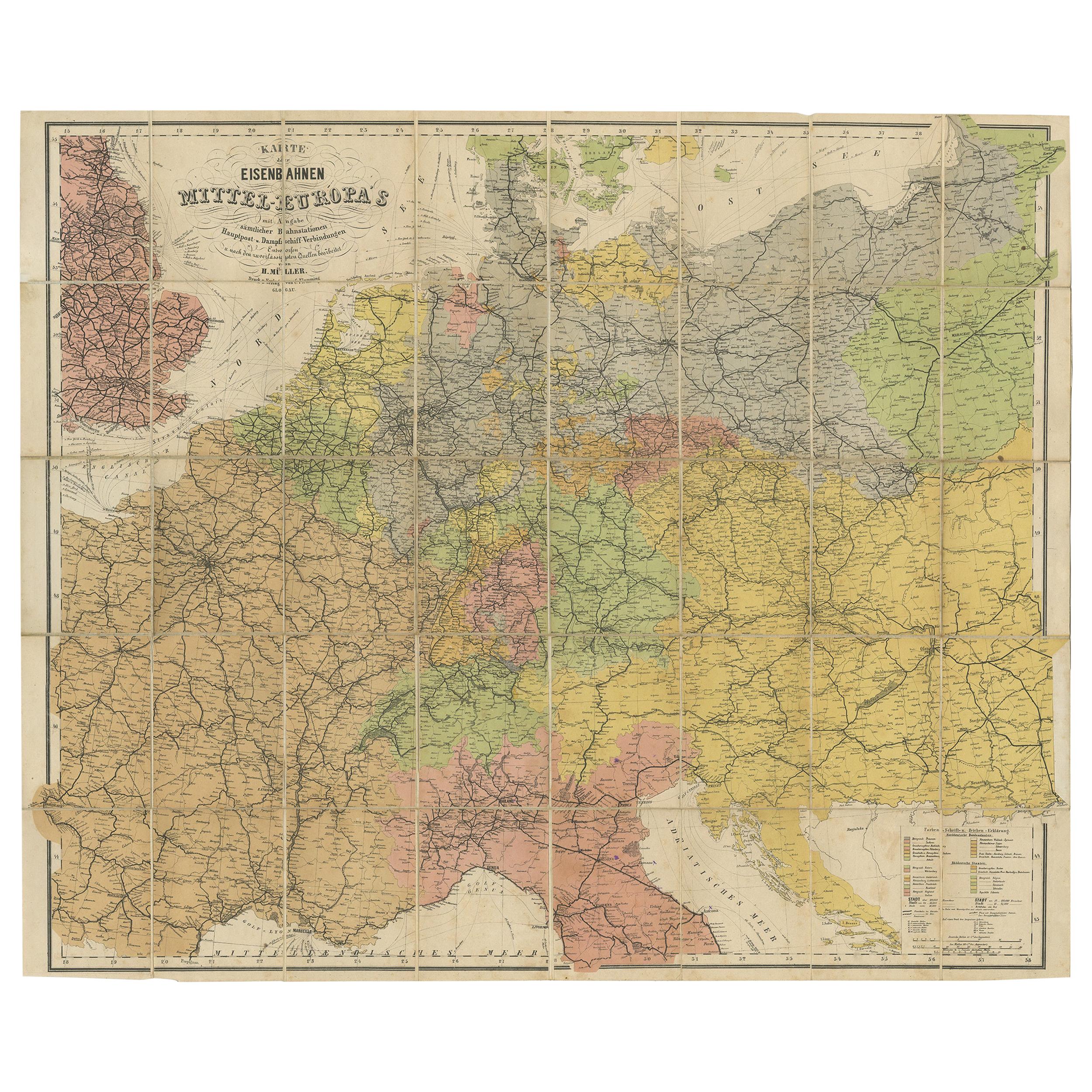
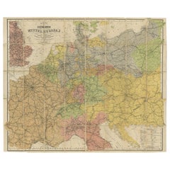
Explore the Heart of Europe with the 'Central Europe' Map, Featuring Principal Railways and Political Boundaries! This map offers a captivating view of the dynamic landscapes and political divisions of Central Europe.
Immerse yourself in the intricate details meticulously illustrated on this vintage masterpiece, showcasing the principal railways and the ever-evolving political boundaries of this pivotal region. With precision and artistry, the map unveils the intricate railway networks and the demarcations of nations, providing a comprehensive view of Central Europe's transportation and governance. The States of the German Empire are listed seperately.
Crafted for history enthusiasts, railway aficionados, and those intrigued by geopolitical shifts, this map serves as a window to a dynamic past. Its portrayal of railways, cities, and political boundaries captures the essence of Central Europe's connectivity and historical evolution.
Whether displayed proudly in a collector's space, adding historical depth to a home, or used as an educational reference for enthusiasts and scholars, this map holds enduring fascination. Take a journey through the heart of Europe and witness the intricacies of Central Europe's railways and political boundaries through the captivating lens of this exceptional antique map!
- Dimensions:Height: 14.97 in (38 cm)Width: 22.45 in (57 cm)Depth: 0 in (0.02 mm)
- Materials and Techniques:
- Period:
- Date of Manufacture:1882
- Condition:Good condition, folding line in the middle. The outer borders are slightly yellowish discolored due to age, but not the image. This map is ideal for framing. Study the image carefully.
- Seller Location:Langweer, NL
- Reference Number:
About the Seller
5.0
Platinum Seller
These expertly vetted sellers are 1stDibs' most experienced sellers and are rated highest by our customers.
Established in 2009
1stDibs seller since 2017
1,960 sales on 1stDibs
Typical response time: <1 hour
- ShippingRetrieving quote...Ships From: Langweer, Netherlands
- Return PolicyA return for this item may be initiated within 14 days of delivery.
More From This SellerView All
- Antique Railway Folding Map of Central Europe by Müller, 1870Located in Langweer, NLAntique map titled 'Karte der Eisenbahnen Mittel-Europa's (..)'. Railway folding map of Central Europe. Published by Carl Flemming, 1870.Category
Antique Late 19th Century Maps
MaterialsPaper
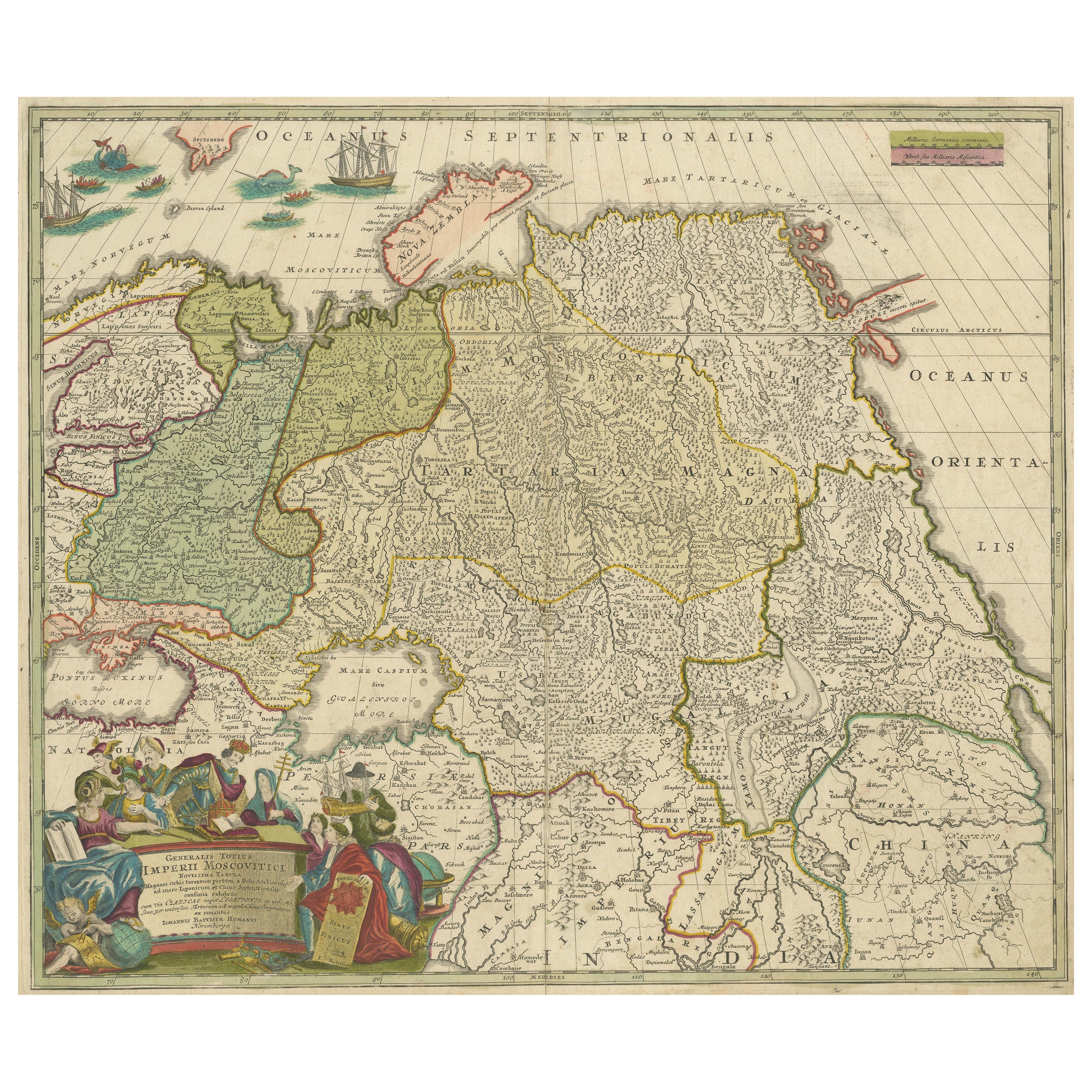
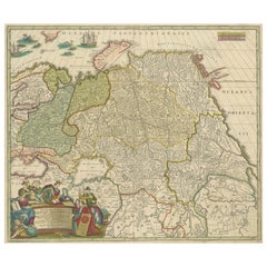
- Antique Map of Russia and Central Asia, showing the Northeast PassageLocated in Langweer, NLAntique map titled 'Generalis Totius Imperii Moscovitici (..)'. Decorative map of Russia and Central Asia, showing the Northeast Passage. The map covers the entirety of the Russian Empire at the time, stretching from the Arctic Circle in the north to the "Oceanus Orientalis" and the northern parts China (Chinae Septentrionalis confinia), Mongolia and India in the south. Published by J.B. Homann, circa 1730. Johann Baptist Homann was born 1664 in Oberkammlach. He founded his business 1702 in Nuremberg, Germany. After a long period of Dutch domination in map publishing, the Homann publishing house became the most important map...Category
Antique Mid-18th Century Maps
MaterialsPaper
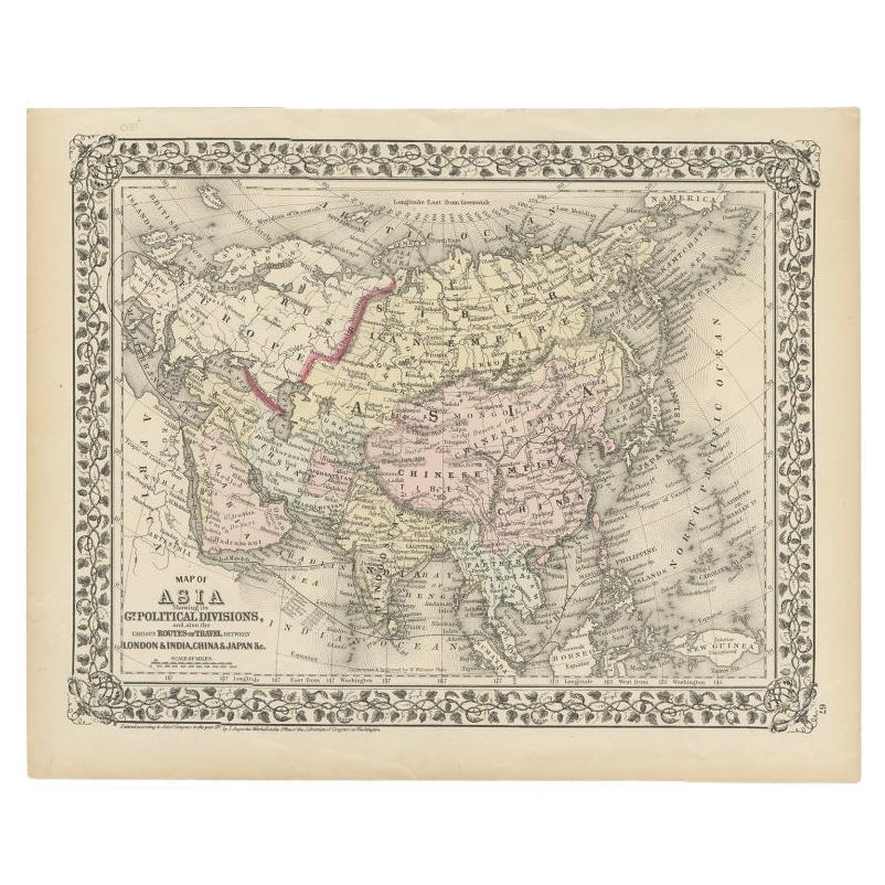
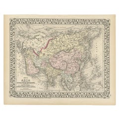
- Antique Map of Asia Showing Its Political Divisions, 1874Located in Langweer, NLAntique map titled 'Map of Asia showing its Gt. Political Divisions and also the various routes of Travel between London & India, China & Japan & c'. This map covers from the Arabian...Category
Antique 19th Century Maps
MaterialsPaper
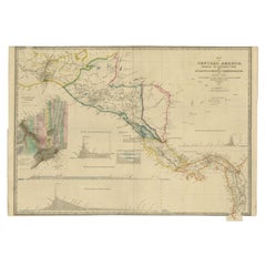
- Antique Map of Central America Showing the Communication Lines, 1850Located in Langweer, NLAntique map titled 'Map of Central America Shewing the Different Lines of Atlantic & Pacific Communication'. A most unusual U.S. Government edition of this handsome map of Central Am...Category
Antique 19th Century Maps
MaterialsPaper
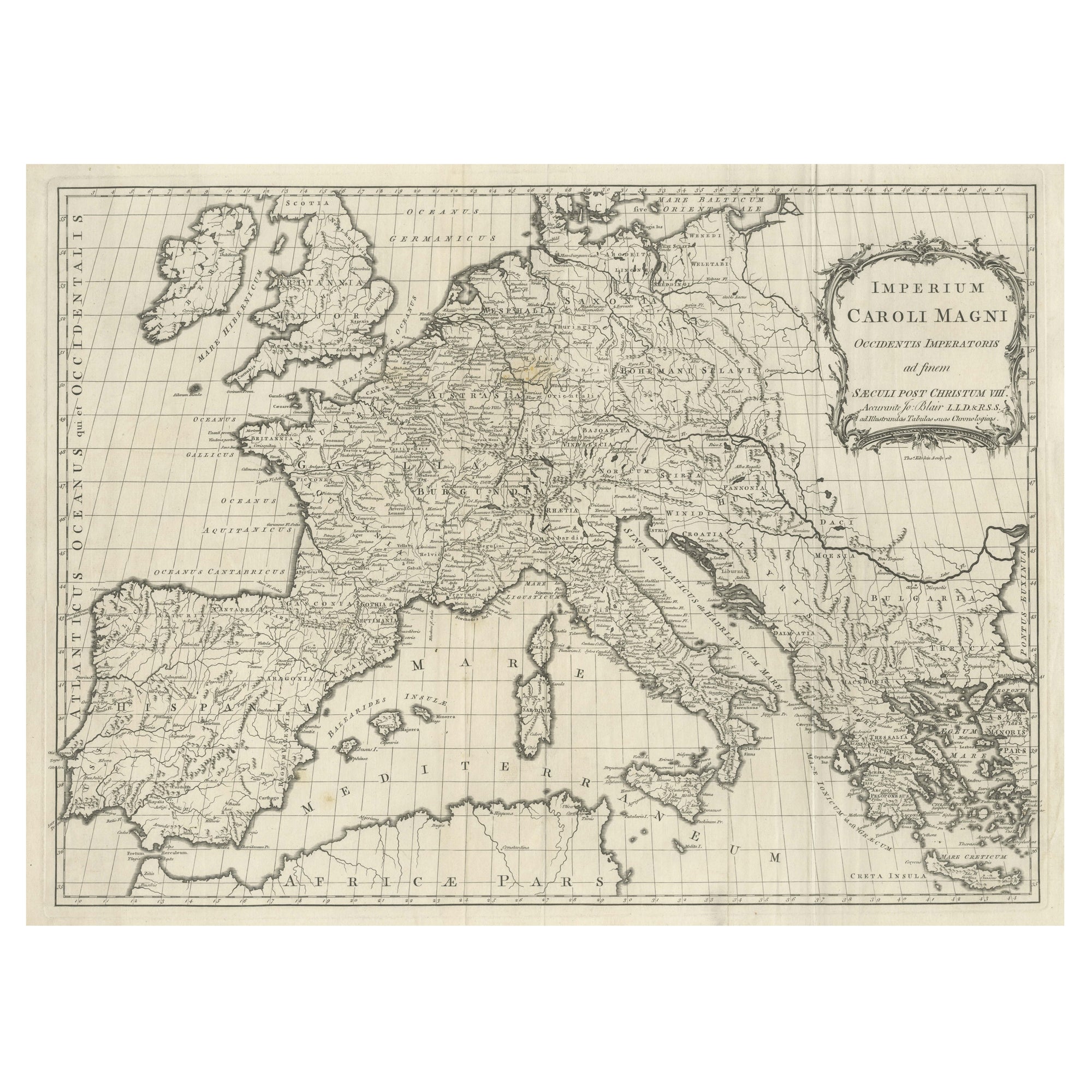
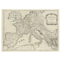
- Large Antique Map of Europe, Showing the Empire of CharlemagneLocated in Langweer, NLAntique map titled 'Imperium Caroli Magni (..)'. Large antique map of Europe, showing the Empire of Charlemagne in the 8th Century. Engraved by T. Kitchin. Published J. Blair, circa ...Category
Antique Late 18th Century Maps
MaterialsPaper
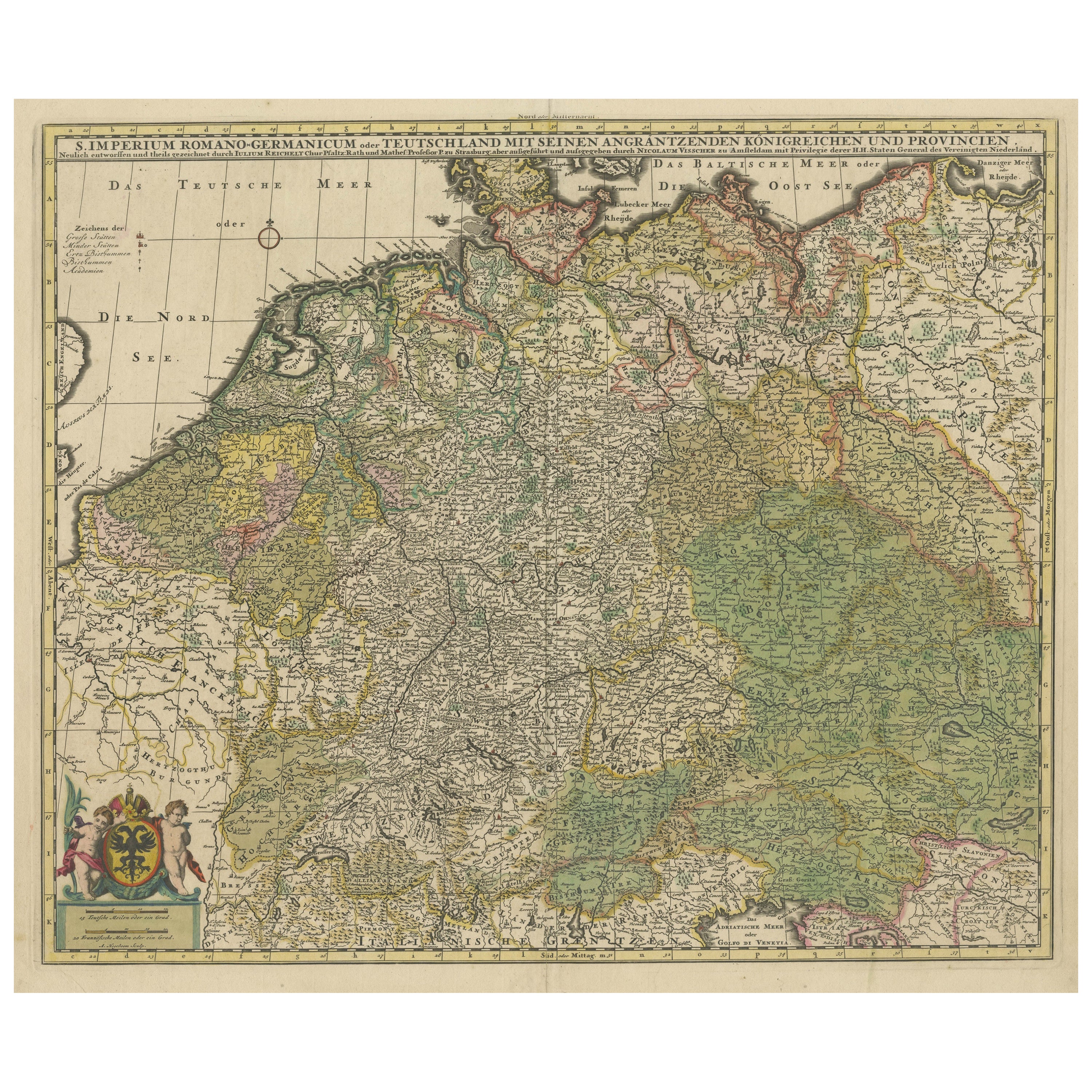
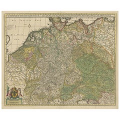
- Antique Map of Germany and Central EuropeLocated in Langweer, NLAntique map titled 'S. Imperium Romano-Germanicum oder Teutschland mit seinen angrantzenden Königreichen und Provincien'. Original antique map of Germany...Category
Antique Late 17th Century Maps
MaterialsPaper
You May Also Like
- 1899 Poole Brothers Antique Railroad Map of the Illinois Central RailroadLocated in Colorado Springs, COThis is an 1899 railroad map of the Illinois Central and Yazoo and Mississippi Valley Railroads, published by the Poole Brothers. The map focuses on the continuous United States from the Atlantic to the Pacific Oceans, the Gulf of Mexico, and the Antilles. Remarkably detailed, the rail routes of the Illinois Central RR are marked in red, which each stop labeled. Major stops are overprinted in red, bold letters, with the short rail distances to New York listed above the stop and short rail distances to New Orleans listed below the name. In addition to the Illinois Central network, numerous different rail lines are illustrated and the company running that line is noted along with many stops along each route. Sea routes from New Orleans to locations in Central America, the Caribbean, and Europe are marked and labeled with destination and distance, along with routes originating from Havana. Inset at bottom left is a map of Cuba; an inset map of Puerto Rico...Category
Antique 1890s American Maps
MaterialsPaper
- Antique Hand Colored Framed Map of EuropeLocated in West Palm Beach, FLAntique reproduction copied from an edition dated 1595 by Ortelius.Category
Antique Late 19th Century Maps
- Original Antique Map of Central America / Florida, Arrowsmith, 1820Located in St Annes, LancashireGreat map of Central America. Drawn under the direction of Arrowsmith. Copper-plate engraving. Published by Longman, Hurst, Rees, Orme and Brown, 1820 Unframed.Category
Antique 1820s English Maps
MaterialsPaper
- Antique Puzzle of Colored Cardboard Depicting World Map, Europe and FranceLocated in Milan, ITEducational puzzle of colored cardboard composed of three folders depicting world map, Europe and France. The world map in addition to the territorial map of the continents depicts t...Category
Antique 1850s French Games
MaterialsPaper
- Large University Chart “Political Map of North America” by BaconLocated in Chillerton, Isle of WightLarge University Chart “Political Map of North America” by Bacon W&A K Johnston’s Charts of Physical Maps By G W Bacon, This is colourful Physical map ...Category
Early 20th Century American Empire Posters
MaterialsLinen
- Large University Chart “Political Map of North America” by BaconLocated in Chillerton, Isle of WightLarge University chart “Political Map of North America” by Bacon W&A K Johnston’s Charts of Political Maps by G W Bacon, This is colorful Physical ...Category
Early 20th Century American Empire Posters
MaterialsLinen


Recently Viewed
View AllMore Ways To Browse
The Antique Hearts
Antique Shifter
Railway Map
Antique Vintage German Collectible
Antique Pennsylvania Map
French School Map
Kentucky Antiques
Map Of Alps
Antique Furniture Western Cape
Antique Map New Jersey
Antique Maps Essex
Antique Physics
Antique Puerto Rico
Antique Vineyard Map
Atlas Map Relief
Bohemia Map
Map Egypt Nile
Map Of Alaska