


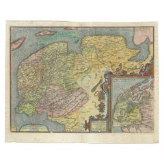
Antique Miniature Map of the Roman Province of Illyricum 'Dalmatia'
About the Item
- Creator:Abraham Ortelius (Artist)
- Dimensions:Height: 4.97 in (12.6 cm)Width: 6.62 in (16.8 cm)Depth: 0.02 in (0.5 mm)
- Materials and Techniques:
- Period:Early 17th Century
- Date of Manufacture:1612
- Condition:Age-related toning. Shows some soiling and staining. Small defect upper left. Latin text on verso. Please study image carefully.
- Seller Location:Langweer, NL
- Reference Number:
Abraham Ortelius
Abraham Ortelius is widely recognized as the inventor of the atlas and one of the most prominent geographers in history. He is one of the best known and most frequently collected of all sixteenth-century mapmakers, and today, hand-colored, copperplate-printed Abraham Ortelius maps continue to command avid interest.
Ortelius was the eldest of the three children of an Antwerp merchant. After his father's death when he was ten, he was raised by his uncle Jacob Van Meteren — a financier and printer of early English versions of the Bible. Ortelius entered the Guild of Saint Luke in 1547 to become a map copier and colorist, but his hobbies overshadowed his studies.
Ortelius was better known as a student of history and a collector of books and old coins than a cartographer — only initially garnering modest praise for his skills at mapmaking. Gleaning what he learned from his uncle, he became a dealer in books and prints. In 1554 he attended the annual Frankfurt Book Fair, where he met the highly respected cartographer Gerardus Mercator.
Ortelius refocused his work in mapmaking after that fateful encounter. He eventually published Theatrum Orbis Terrarum (Theater of the World) — a comprehensive collection of maps that he bound into a book. It was the first of its kind and is now recognized as the first modern-day atlas. While creating his atlas, Ortelius observed that the coast of America shared geometrical similarities with the shores of Europe and Africa. When he lined up maps of the coastlines of the continents, they matched — much like pieces in a jigsaw puzzle.
Some have argued that the concept of continental drift is at least partly rooted in Ortelius’s 16th-century-era suggestion that the continents had once been joined together as a single mass of land before the Americas were pulled away from Europe and Africa. Much later, in 1912, German meteorologist Alfred Wegener proposed in a lecture and an article that the continents had once been locked together based on data he collected. Wegener was widely ridiculed at the time, but the foundation of modern-day science of plate tectonics has its origins in his work.
On May 18, 2008, a Google Doodle celebrated the 300th anniversary of Ortelius’s atlas.
On 1stDibs, find original Abraham Ortelius prints, landscape prints and more.
- ShippingRetrieving quote...Ships From: Langweer, Netherlands
- Return PolicyA return for this item may be initiated within 14 days of delivery.
- Antique Map of the Province of Overijssel, the NetherlandsLocated in Langweer, NLOriginal antique map titled 'Ditio Trans-Isulana'. Original old map of the province of Overijssel, the Netherlands. With coat of arms and two decorative cartouches. Published by J. J...Category
Antique Mid-17th Century Maps
MaterialsPaper
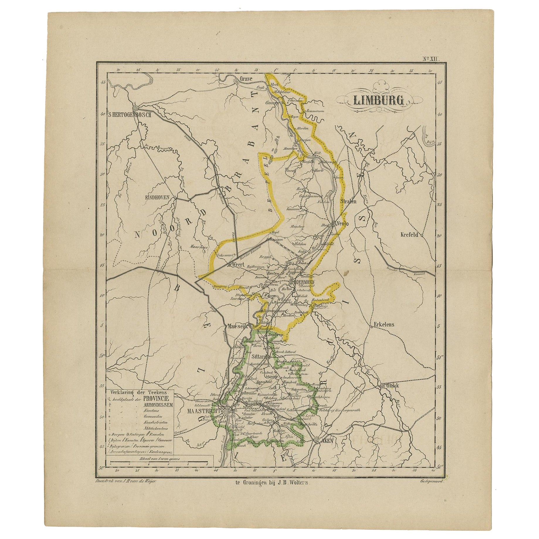
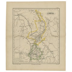
- Antique Map of the Province Limburg, The Netherlands, 1864Located in Langweer, NLAntique map titled 'De Provincie Limburg'. Map of the province of Limburg, the Netherlands. This map originates from 'F. C. Brugsma's Atlas van het Koninkrijk der Nederlanden (..)'. ...Category
Antique 19th Century Maps
MaterialsPaper
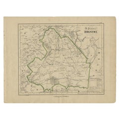
- Antique Map of Drenthe, Province of the Netherlands, C.1870Located in Langweer, NLAntique map titled 'De Provincie Drenthe'. Map of the province of Drenthe, the Netherlands. This map originates from 'F. C. Brugsma's Atlas van het Koninkrijk der Nederlanden (..)'. ...Category
Antique 19th Century Maps
MaterialsPaper
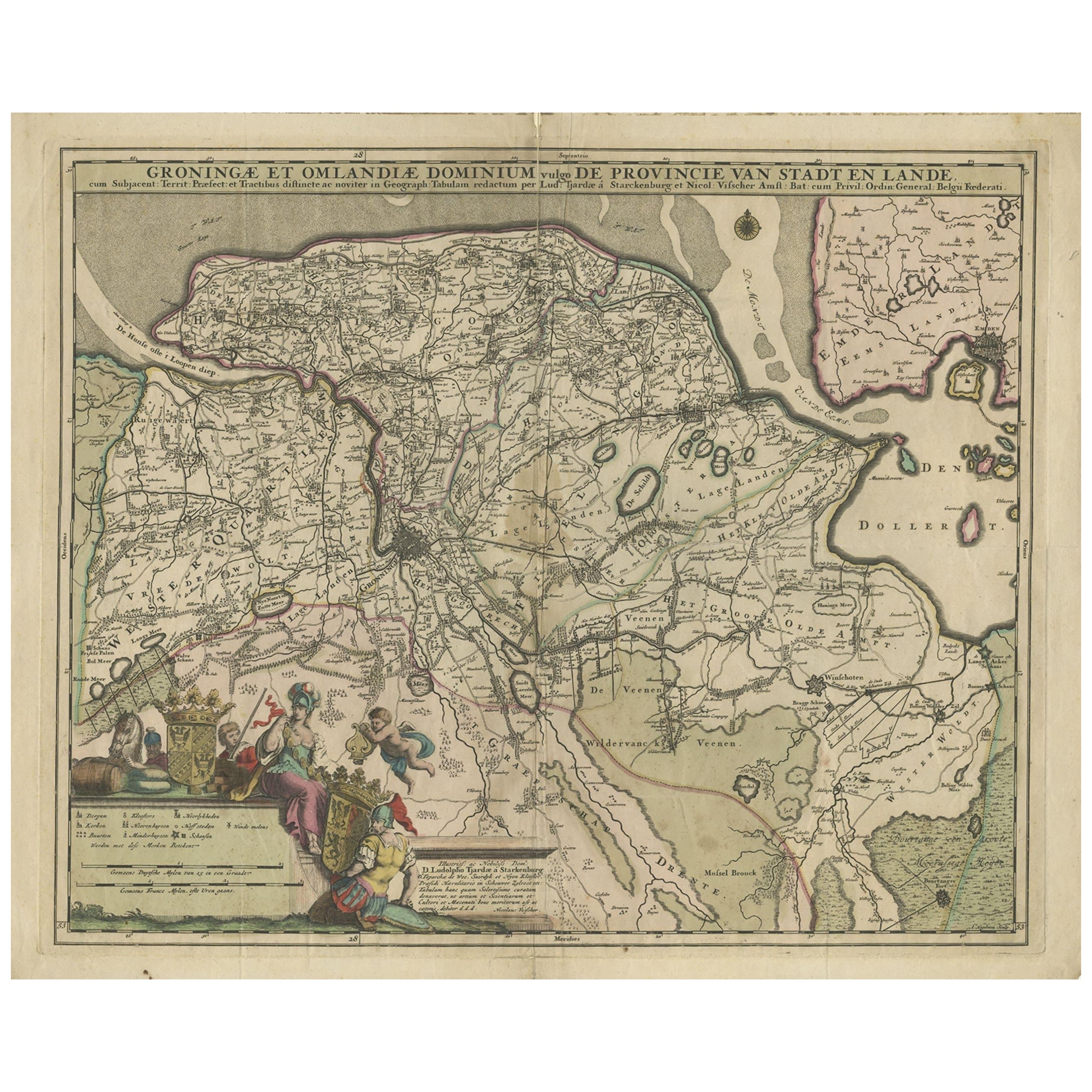
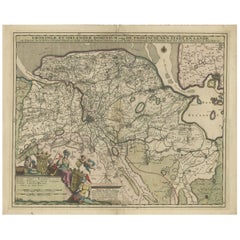
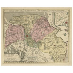
- Antique Map of the Province Groningen in The Netherlands, c.1680Located in Langweer, NLAntique map titled 'Groningae et Omlandiae Dominium vulgo de Provincie van Stadt en Lande'. Old map of the province of Groningen, the Netherlands. This map originates from 'Germani...Category
Antique 17th Century Maps
MaterialsPaper
- Old Antique Map of the Province of Friesland, the Netherlands, c.1580Located in Langweer, NLAntique map titled 'Frisia Occidentalis'. Old map of the province of Friesland, the Netherlands. This map is also known as the 'Pauwenkaart' ('peacock map'), referring to the peacock next to the inset map. Based on a manuscript map...Category
Antique 16th Century Maps
MaterialsPaper
- Antique Map of the Province of Groningen in the Netherlands, c.1700Located in Langweer, NLAntique map titled 'Groningae et Omlandiae Dominium vulgo de Provincie van Stadt en Lande'. Old map of the province of Groningen, the Netherlands. This map originates from 'Atlas C...Category
Antique 18th Century Maps
MaterialsPaper

- Antique 18th Century Map of the Province of Pensilvania 'Pennsylvania State'Located in Philadelphia, PAA fine antique of the colony of Pennsylvania. Noted at the top of the sheet as a 'Map of the province of Pensilvania'. This undated and anonymous map is thought to be from the Gentleman's Magazine, London, circa 1775, although the general appearance could date it to the 1760's. The southern boundary reflects the Mason-Dixon survey (1768), the western boundary is placed just west of Pittsburgh, and the northern boundary is not marked. The map has a number of reference points that likely refer to companion text and appear to be connected to boundaries. The western and southern boundaries are marked Q, R, S, for example. A diagonal line runs from the Susquehanna R to the Lake Erie P. A broken line marked by many letters A, B, N, O, etc., appears in the east. There are no latitude or longitude markings, blank verso. Framed in a shaped contemporary gilt wooden frame and matted under a cream colored matte. Bearing an old Graham Arader Gallery...Category
Antique 18th Century British American Colonial Maps
MaterialsPaper
- Map of the Republic of GenoaLocated in New York, NYFramed antique hand-coloured map of the Republic of Genoa including the duchies of Mantua, Modena, and Parma. Europe, late 18th century. Dimension: 25...Category
Antique Late 18th Century European Maps
- Antique Map of Principality of MonacoBy Antonio Vallardi EditoreLocated in Alessandria, PiemonteST/619 - "Old Geographical Atlas of Italy - Topographic map of ex-Principality of Monaco" - ediz Vallardi - Milano - A somewhat special edition ---Category
Antique Late 19th Century Italian Other Prints
MaterialsPaper
- Original Antique Map of The World by Thomas Clerk, 1817Located in St Annes, LancashireGreat map of The Eastern and Western Hemispheres On 2 sheets Copper-plate engraving Drawn and engraved by Thomas Clerk, Edinburgh. Published by Mackenzie And Dent, 1817 ...Category
Antique 1810s English Maps
MaterialsPaper
- Map "Estuary- Mouth of the Thames"Located in Alessandria, PiemonteST/426 - Antique French Map of the estuary of the Thames, map dated 1769 - "Mape of the entrance of the Thames. Designed by filing of Navy cards fo...Category
Antique Mid-18th Century French Other Prints
MaterialsPaper
- Original Antique Map of The Netherlands, Sherwood, Neely & Jones, Dated 1809Located in St Annes, LancashireGreat map of The Netherlands Copper-plate engraving by Cooper Published by Sherwood, Neely & Jones. Dated 1809 Unframed.Category
Antique Early 1800s English Maps
MaterialsPaper


