Items Similar to The Biblical Kingdom of Israel under the Kings Saul, David and Solomon, Ca.1758
Want more images or videos?
Request additional images or videos from the seller
1 of 5
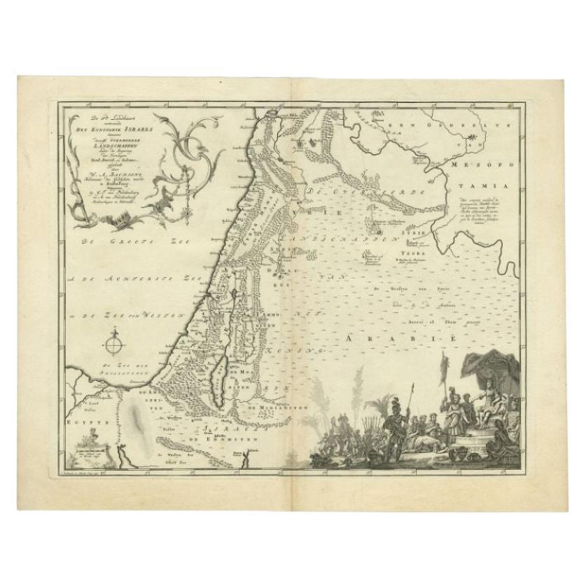
The Biblical Kingdom of Israel under the Kings Saul, David and Solomon, Ca.1758
About the Item
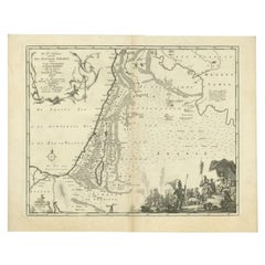
Antique map titled 'De IVde Landkaart vertoonende het Koningryk Israels benevens deszelfs overheerde Landschappen (..).'
Map of the biblical Kingdom of Israel under the Kings Saul, David and Solomon. Published by A. van Paddenburg, Netherlands c. 1758.
Artists and Engravers: Made by 'O. Lindeman' after 'Willem Albert Bachiene'. Author: Willem Albert Bachiene (Leerdam 1712 - Maastricht 1783). He was a Clergyman in the army and in Namen, Belgium and Kuilenburg (Culemborg). From 1759 he was Clergyman in Maastricht and also Professor in Astronomy and Geography at the 'Illustere School'.
- Dimensions:Height: 15.16 in (38.5 cm)Width: 19.3 in (49 cm)Depth: 0 in (0.02 mm)
- Materials and Techniques:
- Period:1750-1759
- Date of Manufacture:circa 1758
- Condition:Wear consistent with age and use. Condition: Good, given age. Slight discolouration near middle fold. Some minor crinkles. A few small spots. Original middle fold as issued. General age-related toning and/or occasional minor defects from handling. Please study image carefully.
- Seller Location:Langweer, NL
- Reference Number:
About the Seller
5.0
Platinum Seller
These expertly vetted sellers are 1stDibs' most experienced sellers and are rated highest by our customers.
Established in 2009
1stDibs seller since 2017
1,960 sales on 1stDibs
Typical response time: <1 hour
- ShippingRetrieving quote...Ships From: Langweer, Netherlands
- Return PolicyA return for this item may be initiated within 14 days of delivery.
More From This SellerView All
- Antique Map of the Biblical Kingdom of Israel by Lindeman, c.1758Located in Langweer, NLAntique map titled 'De IVde Landkaart vertoonende het Koningryk Israels benevens deszelfs overheerde Landschappen (..).' Map of the biblical Kingdom of Israel under the Kings Saul, D...Category
Antique 18th Century Maps
MaterialsPaper
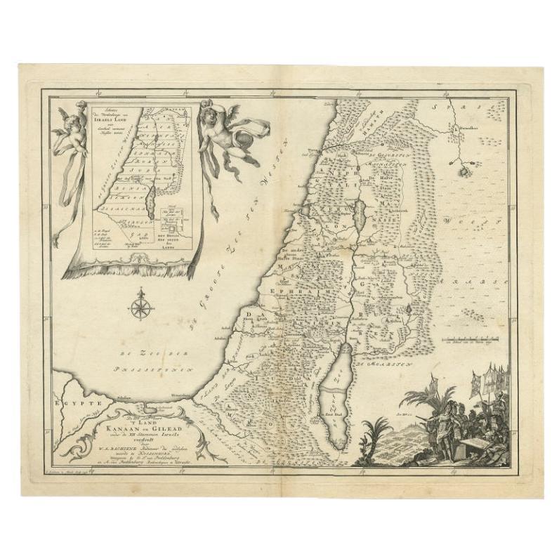
- Antique Map of Biblical Palestine with Inset of Israel's 12 Tribes, 1758Located in Langweer, NLAntique map titled 'De IIIde Landkaart 't land Kanaan en Gilead onder de XII stammen Israëls verdeelt.' Map of biblical Palestine. Inset map of the land of Israel divided in 12 tribes...Category
Antique 18th Century Maps
MaterialsPaper
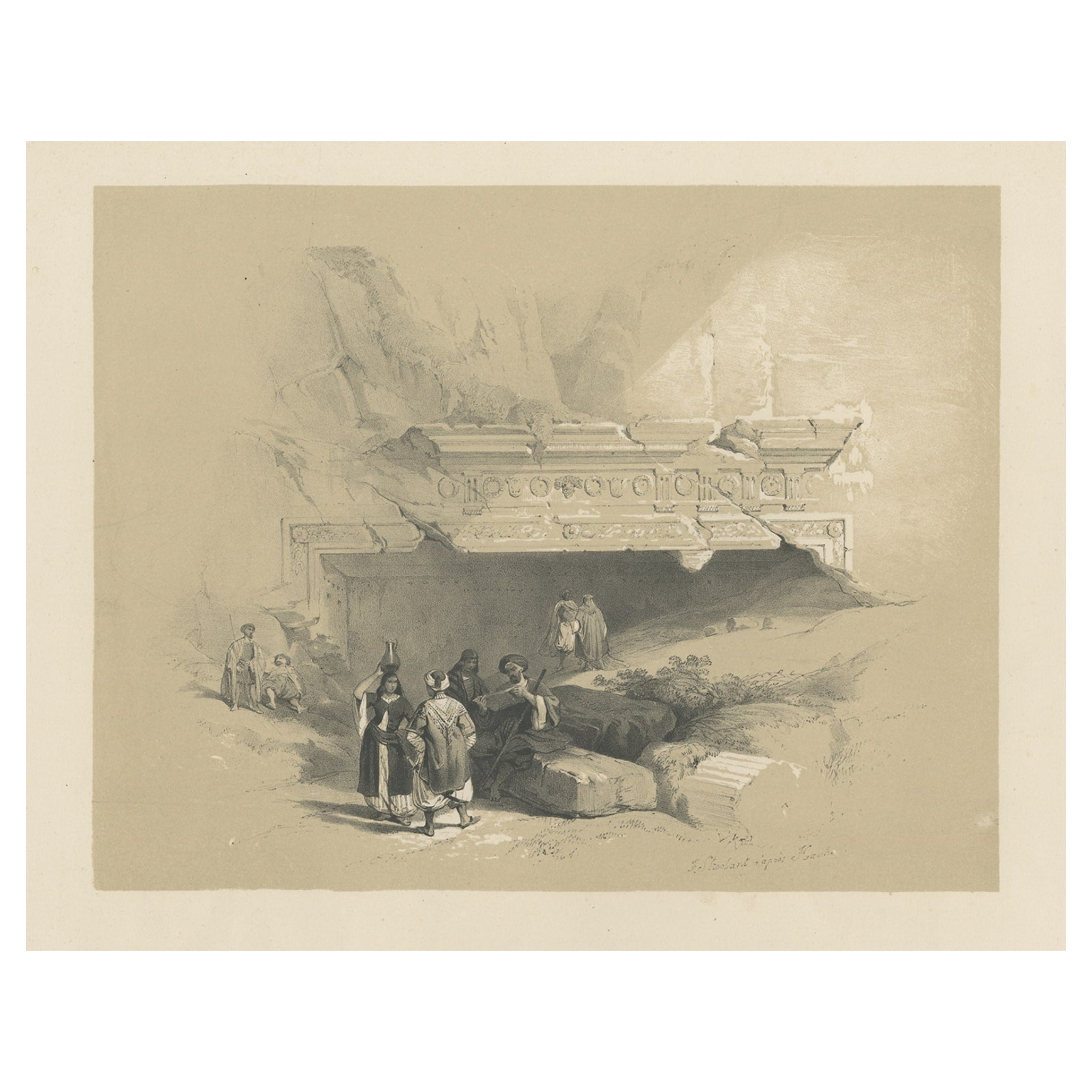
- Old Print of the Tombs of the Kings, Jerusalem, ca.1845Located in Langweer, NLAntique print titled 'Entrée du Tombeau des Rois'. Old print of the Tombs of the Kings, Jerusalem. Made after the designs of the reknown David Roberts. ...Category
Antique 1840s Prints
MaterialsPaper
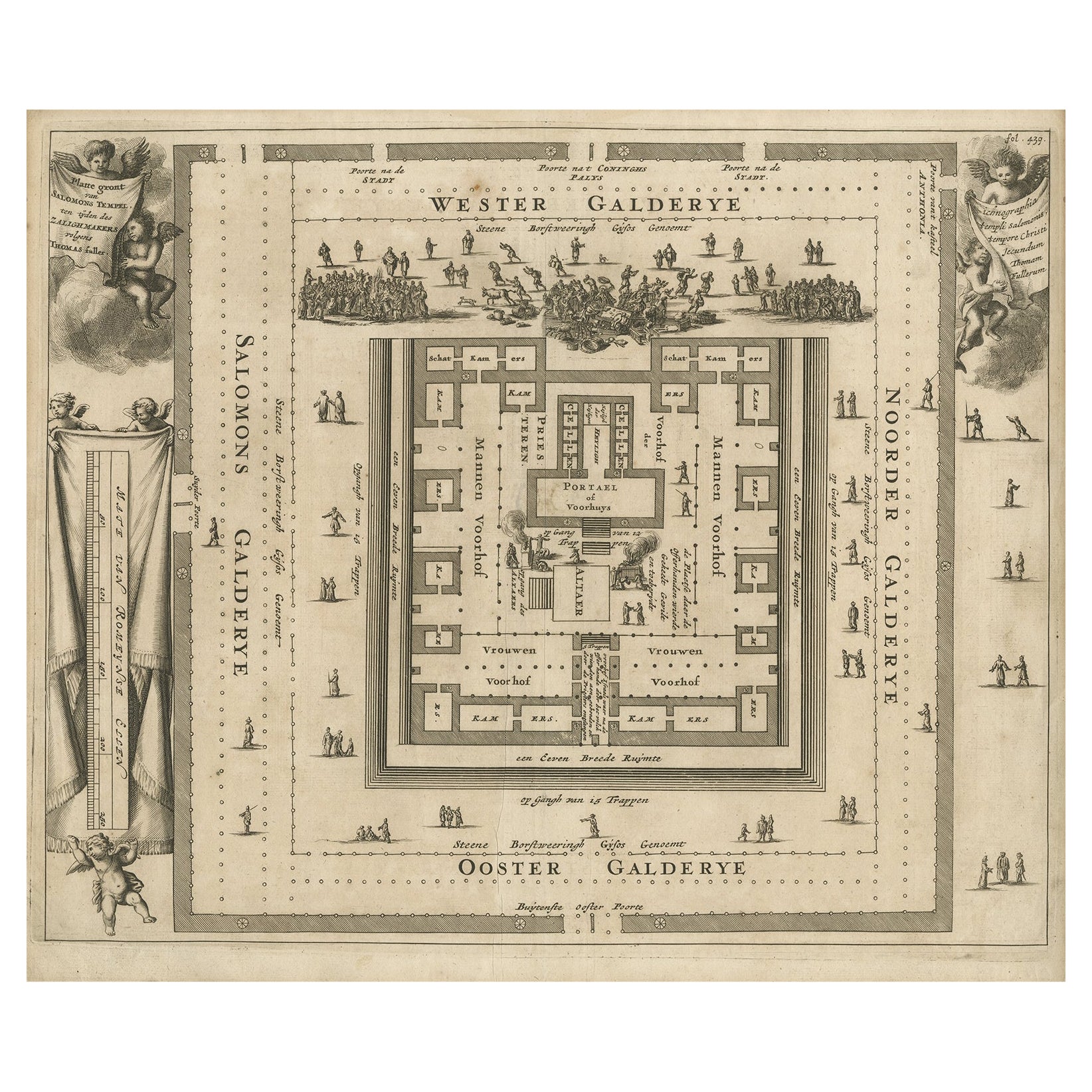
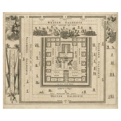
- Bird's-Eye Plan of Solomon's Temple to the West, Jerusalem in Israel, 1677Located in Langweer, NLAntique print religion titled 'Platte gront van Salomons Tempel ten tijden des Zalighmakers volgens Thomas Fuller'. Bird's-eye plan of Solomon's Temple, oriented to the west (Jer...Category
Antique 1670s Prints
MaterialsPaper
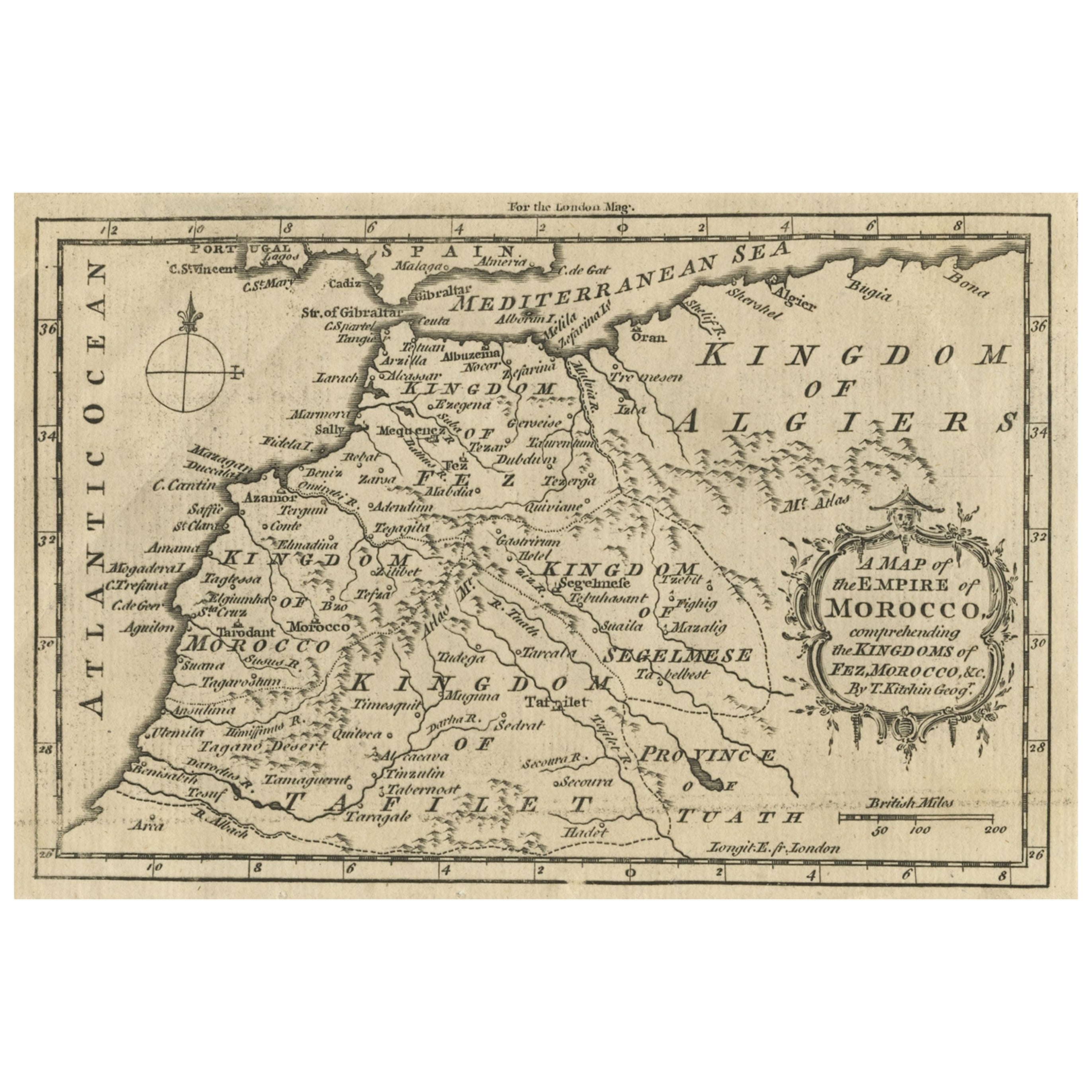
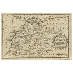
- Old Map of the Kingdoms of Fez, Algiers, Segelmese, Tafilet and Morocco, ca.1760Located in Langweer, NLAntique map titled 'A Map of the Empire of Morocco Comprehending the Kingdoms of Fez, Morocco'. Original antique map of the kingdoms of Fez, Algiers, Segelmese, Tafilet and Moroc...Category
Antique 1760s Maps
MaterialsPaper
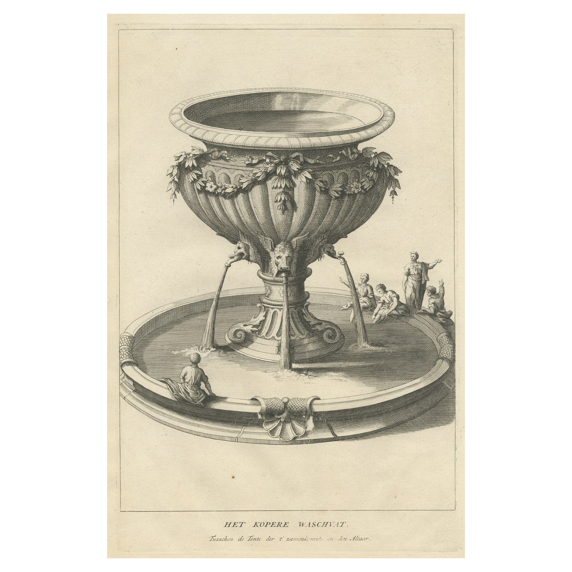
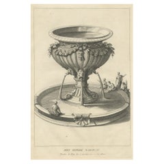
- Antique Engraving of the Brass Laver in Solomon's Temple, Jerusalem, ca.1725Located in Langweer, NLAntique religion print titled 'Het kopere Waschvat, Tusschen de Tente der t'zamenkomst en den altaar'. Antique print of the Brass Laver in Solomon's Temple. This print originates...Category
Antique 1720s Prints
MaterialsPaper


You May Also Like
- The Kingdom of Naples and Southern Italy: A Hand-Colored 18th Century Homann MapBy Johann Baptist HomannLocated in Alamo, CA"Novissima & exactissimus Totius Regni Neapolis Tabula Presentis Belli Satui Accommo Data" is a hand colored map of southern Italy and the ancient Kingdom of Naples created by Johann...Category
Antique Early 18th Century German Maps
MaterialsPaper
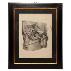
- Lithographic print on paper, depicting the atlas of the hand, France 1850 ca.Located in Milan, ITAn anatomical lithographic print on paper, depicting the anatomical atlas of the hand. Black lacquered fir wood frame with golden ramin wood batting. N. H. Ja...Category
Antique Mid-19th Century French Prints
MaterialsGlass, Wood, Paper
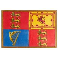
- Antique Royal Standard of the United Kingdom in Giltwood Frame and Under GlassLocated in Morristown, NJAn antique Royal Standard of the United Kingdom, possibly by Benjamin Edgington, London. The fabric is in a giltwood frame under glass. Each of the four quadrants on the flag represe...Category
Antique 1830s English British Colonial Historical Memorabilia
MaterialsFabric, Glass, Wood
- Map of the Kingdom of Sardinia and Part of the Kingdom of Genoa, RomeBy Giovanni Maria CassiniLocated in Hamilton, Ontario18th century map by Italian engraver Giovanni Maria Cassini (Italy 1745-1824). Map of Part of the Kingdom of Sardinia and Part of the Kingdom of Genoa: Rome. This is a hand colored a...Category
Antique 18th Century Italian Maps
MaterialsPaper
- Lithographic Print on Paper, Depicting the Male Genital System, France 1850 CaLocated in Milan, ITAn anatomical lithographic print on paper, depicting the male genital system. Black lacquered fir wood frame with golden ramin wood batting. N. H. Jacob, Pari...Category
Antique Mid-19th Century French Prints
MaterialsGlass, Wood, Paper
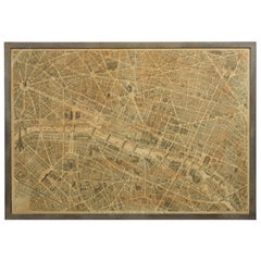
- French 1930s Map of Paris à Vol d'Oiseau under Glass in Custom Iron FrameLocated in Atlanta, GAA French map of Paris from the early 20th century, with custom iron frame. Created in Paris during the second quarter of the 20th century, this map of Paris à vol d'oiseau (as the Cr...Category
Early 20th Century French Prints
MaterialsIron


Recently Viewed
View AllMore Ways To Browse
Israeli Artist Furniture
Antique Israel
Israel Antique
Israeli Antique
Antique Furniture Israel
Belgian Army
Belgium Army
Biblical Maps
Antique Map Israel
Antique Map Of Israel
Antique Maps Of Israel
Israel Map
Map Of Israel
Island Colonial
Antique English County Maps
Portuguese 16th
Large Map Of The Netherlands
Antique Map Of The South Of France