Items Similar to Framed 1839 Hand Colored Map of the United States


Want more images or videos?
Request additional images or videos from the seller
1 of 8
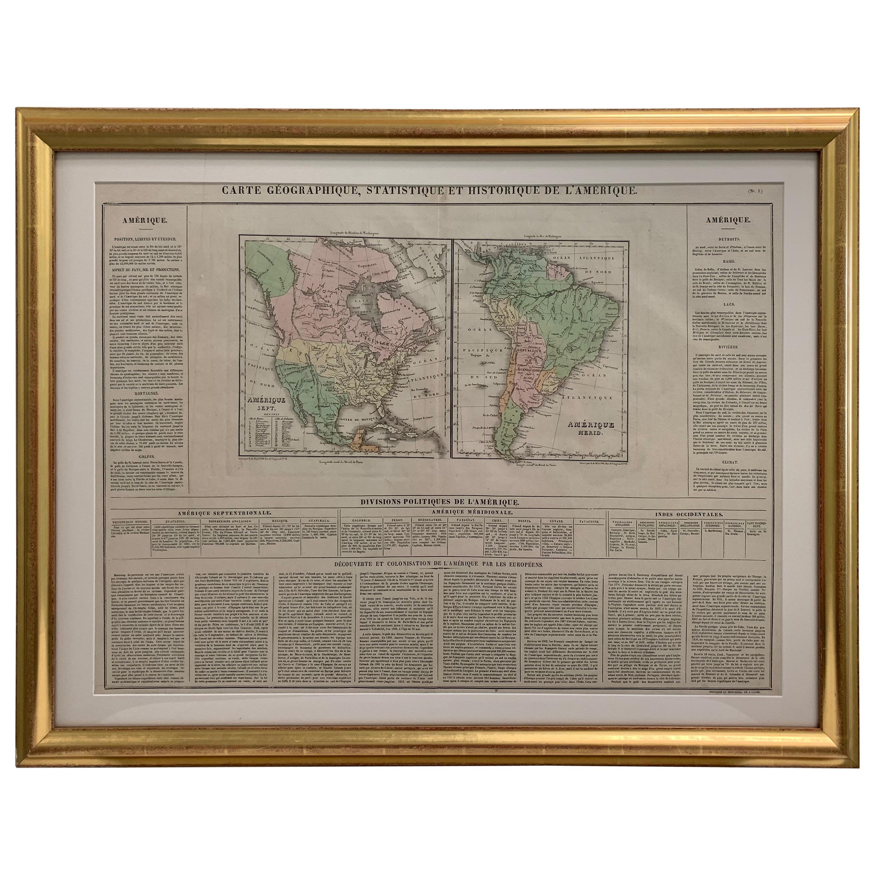
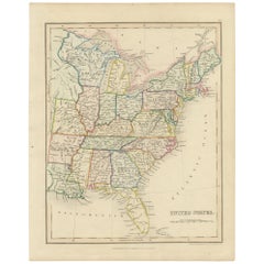
Framed 1839 Hand Colored Map of the United States
About the Item
Framed hand colored map of the United States of America from 1839. Newly framed in a giltwood frame.
- Dimensions:Height: 19 in (48.26 cm)Width: 15.5 in (39.37 cm)Depth: 1 in (2.54 cm)
- Style:American Classical (In the Style Of)
- Materials and Techniques:
- Place of Origin:
- Period:
- Date of Manufacture:1839
- Condition:Additions or alterations made to the original: Reframed. Wear consistent with age and use. Light overall wear.
- Seller Location:Stamford, CT
- Reference Number:1stDibs: LU1860319379752
About the Seller
5.0
Platinum Seller
These expertly vetted sellers are 1stDibs' most experienced sellers and are rated highest by our customers.
Established in 2010
1stDibs seller since 2016
397 sales on 1stDibs
Typical response time: 1 hour
- ShippingRetrieving quote...Ships From: Santa Barbara, CA
- Return PolicyA return for this item may be initiated within 2 days of delivery.
More From This SellerView All
- Framed 1820s Hand Colored Map of the United StatesLocated in Stamford, CTFramed 1820s hand colored map photos of North America and South America. As found framed in giltwood frame.Category
Antique 1820s American Spanish Colonial Maps
MaterialsGiltwood, Paper, Glass
- 1830 Mexico and United States Framed MapLocated in Stamford, CTMap of North America published circa 1830. Map shows United States into Canada. Mexico extending into the upper California territory. Texas appears in name but prior to the period of...Category
Antique 1830s American American Classical Maps
MaterialsGlass, Wood, Paper
- Framed 1838 Mexico & Gulf of Mexico MapLocated in Stamford, CTFramed 1838 Mexico & Gulf of Mexico map. Printed by Fisher, Son & Co. of London in 1838. As found framed condition. Map has not been examined outside of th...Category
Antique 1830s English American Classical Maps
MaterialsGlass, Wood, Paper
- Framed 1838 North America & Recent Discoveries MapLocated in Stamford, CT1838 map of North America & recent discoveries. Engraved color map by J. Wyld, London, England. This map shows Texas as a Republic without its panhandle. Framed in brown carved wood...Category
Antique 1830s American American Classical Maps
MaterialsGlass, Wood, Paper
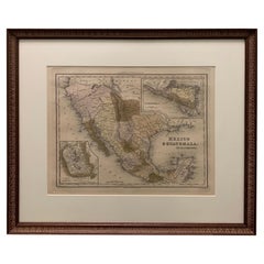
- 1834 Mexico & Guatemala Framed Map by H.S. TannerLocated in Stamford, CT1834 Mexico & Guatemala map of published by H.S. Tanner, Philadelphia, Pennsylvania. Engraved by J. Knight. As found high end custom framing with carved wood frame, custom matting a...Category
Antique 1830s American American Classical Maps
MaterialsGlass, Wood, Paper
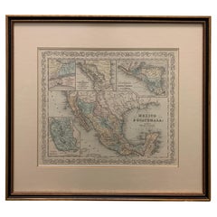
- Large 1856 Mexico & Guatemala Framed Map by Charles DesilverLocated in Stamford, CTLarge 1856 Mexico & Guatemala Framed map. Published by Charles Desilver, Philadelphia, Pennsylvania. As found high end custom framing with black giltwood frame, custom matting and UV...Category
Antique 1850s American American Classical Maps
MaterialsGlass, Wood, Paper


You May Also Like
- Original Antique Hand-colored Map of the United States, circa 1845Located in Langweer, NLAntique map titled 'United States'. Old map of the United States, includes the last part of the North West Territory (present day Wisconsin and part of Minnesota). It also marks Ft. Crawford at the confluence of the Mississippi River and the Ouisconsin River (present day Wisconsin River). Published by Orr & Company; Amen Corner...Category
Antique Mid-19th Century Maps
MaterialsPaper
- Vintage Framed United States MapLocated in New York, NYVintage aged paper map of the United States mounted on particle board and framed in a simple wooden frame.Category
20th Century American Mid-Century Modern Maps
MaterialsWood, Paper
- Small Map of the United StatesLocated in Langweer, NLAntique map titled 'Amérique septe. Physique'. Small map of the United States. lithographed by C. Callewaert brothers in Brussels circa 1870.Category
Antique Mid-19th Century Maps
MaterialsPaper
- English Engraved Hand Colored Map of the North Eastern United States, circa 1817Located in Hollywood, SCEnglish copper engraved hand colored map of the North Eastern United States matted under glass in a gilt frame, Early 19th Century. Drawn and Engraved for Thomson's New General Atlas...Category
Antique 1810s English George III Maps
MaterialsPaper, Paint, Giltwood, Glass
- Early 19th Century Hand Colored Map of the United States and Caribbean IslandsLocated in Hamilton, OntarioHand coloured early 19th century map by Giraldon of France titled "Etats Unis et Grandes Antilles" (United States and Greater Antilles).Category
Antique Early 19th Century French Maps
MaterialsPaper
- Antique Map with Hand Coloring of the United States and the CaribbeanLocated in Langweer, NLAntique map titled 'Verein-Staaten von Nord-America, Mexico, Yucatan u.a.'. Very detailed map of the United States of America showing the Caribbean. With an inset map of the surround...Category
Antique Late 19th Century Maps
MaterialsPaper


Recently Viewed
View AllMore Ways To Browse
Antique United States
Antique Furniture United States
Hand Colored Antique
United States Map
Map Of United States
The United States Map
Hand Colored Map
Framed Map
Antique Map Framing
Antique Maps Framed
Framing Antique Maps
Antique Map United States
Antique United States Maps
Antique Maps Of United States
Antique Map Of The United States
Framed Map United States
Antique Geography
Antique World Atlas