Items Similar to Map of Rhône: Culture and Commerce in Lyon's Silk and Wine Legacy, 1852


Want more images or videos?
Request additional images or videos from the seller
1 of 8
Map of Rhône: Culture and Commerce in Lyon's Silk and Wine Legacy, 1852
About the Item
This original hand-colored map is from the "Atlas National Illustré," a work by Victor Levasseur, a French geographer and cartographer known for his richly illustrated maps.
The map is a steel engraving, which was a common and precise method for creating maps at the time. The inclusion of the publisher's name, A. Combette from Paris, and the addresses of the various contributors to the map's creation, like the engravers Laguillermie and Rainaud, adds to the historical context of the piece.
The margins of the map are adorned with detailed illustrations that serve as a visual encyclopedic reference to the region's geography, economy, and notable figures. The use of color along the boundaries makes the map not only a tool for navigation but also an educational resource, providing insights into the department's landscape, economy, and cultural significance.
The text included in the map's design provides statistical information, a map legend, and discussions about the land, local curiosities, notable personalities, products, and commerce, which would have been invaluable for education and reference at the time.
The 'Atlas National Illustré' is celebrated for its combination of cartographic detail and artistic embellishment, making it a valuable cultural artifact. It represents the height of decorative map-making in the 19th century, alongside the works of John Tallis and Archibald Fullarton.
This original handcolored antique print is a map of the 'Département du Rhône' from Victor Levasseur's "Atlas National Illustré." The map is titled 'Dépt. du Rhône' and, as with other maps from this series, it features a blend of geographical detail and artistic embellishment.
The map of the Rhône department, which includes the city of Lyon, is central to the image, with various roads, towns, and possibly the river systems illustrated. The surrounding vignettes and illustrations are likely to depict the cultural and economic life of the region. Given the Rhône's location, they may include images that relate to the silk industry, which was historically important in Lyon, and possibly the wine production that the Rhône valley is famous for.
The left and right margins of the map contain columns of text that provide statistical information, a historical account, and descriptions of the region's significant features. Portraits of notable individuals may be included, representing important historical figures or contributors to the region's development.
Notable places within the Rhône department that might be of interest on the map include:
1. **Lyon**: Known for its historical and architectural landmarks, it's a UNESCO World Heritage site.
2. **Beaujolais**: Just north of Lyon, this area is famous for its wine production, especially the Beaujolais Nouveau.
3. **The Rhône Valley**: Home to some of the oldest vineyards in France, producing both red and white wines, including Côte-Rôtie and Condrieu.
These maps are not just navigation tools but also serve as historical documents, capturing the essence of the department's identity during the mid-19th century. The illustrations on the map reflect the local industries, agriculture, and landscapes that are characteristic of the Rhône area.
- Dimensions:Height: 20.28 in (51.5 cm)Width: 13.94 in (35.4 cm)Depth: 0 in (0.02 mm)
- Materials and Techniques:
- Period:
- Date of Manufacture:1852
- Condition:Good. Minor soiling around the edges, one ver small corner chipped. The image clean and decorative. Study the images carefully.
- Seller Location:Langweer, NL
- Reference Number:
About the Seller
5.0
Platinum Seller
These expertly vetted sellers are 1stDibs' most experienced sellers and are rated highest by our customers.
Established in 2009
1stDibs seller since 2017
1,973 sales on 1stDibs
Typical response time: <1 hour
- ShippingRetrieving quote...Ships From: Langweer, Netherlands
- Return PolicyA return for this item may be initiated within 14 days of delivery.
More From This SellerView All
- Antique Map of Turkey and Greece, 1852Located in Langweer, NLAntique map titled 'Europisch Turkije en Griekenland'. Map of Turkey in Europe and Greece. This map originates from 'School-Atlas van alle deelen der Aar...Category
Antique 19th Century Maps
MaterialsPaper
- Antique Map of the Bosporus and Dardanelles, 1852Located in Langweer, NLAntique map titled 'The Bosphorus and Dardanelles'. Original map of the Bosphorus and Dardanelles. This map originates from 'Lowry's Table Atlas constructed and engraved from the mos...Category
Antique Mid-19th Century Maps
MaterialsPaper
- Antique Map of Eastern Persia, 1852Located in Langweer, NLAntique map titled 'Eastern Persia'. Original map of Eastern Persia. This map originates from 'Lowry's Table Atlas constructed and engraved from the most recent Authorities' by J.W. ...Category
Antique Mid-19th Century Maps
MaterialsPaper
- Antique Map of the World in two sheets, 1852Located in Langweer, NLAntique map titled 'The World on Mercator's Projection'. Two individual sheets of the world. This map originates from 'Lowry's table Atlas constructed and engraved from the most rece...Category
Antique Mid-19th Century Maps
MaterialsPaper
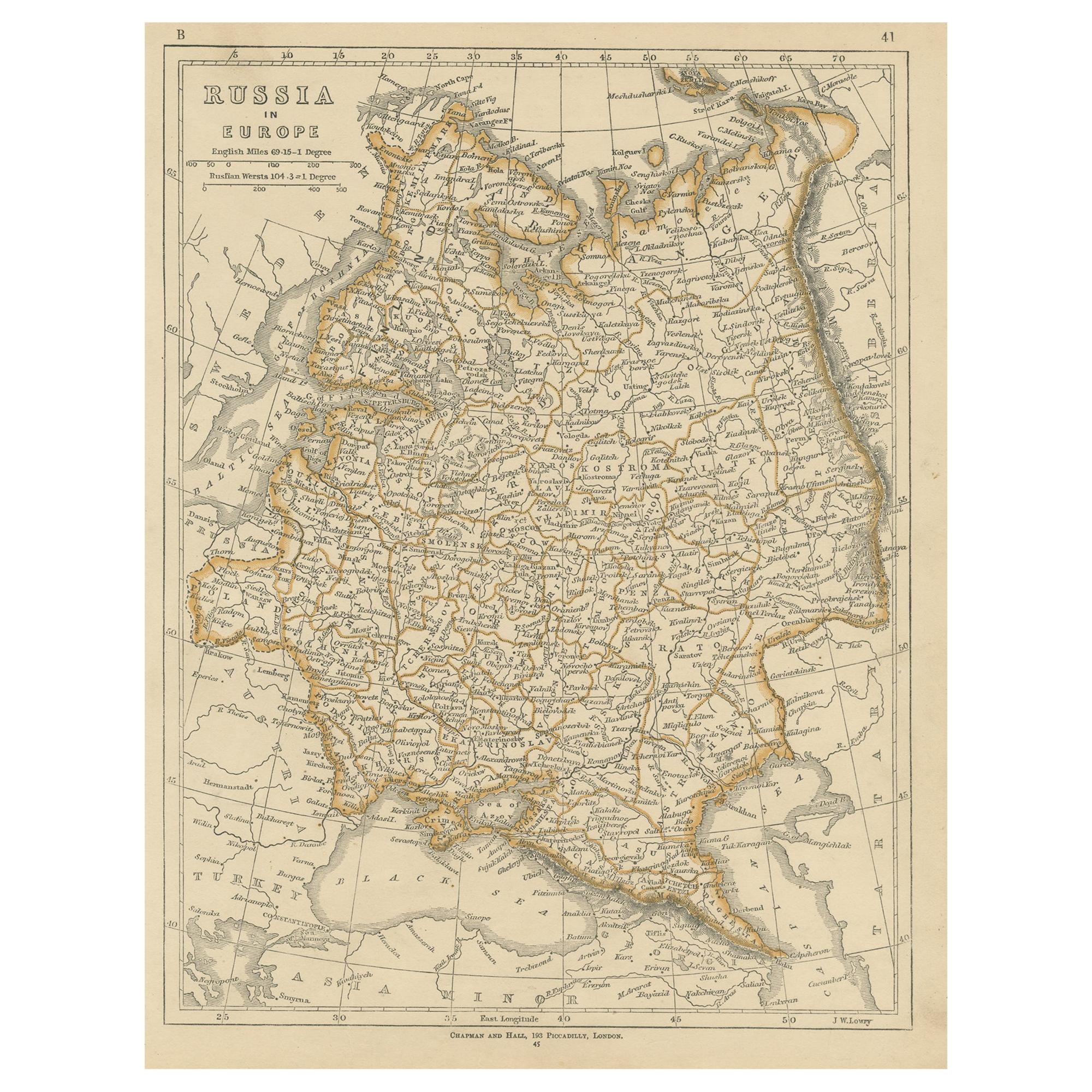
- Antique Map of Russia in Europe by Lowry, 1852Located in Langweer, NLAntique map titled 'Russia in Europe'. Original map of Russia in Europe. This map originates from 'Lowry's Table Atlas constructed and engraved from the most recent Authorities' by J...Category
Antique Mid-19th Century Maps
MaterialsPaper
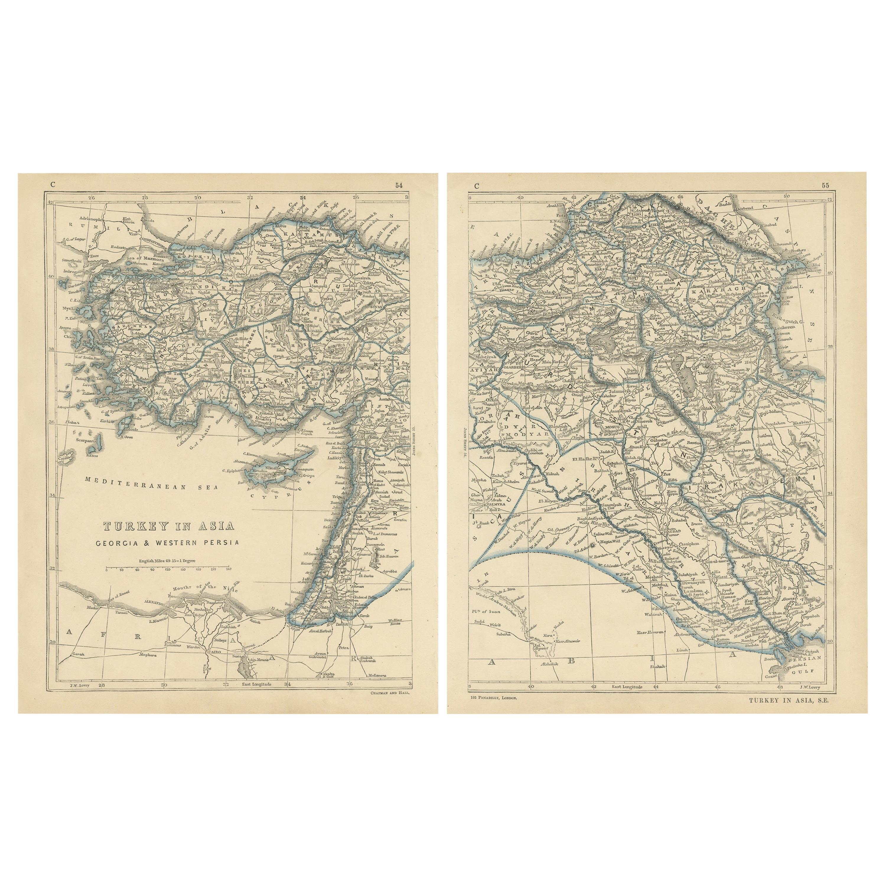
- Antique Map of Turkey in Asia by Lowry '1852'Located in Langweer, NLAntique map titled 'Turkey in Asia, Georgia & Western Persia'. Two individual sheets of Turkey in Asia. This map originates from 'Lowry's Table Atlas constructed and engraved from th...Category
Antique Mid-19th Century Maps
MaterialsPaper


You May Also Like
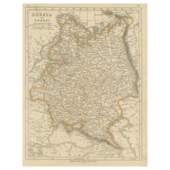
- Large1852 Map "Russian Empire" Ric.r0011Located in Norton, MALarge 1852 map "Russian Empire" George Phillips & Son 1852 Ric.r0011 Dimension: Paper: 67 cm W x 52 cm H ; Sight: 60cm W x 50 cm H Condition: Good Condition with aged tonin...Category
Antique 19th Century Unknown Maps
MaterialsPaper
- Gilt Framed Vintage Wine Regions of France MapLocated in Alton, GBFramed French wine region map 1973. The print has been removed to clean the glass, the frame has minor damage in places but nothing that detracts from ...Category
Vintage 1970s French Posters
MaterialsPaper
- Map of Boston and Surrounding TownsLocated in Norwell, MALater copy of a nineteenth century map of Boston and surrounding towns. Showing parts of Quincy, Milton, Hyde Park, Winthrop and Revere. Showing all of B...Category
Antique 19th Century North American Maps
MaterialsPaper
- 1854 Map of Massachusetts, Connecticut and Rhode Island, Antique Wall MapLocated in Colorado Springs, COThis striking wall map was published in 1854 by Ensign, Bridgman & Fanning and has both full original hand-coloring and original hardware. This impression is both informative and highly decorative. The states are divided into counties, outlined in red, green, and black, and subdivided into towns. Roads, canals, and railroad lines are prominently depicted, although they are not all labeled. The mapmakers also marked lighthouses, banks, churches, and prominent buildings, with a key at right. The map is an informative and comprehensive overview of the infrastructural development of New England prior to the Civil War. Physical geographies depicted include elevation, conveyed with hachure marks, rivers and lakes. The impression features an inset map of Boston...Category
Antique 19th Century American Maps
MaterialsPaper
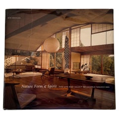
- Nature, Form & Spirit: The Life and Legacy of George NakashimaBy Mira Nakashima, George NakashimaLocated in New York, NYFirst edition of Mira Nakashima’s tribute to her father, George, whose standing as one of America’s foremost designer/craftsmen is reflected in his blue-chip status in the vintage de...Category
Early 2000s American American Craftsman Books
MaterialsPaper
- Map of LancashireLocated in Cheshire, GBSaxton Map of Lancashire hand coloured. Encased in an ebonised frame. Dimensions Height 21 Inches Width 24 Inches Depth 1 InchesCategory
Early 20th Century British Maps
MaterialsPaper


Recently Viewed
View AllMore Ways To Browse
Wine And Vineyard
Century Furniture Silk Road
Paris City Maps
Column Engraving
Wine Tools
Handcolored Engraving
Rhone River
Antique Geological Maps
Antique Map Fabric
Antique Map Of New Jersey
Antique Map Singapore
Antique Maps Of New Jersey
Antique Maps Singapore
Constantinople Map
Map Colonial Africa
Map Of Constantinople
Pair Of Antique Maps
Romania Map