Items Similar to Old Map of the Chinese Empire and Japan, 1882


Want more images or videos?
Request additional images or videos from the seller
1 of 7
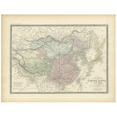
Old Map of the Chinese Empire and Japan, 1882
About the Item
An original antique map titled "The Chinese Empire and Japan," dating from an 1882 atlas by Blackie & Son. It is a color map with geographical features such as mountain ranges, rivers, and political boundaries. The vast area of China is central, with its provinces outlined and labeled in detail. To the east, the archipelago of Japan is depicted, including the main islands, as well as Korea, Taiwan (Formosa), Hainan and Macau . The topography is represented with hachures, a method of shading used to indicate slopes and mountains.
The map uses latitudinal and longitudinal lines for reference, and the color coding may represent different political regions or elevations. The waters around Japan and along the coast of China are well-charted.
This map likely reflects the geopolitical boundaries of the time, which could differ from present-day borders. Since this is from a 19th-century British atlas, place names are probably anglicized, and the map would serve educational purposes or as a reference for those interested in the region's geography and political divisions at that time.
- Dimensions:Height: 14.97 in (38 cm)Width: 22.45 in (57 cm)Depth: 0 in (0.02 mm)
- Materials and Techniques:
- Period:
- Date of Manufacture:1882
- Condition:Good condition, folding line in the middle. The outer borders are slightly discolored due to age, but not the image. This map is ideal for framing. Study the image carefully.
- Seller Location:Langweer, NL
- Reference Number:
About the Seller
5.0
Platinum Seller
These expertly vetted sellers are 1stDibs' most experienced sellers and are rated highest by our customers.
Established in 2009
1stDibs seller since 2017
1,959 sales on 1stDibs
Typical response time: <1 hour
- ShippingRetrieving quote...Ships From: Langweer, Netherlands
- Return PolicyA return for this item may be initiated within 14 days of delivery.
More From This SellerView All
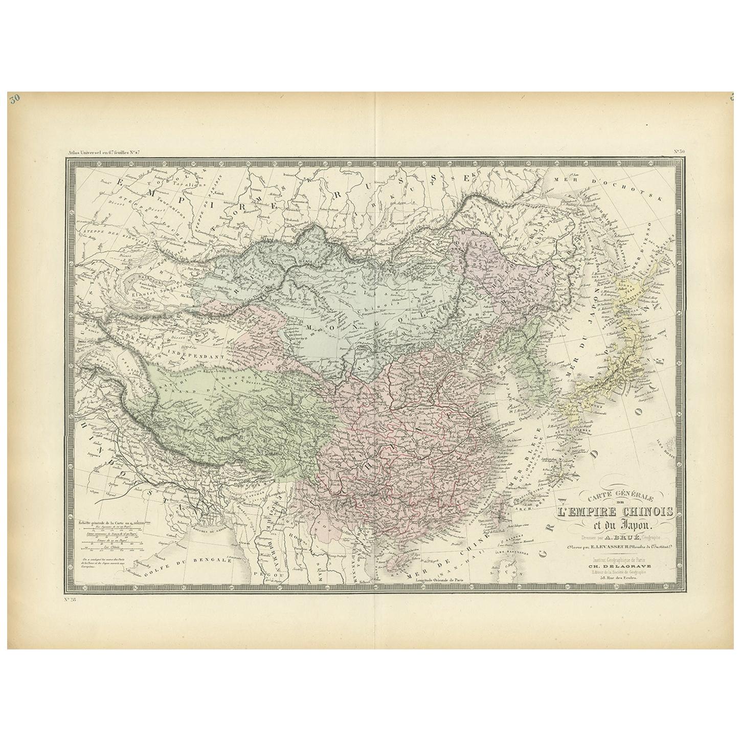
- Antique Map of the Chinese Empire and Japan, '1875'Located in Langweer, NLAntique map titled 'Carte générale de l'Empire Chinois et du Japon'. Large map of the Chinese Empire and Japan. This map originates from 'Atlas de Géographie Moderne Physique et Poli...Category
Antique Late 19th Century Maps
MaterialsPaper
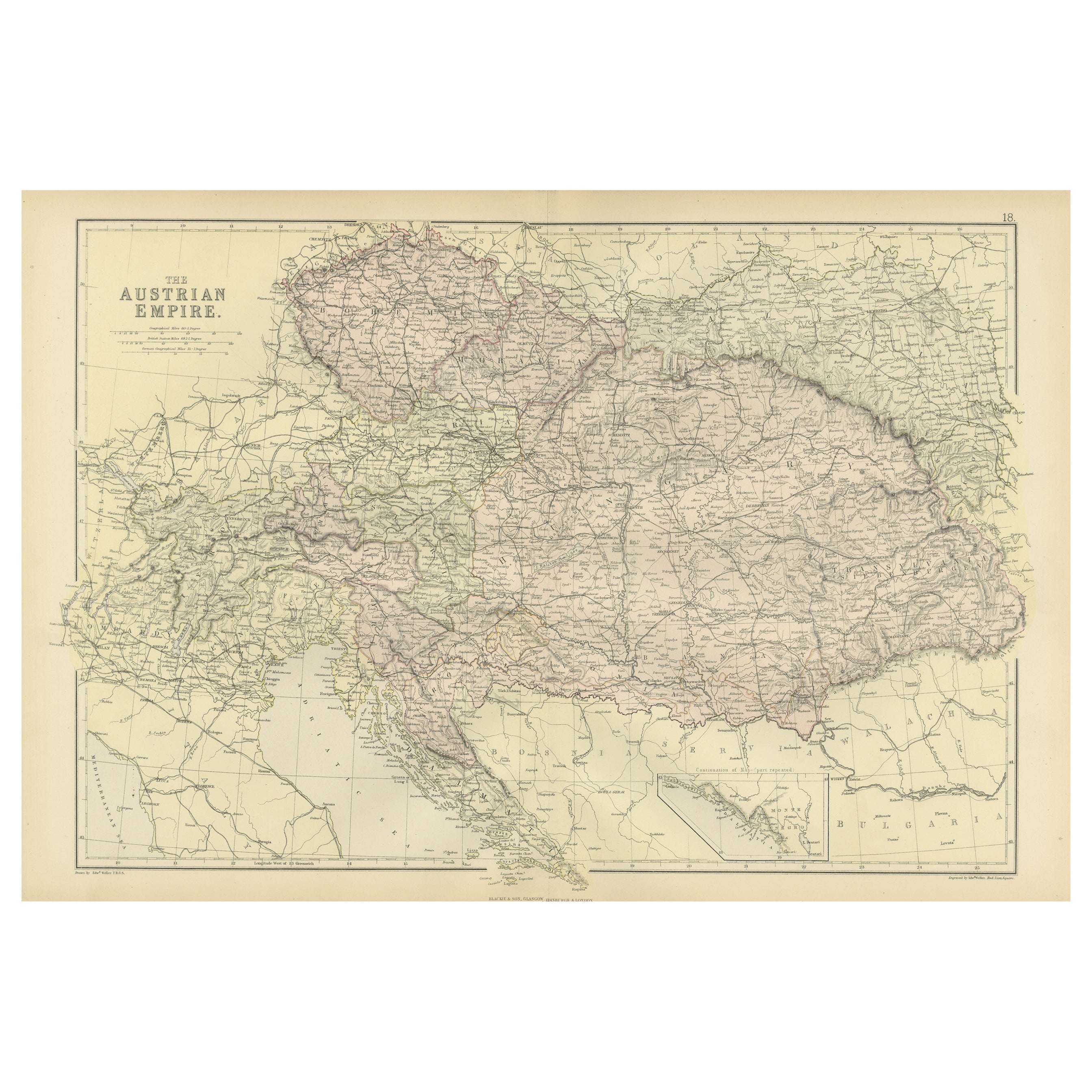
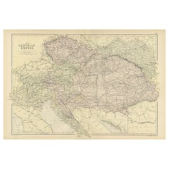
- Original Antique Map of The Austrian Empire, 1882Located in Langweer, NLStep into the past with an original Antique Map of The Austrian Empire from the esteemed 'Comprehensive Atlas and Geography of the World,' meticulously crafted in 1882. This intricat...Category
Antique 1880s Maps
MaterialsPaper
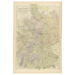
- Antique Map of the German Empire by Johnston, 1882By Alexander Keith JohnstonLocated in Langweer, NLAntique map titled 'Empire of Germany'. Old map of the German Empire with an inset map of Berlin and Potsdam. This map originates from 'The Royal Atlas o...Category
Antique 19th Century Maps
MaterialsPaper
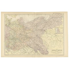
- Antique Map of The German Empire (West Sheet), 1882Located in Langweer, NLTransport yourself to the heart of history with an original Antique Map of The German Empire (west sheet) from 'The Comprehensive Atlas and Geography of the World,' meticulously craf...Category
Antique 1880s Maps
MaterialsPaper
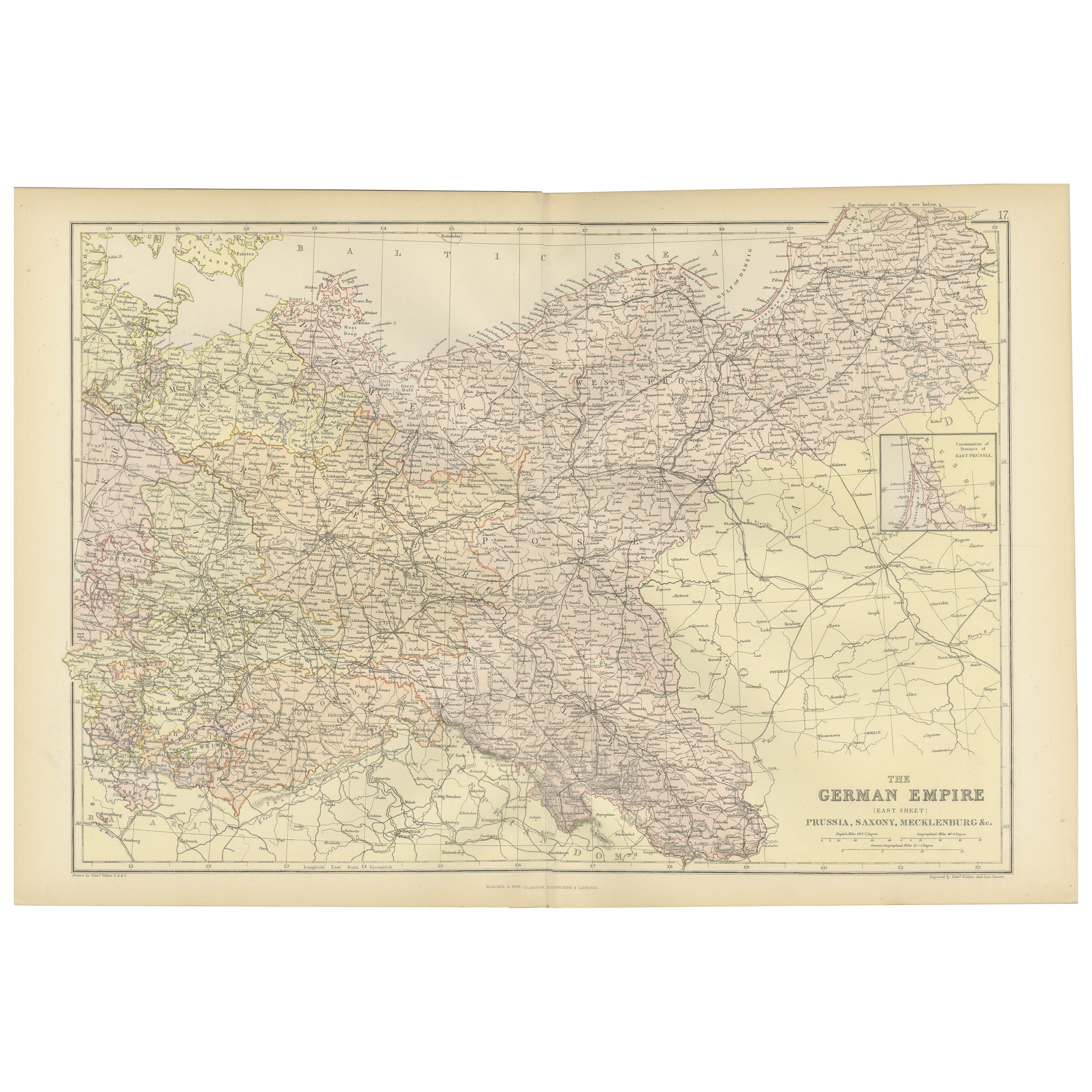
- Antique Map of The German Empire (East Sheet), 1882Located in Langweer, NLStep into history with an authentic Antique Map of The German Empire (East Sheet) from the esteemed 'Comprehensive Atlas and Geography of the World,' meticulously crafted in 1882. Th...Category
Antique 1880s Maps
MaterialsPaper
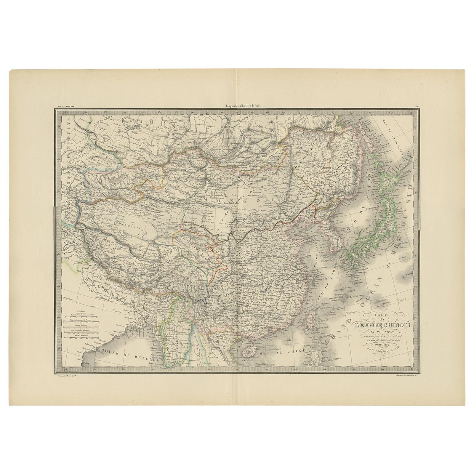
- Antique Map of the Chinese Empire and Japan by Lapie, 1842Located in Langweer, NLAntique map titled 'Carte de L'Empire Chinois et du Japon'. Map of the Chinese Empire (China) and Japan. This map originates from 'Atlas universel de géographie ancienne et moderne (...Category
Antique Mid-19th Century Maps
MaterialsPaper


You May Also Like
- Super Rare Antique French Map of Chine and the Chinese Empire, 1780Located in Amsterdam, Noord HollandSuper Rare Antique French Map of Chine and the Chinese Empire, 1780 Very nice map of Asia. 1780 Made by Bonne. Additional information: Type: Map ...Category
Antique 18th Century European Maps
MaterialsPaper
- Antique Carte de L'Inde Myanmar, Malaysia Vietnam Map of Asia the Chinese EmpireLocated in Amsterdam, Noord HollandAntique Carte de L'Inde Myanmar, Malaysia Vietnam Map of Asia the Chinese Empire Very nice map of Asia. Additional information: Type: Map Country of Man...Category
Antique 18th Century European Maps
MaterialsPaper
- Framed Map of ChinaLocated in Greenwich, CTMap of China, 19th century. European print map of China Conservation frame with walnut frame Overall dimension : 28 1/2" wide 31" high 2" depth with fra...Category
Antique 19th Century European Qing Prints
MaterialsPaper
- Old Nautical Map of CorsicaLocated in Alessandria, PiemonteST/556/1 - Old map of Corsica isle, surveyed by Captain Hell, of the French Royal Navy in 1824, engraved and published on 1874, with additions and corre...Category
Antique Early 19th Century English Other Prints
MaterialsPaper
- Old Horizontal Map of EnglandBy TassoLocated in Alessandria, PiemonteST/520 - Old rare Italian map of England, dated 1826-1827 - by Girolamo Tasso, editor in Venise, for the atlas of M.r Le-Sage.Category
Antique Early 19th Century Italian Other Prints
MaterialsPaper
- 1882 The Works of Henry Fielding, Esq.By Henry FieldingLocated in Bath, GBA limited edition ten-volume set of the works of Henry Fielding, edited with a biography by Leslie Stephen. A ten-volume set in half morocco bindings. All edges gilt. No. 92 of a t...Category
Antique 1880s British Books
MaterialsPaper


Recently Viewed
View AllMore Ways To Browse
The China
Day Date Time
British Antique China
Empire China
Taiwan Antique Map
Taiwan Map
Constantinople Map
Map Colonial Africa
Map Of Constantinople
Pair Of Antique Maps
Romania Map
Antique Chicago Maps
Antique Furniture Alabama
Antique Furniture Dundee
Antique Map Chicago
Antique Map Copenhagen
Antique Map Malta
Antique Map Of Malta