Items Similar to Original Antique Map of England, Showing the Most Memorable Battles

Want more images or videos?
Request additional images or videos from the seller
1 of 6
Original Antique Map of England, Showing the Most Memorable Battles
About the Item
Antique map titled 'Carte d'Angleterre ou l'on fait observer les Batailes les plus Memorables de ce Royaume'. Original antique map of England, showing the most memorable battles. This map was originally published as part of a larger genealogical chart of mediaeval English and Scottish royal families, this print is trimmed. Published by H.A. Chatelain, 1719.
- Dimensions:Height: 5.52 in (14 cm)Width: 5.4 in (13.7 cm)Depth: 0.02 in (0.5 mm)
- Materials and Techniques:
- Period:
- Date of Manufacture:1719
- Condition:Image trimmed, narrow margins. General age-related toning, blank verso. Please study image carefully.
- Seller Location:Langweer, NL
- Reference Number:
About the Seller
5.0
Platinum Seller
These expertly vetted sellers are 1stDibs' most experienced sellers and are rated highest by our customers.
Established in 2009
1stDibs seller since 2017
1,959 sales on 1stDibs
Typical response time: <1 hour
- ShippingRetrieving quote...Ships From: Langweer, Netherlands
- Return PolicyA return for this item may be initiated within 14 days of delivery.
More From This SellerView All
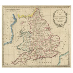
- Antique Map of England, Also Showing CalaisLocated in Langweer, NLAntique map titled 'Carte de l'Angleterre pour le Voyage dans les trois Royaumes'. Original old map of England, also showing Calais. This map originates from 'Voyage dans les trois r...Category
Antique Late 18th Century Maps
MaterialsPaper
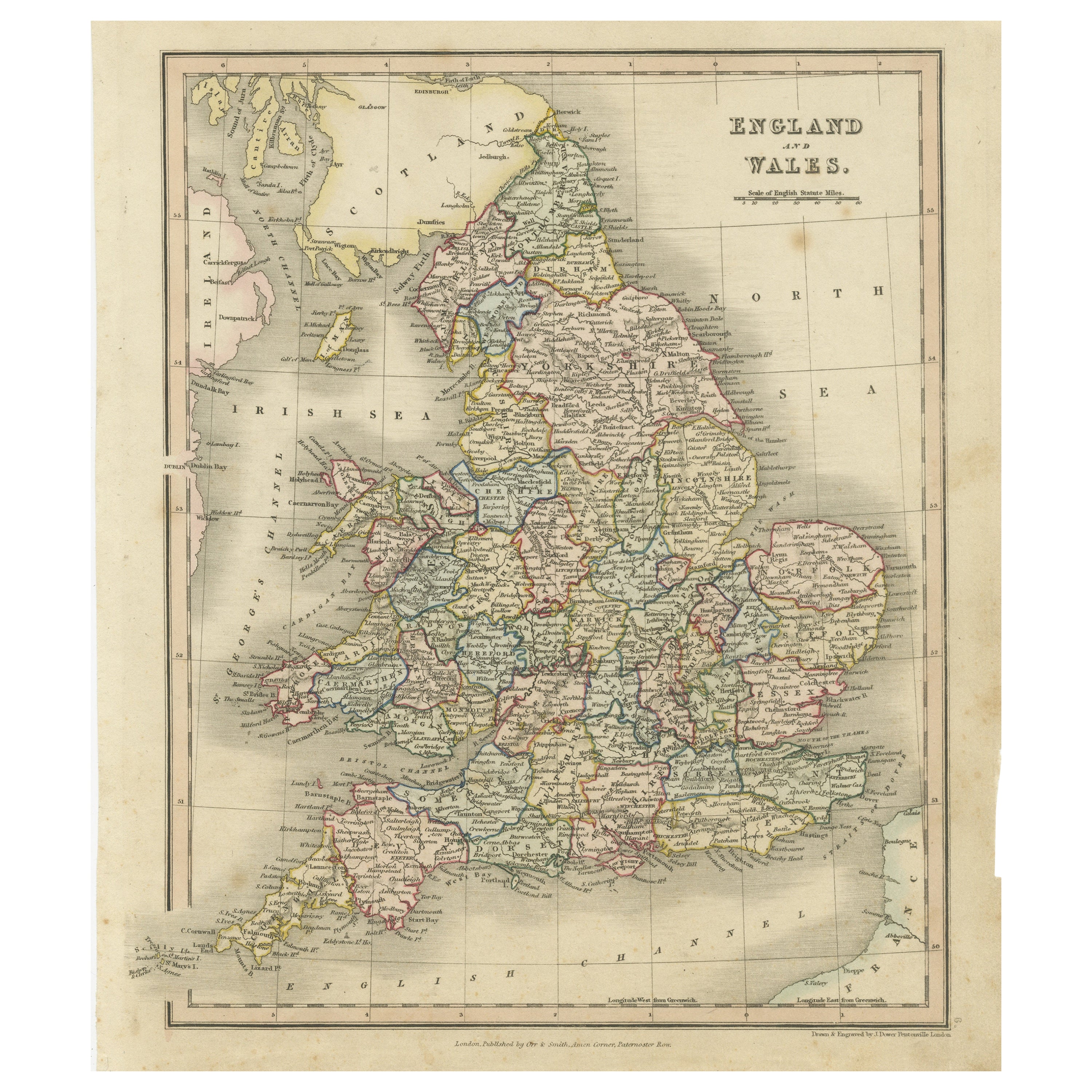
- Antique Map of England and Wales, Also Showing the English ChannelLocated in Langweer, NLAntique map titled 'England and Wales'. Original antique map of England and Wales. Drawn and engraved by J. Dower. Originates from 'A General Descriptive Atlas Of The Earth, Containi...Category
Antique Mid-19th Century Maps
MaterialsPaper
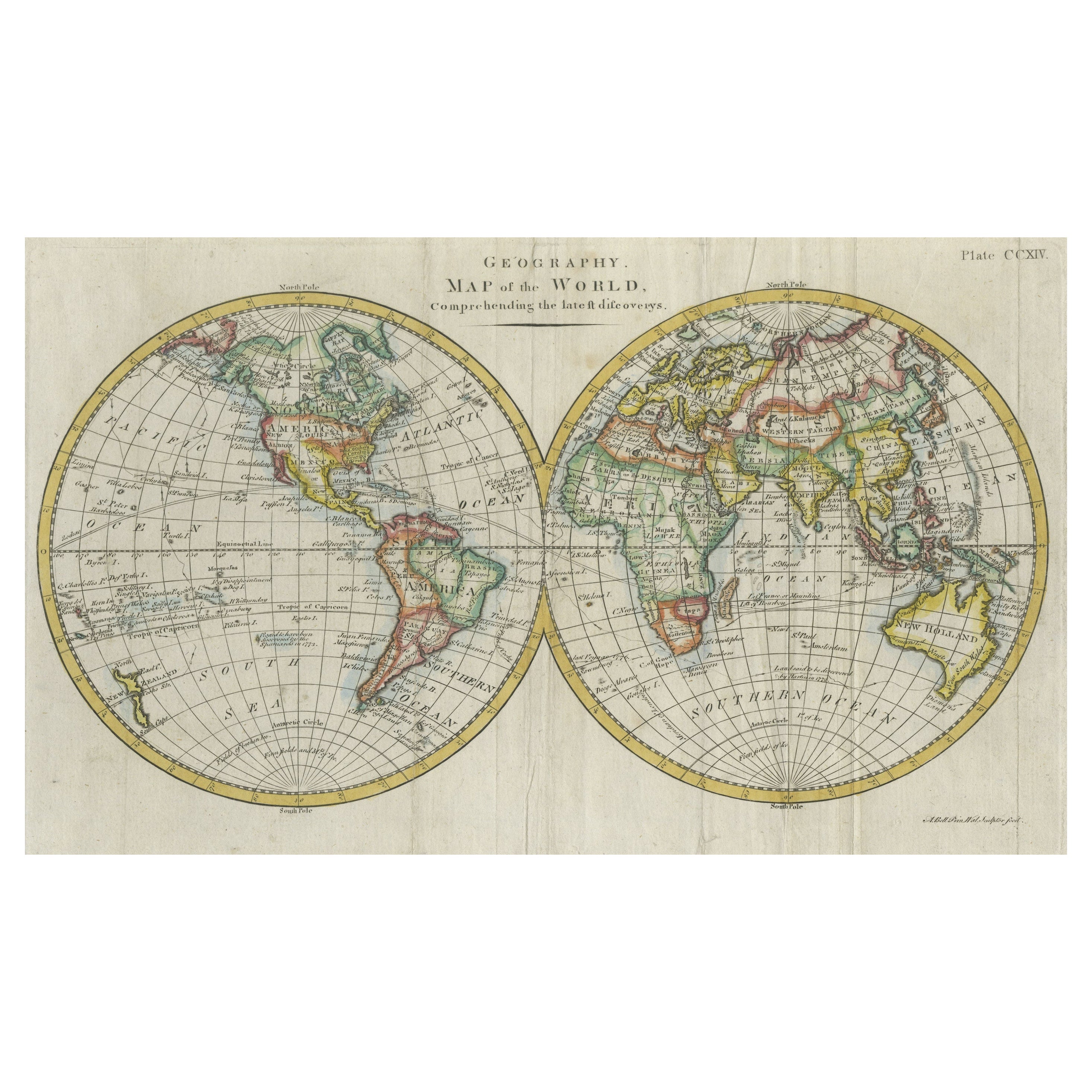
- Interesting Original Antique Hemisphere Map Showing the Latest DiscoveriesLocated in Langweer, NLAntique world map titled 'A Map of the World from the best Authorities'. Detailed map of the World, showing tracks of Captain James Cook in his 3 voyages in great detail. The map is ...Category
Antique Late 18th Century Maps
MaterialsPaper
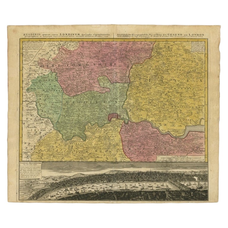
- Antique Map of London Showing the Area from Essex to Surrey, England, 1741Located in Langweer, NLAntique map titled 'Regionis quae est circa Londinum specialis repraesentatio (..)' Very detailed map showing the area from Essex to Surrey and shows a lovely view of London with a high level of detail, stretching from Old London Bridge...Category
Antique 18th Century Maps
MaterialsPaper
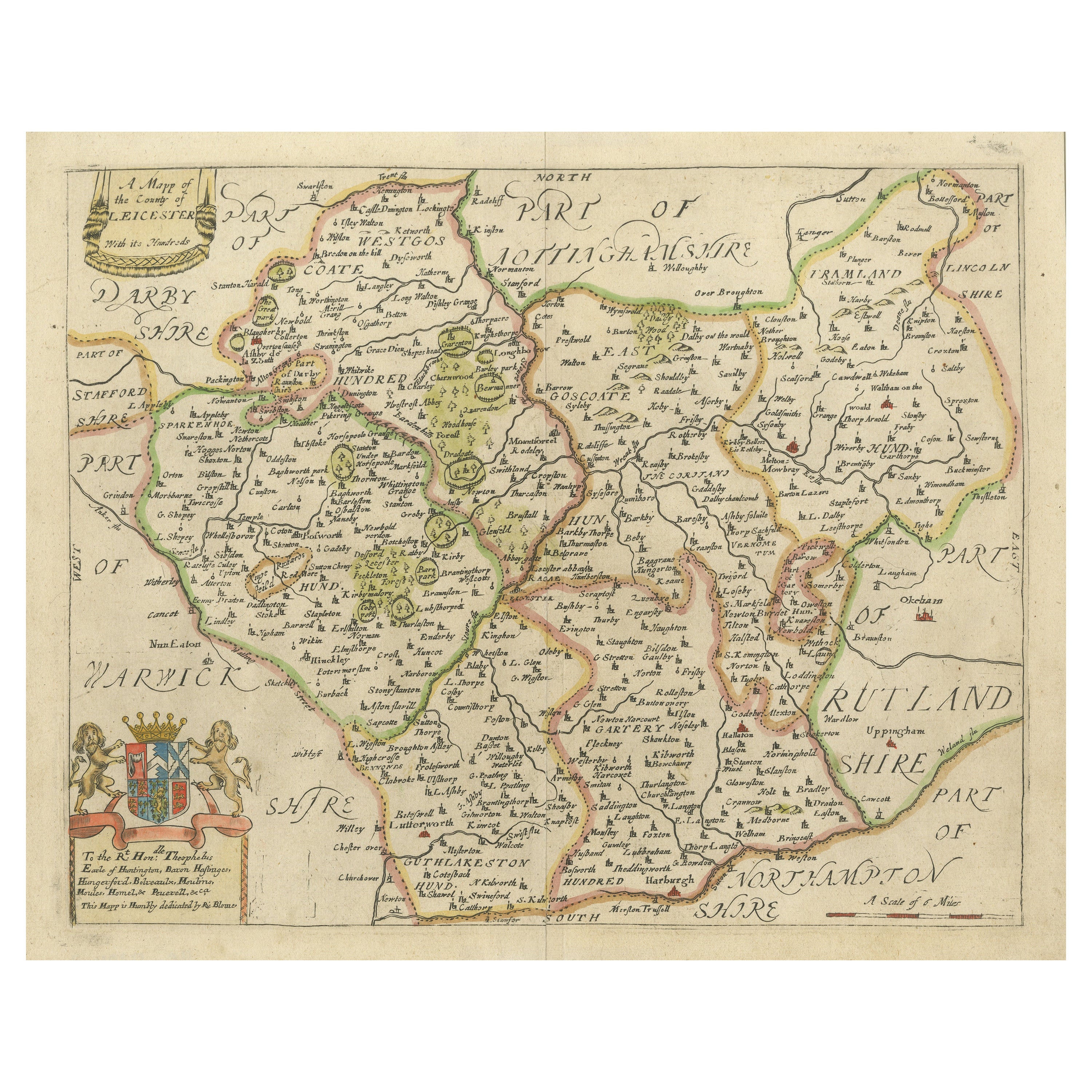
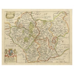
- Original Antique Map of Leicestershire, EnglandLocated in Langweer, NLAntique map titled 'A Mapp of the Country of Leicester'. Original old map of Leicestershire, England. This map originates from 'Britannia: or, a Geographical Description of the Kingd...Category
Antique Late 17th Century Maps
MaterialsPaper
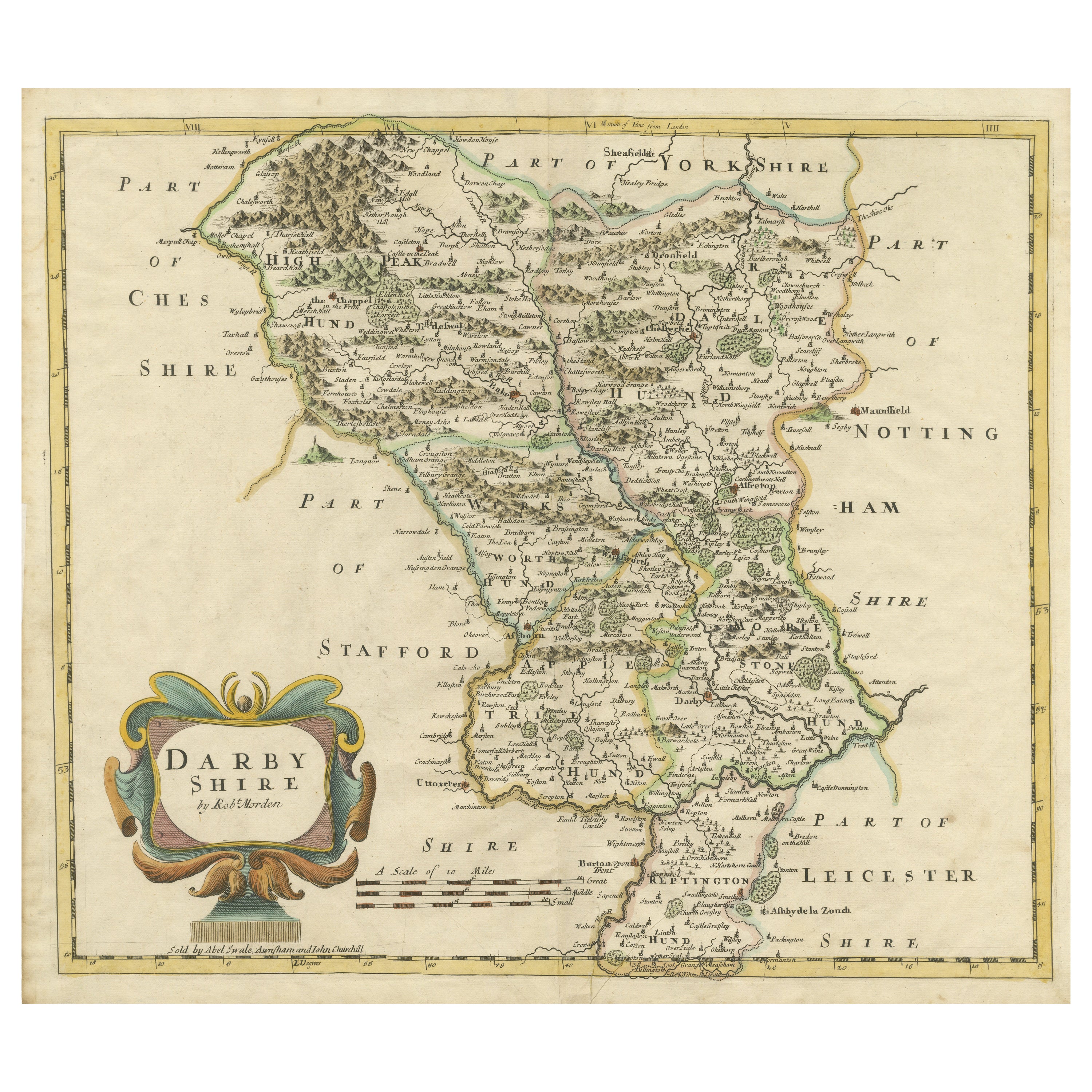
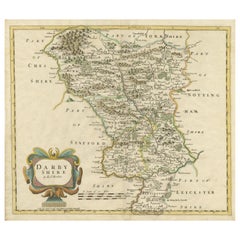
- Original Antique County Map of Derbyshire, EnglandLocated in Langweer, NLAntique map titled 'Darbyshire'. Original antique map of the country of Derbyshire, England. Engraved by Robert Morden. Sold by Abel Swale, Awnsham and John Churchill...Category
Antique Late 17th Century Maps
MaterialsPaper


You May Also Like
- Old Horizontal Map of EnglandBy TassoLocated in Alessandria, PiemonteST/520 - Old rare Italian map of England, dated 1826-1827 - by Girolamo Tasso, editor in Venise, for the atlas of M.r Le-Sage.Category
Antique Early 19th Century Italian Other Prints
MaterialsPaper
- Original Antique Map of Asia. C.1780Located in St Annes, LancashireGreat map of Asia Copper-plate engraving Published C.1780 Two small worm holes to right side of map Unframed.Category
Antique Early 1800s English Georgian Maps
MaterialsPaper

- Original Antique Map of Italy. C.1780Located in St Annes, LancashireGreat map of Italy Copper-plate engraving Published C.1780 Unframed.Category
Antique Early 1800s English Georgian Maps
MaterialsPaper

- Original Antique Map of India. C.1780Located in St Annes, LancashireGreat map of India Copper-plate engraving Published C.1780 Three small worm holes to right side of map and one bottom left corner Unframed.Category
Antique Early 1800s English Georgian Maps
MaterialsPaper

- Original Antique Map of The World by Thomas Clerk, 1817Located in St Annes, LancashireGreat map of The Eastern and Western Hemispheres On 2 sheets Copper-plate engraving Drawn and engraved by Thomas Clerk, Edinburgh. Published by Mackenzie And Dent, 1817 ...Category
Antique 1810s English Maps
MaterialsPaper
- Original Antique Map of The Netherlands, Engraved by Barlow, Dated 1807Located in St Annes, LancashireGreat map of Netherlands Copper-plate engraving by Barlow Published by Brightly & Kinnersly, Bungay, Suffolk. Dated 1807 Unframed.Category
Antique Early 1800s English Maps
MaterialsPaper


Recently Viewed
View AllMore Ways To Browse
18th Century Scottish Furniture
Antique Genealogy
Antique Genealogy Chart
Ipswich Antique Furniture
Antique Compass Made In France
Antique Maps Of Texas
Antique Maps Of Venice Italy
Mississippi Map
Used Office Furniture Cornwall
Yorkshire Map
Antique Alaska Maps
Antique Copper Australia
Antique Iranian Map
Antique Map New South Wales
Antique Newfoundland Canada
Bush Antiques
Canadian Atlas Furniture
Harley Antique