Items Similar to Original Antique Map of England and Wales from the 1909 Royal Atlas


Want more images or videos?
Request additional images or videos from the seller
1 of 5
Original Antique Map of England and Wales from the 1909 Royal Atlas
About the Item
The antique map titled 'England and Wales' is a historical cartographic representation of these two nations. This original antique map of England and Wales is sourced from the 'Royal Atlas of Modern Geography,' which was published by W. & A.K. Johnston in the year 1909.
**Key Aspects of the Map:**
1. **Geographical Coverage**: The map provides a comprehensive view of the geography and topography of England and Wales, two distinct countries within the United Kingdom. It includes details of cities, towns, rivers, mountains, and coastlines.
2. **Historical Context**: Published in 1909, this map reflects the political and geographical landscape of England and Wales during the early 20th century. It is a valuable reference for understanding the boundaries and administrative divisions of the time.
3. **Publisher**: The 'Royal Atlas of Modern Geography' by W. & A.K. Johnston was known for its accuracy and detail. Maps from this atlas are esteemed for their cartographic quality.
4. **Educational Value**: Antique maps like this one are valuable educational tools, offering historical insights into the geography, cartography, and political divisions of the era.
5. **Cartographic Style**: The map's cartographic style adheres to the standards of mapmaking in the early 20th century, with a focus on precision and clarity. It likely includes a legend to help interpret the map's symbols and features.
6. **Administrative Boundaries**: The map may depict county boundaries, administrative regions, and major transportation routes, providing a comprehensive view of the political and logistical structure of England and Wales.
7. **Historical Place Names**: Antique maps often feature historical place names, shedding light on the nomenclature and historical significance of various locations.
8. **Geographical Features**: Details such as mountain ranges, rivers, lakes, and coastal features are likely included, offering a comprehensive view of the natural landmarks of the region.
Overall, the 'England and Wales' antique map is a valuable historical document, providing insights into the geographical and political characteristics of these two nations within the United Kingdom during the early 20th century. It serves as a valuable resource for historians, geographers, and those interested in the history and geography of England and Wales.
- Dimensions:Height: 19.49 in (49.5 cm)Width: 24.41 in (62 cm)Depth: 0.02 in (0.5 mm)
- Materials and Techniques:
- Period:
- Date of Manufacture:1909
- Condition:Minor fading. General age-related toning, some foxing. Please study image carefully.
- Seller Location:Langweer, NL
- Reference Number:Seller: BG-12940-51stDibs: LU3054324702522
About the Seller
5.0
Platinum Seller
These expertly vetted sellers are 1stDibs' most experienced sellers and are rated highest by our customers.
Established in 2009
1stDibs seller since 2017
1,960 sales on 1stDibs
Typical response time: <1 hour
- ShippingRetrieving quote...Ships From: Langweer, Netherlands
- Return PolicyA return for this item may be initiated within 14 days of delivery.
Auctions on 1stDibs
Our timed auctions are an opportunity to bid on extraordinary design. We do not charge a Buyer's Premium and shipping is facilitated by 1stDibs and/or the seller. Plus, all auction purchases are covered by our comprehensive Buyer Protection. Learn More
More From This SellerView All
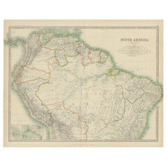
- Exploring South America's North: Antique Map from the Royal Atlas of 1909Located in Langweer, NLThe antique map titled 'South America, Northern Sheet' is a historical cartographic representation of the northern part of South America. This original antique map features inset map...Category
Early 20th Century Maps
MaterialsPaper
- Original Antique Map of England and WalesLocated in Langweer, NLAntique map titled 'A New and Correct Map of England and Wales from the Latest and Best Improvements'. Original antique map of England and Wales. Printed by Alex Hogg, London for George Henry Millar's 'New, Complete and Universal System...Category
Antique Late 18th Century Maps
MaterialsPaper
- Original Antique Map of England, Ireland, Scotland and WalesLocated in Langweer, NLAntique map titled 'Les Isles Britanniques, ou sont les Royaumes d Angleterre (..)'. Detailed map of England, Ireland, Scotland and Wales, with French coast and part of the Netherlan...Category
Antique Early 18th Century Maps
MaterialsPaper
- Large Antique Map of England and WalesLocated in Langweer, NLAntique map titled 'An Accurate Map of England and Wales'. Original old map of England and Wales. Engraved by John Cary. Originates from 'New British Atlas' by John Stockdale, publis...Category
Antique Early 19th Century Maps
MaterialsPaper
- Lithographed Antique Map of England and WalesLocated in Langweer, NLOriginal antique map titled 'Map XXIII England & Wales'. Lithographed map of England and Wales. Published by Fisk & See, circa 1890.Category
Antique Late 19th Century Maps
MaterialsPaper
- Miniature Antique Map of England and WalesLocated in Langweer, NLMiniature map titled 'England & Wales'. Original antique map of England & Wales. This map originates from 'Darton's New Miniature Atlas' publis...Category
Antique Early 19th Century Maps
MaterialsPaper


You May Also Like
- Old Horizontal Map of EnglandBy TassoLocated in Alessandria, PiemonteST/520 - Old rare Italian map of England, dated 1826-1827 - by Girolamo Tasso, editor in Venise, for the atlas of M.r Le-Sage.Category
Antique Early 19th Century Italian Other Prints
MaterialsPaper
- Original Antique Map of Italy. Arrowsmith. 1820Located in St Annes, LancashireGreat map of Italy Drawn under the direction of Arrowsmith Copper-plate engraving Published by Longman, Hurst, Rees, Orme and Brown, 1820 Unframed.Category
Antique 1820s English Maps
MaterialsPaper
- Hampshire County, Britain/England: A Map from Camden's" Britannia" in 1607By John NordenLocated in Alamo, CAAn early hand-colored map of Britain's Hampshire county, published in the 1607 edition of William Camden's great historical description of the British Isles, "Britannia". This map was drawn by cartographer John Norden (c. 1547-1625) and engraved by William Hole (active 1607-1624) and William Kip...Category
Antique Early 17th Century English Maps
MaterialsPaper
- Original Antique Map of Russia By Arrowsmith. 1820Located in St Annes, LancashireGreat map of Russia Drawn under the direction of Arrowsmith Copper-plate engraving Published by Longman, Hurst, Rees, Orme and Brown, 1820 Unframed.Category
Antique 1820s English Maps
MaterialsPaper
- New Map of North America from the Latest Discoveries, 1763Located in Philadelphia, PAA fine antique 18th century map of the North American seaboard. Entitled "A New Map of North America from the Latest Discoveries 1763". By the Cartographer/Engraver - John Spil...Category
Antique Mid-18th Century English Georgian Maps
MaterialsPaper
- Vintage "View of the Center of Paris Taken from the Air" Lithograph MapLocated in San Diego, CAA very stylish "View of the Center of Paris Taken from the Air" lithograph map published by the Paris Ministry of Tourism, circa early 1950s. The piece measures 27" x 43" and shows...Category
20th Century French Mid-Century Modern Prints
MaterialsPaper


Recently Viewed
View AllMore Ways To Browse
Wales And Wales Furniture
Royal Standard
Antique Furniture Wales
Route Map
Atlas 5
Map Of United Kingdom
Antique Mountain Maps
Coastal Maps
Antique Maps Wales
Antique Maps Of Wales
Antique Maps Book
Map Globe
Antique English Maps
Antique Maps Of Asia
Route Map
Map Of India
Antique Furniture Edinburgh
American West Antiques