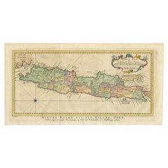
Items Similar to Rare Small Map of Sumatra, Java, Borneo, Macassar, Madura, Bali, 1614


Want more images or videos?
Request additional images or videos from the seller
1 of 7
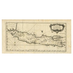
Rare Small Map of Sumatra, Java, Borneo, Macassar, Madura, Bali, 1614
About the Item
One of the first maps of the Indonesia islands of Java, Bali, Sumbawa etc. in early days of the Dutch Indies. Also showing Banten, Jakarta (Jacatra), Indragiri, Barus Tiku, Palembang, Indramayu, Tegal, Jepara, Kota agung, Bima, Makassar (Celebes/Sulawesi).
From the Johan Isaac Pontanus & J. Hondius edition of 1614 - 'Historische beschrijvinghe der seer wijt beroemde coop-stadt Amsterdam'- which includes the text of the first voyage around the Cape to the East Indies (including a visit to Madagascar), the fight against the Portuguese on Bantam (West Java), description of Java, etc.
creator: Anoniem / Anonymous(engraver / etcher), Lodewijcksz, Willem(copied after)
period: 1614
material: paper
technique: engraving
inscriptiion: Iauva Insula / Samatra Insula / Borneo Insula / Miliaria Germanica quoru 15 uni gradui respondent Anoniem / Anonymous
measurements sheet: 9.5 x 7 inch ( 24x18 cm)
measurement map: 5.1 x 3.5 inch ( 13x9 cm )
The condition of the small map is very good, Dutch text on verso of the leaf. The area around the map has water damage. Study the image of the larger leaf carefully.
- Dimensions:Height: 7.09 in (18 cm)Width: 9.45 in (24 cm)Depth: 0 in (0.02 mm)
- Materials and Techniques:
- Period:Early 17th Century
- Date of Manufacture:1614
- Condition:
- Seller Location:Langweer, NL
- Reference Number:
About the Seller
5.0
Platinum Seller
These expertly vetted sellers are 1stDibs' most experienced sellers and are rated highest by our customers.
Established in 2009
1stDibs seller since 2017
1,974 sales on 1stDibs
Typical response time: <1 hour
- ShippingRetrieving quote...Ships From: Langweer, Netherlands
- Return PolicyA return for this item may be initiated within 14 days of delivery.
More From This SellerView All
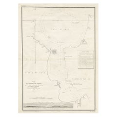
- Antique Map of Singapore, Malaysia, Borneo, Sumatra and Java (Indonesia), 1739Located in Langweer, NL"Antique map titled 'Nieuwe kaart van de Sundasche Eilanden als Borneo, Sumatra en Groot Iava & c'. Detailed map of Southeast Asia, extending from the tip of Cambodia to Java. This m...Category
Antique 18th Century Maps
MaterialsPaper
- Antique Map of the Sunda Islands Sumatra, Java, Malay Peninsula & Borneo (1739)By Isaak TirionLocated in Langweer, NLAntique map titled 'Nieuwe kaart van de Sundasche Eilanden als Borneo, Sumatra en Groot Iava & c'. Detailed map of the Sunda Islands, Southeast Asia, extending from the tip of Cambod...Category
Antique Mid-18th Century Maps
MaterialsPaper
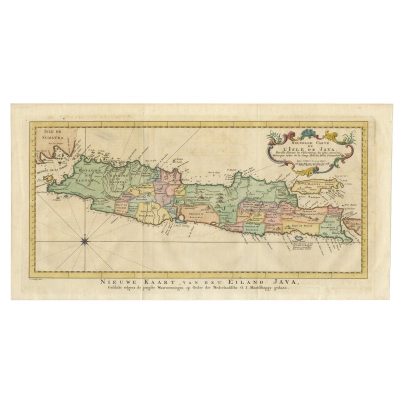
- Antique Map of Java, Madura, Bali and the Sunda Strait, Indonesia, c.1770Located in Langweer, NLAntique map Indonesia titled 'Nouvelle Carte de l'Isle de Java - Nieuwe kaart, van het Eiland Java'. Chart of the island of Java, depicting soun...Category
Antique 18th Century Maps
MaterialsPaper
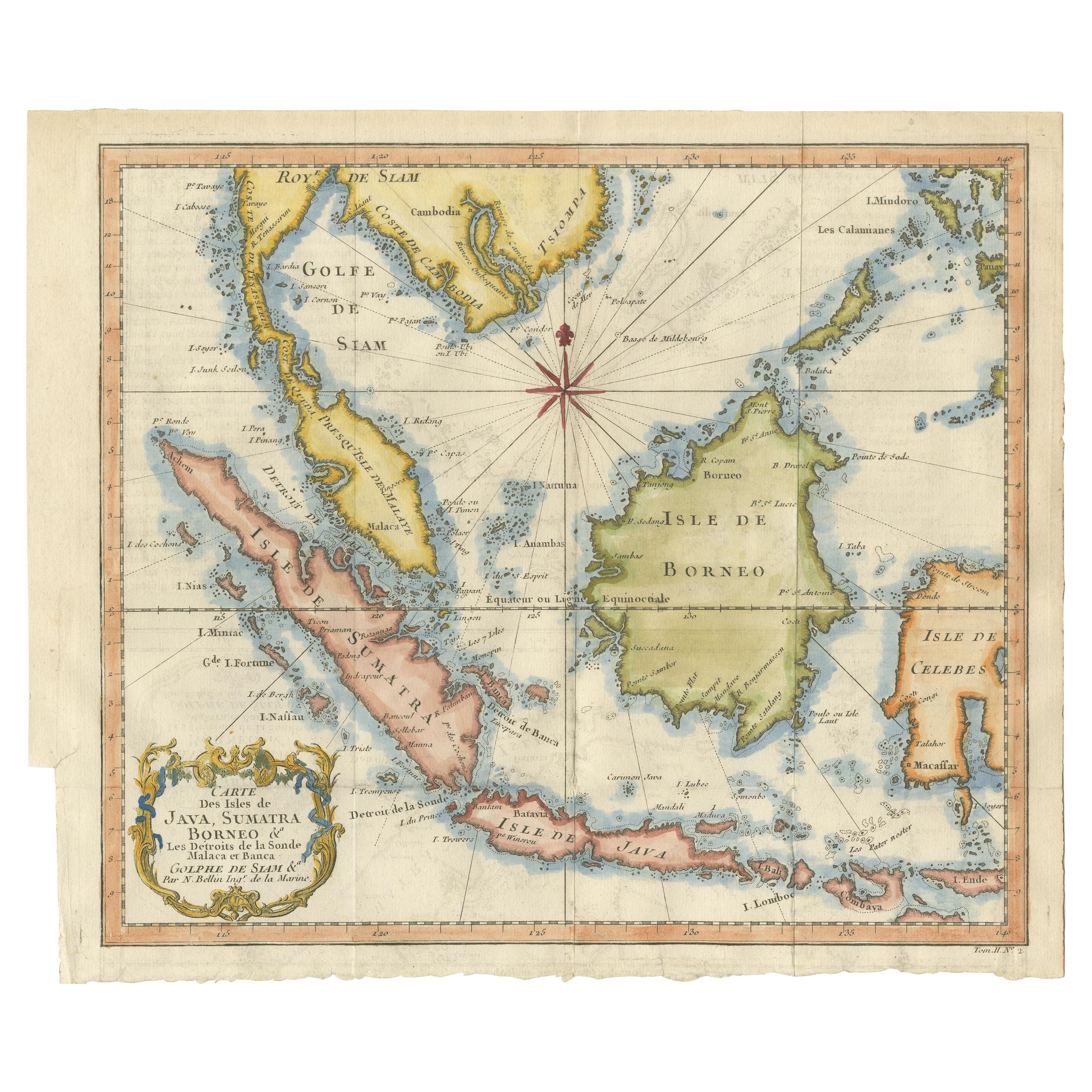
- Antique Engraving of Malaysia, Brunei, Singapore, Java, Borneo, Sumatra, c.1750Located in Langweer, NLNice decorative and detailed map from the Gulf of Siam and Mindoro to Timo, Java and Sumatra Borneo and Roy de Siam. Large compass rose and nice cartouche. Title: Carte des Isles ...Category
Antique Mid-18th Century Maps
MaterialsPaper
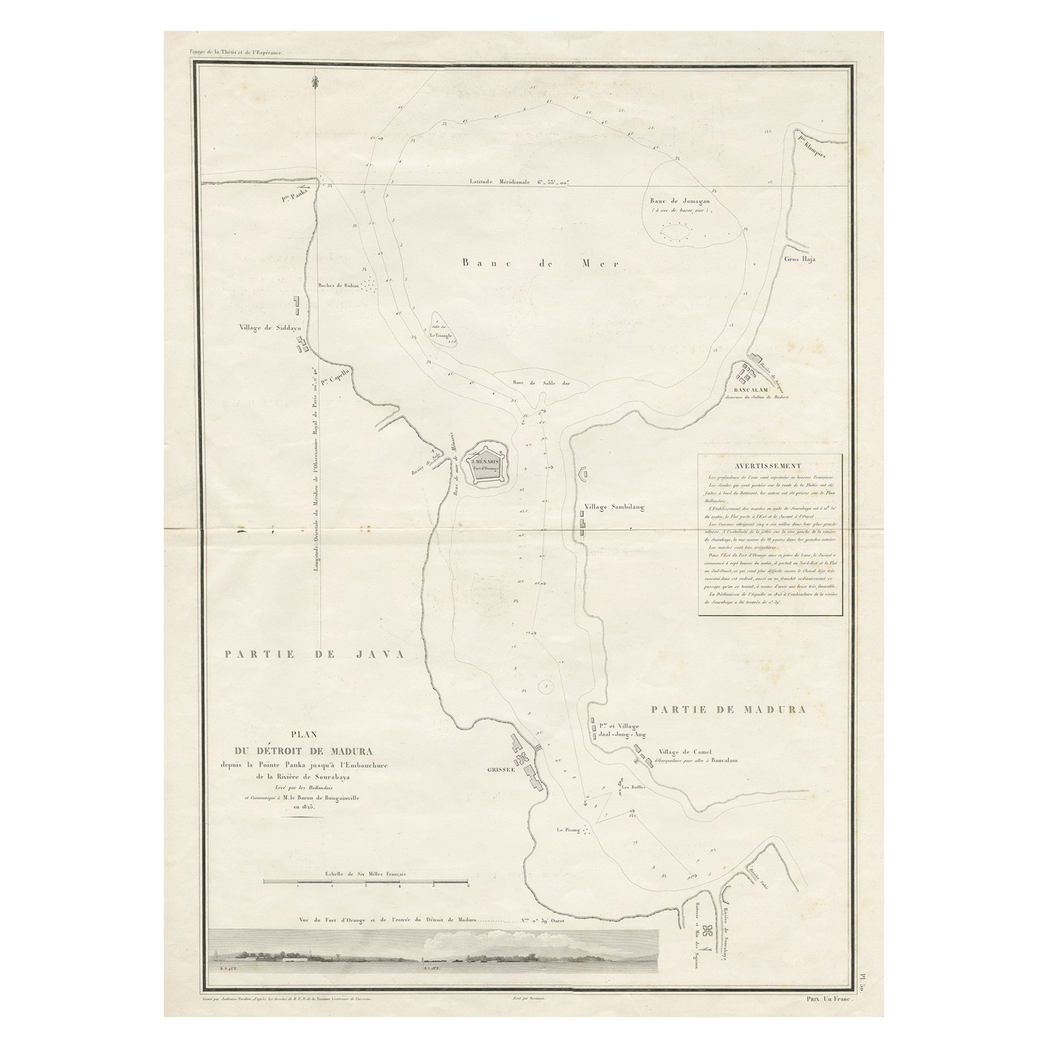
- Detailed Map of the Madura Strait, between Java & Madura Island, Indonesia, 1825Located in Langweer, NLAntique map titled 'Plan du Détroit de Madura'. Detailed map of the Madura Strait in Indonesia. The eastern part of the island Java with the city of Gresik and the western part o...Category
Antique 1820s Maps
MaterialsPaper
- Antique Map of Java and Madura Island, Indonesia, c.1760Located in Langweer, NLAntique map titled 'Idee de l'Isle de Java.' Well engraved and attractive chart of the island shows all principal harbors and coastal details, plus rivers, mountains and volcanoe...Category
Antique 18th Century Maps
MaterialsPaper


You May Also Like
- Large Original Antique Map of Java and Borneo, Fullarton, C.1870Located in St Annes, LancashireGreat map of Java and Borneo Wonderful figurative borders From the celebrated Royal Illustrated Atlas Lithograph. Original color. Published by Fullarton, Edinburgh. C.1870 Unfr...Category
Antique 1870s Scottish Maps
MaterialsPaper
- Antique Map of Principality of MonacoBy Antonio Vallardi EditoreLocated in Alessandria, PiemonteST/619 - "Old Geographical Atlas of Italy - Topographic map of ex-Principality of Monaco" - ediz Vallardi - Milano - A somewhat special edition ---Category
Antique Late 19th Century Italian Other Prints
MaterialsPaper
- Map of the Republic of GenoaLocated in New York, NYFramed antique hand-coloured map of the Republic of Genoa including the duchies of Mantua, Modena, and Parma. Europe, late 18th century. Dimension: 25...Category
Antique Late 18th Century European Maps
- Old Nautical Map of CorsicaLocated in Alessandria, PiemonteST/556/1 - Old map of Corsica isle, surveyed by Captain Hell, of the French Royal Navy in 1824, engraved and published on 1874, with additions and corre...Category
Antique Early 19th Century English Other Prints
MaterialsPaper
- Old Horizontal Map of EnglandBy TassoLocated in Alessandria, PiemonteST/520 - Old rare Italian map of England, dated 1826-1827 - by Girolamo Tasso, editor in Venise, for the atlas of M.r Le-Sage.Category
Antique Early 19th Century Italian Other Prints
MaterialsPaper
- Map "Estuary- Mouth of the Thames"Located in Alessandria, PiemonteST/426 - Antique French Map of the estuary of the Thames, map dated 1769 - "Mape of the entrance of the Thames. Designed by filing of Navy cards fo...Category
Antique Mid-18th Century French Other Prints
MaterialsPaper


