Items Similar to Religious Antique Map of the Twelve Tribes of Israel, circa 1750

Want more images or videos?
Request additional images or videos from the seller
1 of 6
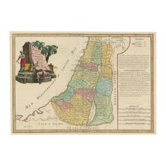
Religious Antique Map of the Twelve Tribes of Israel, circa 1750
About the Item
Antique map titled 'Palaestina in XII. Tribus (..)'. Large map of the Holy Land, published by the Homann Heirs for the Maior Atlas Superiore following the cartography of the theologian Johann Christoph Harenberg. The map divides the region into the territories of the Twelve Tribes of Israel, as well as featuring the neighbouring kingdoms and nations of Egypt, the Edomites, the Nabataeans, the Moabites, the Ammonites, Syria, and the Arabian Desert. The territory of each of the twelve sons of Jacob is presented in full hand colour, and mountains, rivers, and lakes are shown pictorially. In the top left corner of the map, a large inset map on a scroll shows the division of Palestine into its biblical kingdoms. The title of the map is enclosed in a decorative baroque cartouche in the bottom right corner, while a banner in the top right features a lengthy dedication to Charles William Ferdinand, Duke of Brunswick. Published circa 1750.
- Dimensions:Height: 20.32 in (51.6 cm)Width: 25.04 in (63.6 cm)Depth: 0.02 in (0.5 mm)
- Materials and Techniques:Paper,Engraved
- Period:
- Date of Manufacture:c.1750
- Condition:Repaired: Left margin extended. Original/contemporary hand coloring. Left margin extended. Shows a few tiny defects affecting image. Large staining, sl affecting image. Some wear and soiling. Blank verso. Please study image carefully.
- Seller Location:Langweer, NL
- Reference Number:
About the Seller
5.0
Platinum Seller
These expertly vetted sellers are 1stDibs' most experienced sellers and are rated highest by our customers.
Established in 2009
1stDibs seller since 2017
1,965 sales on 1stDibs
Typical response time: <1 hour
- ShippingRetrieving quote...Ships From: Langweer, Netherlands
- Return PolicyA return for this item may be initiated within 14 days of delivery.
More From This SellerView All
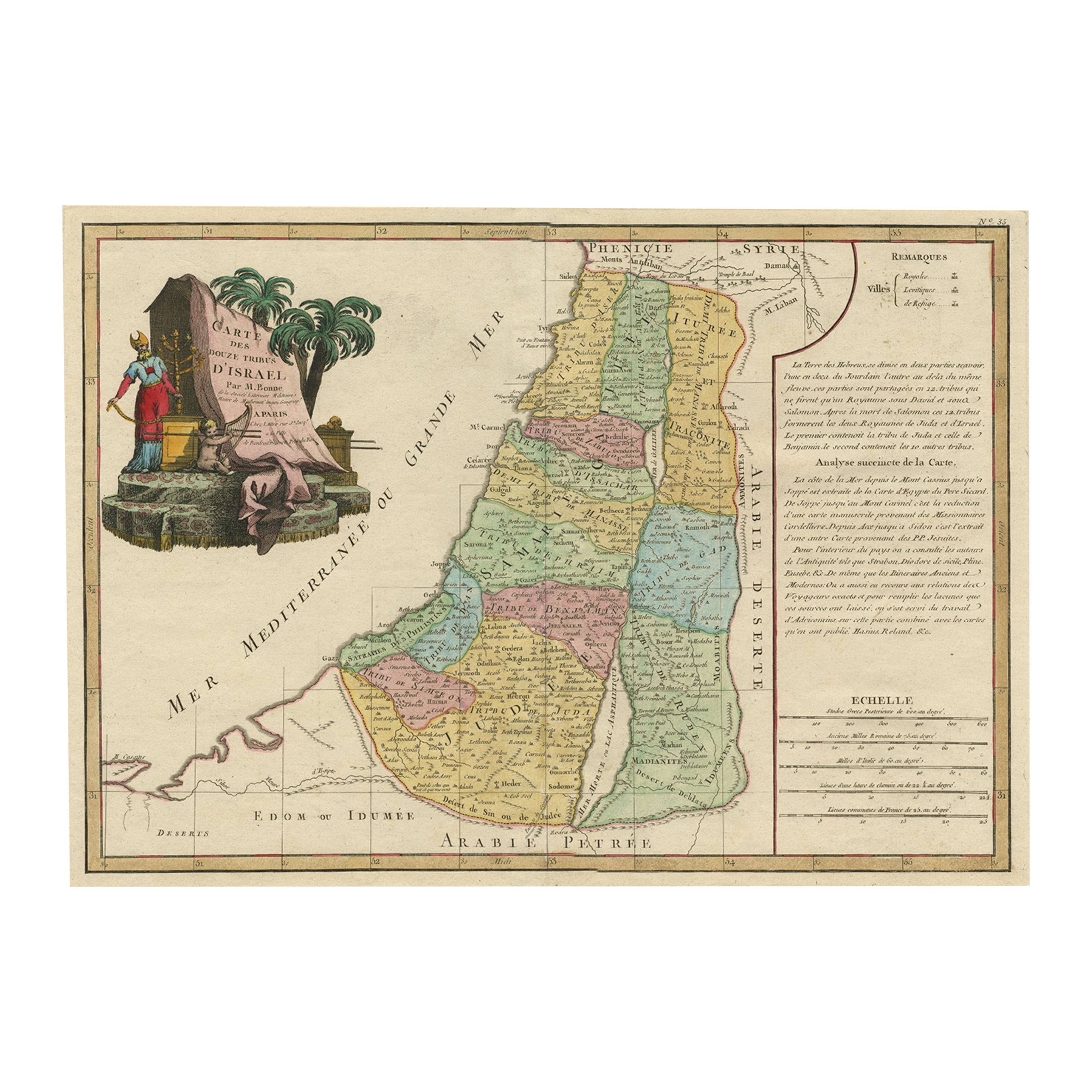
- Original Rare Map of the Holy Land Showing the Twelve Tribes of Israel's, 1782Located in Langweer, NLAntique map titled 'Carte des Douze Tribus D'Israel (..).' Map of the Holy Land showing the twelve tribes of Israel's. Tribes are all named...Category
Antique 1780s Maps
MaterialsPaper
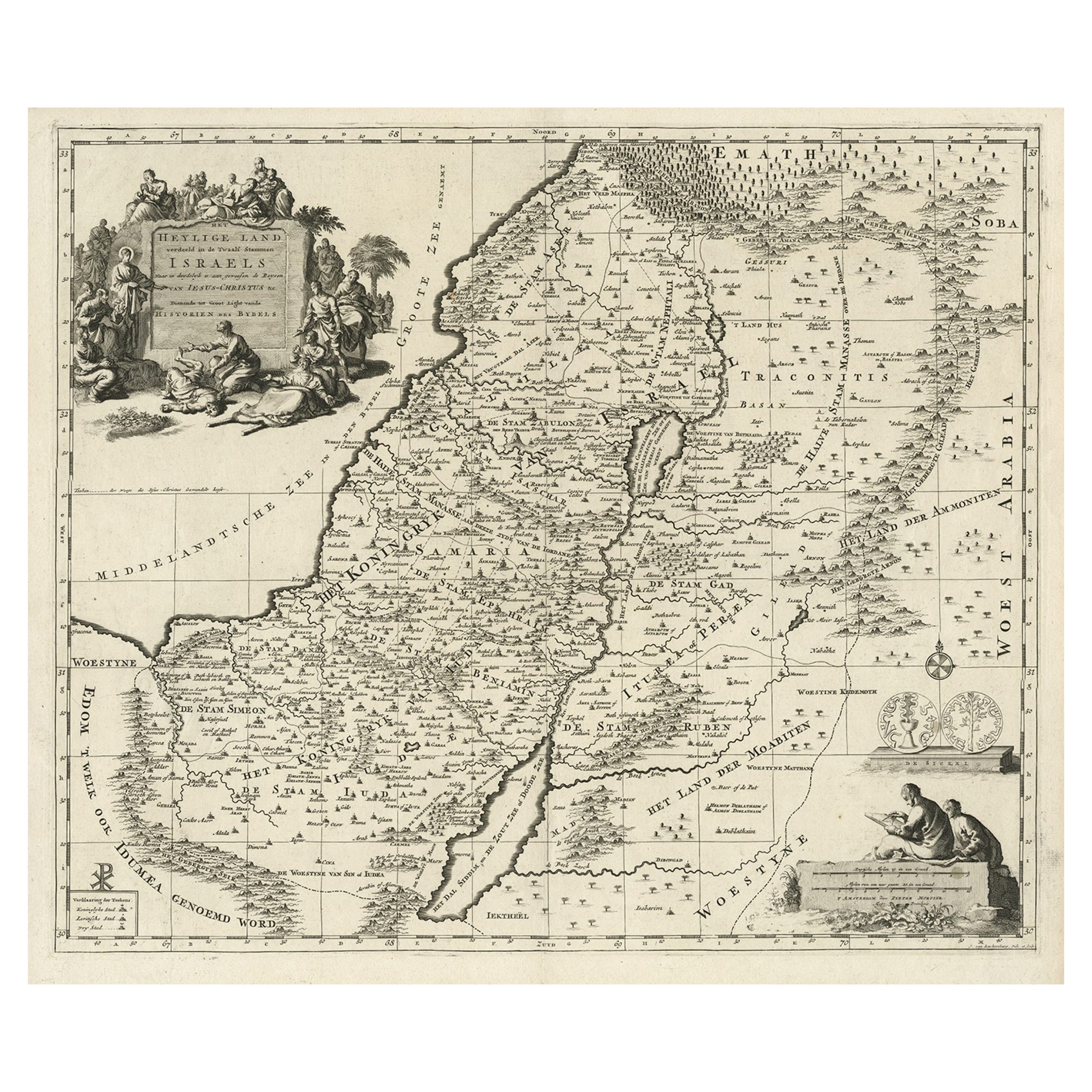
- Highly Detailed Antique Map of the Holy Land Showing 12 Tribes of Israel, c.1720Located in Langweer, NLAntique map titled 'Heylige Land verdeeld in de Twaalf Stammen Israels (..).' Highly detailed map of the Holy Land divided into 12 tribes of Israel...Category
Antique 1720s Maps
MaterialsPaper
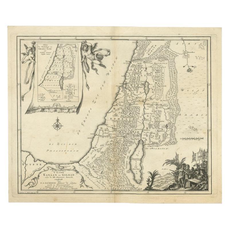
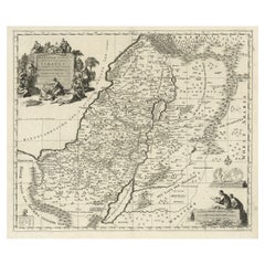
- Antique Map of Biblical Palestine with Inset of Israel's 12 Tribes, 1758Located in Langweer, NLAntique map titled 'De IIIde Landkaart 't land Kanaan en Gilead onder de XII stammen Israëls verdeelt.' Map of biblical Palestine. Inset map of the land of Israel divided in 12 tribes...Category
Antique 18th Century Maps
MaterialsPaper
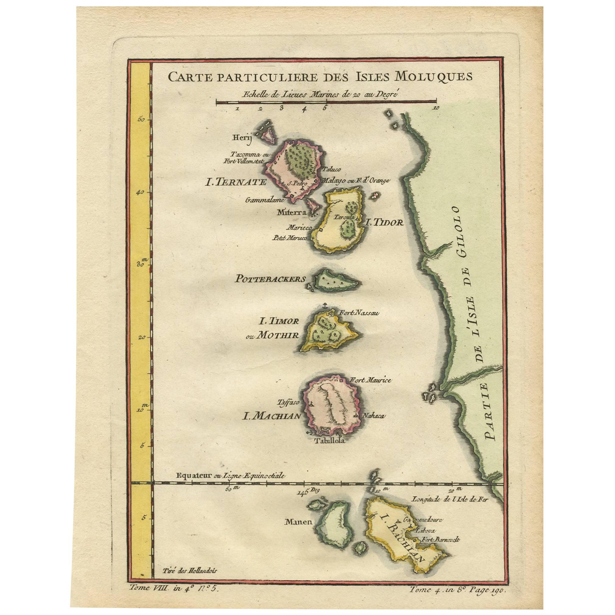
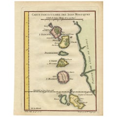
- Antique Map of the Moluques Islands, Part of Indonesia, circa 1750Located in Langweer, NLMap of the Moluques (also known as the Moluccas, Moluccan Islands or simply Maluku). Depicts the islands of Herij, Ternate, Tidor, Pottebackers, Timor, Machian and Bachian.Category
Antique Mid-18th Century Maps
MaterialsPaper
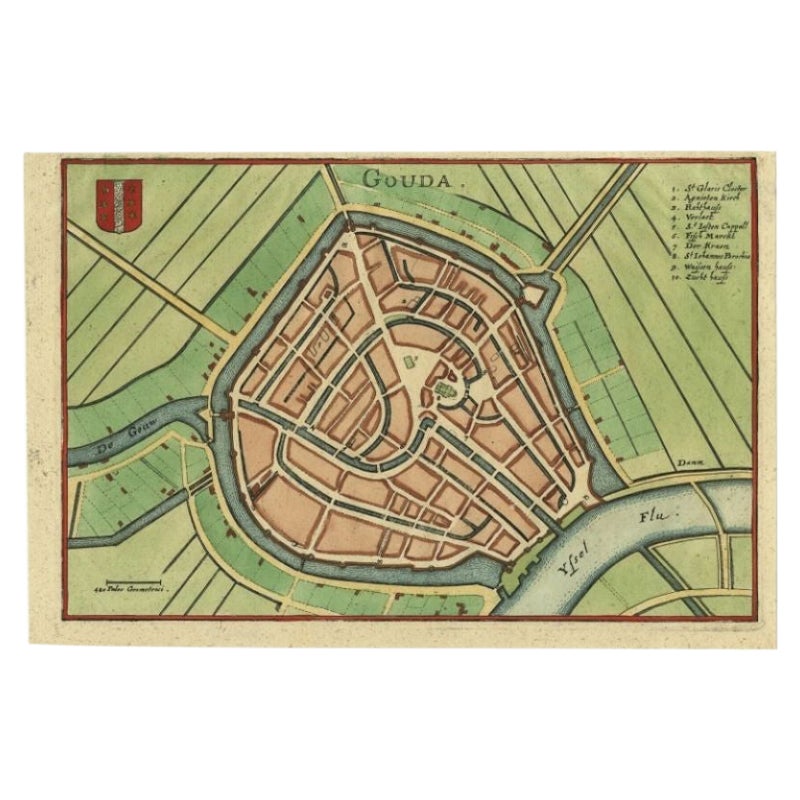
- Antique Map of the City of Gouda, c.1750Located in Langweer, NLAntique map titled 'Gouda' Plan of Gouda, the Netherlands. With coat of arms and key. Source unknown, to be determined. Artists and Engravers: Anonymous. Condition: Very good, ...Category
Antique 18th Century Maps
MaterialsPaper
- Antique Map of Pomerania by Schenk, circa 1750Located in Langweer, NLThe "Ducatus Pomeraniae" is a historical map depicting the Duchy of Pomerania, a region that straddles the modern border between northeastern Germany and Poland. Crafted with ornamen...Category
Antique Mid-18th Century Maps
MaterialsPaper


You May Also Like
- Large Original Vintage Map of Israel, circa 1920Located in St Annes, LancashireGreat map of Israel Original color. Good condition Published by Alexander Gross Unframed.Category
Vintage 1920s English Edwardian Maps
MaterialsPaper
- Original Antique Map of The United States of America, circa 1890Located in St Annes, LancashireGreat map of the USA By The Stanford's Geographical Establishment Original colour Unframed.Category
Antique 1890s English Victorian Maps
MaterialsPaper
- Large Original Antique Map of the World, Fullarton, circa 1870Located in St Annes, LancashireGreat map of the World. From the celebrated Royal Illustrated Atlas Lithograph. Original color. Published by Fullarton, Edinburgh, circa 1870. Unframed.Category
Antique 1870s Scottish Maps
MaterialsPaper
- Large Original Antique Map of the Environs of Cork, Ireland, circa 1880Located in St Annes, LancashireGreat map of The Environs of Cork Published circa 1880 Unframed Free shipping.Category
Antique 1880s Scottish Maps
MaterialsPaper
- Large Original Antique Map of The Environs of Dublin, Ireland, circa 1880Located in St Annes, LancashireGreat map of The Environs of Dublin Published circa 1880 Unframed Free shipping.Category
Antique 1880s Scottish Maps
MaterialsPaper
- Original Antique Map of Cyprus. Circa 1880Located in St Annes, LancashireGreat map of Cyprus Drawn and Engraved by R.Walker Published W.Mackenzie, London Original colour Unframed.Category
Antique 1880s English Maps
MaterialsPaper


Recently Viewed
View AllMore Ways To Browse
Circa 1750
Pictorial Map
Palestine Antique
Antique Furniture Israel
Jacob May
Large Banner
Brunswick Antique
Egyptian Scroll
Egyptian Cartouche
Used Furniture Lake Charles
Antique Furniture Brunswick
Scroll Map
Large Ammonite
Arabian Syrian
Map Of Palestine
Palestine Map
Antique Map Palestine
Antique Religious Banner