Items Similar to Antique Portrait of Zachary Taylor, the 12th President of the United States


Want more images or videos?
Request additional images or videos from the seller
1 of 6
Antique Portrait of Zachary Taylor, the 12th President of the United States
About the Item
Antique print titled 'Maj. Gen. Zachary Taylor'. Old portrait of Zachary Taylor. Zachary Taylor (November 24, 1784 – July 9, 1850) was the 12th president of the United States, serving from March 1849 until his death in July 1850. This print originates from 'The national portrait gallery of distinguished Americans'.
Artists and Engravers: Engraved by T.B. Welch.
Condition: Very good, general age-related toning. Please study image carefully.
Date: c.1865
Overall Size: 17.7 x 26.2 cm.
Image Size: 10 x 11.8 cm.
We sell original antique maps to collectors, historians, educators and interior decorators all over the world. Our collection includes a wide range of authentic antique maps from the 16th to the 20th centuries. Buying and collecting antique maps is a tradition that goes back hundreds of years. Antique maps have proved a richly rewarding investment over the past decade, thanks to a growing appreciation of their unique historical appeal. Today the decorative qualities of antique maps are widely recognized by interior designers who appreciate their beauty and design flexibility. Depending on the individual map, presentation, and context, a rare or antique map can be modern, traditional, abstract, figurative, serious or whimsical. We offer a wide range of authentic antique maps for any budget.
- Dimensions:Height: 10.32 in (26.2 cm)Width: 6.97 in (17.7 cm)Depth: 0 in (0.01 mm)
- Materials and Techniques:
- Period:
- Date of Manufacture:circa 1865
- Condition:Condition: Very good, general age-related toning. Please study image carefully.
- Seller Location:Langweer, NL
- Reference Number:
About the Seller
5.0
Platinum Seller
These expertly vetted sellers are 1stDibs' most experienced sellers and are rated highest by our customers.
Established in 2009
1stDibs seller since 2017
1,974 sales on 1stDibs
Typical response time: <1 hour
- ShippingRetrieving quote...Ships From: Langweer, Netherlands
- Return PolicyA return for this item may be initiated within 14 days of delivery.
More From This SellerView All
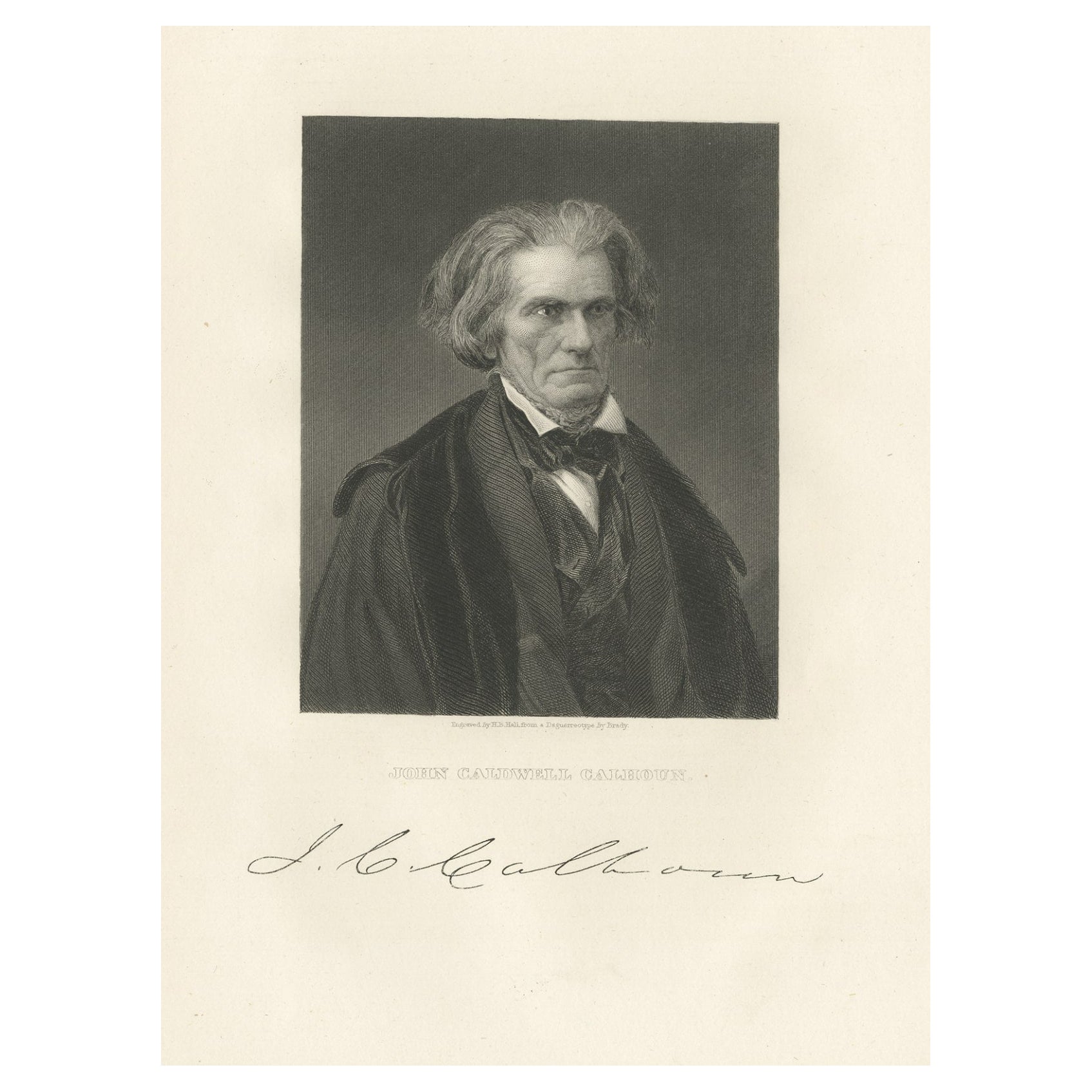
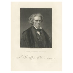
- Old Portrait of John C. Calhoun, 7th Vice President of the United States, c.1865Located in Langweer, NLAntique print titled 'John Caldwell Calhoun'. Old portrait of John C. Calhoun. John Caldwell Calhoun was an American statesman from the Democratic party...Category
Antique 1860s Prints
MaterialsPaper
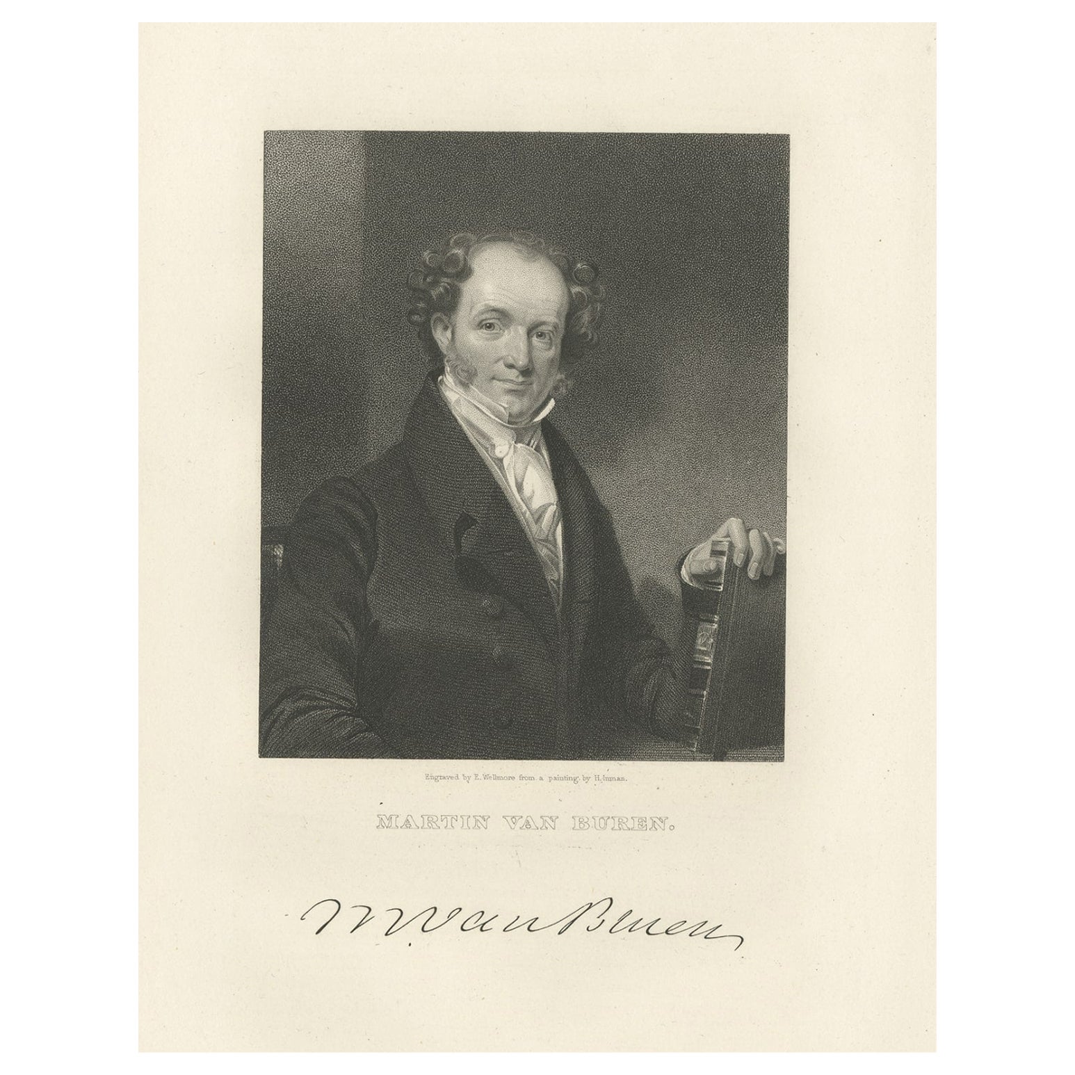
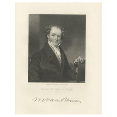
- Old Print of the 8th President of the United States Martin van Buren, ca.1865Located in Langweer, NLAntique print titled 'Martin van Buren'. Old portrait of Martin van Buren. Martin Van Buren was an American statesman who served as the eighth preside...Category
Antique 1860s Prints
MaterialsPaper
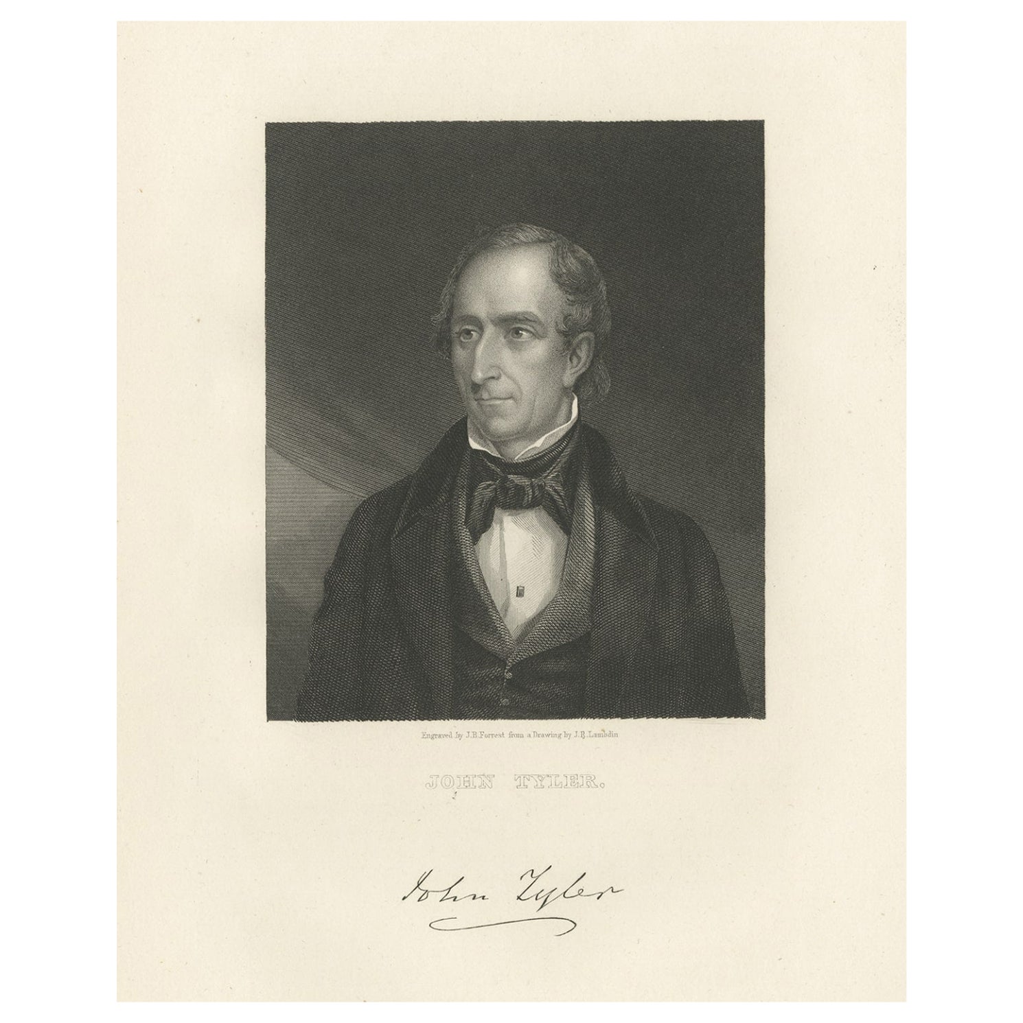
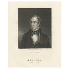
- Old Print of John Tyler, the Tenth President of the United States, ca.1865Located in Langweer, NLAntique print titled 'John Tyler'. Old portrait of John Tyler. John Tyler was the tenth president of the United States from 1841 to 1845 after briefly serving as the tenth vice president in 1841; he was elected to the latter office on the 1840 Whig ticket with President William Henry Harrison...Category
Antique 1860s Prints
MaterialsPaper
- Small Map of the United StatesLocated in Langweer, NLAntique map titled 'Amérique septe. Physique'. Small map of the United States. lithographed by C. Callewaert brothers in Brussels circa 1870.Category
Antique Mid-19th Century Maps
MaterialsPaper
- Antique Map of the United States by Lowry, '1852'Located in Langweer, NLAntique map titled 'United States'. Four individual sheets of the United States. This map originates from 'Lowry's Table Atlas constructed and engraved from the most recent Authoriti...Category
Antique Mid-19th Century Maps
MaterialsPaper
- Antique Map of the United States by Titus '1871'Located in Langweer, NLAntique map titled 'The United States of America'. Original antique map of the United States. This map originates from 'Atlas of Prebl...Category
Antique Late 19th Century Maps
MaterialsPaper


You May Also Like
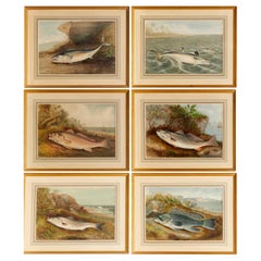
- S. A. Kilbourne "Game Fishes of the United States" 4 Framed ChromolithographsLocated in Morristown, NJAfter Samuel A. Kilbourne (American, 1836-1881), "Game Fishes of the United States", uniformly matted and framed under glass. Clockwise from upper left, The Kingfish and The Whitin...Category
Vintage 1970s American American Classical Prints
MaterialsGlass, Wood, Paper
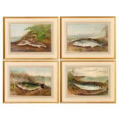
- S. A. Kilbourne "Game Fishes of the United States" 6 Framed ChromolithographsLocated in Morristown, NJAfter Samuel A. Kilbourne (American, 1836-1881), "Game Fishes of the United States", uniformly matted and framed under glass. Clockwise from upper left, The Mackerel, The Spanish M...Category
Vintage 1970s American American Classical Prints
MaterialsGlass, Wood, Paper
- N.E. View of the United States Capitol, Washington, DC Antique Proof Print 1858Located in Colorado Springs, COThis engraved print shows a view of the United States Capitol Building, in Washington, D.C. The print depicts the neoclassical building from the northeast orientation, with a bustling street scene in front. The steel engraving is a proof printing, drawn and engraved by Henry Sartain and published in 1858. Plans began in May 1854 to build a new cast-iron dome for the United States Capitol. The then-architect of the Capitol Thomas Walter and his team were sold on the aesthetics of a new dome, as well as the utility of a fire-proof one. A year later, on March 3, 1855, President Franklin Pierce...Category
Antique 1850s American Prints
MaterialsPaper
- Original Antique Map of United States, Grattan and Gilbert, 1843Located in St Annes, LancashireGreat map of United States Drawn and engraved by Archer Published by Grattan and Gilbert. 1843 Original colour Unframed.Category
Antique 1840s English Maps
MaterialsPaper
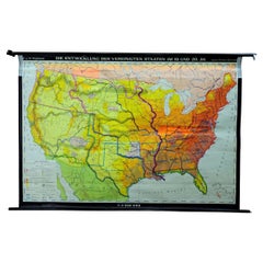
- Vintage Mural Map United States Development in the 19th and 20th centuriesLocated in Berghuelen, DEA fantastic pull-down wall chart depicting a map of the development of the United States in the 19th and 20th centuries. Used as teaching material in German schools. Colorful print on paper reinforced with canvas. Published by Justus Perthes, Darmstadt. Measurements: Width 194cm (76-38 inch) Height 134cm (52.76 inch) The measurements shown refer just to the canvas and do not include the poles. Background information on the history of school wall charts: The idea to upgrade every day school life by using pictures was supported in the late 18th century by Johann Bernhard Basedow. In 1774 he published a four-volume book "Elementarwerk" which combined pictures, text and information with merely hundred copperplates. Modern printing methods enabled the spread from rich private schools to rural grade schools. From 1820-1836 the oldest mentioned series of wall charts were published with the range of six booklets including 63 large sized charts...Category
Vintage 1970s German Country Prints
MaterialsCanvas, Wood, Paper
- Anna Condo, Mangosteens, Photograph, United States, 2020By Anna CondoLocated in New York, NYAnna Condo, a filmmaker and a photographer born in Armenia and raised in France, has been photographing flowers, primarily, her "ultimate muse," since 2013. This framed photograph of...Category
2010s American Photography
MaterialsPaper


Recently Viewed
View AllMore Ways To Browse
Antique American 19th Century Portrait
1850 Portrait American
Wheat Motif
Woodard Wrought Iron Patio Furniture
Woodard Wrought Iron Patio
Yellow Cabinet Italy
Alberto Giacometti Bronze
Antique And Vintage Woods Of America
Antique Burl Wood Cabinet
Antique China Cabinet Styles
Art Deco Wood Two Door Cabinet
Asian Wood Antique Panels
Claw Cabinet
Court Cabinet
Gold Gilt Cross
H Email
Long Bar Cabinet
Mid Century Herman Miller Desk