Items Similar to Antique Print of Kerguelens Island by Cook, C.1784
Want more images or videos?
Request additional images or videos from the seller
1 of 6
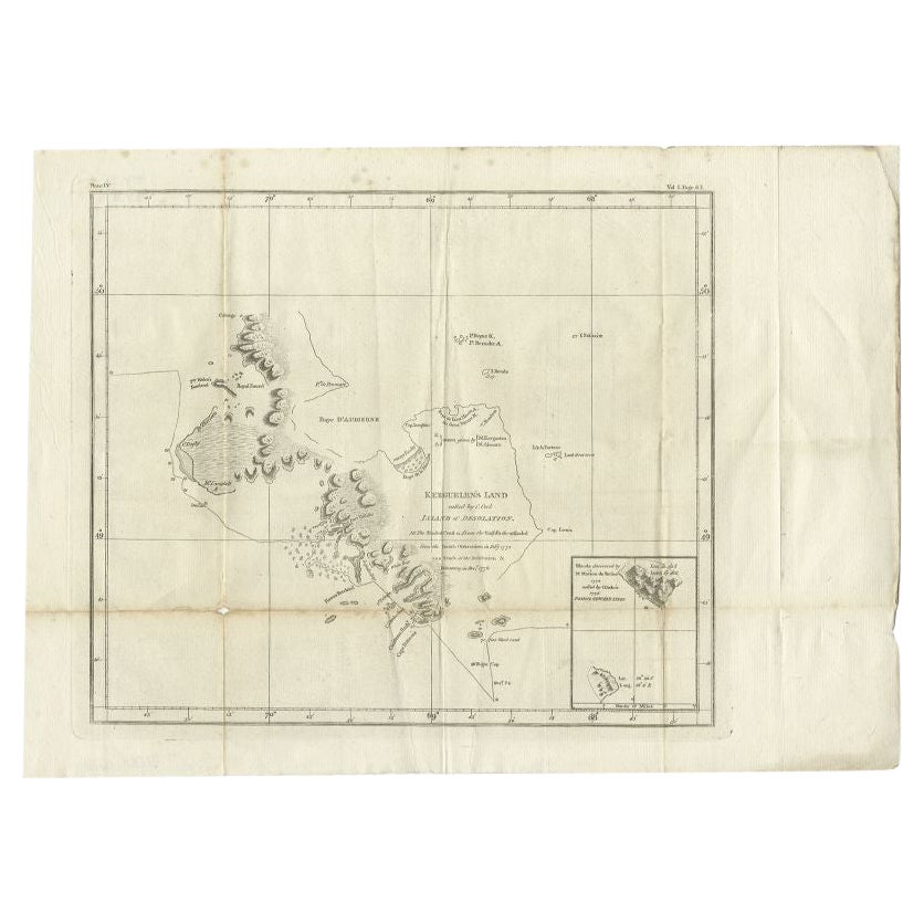
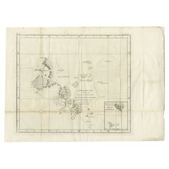
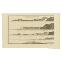
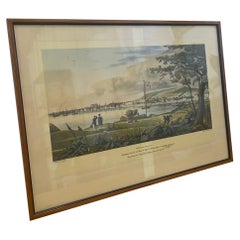
Antique Print of Kerguelens Island by Cook, C.1784
About the Item
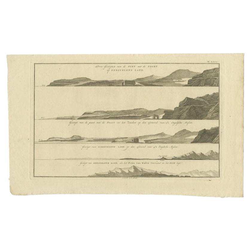
Antique print titled 'Three views of Arched Point (..)'. Four views of Kerguelens Island/Desolation Islands, discovered by the Frenchman Marion du Fresne in 1772 and visited by Cook in 1776. Originates from an edition of Cook's Voyages.
Artists and Engravers: James Cook (Author, 1728-1779) was a British captain, explorer and cartographer.
Condition: Good, some wear and age-related toning. Please study image carefully.
Date: c.1784
Overall size: 49 x 31 cm.
Image size: 39 x 26 cm.
Antique prints have long been appreciated for both their aesthetic and investment value. They were the product of engraved, etched or lithographed plates. These plates were handmade out of wood or metal, which required an incredible level of skill, patience and craftsmanship. Whether you have a house with Victorian furniture or more contemporary decor an old engraving can enhance your living space. We offer a wide range of authentic antique prints for any budget.
- Creator:James Cook (Author)
- Dimensions:Height: 12.21 in (31 cm)Width: 19.3 in (49 cm)Depth: 0 in (0.01 mm)
- Materials and Techniques:
- Period:
- Date of Manufacture:circa 1784
- Condition:Condition: Good, some wear and age-related toning. Please study image carefully.
- Seller Location:Langweer, NL
- Reference Number:
About the Seller
5.0
Platinum Seller
These expertly vetted sellers are 1stDibs' most experienced sellers and are rated highest by our customers.
Established in 2009
1stDibs seller since 2017
1,960 sales on 1stDibs
Typical response time: <1 hour
- ShippingRetrieving quote...Ships From: Langweer, Netherlands
- Return PolicyA return for this item may be initiated within 14 days of delivery.
More From This SellerView All
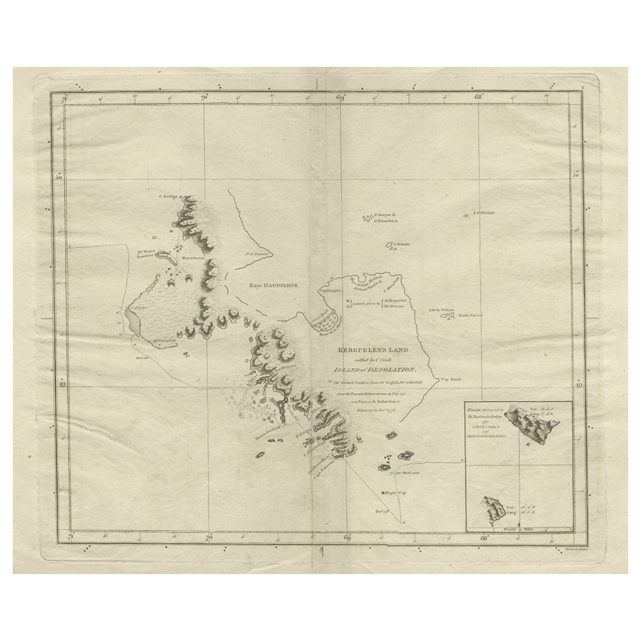
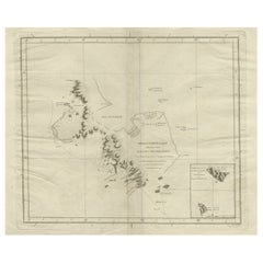
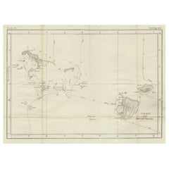
- Antique Map of Kerguelens Island Coast by Cook, 1784By James CookLocated in Langweer, NLAntique print titled 'Kerguelen's Land (..)'. Antique map of Kerguelens island coast, known today as the Desolation islands. Originates from 'A Voyage to the Pacific Ocean: Undertaken, by the Command of His Majesty, for Making Discoveries in the Northern Hemisphere (..)' published in Dublin. Artists and Engravers: James Cook...Category
Antique 18th Century Prints
MaterialsPaper
- Antique Map of Kerguelens Island Coast in the Indian Ocean by Cook, 1785By James CookLocated in Langweer, NLAntique print titled 'Kerguelen's Land (..)'. Antique map of Kerguelens island coast, known today as the Desolation islands. Originates from 'Voyage to the Pacific Ocean, undertaken ...Category
Antique 18th Century Prints
MaterialsPaper
- Antique Print with Views of Kerguelens Island by Cook, 1803Located in Langweer, NLAntique print Kerguelen Islands titled 'Drie gezichten van de punt met de poort op Kerguelens Land'. Four views of Kerguelens Island/Desolation Islands, discovered by the Frenchman M...Category
Antique 19th Century Prints
MaterialsPaper
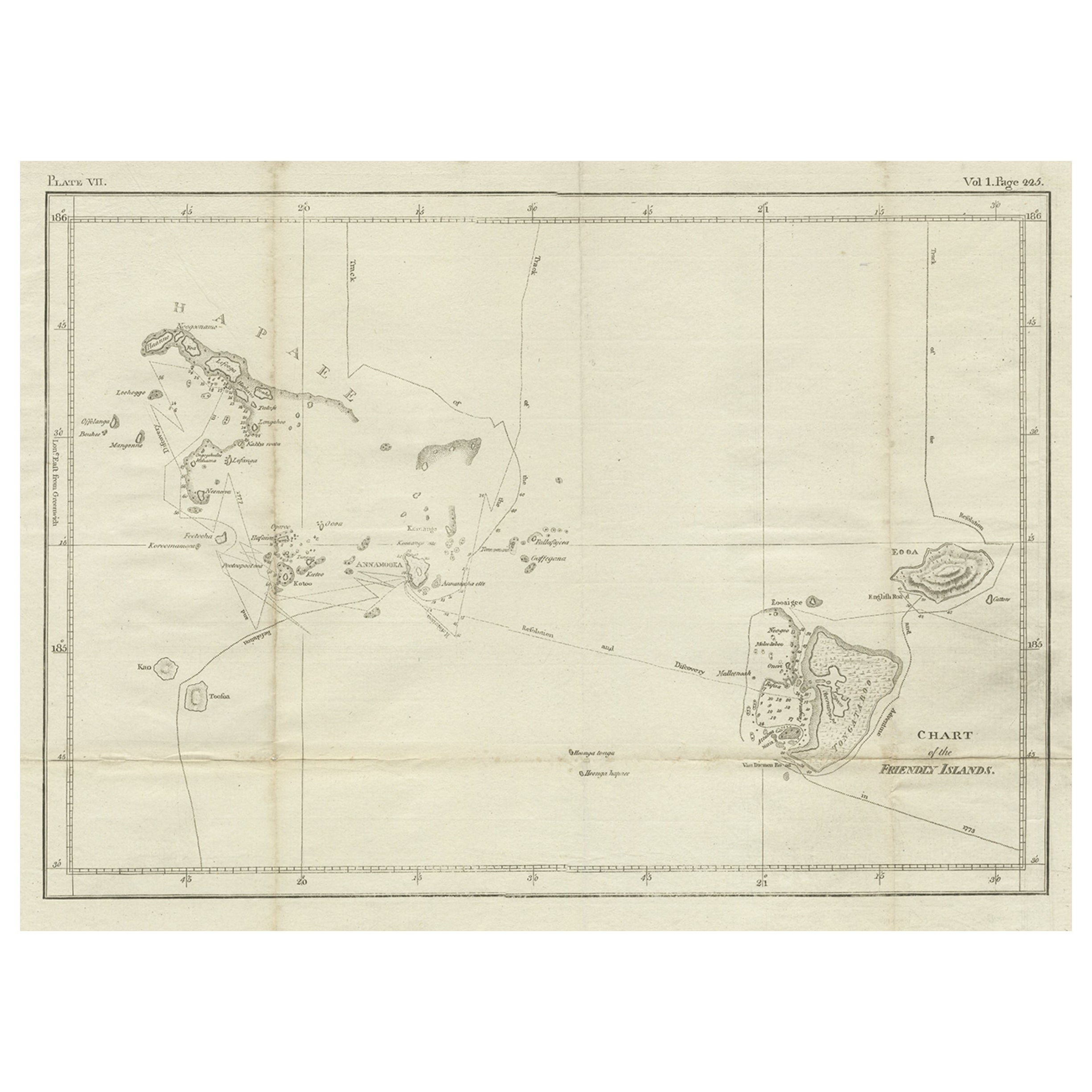
- Antique Chart of the Friendly Islands or Nowadays Tonga, by Cook, 1784By James CookLocated in Langweer, NLAntique print titled 'Chart of the Friendly Islands'. Antique map of the Friendly Islands depicting Rotterdam or Anamocka, Middelburg or Eaoowe and Amsterdam or Tongatabu. Originates...Category
Antique 18th Century Prints
MaterialsPaper
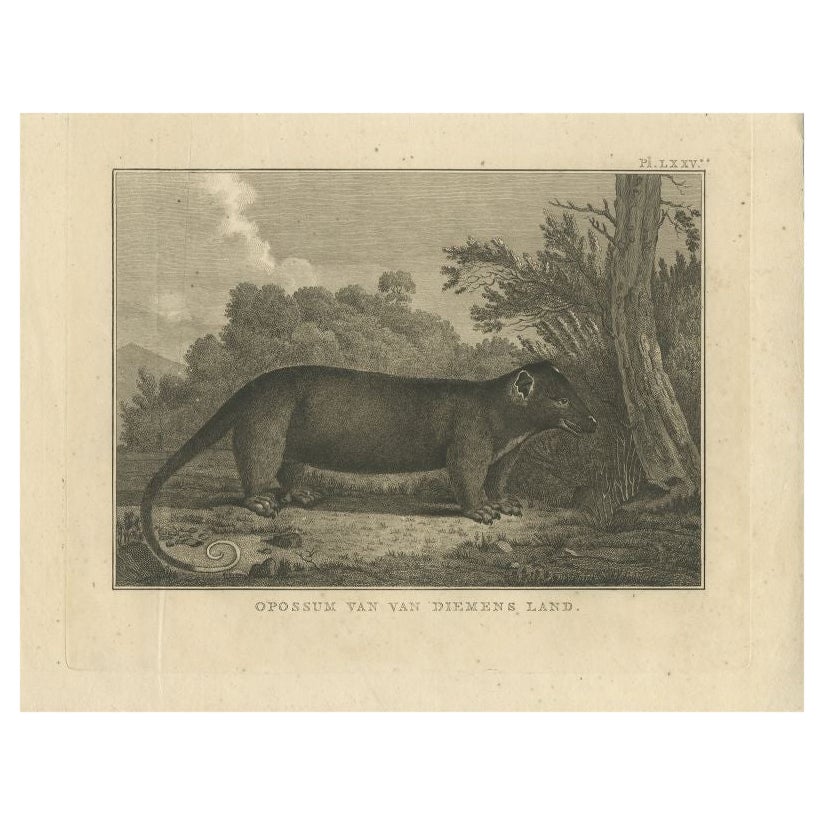
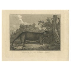
- Antique Print of an Opossum by Cook, 1803By James CookLocated in Langweer, NLAntique animal print titled 'Opossum van Van Diemens Land'. Old print depicting an Opossum of Van Diemen's Land. Originates from 'Reizen Rondom de Waereld door James Cook (..)'. ...Category
Antique 19th Century Prints
MaterialsPaper
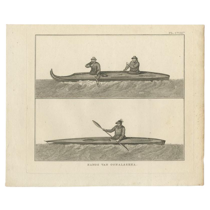
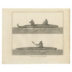
- Antique Print of Canoes of Unalaska by Cook, 1803By James CookLocated in Langweer, NLAntique print Alaska titled 'Kanos van Oonalashka'. Antique print depicting two canoes of Unalaska. Originates from 'Reizen Rondom de Waereld door James Cook (..)'. Artists and E...Category
Antique 19th Century Prints
MaterialsPaper
You May Also Like
- Set of 20 Original Antique Architectural Prints, A.G. Cook, circa 1820Located in St Annes, LancashireWonderful set of 20 architectural prints Copper-plate engravings by J. Carter after the original antique architectural drawings by Andrew George Cook. ...Category
Antique 1810s English Palladian Prints
MaterialsPaper
- Vintage Framed Scenic Print of Montreal St. Helens Island by J Gray.Located in Seattle, WADedication and information about this Print are included at the bottom of the frame. Two similar artwork are available through Separate listings. Vintage Condition Consistent with Ag...Category
Vintage 1970s Mid-Century Modern Prints
MaterialsWood
- Vintage Framed Print of Spain, Canary Islands and Portugal, FramedLocated in Miami, FLVintage Framed Print of Spain, Canary Islands and Portugal, Framed Offered for sale is a vintage framed print of a map of Spain, the Canary Islands, and Portugal. The maps show som...Category
20th Century European Prints
MaterialsWire
- Antique Map Long Island, Southold, Shelter Island, Orient, New YorkBy Beers Atlas Co.Located in Sag Harbor, NYAntique map of Long Island, Southold, Shelter Island, Orient, Great details, Names of homes, Roads and Businesses in 1870. Unframed. This is...Category
Antique Mid-19th Century American Early Victorian Prints
MaterialsPaper
- Couple Prints of Antique CarriagesBy Denis DiderotLocated in Alessandria, PiemonteST/530 - French Horsemanships 1774-1775 engravings by the famous Diderot & D'Alembert Encyclopedie - Paris - They are the only two engravings of carriages in the intere Encyclopedia,...Category
Antique Late 18th Century French Other Prints
MaterialsPaper
- Captain Cook's Exploration of Tahiti 18th C. Hand-Colored Map by BellinBy Jacques-Nicolas BellinLocated in Alamo, CAThis beautiful 18th century hand-colored copper plate engraved map is entitled "Carte de l'Isle de Taiti, par le Lieutenant J. Cook" was created by Jacques Nicolas Bellin and publish...Category
Antique Mid-18th Century French Maps
MaterialsPaper


Recently Viewed
View AllMore Ways To Browse
Arched Wall Decor
Mare Island
Hand Carved Chinese Cabinet
Herman Miller Chairs Eames Office
Japanese Lacquered Painting
Japanese Six Screen
Large Chinese Box
Mid Century Cabinet Highboy Storage
Retro King Headboard
Small Antique French Commodes
Tall Cabinet Teak
Used Exterior Wood Doors
Used Wood Exterior Doors
Vintage Patio Table
Vintage Tool Case
Vintage Walnut Headboard
Wavy Storage
Wood Dining Chairs 70s