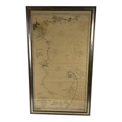
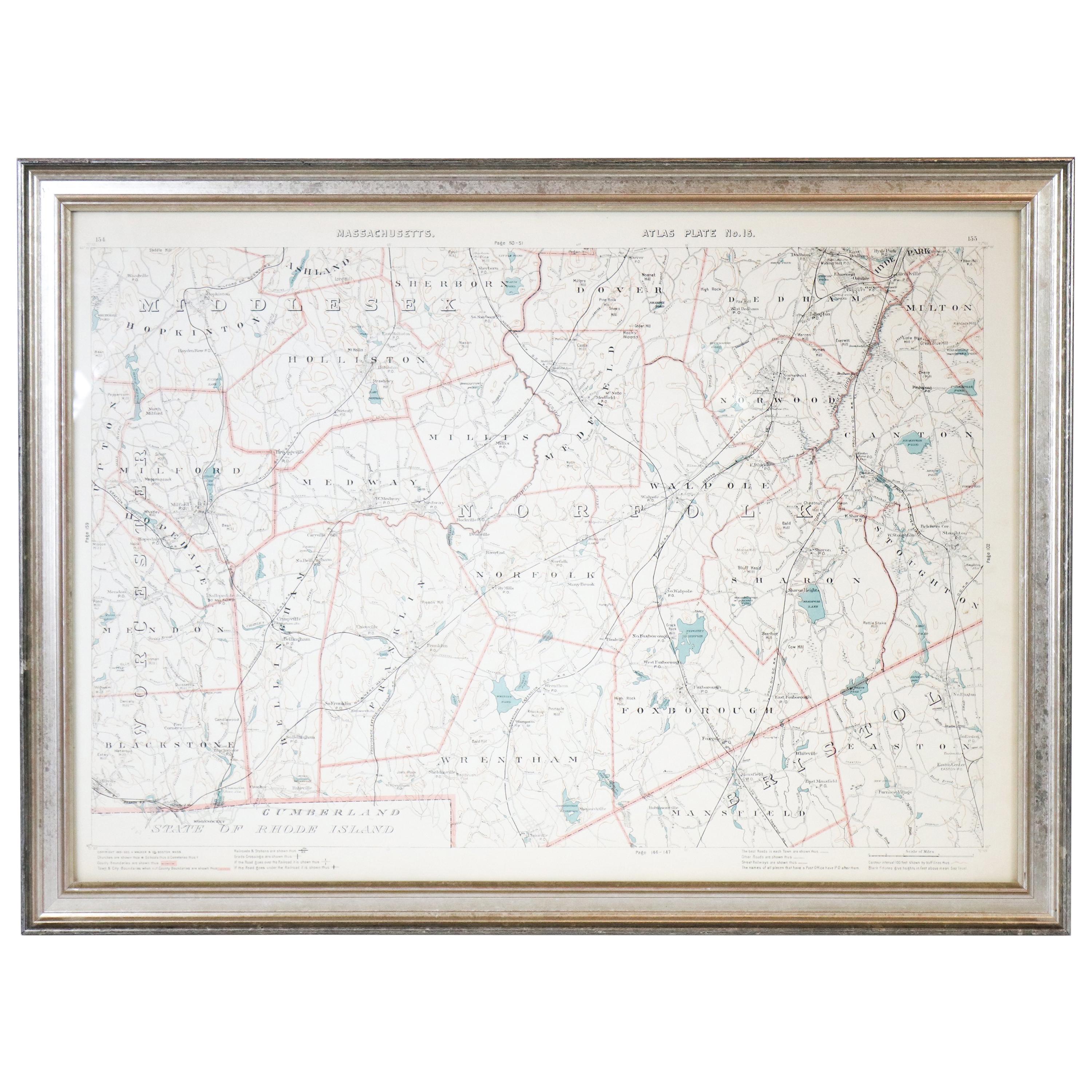
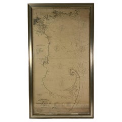
1918 George Eldridge Chart of Massachusetts Bay
View Similar Items


Want more images or videos?
Request additional images or videos from the seller
1 of 20
1918 George Eldridge Chart of Massachusetts Bay
About the Item
- Dimensions:Height: 60 in (152.4 cm)Width: 35 in (88.9 cm)Depth: 3 in (7.62 cm)
- Materials and Techniques:
- Place of Origin:
- Period:1910-1919
- Date of Manufacture:1918
- Condition:
- Seller Location:Norwell, MA
- Reference Number:Seller: 81851stDibs: LU1741235732532
About the Seller
5.0
Vetted Seller
These experienced sellers undergo a comprehensive evaluation by our team of in-house experts.
Established in 1967
1stDibs seller since 2015
352 sales on 1stDibs
Typical response time: 2 hours
More From This SellerView All
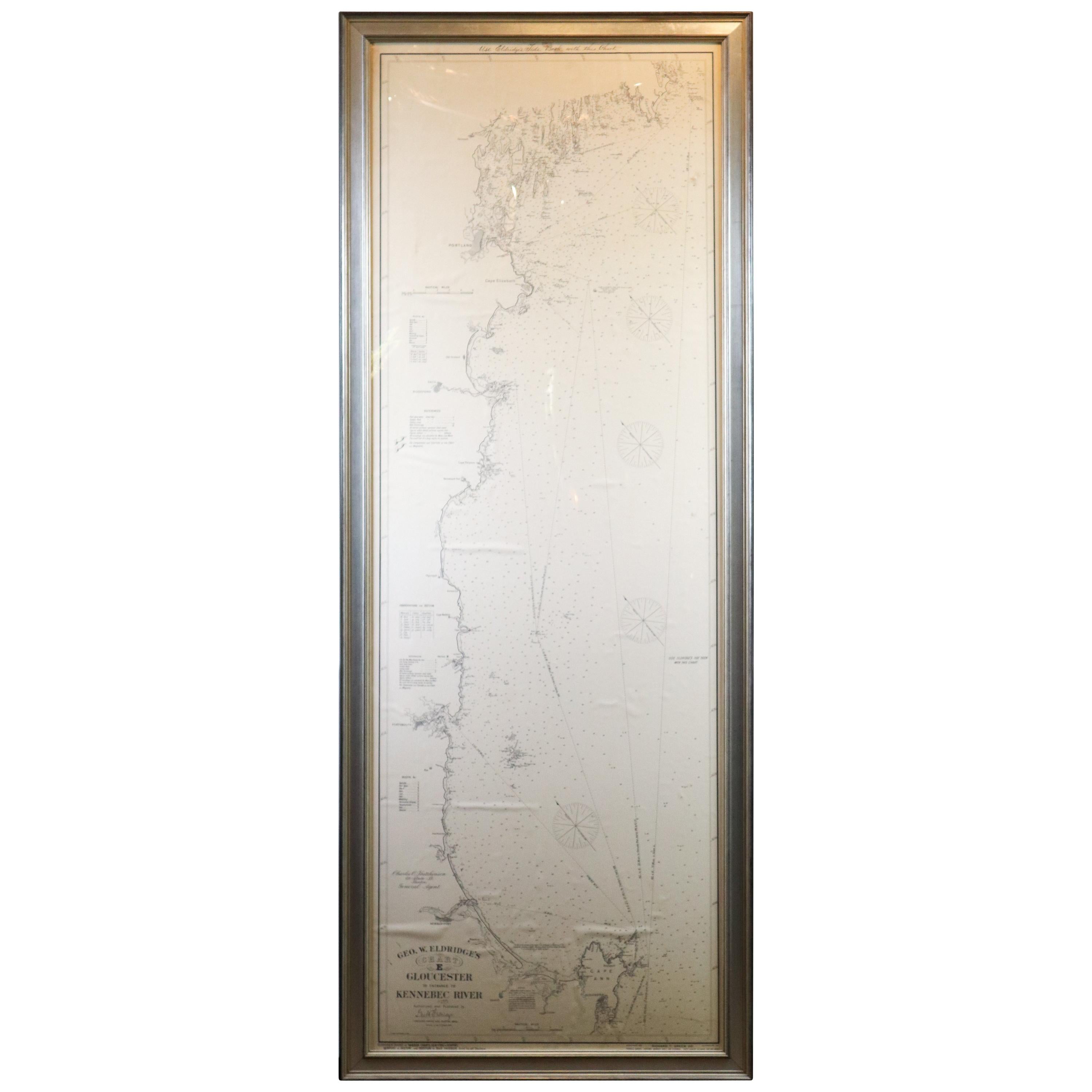
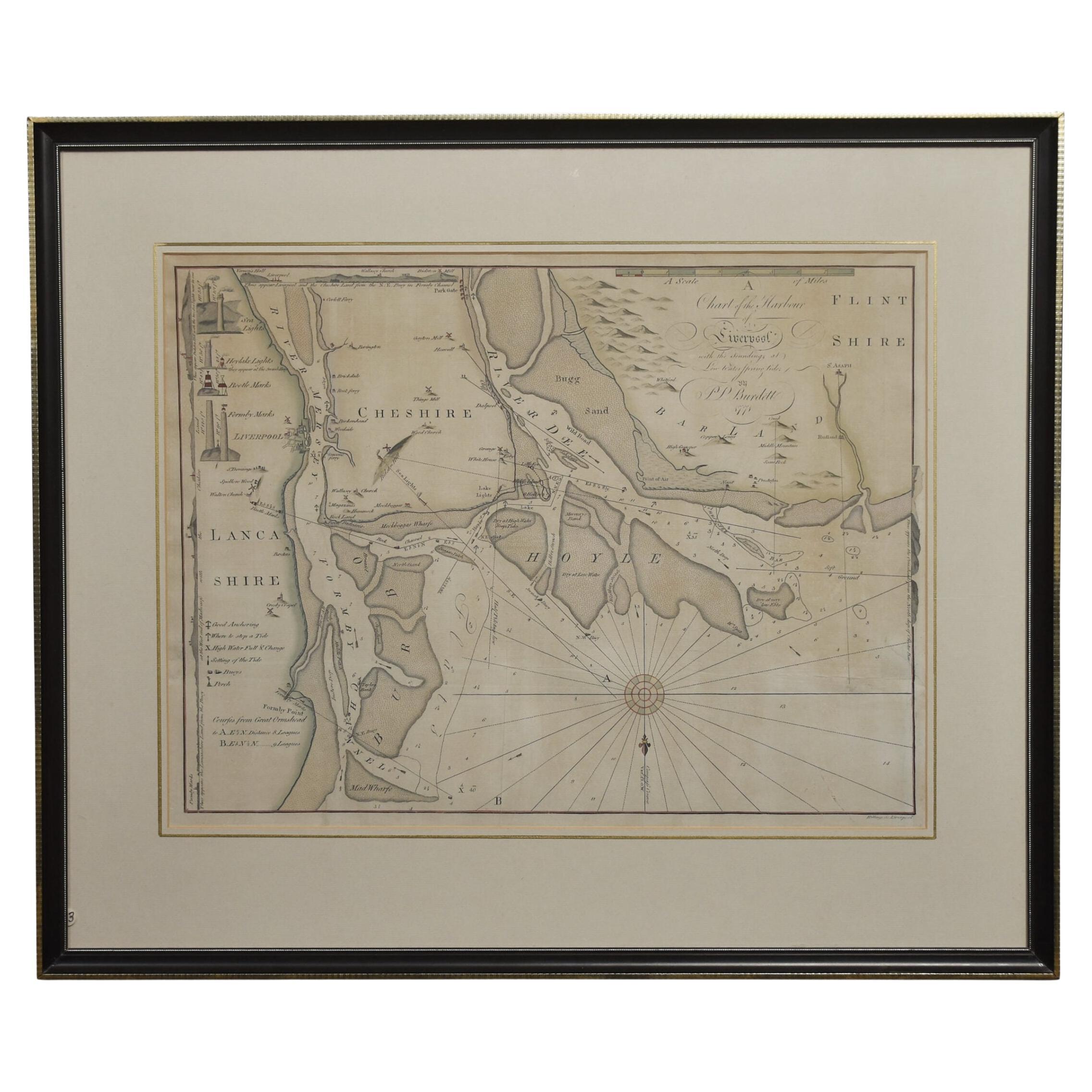
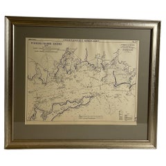
- Original 1910 George Eldridge ChartLocated in Norwell, MAOriginal framed 1910 George Eldridge chart "E" showing Gloucester to the Kennebec river. Showing the coast of Maine in great detail. Towns include Bath, Camden, Portland, the Coastal...Category
20th Century Unknown Maps
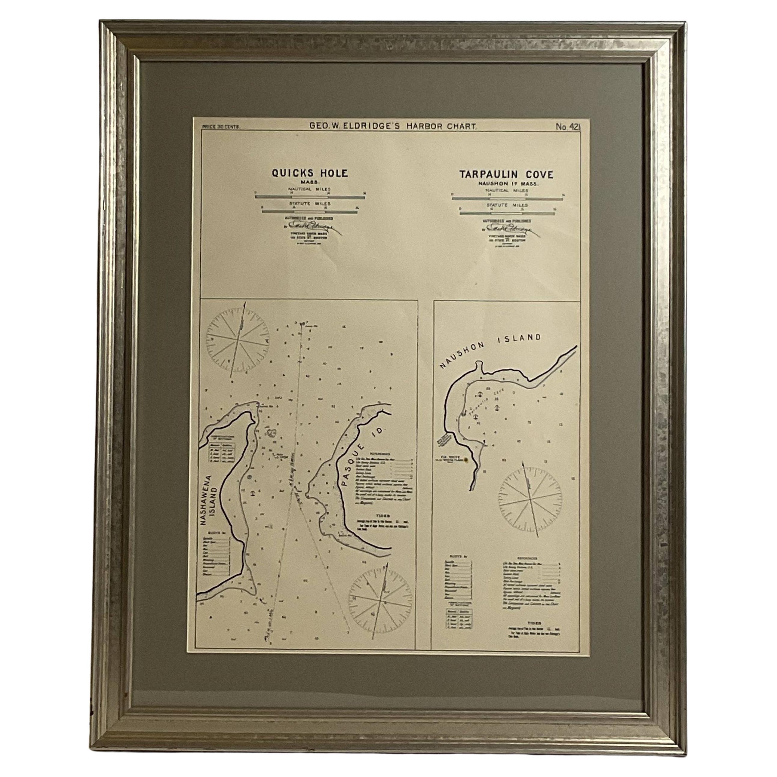
- Mariners Chart of Quicks Hole and Tarpaulin Cove by George Eldridge 1901Located in Norwell, MANautical chart showing the harbor and local waters of Naushon Island Quick Holes. The chart display depths buoys, lightness, etc., The chart shows the cove in Naushon with ships stor...Category
Antique Early 1900s North American Maps
MaterialsPaper
- Ocean Chart Of Massachusetts BayLocated in Norwell, MACape Cod Bay chart from 1907 by George W. Eldridge. This is chart "D" Massachusetts Bay and the coast from Chatham to Boston. Showing plotted courses, depths, lighthouses, ports, etc.. Excellent graphics. Ports include Barnstable, Sandwich, Duxbury, Plymouth, Cohasset, Hingham, Quincy, Boston, Marblehead, Lynn. Manchester by the Sea...Category
Antique Early 1900s North American Prints
MaterialsPaper
- 1898 Chart of Boston BayLocated in Norwell, MAOriginal 1898 chart showing Massachusetts Bay with the coast from Cape Ann to Cape Cod. This is a U.S. Navy Geodetic survey chart. All towns are noted along the coast. Framed with gl...Category
Antique 1890s Nautical Objects
MaterialsPaper
 $1,495
 - Mariners Chart of Marion Massachussets by George Eldridge 1901Located in Norwell, MANautical chart showing the harbor and local waters of Marion Harbor., The chart displays depth, buoys, lighthouses, etc., Shown are Planting Island, Ram Island, Sippican Neck, Little...Category
Antique Early 1900s North American Prints
MaterialsPaper
- Mariners Chart of Fishers Island Sound by George Eldridge 1901Located in Norwell, MANautical Chart showing the harbor and local waters of fishers island sound. The chart displays depths, buoys, lighthouses, etc., Shown is Watch Hill Point, Stonington, Mason Island, ...Category
Antique Early 1900s North American Prints
MaterialsPaper

You May Also LikeView All
- Large Sea Chart of the British Islands, 1918Located in Langweer, NLAntique map titled 'The British Islands'. Large sea chart of the British Islands. It shows Ireland, Scotland, England, the Shetland Islands and part of Fra...Category
Vintage 1910s Maps
MaterialsPaper
 $497 Sale Price20% Off
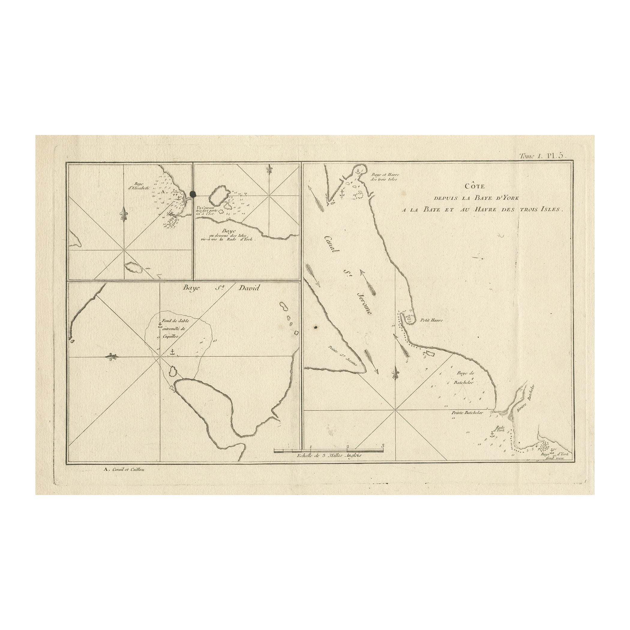
 - Antique Print with Charts of York's Bay and SurroundingsLocated in Langweer, NLAntique map titled 'Côte depuis la Baye d'York (..)'. Charts of York's Bay, Haven of the Three Islands, St. David's Bay, and Elizabeth's Bay. Published in an edition of John Hawk...Category
Antique Late 18th Century Maps
MaterialsPaper
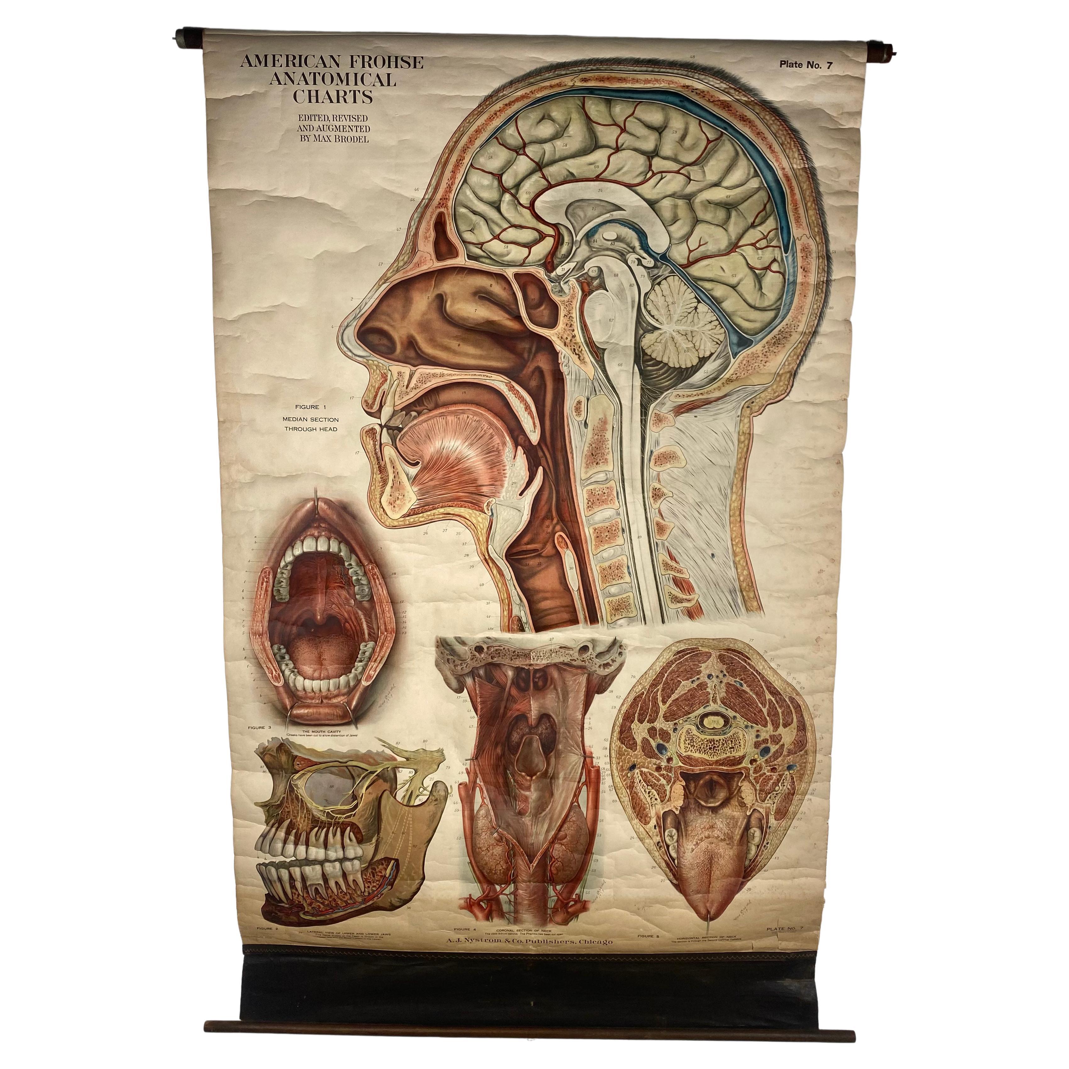
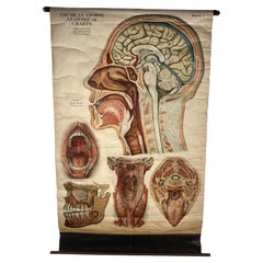
- 1918 American Frohse Anatomical Chart, A. J. Nystrom, Max Brodel IllustratorBy Max Brödel, A.J. Nystrom & CoLocated in Buffalo, NYAntique American Frohse Anatomical pull down chart, by A. J. Nystrom, ,revised and augmented by Max Brodel illustrator... Amazing color, patina, age appropriate wear. dated 1918.. Max (Paul Heinrich) Brödel 1870-1941 Brödel, an illustrator and the first director of the Art as Applied to Medicine program at Johns Hopkins...Category
Vintage 1910s American Steampunk Prints
MaterialsWood, Paper
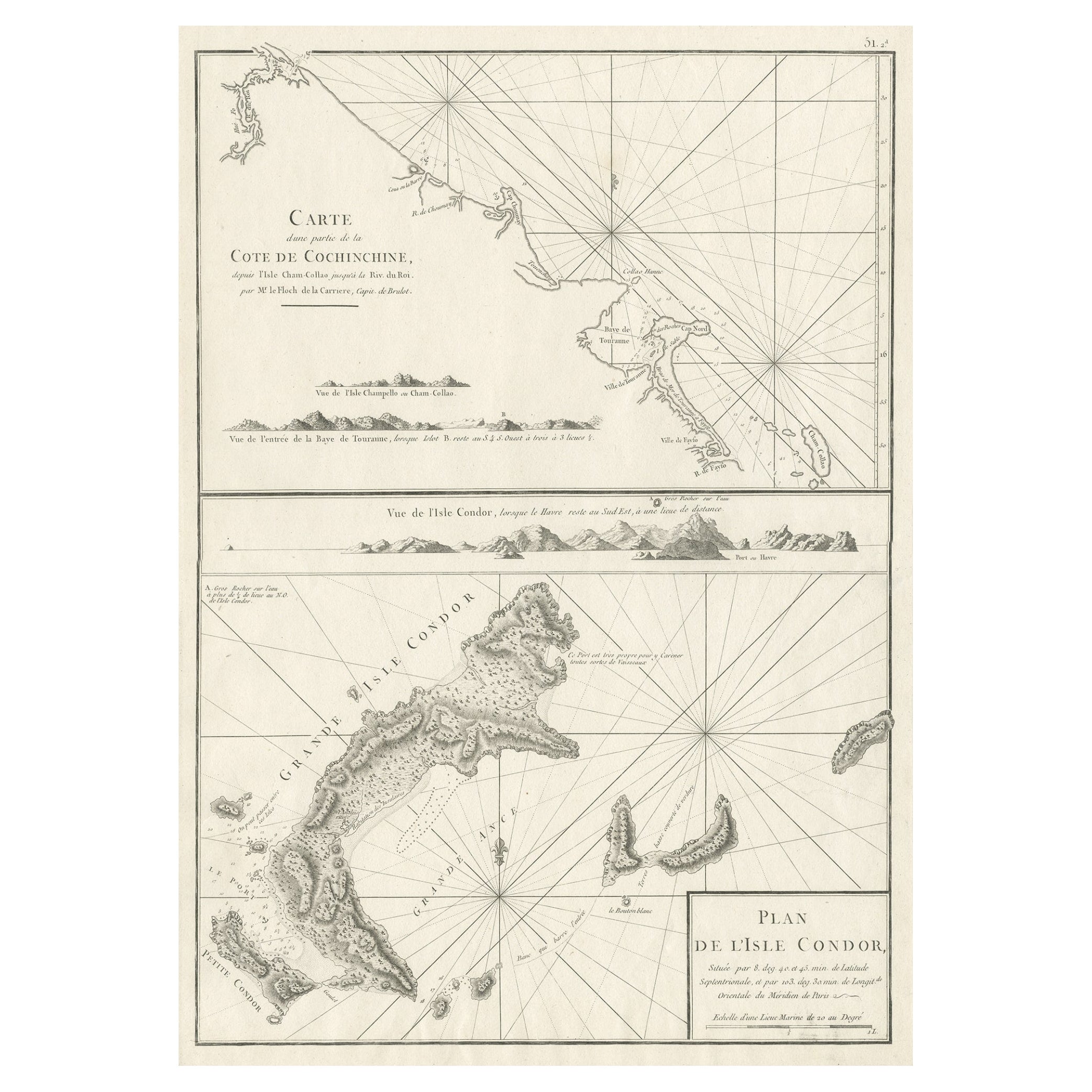
- Old Sea Charts of Tourane Bay & the Con Dao Islands 'Pulo Condor', Vietnam, 1780Located in Langweer, NLDescription: Two maps on one sheet titled 'Carte d'une partie de la Cote de Cochinchine [and] Plan de l'Isle Condor'. Sea charts of the coast of Vietnam around the Tourane Bay an...Category
Antique 1780s Maps
MaterialsPaper
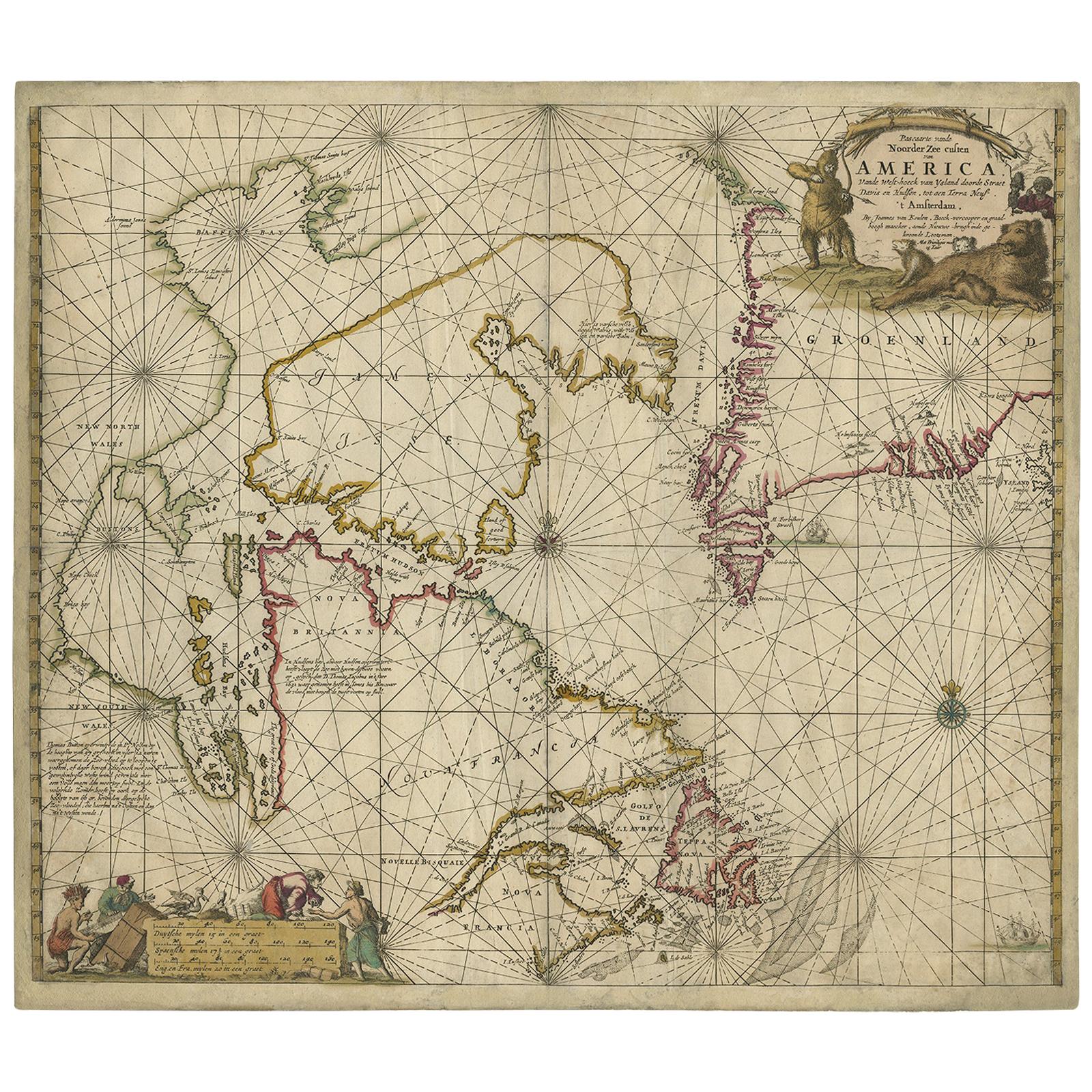
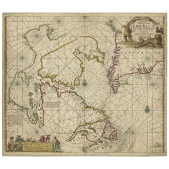
- Antique Sea Chart of Hudson Bay and Arctic Canada by Van Keulen, circa 1681Located in Langweer, NLAntique map titled 'Pascaarte vande Noorderzee Custen van America (..)'. Sea chart of Hudson Bay and Arctic Canada. Compass roses, loxodromic lines, and ships decorate the oceans and...Category
Antique Late 17th Century Maps
MaterialsPaper
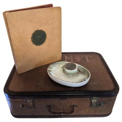
- Mid Century Massachusetts Institute of Technology CollectiblesLocated in Riverdale, NYMid Century Massachusetts Institute of Technology Collectibles. Upgrade your legacy and clout with a few well placed trinkets from Mid Century M.I.T. sca...Category
Vintage 1950s American Mid-Century Modern Historical Memorabilia
MaterialsPorcelain, Wood, Paper
Recently Viewed
View AllMore Ways To Browse
George Brewster
George Weymouth
Cape Cod Map
Antique Maps Massachusetts
Antique Map Of Massachusetts
Antique Maps Of Massachusetts
Antique Furniture Kingston
Antique Yarmouth
Vintage Hawaiian Maps
Matthew Seutter On Sale
Teak Root Bowls
Rand Mcnally Map Of California
Jordan Antique Map
Vincenzo Coronelli On Sale
Saudi Arabia Antique Map
Moravia Map
Antique Map Of Chesapeake Bay
Yemen 1789