Items Similar to Antique Map of the East Indies by Van der Aa '1849'


Want more images or videos?
Request additional images or videos from the seller
1 of 5
Antique Map of the East Indies by Van der Aa '1849'
About the Item
Antique map titled 'Kaart van Nederlands OostIndie door A.J. van der Aa'. Old map of the Dutch East Indies. This map originates from 'Nederlands Oost-Indië, of beschrijving der Nederlandsche bezittingen in Oost-Indië, voorafgegaan door een beknopt overzicht van de vestiging en uitbreiding der magt van Nedereland aldaar' by A.J. van der Aa.
- Dimensions:Height: 14.18 in (36 cm)Width: 22.64 in (57.5 cm)Depth: 0.02 in (0.5 mm)
- Materials and Techniques:
- Period:
- Date of Manufacture:1849
- Condition:Minor structural damages. General age-related toning. Few minor defects, mostly professionally restored. Please study images carefully.
- Seller Location:Langweer, NL
- Reference Number:
About the Seller
5.0
Platinum Seller
These expertly vetted sellers are 1stDibs' most experienced sellers and are rated highest by our customers.
Established in 2009
1stDibs seller since 2017
1,967 sales on 1stDibs
Typical response time: <1 hour
- ShippingRetrieving quote...Ships From: Langweer, Netherlands
- Return PolicyA return for this item may be initiated within 14 days of delivery.
More From This SellerView All
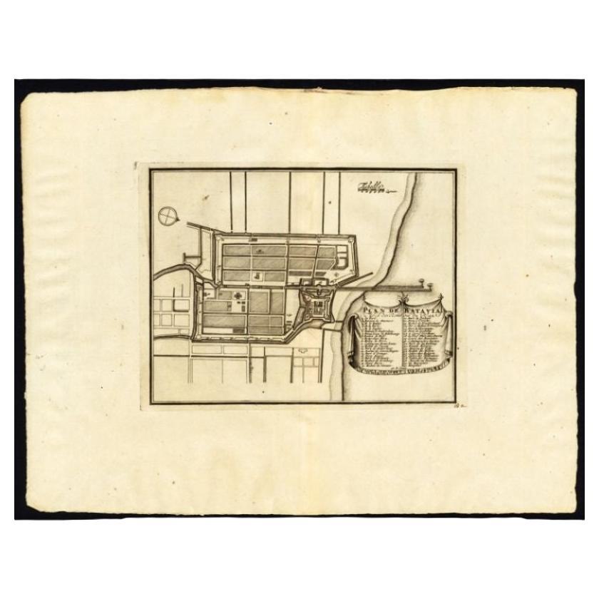
- Antique Plan of Batavia, Capital of the Dutch East Indies, by Van Der Aa, 1725By Pieter Van Der AaLocated in Langweer, NLAntique map titled 'Plan de Batavia'. (Plan of Batavia.) This plate shows a plan of the city of Batavia / Jakarta in Indonesia. With extensive legend, compass rose and scale. This pl...Category
Antique 18th Century Maps
MaterialsPaper
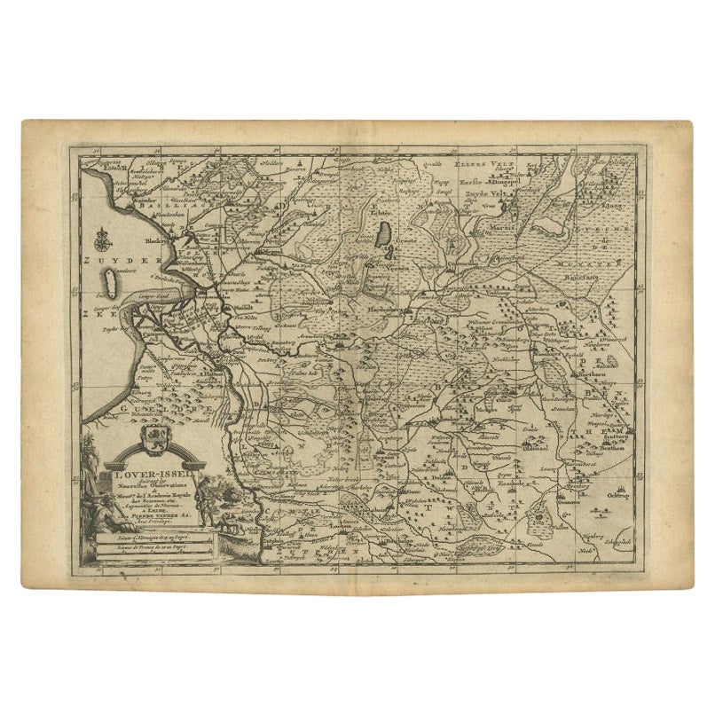
- Antique Map of Overijssel by Van der Aa, c.1715Located in Langweer, NLAntique map titled 'L'Over-Issel'. This map depicts the Dutch province Overijssel. This map originates from 'Nouvel Atlas, très exact et fort commode pour toutes sortes de personnes,...Category
Antique 18th Century Maps
MaterialsPaper
- Antique Map of the Maluku Islands by Van der Aa, 1714By Pieter Van Der AaLocated in Langweer, NLAntique Map Moluccas titled 'Les Isles Moluques'. Rare map of the Spice Islands made after a map engraved by Pieter van den Keere and published in the 1628 edition of the Mercator At...Category
Antique 18th Century Maps
MaterialsPaper
- Antique Map of the Mughal Empire by Van der Aa, C.1725By Pieter Van Der AaLocated in Langweer, NLAntique map titled 'Royaume de Grand Mogol (..).' This map shows the extend of the Mughal Empire, which includes northern India, from Golconda to Afghanistan and eastwards to Bengal....Category
Antique 18th Century Maps
MaterialsPaper
- Antique Map of the Maluku Islands by Van der Aa, 1725By Pieter Van Der AaLocated in Langweer, NLAntique map titled 'Les Iles Moluques (..).' (The Moluccan Islands, Maluku, Moluccas, Spice Islands, Indonesia.) Extremely rare in this edition. This plate originates from the very s...Category
Antique 18th Century Maps
MaterialsPaper
- Antique Map of the Bay of Batavia by Van der Aa, c.1720Located in Langweer, NLAntique map titled 'La Rade de Batavia'. A small early 18th century black and white map of the Bay of Batavia (Jakarta), Indonesia. Published by P....Category
Antique 18th Century Maps
MaterialsPaper


You May Also Like
- Large Original Antique Map of The West Indies by Sidney Hall, 1847Located in St Annes, LancashireGreat map of The West Indies Drawn and engraved by Sidney Hall Steel engraving Original colour outline Published by A & C Black. 1847 Unframed Free shipping.Category
Antique 1840s Scottish Maps
MaterialsPaper
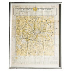
- London AA MapLocated in Alton, GBLondon AA map.Category
20th Century Maps
MaterialsPaper
- Seminal guide to the East and West Indies, with 42 coloured maps and platesBy Jan Huygen van LinschotenLocated in ZWIJNDRECHT, NLSeminal guide to the East and West Indies, with 42 double-page and folding plates, including 6 maps, all engravings beautifully coloured by a contemporary hand LINSCHOTEN, Jan Huygh...Category
Antique Early 17th Century Dutch Dutch Colonial Books
MaterialsPaper
- East German MapBy VEB Hermann HaackLocated in Baltimore, MDA brilliantly colourful map of the Leipzig, Karl Marx Stadt and Dresden area in the former German Democratic Republic by VEB Hermann Haack of Gotha.Category
Vintage 1970s German Maps
- Original Antique Map of South East Asia by Becker, circa 1840Located in St Annes, LancashireGreat map of South East Asia Steel engraving with original color outline Engraved by Becker Published by Virtue, circa 1840. Unframed.Category
Antique 1840s English Other Maps
MaterialsPaper
- Original Antique Map of South East Asia by Thomas Clerk, 1817Located in St Annes, LancashireGreat map of South East Asia Copper-plate engraving Drawn and engraved by Thomas Clerk, Edinburgh. Published by Mackenzie And Dent, 1817 Unframed.Category
Antique 1810s English Maps
MaterialsPaper


Recently Viewed
View AllMore Ways To Browse
East Indies Furniture
East Indies
Dutch Indies
Dutch East Indies
Buy Antique Paper
Map Of Itsly
World Atlas
Antique Maps 18th Century
Antique Old Maps
Used World Atlas
Antique German Collectibles
Antique French Maps
Antique Map France
Antique Maps France
Antique Map Of France
Antique Maps Of France
Antique Curiosities Prints
Collectible Fair