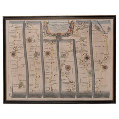
Map Of St Thomas
2
to
9
117
40
90
83
43
26
26
18
16
16
13
13
11
11
8
5
5
5
4
4
4
3
3
3
3
2
2
1
1
1
1
1
1
1
1
1
1
1
42
42
8
5
4
Sort By
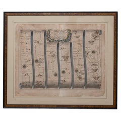
Road Map John Ogilby London St David's Britannia No 15 Abingdon Monmouth Framed
By John Ogilby
Located in BUNGAY, SUFFOLK
John Ogilby (British 1600-1676) Cosmographer and Geographick Printer to Charles II. A road map from
Category
Antique 1670s English Baroque Maps
Materials
Paper
H 20.48 in W 24.41 in D 0.6 in
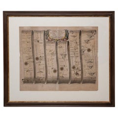
Road Map Britannia No 15 London to St Davids John Ogilby Brown Gilt Frame
By John Ogilby
Located in BUNGAY, SUFFOLK
The continuation of the road from London to St Davids, commencing at Abingdon Com Berks and
Category
Antique Late 17th Century British Charles II Maps
Materials
Paper
H 22.05 in W 26.19 in D 0.6 in
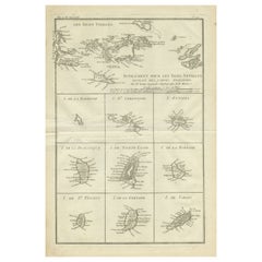
Original Antique Map of the Virgin Islands with Insets of Caribbean Isles, 1787
Located in Langweer, NL
, and Tobago. The main map covers the region from St. Thomas and St. Croix to St. Martin and Anguilla
Category
Antique Late 18th Century Maps
Materials
Paper
Free Shipping
H 16.26 in W 10.52 in D 0.02 in
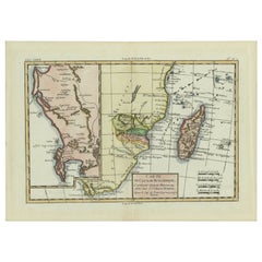
Antique Map of Mozambique and Cape of Good Hope with Kingdom Monomotapa, 1780
Located in Langweer, NL
Antique map titled 'Carte Du Canal De Mozambique.' The main map, on the right, covers from the Cape
Category
Antique 18th Century Maps
Materials
Paper
H 14.69 in W 10.44 in D 0 in
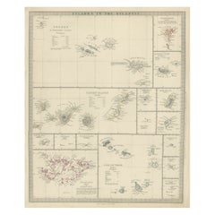
Antique Map of the Islands in the Atlantic Ocean including Bermuda & Cape Verde
Located in Langweer, NL
, Madeira Isles, Princes Island, Canary Islands, Fernando Po, Anno Bon, St. Thomas, Bermuda Isles, Trinidade
Category
Antique Mid-19th Century Maps
Materials
Paper
H 17.05 in W 14.38 in D 0.02 in
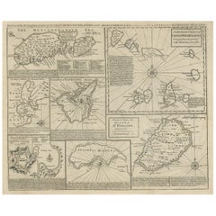
Antique Map of 'African' Islands in the Mediterranean Sea and The Atlantic, 1747
Located in Langweer, NL
Kitchin and Thomas Jeffreys.
Condition: Fair, age-related toning. Worm holes in the maps of St. Helena
Category
Antique 18th Century Maps
Materials
Paper
H 19.49 in W 15.16 in D 0 in
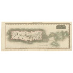
1817 Map of Puerto Rico and the Virgin Islands with Original Hand Coloring
Located in Langweer, NL
geographical layout of Puerto Rico and the nearby Virgin Islands, including St. Thomas and St. Croix. The hand
Category
Antique Early 19th Century Maps
Materials
Paper
Free Shipping
H 25.99 in W 11.03 in D 0 in
Map Shropshire Joseph Ellis Robert Sayer Carington Bowles Framed
Located in BUNGAY, SUFFOLK
A modern map of Shropshire Drawn from the latest surveys corrected and improved by the best
Category
Antique 18th Century English Georgian Maps
Materials
Paper
Road Map, John Ogilby, No 54, London, Yarmouth, Britannia
By John Ogilby
Located in BUNGAY, SUFFOLK
-sixth year, as a publisher of maps and geographical accounts.
Ogilby was born outside Dundee, in
Category
Antique 1670s English Baroque Maps
Materials
Paper
Road Map John Ogilby No 75 Kings Lyn Harwich, Britannia Framed Wallhanging
By John Ogilby
Located in BUNGAY, SUFFOLK
, as a publisher of maps and geographical accounts.
Ogilby was born outside Dundee, in 1600, the
Category
Antique 1670s European Baroque Maps
Materials
Paper
H 15.75 in W 19.69 in D 0.6 in
Map Road John Ogilby Britannia No 74 Ipswich to Norwich Cromer Framed
By John Ogilby
Located in BUNGAY, SUFFOLK
his sixty-sixth year, as a publisher of maps and geographical accounts.
Ogilby was born outside
Category
Antique 1670s English Baroque Maps
Materials
Paper
Map Road Strip Britannia Sheet 2 John Ogilby London Aberistwith Islip Bramyard
By John Ogilby
Located in BUNGAY, SUFFOLK
of England and Wales.
Strip map Islip to Bramyard, on a scale of approximately one inch to the mile
Category
Antique 17th Century English Baroque Maps
Materials
Paper
H 14.38 in W 19.3 in D 0.79 in
Road Map No43 London to Kings Lynn, Royston to Downham, John Ogilby, Britannia
By John Ogilby
Located in BUNGAY, SUFFOLK
John Ogilby (British 1600-1676) Cosmographer and Geographick Printer to Charles II.
A road map
Category
Antique Late 17th Century British Charles II Maps
Materials
Paper
H 20.48 in W 24.41 in D 0.4 in
Road Map Britannia No 32 the Road from London to Barnstable John Ogilby Framed
By John Ogilby
Located in BUNGAY, SUFFOLK
collector with no 15 London to St Davids. Framed as a pair.
Measures: Black Linear Border around Map
Category
Antique Late 17th Century English Charles II Maps
Materials
Paper
H 20.48 in W 24.41 in D 0.6 in
Road Map Britannia No 25 London to the Lands End, John Ogilby Brown Gilded Frame
By John Ogilby
Located in BUNGAY, SUFFOLK
Senan in Cornwall. By John Ogilby His Majesties Cosmographer. A road map from Britannia, 1675/6. No 25
Category
Antique Late 17th Century British Charles II Maps
Materials
Paper
H 22.05 in W 26.19 in D 0.6 in
Road Map Britannia 1675/6 No 5 Road London to Barwick, London Stilton Grey Frame
By John Ogilby
Located in BUNGAY, SUFFOLK
John Ogilby (British 1600-1676) cosmographer and geographick printer to Charles II.
A road map from
Category
Antique Late 17th Century British Charles II Maps
Materials
Paper
H 22.84 in W 25.99 in D 0.4 in
Antique Print of the City of Ten-Tchoo-Foo, China, 1796
Located in Langweer, NL
Thomas Hickey.
From another source: Macartney was dispatched to Beijing in 1792, traveling via Madeira
Category
Antique 1790s Maps
Materials
Paper
Rare Engraving of Dutch and Danish Forts on the West African Gold Coast, 1744
Located in Langweer, NL
house in St John’s Street in Westminster. Awnsham Churchill (d. 1728), bookseller, was connected with
Category
Antique 1740s Maps
Materials
Paper
H 15.36 in W 13.67 in D 0 in
Map of the World: An Original 18th Century Hand-colored Map by E. Bowen
Located in Alamo, CA
This is an original 18th century hand-colored map entitled "A New & Correct Chart of All The Known
Category
Mid-18th Century Old Masters Landscape Prints
Materials
Engraving
Keating, William. Narrative of an Expedition to the Source of St. Peter's River
Located in Middletown, NY
Keating William H
Narrative of an Expedition to the Source of St Peter's River Lake Winnipeek Lake
Category
Antique Early 19th Century English Books
Materials
Leather, Paper
H 8.75 in W 5.5 in D 3 in
John Speede Map The Countye Palatine of Chester with that most ancient citie
By John Speed
Located in London, GB
Thomas Bassett in Fleetstreet, and Richard Chiswell in St Paul's Churchyard.
Probably the most famous
Category
17th Century Realist Landscape Prints
Materials
Engraving
Primary Triangulation Between the Hudson and St. Croix Rivers
Located in Florham Park, NJ
, dating from 1807 when President Thomas Jefferson signed “AN ACT TO provide for surveying the coasts of
Category
Late 19th Century Academic Prints and Multiples
Materials
Watercolor, Lithograph
1935 Seven Pillars of Wisdom
By T. E. Lawrence
Located in Bath, GB
folding maps, and in-text illustrations.
Collated, complete.
Thomas Lawrence became famous in his
Category
Vintage 1930s British Books
Materials
Paper
Sir Francis Bacon: 18th C. Portrait of Philosopher, Scientist, Author, Statesman
By Jacobus Houbraken
Located in Alamo, CA
This is an 18th century copperplate engraved portrait of Sir Francis Bacon, Viscount St. Albans
Category
1730s Portrait Prints
Materials
Engraving
Rare Antique Engraving of Life Near The Sestro River, Liberia in Africa, 1744
Located in Langweer, NL
Description: Antique print, titled: 'A map of Sestro River (…).' - This plate shows Fish, birds
Category
Antique 1740s Prints
Materials
Paper
No Reserve
H 13.67 in W 16.03 in D 0 in
"Actions Speak Louder Than Words"- Colorful Mixed Media Abstract Painting
By Paddy Cohn
Located in Brooklyn, NY
St. Thomas in 1989. There, a passion was born for vibrant optics, distressed textures and the
Category
2010s Abstract Paintings
Materials
Canvas, Mixed Media, Acrylic
H 30 in W 30 in D 1.5 in
"Riveted" - Textured, Richly Colored Mixed Media Abstract Painting, 2020
By Paddy Cohn
Located in Brooklyn, NY
St. Thomas in 1989. There, a passion was born for vibrant optics, distressed textures and the
Category
2010s Contemporary Abstract Paintings
Materials
Acrylic, Canvas, Mixed Media
"Walk With Me"- Softly Colored, Mixed Media, Abstract Fine Art Painting
By Paddy Cohn
Located in Brooklyn, NY
St. Thomas in 1989. There, a passion was born for vibrant optics, distressed textures and the
Category
2010s Contemporary Abstract Paintings
Materials
Canvas, Mixed Media, Acrylic
H 48 in W 48 in D 1.5 in
The New Testament /// Old Masters Biblical Religious Engraving Dutch Angel Art
By Michael Burghers
Located in Saint Augustine, FL
: John Baskett, London?, UK
Publisher: Moses Pitt, Peter Parker, and Thomas Guy, London?, UK
Sheet size
Category
1680s Old Masters Figurative Prints
Materials
Watercolor, Engraving, Etching, Laid Paper, Intaglio
Llangorse Lake, Brecon Beacons, Wales, circa 1964. Welsh Landscape. Abstract.
By Roger Cecil
Located in Sutton Poyntz, Dorset
: Previously with the Howard Roberts Gallery, Imperial Buildings, 69/74 St Mary Street, Cardiff.
Roger Cecil
Category
Mid-20th Century Abstract Expressionist Landscape Drawings and Watercolors
Materials
Paper, Pastel, Watercolor
H 24.61 in W 34.65 in D 0.99 in
Altona 88 Acrylic, Mixed Media, 30 x 24, Colors, Nature, Free Shipping On Sale
By Paddy Cohn
Located in Houston, TX
to return to her roots in St. Thomas in 1989. There, a passion was born for vibrant optics
Category
2010s Abstract Abstract Paintings
Materials
Acrylic, Mixed Media
Bamboo Forest, Acrylic , Caribbean, Rising from the Sea, 48 x 36, Colors
By Paddy Cohn
Located in Houston, TX
a successful textile designer, only to return to her roots in St. Thomas in 1989. There, a passion
Category
2010s Abstract Abstract Paintings
Materials
Acrylic, Mixed Media, Cotton Canvas
H 36 in W 48 in D 0.75 in
Steam Punk, Mixed Media , Acrylic, Color, Abstract, Paddy Cohn, Nature, 40 x 30
By Paddy Cohn
Located in Houston, TX
decade in New York City as a successful textile designer, only to return to her roots in St. Thomas in
Category
2010s Abstract Abstract Paintings
Materials
Cotton Canvas, Mixed Media, Acrylic
XO, Abstract, Acrylic, Mixed Media, Paddy Cohn, Color, Nature, Free Shipping
By Paddy Cohn
Located in Houston, TX
successful textile designer, only to return to her roots in St. Thomas in 1989. There, a passion was born for
Category
2010s Abstract Abstract Paintings
Materials
Mixed Media, Acrylic, Cotton Canvas
H F Gravelot (1699-1773) Two Allegories, Faith and Vigilance, Pen and Ink
By Hubert-François Gravelot
Located in Paris, FR
latter then begins to attend an artists' society, the St Martin's Lane Academy run bWilliam Hogarth, at a
Category
1760s Old Masters Figurative Drawings and Watercolors
Materials
Ink
Antique Print with Various Creatures from A Travel Account, 1744
Located in Langweer, NL
creatures (parakeet, sea cow, monkeys), a small map of Papo’s Bay at Tary (Cayenne?), birds eating fish at
Category
Antique 1740s Prints
Materials
Paper
Original Drawing Painting Abstract Biomorphic Art Phoenix Bird Michele Oka Doner
By Michele Oka Doner
Located in Surfside, FL
Manupelli experimental film, a "Map Read" performance with art drawing instructor Al Loving and Judsonite
Category
Early 2000s Abstract Abstract Drawings and Watercolors
Materials
Gold Leaf
Original Drawing Painting Abstract Biomorphic Art Gold Leaf Michele Oka Doner
By Michele Oka Doner
Located in Surfside, FL
today. Oka Doner participated in a Manupelli experimental film, a "Map Read" performance with art
Category
Early 2000s Abstract Abstract Drawings and Watercolors
Materials
Gold Leaf
Lithograph - Flowers
By (after) Henri Matisse
Located in Collonge Bellerive, Geneve, CH
ways unchanged since Roman times. The coming of the railway had put Bohain on the industrial map, but
Category
1940s Modern Still-life Prints
Materials
Lithograph
Henri Matisse (After) - Lithograph - Pumpkin and Flowers
By (after) Henri Matisse
Located in Collonge Bellerive, Geneve, CH
ways unchanged since Roman times. The coming of the railway had put Bohain on the industrial map, but
Category
1940s Modern Still-life Prints
Materials
Lithograph
H 9.45 in W 12.6 in D 0.04 in
Henri Matisse (After) - Lithograph - Flowers
By (after) Henri Matisse
Located in Collonge Bellerive, Geneve, CH
ways unchanged since Roman times. The coming of the railway had put Bohain on the industrial map, but
Category
1940s Modern Still-life Prints
Materials
Lithograph
H 9.45 in W 12.6 in D 0.04 in
Henri Matisse (After) - Lithograph - Pumpkin and Flowers
By (after) Henri Matisse
Located in Collonge Bellerive, Geneve, CH
ways unchanged since Roman times. The coming of the railway had put Bohain on the industrial map, but
Category
1940s Modern Figurative Prints
Materials
Lithograph
H 12.6 in W 9.45 in D 0.04 in
Henri Matisse (After) - Lithograph - Flowers
By (after) Henri Matisse
Located in Collonge Bellerive, Geneve, CH
railway had put Bohain on the industrial map, but people still traveled everywhere on foot or horseback
Category
1940s Modern Figurative Prints
Materials
Lithograph
H 12.6 in W 9.45 in D 0.04 in
Henri Matisse (After) - Lithograph - Woman with Flowers in Her Hair
By (after) Henri Matisse
Located in Collonge Bellerive, Geneve, CH
railway had put Bohain on the industrial map, but people still traveled everywhere on foot or horseback
Category
1940s Modern Portrait Prints
Materials
Lithograph
H 12.6 in W 9.45 in D 0.04 in
Original Lithograph - Henri Matisse - Apollinaire
By Henri Matisse
Located in Collonge Bellerive, Geneve, CH
Roman times. The coming of the railway had put Bohain on the industrial map, but people still traveled
Category
1930s Modern Portrait Prints
Materials
Linocut
Guillaume Apollinaire
By Henri Matisse
Located in Collonge Bellerive, Geneve, CH
Roman times. The coming of the railway had put Bohain on the industrial map, but people still traveled
Category
1930s Modern Portrait Prints
Materials
Lithograph
Original Lithograph - Henri Matisse - Apollinaire
By Henri Matisse
Located in Collonge Bellerive, Geneve, CH
Roman times. The coming of the railway had put Bohain on the industrial map, but people still traveled
Category
1930s Modern Portrait Prints
Materials
Linocut
Original Lithograph - Henri Matisse - Apollinaire
By Henri Matisse
Located in Collonge Bellerive, Geneve, CH
Roman times. The coming of the railway had put Bohain on the industrial map, but people still traveled
Category
1930s Modern Portrait Prints
Materials
Linocut
Creole Dancer
By (after) Henri Matisse
Located in Collonge Bellerive, Geneve, CH
railway had put Bohain on the industrial map, but people still traveled everywhere on foot or horseback
Category
Mid-20th Century Modern Still-life Prints
Materials
Lithograph
1762 Map of North America
By Thomas Kitchin
Located in New York, NY
well-known British map maker Thomas Kitchin. Shows the British Colonies in North America with an inset
Category
1760s Realist Landscape Prints
Materials
Engraving
A Map of the Eastern Part of the Province of New York with part of New Jersey...
By Thomas Kitchin
Located in New York, NY
Rare hand-colored map full title "A Map of the Eastern Part of the Province of New York with part
Category
1750s Realist Landscape Prints
Materials
Engraving
Framed French Color Engraving of a 1575 Ancient Map of Paris
Located in Petaluma, CA
the St Thomas d'Aquin area in the 7th) towards "la Tour de Nesles" (The Tour de Nesle or Nesle's Tower
Category
Late 20th Century French Prints
Materials
Paper
Bellin 18th Century Hand Colored Map of St. Christophe (St. Kitts)
By Jacques-Nicolas Bellin
Located in Alamo, CA
federation it currently forms with Nevis, forming the State of St. Kitts and Nevis.
The map is displayed
Category
Antique Mid-18th Century French Maps
Materials
Paper
Bellin 18th Century Hand Colored Map of "L'isle de Sainte Lucie" 'St. Lucia'
By Jacques-Nicolas Bellin
Located in Alamo, CA
. There is a central vertical fold, as issued. The map is in excellent condition.
Provenance: Thomas J
Category
Antique Mid-18th Century French Maps
Materials
Paper
H 13.13 in W 17 in D 0.75 in
Antique Map of West Africa by N. Sanson, 1656
Located in Langweer, NL
around to Gabon, including São Thome (St. Thomas). Parts of present-day Mali and Niger appear in the
Category
Antique Mid-17th Century Maps
Materials
Paper
1828 "Map of the United States" by T. Ensign
Located in Colorado Springs, CO
peak at the time of this map’s publication. In 1803, President Thomas Jefferson’s Louisiana Purchase
Category
Antique 1820s American Maps
Materials
Paper
Florida and Virginia: A 17th Century Hand-colored Map by Hondius after Mercator
By Gerard Mercator
Located in Alamo, CA
This hand-colored early 17th century copper-plate map entitled "Virginia et Florida" was originally
Category
Antique Early 17th Century Dutch Maps
Materials
Paper
H 6.75 in W 8.63 in D 0.13 in
Gulf of Mexico, Florida, C. America, Cuba: 18th C. Hand-colored Map by Bellin
By Jacques-Nicolas Bellin
Located in Alamo, CA
Dominican Republic (St. Dominique), Jamaica, The Bahamas, St. Thomas, St. Bart, Martinique, and many more
Category
1750s Landscape Prints
Materials
Engraving
Oil Painting Portrait of Lord Edward Grenfell, 1st Baron St Just (1870-1941)
By Oswald Birley
Located in London, GB
Sir Oswald Birley MC RA (English, 1880-1952)
Portrait of Edward Charles Grenfell, 1st Baron St
Category
Early 20th Century Victorian Portrait Paintings
Materials
Oil
History of the Expedition under the Command of Lewis and Clark, Edited by Cues
Located in Colorado Springs, CO
local Native American tribes. With maps, sketches, and journals in hand, the expedition returned to St
Category
Antique 1890s American Books
Materials
Paper
H 10.13 in W 6.88 in D 6.5 in
- 1
Get Updated with New Arrivals
Save "Map Of St Thomas", and we’ll notify you when there are new listings in this category.
Map Of St Thomas For Sale on 1stDibs
There is a broad range of map of st thomas for sale on 1stDibs. There are many modern, abstract and Post-Impressionist versions of these works for sale. These items have been produced for many years, with earlier versions available from the 18th Century and newer variations made as recently as the 21st Century. Map of st thomas available on 1stDibs span a range of colors that includes gray, blue, beige, black and more. There have been many well-done artworks of this subject over the years, but those made by (after) Henri Matisse, Henri Matisse, Paddy Cohn, Thomas Kitchin and Michele Oka Doner are often thought to be among the most beautiful. Each of these unique pieces was handmade with extraordinary care, with artists most often working in lithograph, engraving and paint.
How Much are Map Of St Thomas?
The average selling price for map of st thomas we offer is $1,633, while they’re typically $221 on the low end and $47,793 for the highest priced.
More Ways To Browse
Herring Boat
English 18th Century Painting Allegory
Gabon Antique Map
Map Of Antigua
Map Of Native American Tribes
Mill Wheel
Native American Tribes Map
Oleg U
Antique Large Spinning Wheel
Antique Printing Press Machine
En Van Rijn
Fabric Palm Tree Sculpture
Flapper Car
Floor Standing Speakers
Florence White Williams
Gainsborough China
Ginger Curtis
His Girl Friday
