Carlos Antonini Art
to
3
1
4
1
3
Overall Height
to
Overall Width
to
3
2
1
3
1
1
4
6,938
3,292
2,514
1,213
2
2
2
2
Artist: Carlos Antonini
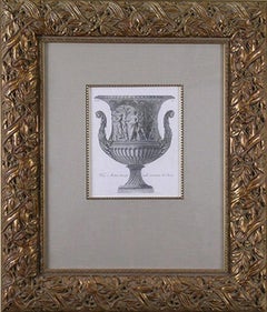
Vaso Antico (Urn)
By Carlos Antonini
Located in Florham Park, NJ
CARLOS ANTONINI
Manuale di Vari Ornamenti
Rome, 1781-1790
Engraving.
100 Illustrations.
Late eighteenth-century Europe was a world in revolution. People in France were losing their heads to Louis XVI and England had a mad king...
Category
16th Century Carlos Antonini Art
Materials
Engraving
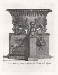
Classical Roman vase, early 19th century Italian Grand Tour engraving, c1820
By Carlos Antonini
Located in Melbourne, Victoria
Italian Neoclassical engraving depicting the Roman bronze and marble vases in collections of antiquities in Rome. Circa 1820.
175mm by 130mm (platemark) 330mm by 215mm (sheet size)
Category
Early 19th Century Renaissance Carlos Antonini Art
Materials
Engraving
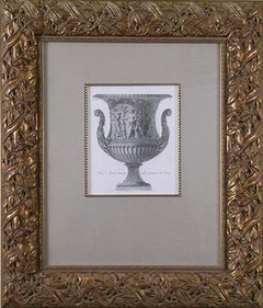
T-III. Vaso Antico
By Carlos Antonini
Located in Florham Park, NJ
CARLOS ANTONINI
Manuale di Vari Ornamenti
Rome, 1781-1790
Engraving.
100 Illustrations.
Late eighteenth century Europe was a world in revolution. People in France were losing their heads to Louis XVI and England had a mad king...
Category
1780s Academic Carlos Antonini Art
Materials
Laid Paper, Handmade Paper
T-III. Vaso Antico
By Carlos Antonini
Located in Florham Park, NJ
CARLOS ANTONINI
Manuale di Vari Ornamenti
Rome, 1781-1790
Engraving.
100 Illustrations.
Late eighteenth century Europe was a world in revolution. People in France were losing their heads to Louis XVI and England had a mad king...
Category
18th Century and Earlier Academic Carlos Antonini Art
Materials
Handmade Paper, Laid Paper
Related Items
View of Emden, Germany: A 16th Century Hand-colored Map by Braun & Hogenberg
By Franz Hogenberg
Located in Alamo, CA
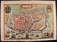
This is a 16th century original hand-colored copperplate engraved map of a bird's-eye View of Embden, Germany entitled " Emuda, vulgo Embden vrbs Frisia orientalis primaria" by Georg Braun & Franz Hogenberg, in volume II of their famous city atlas "Civitates Orbis Terrarum", published in Cologne, Germany in 1575.
This is a beautifully colored and detailed map of Emden, a seaport in northwestern Germany, along the Ems River and perhaps portions of over Dollart Bay, near the border with the Netherland. The map depicts a bird's-eye view of the city from the southwest, as well as a view of the harbor and an extensive system of canals. Numerous ships of various sizes, as well as two rowboats containing numerous occupants are seen in the main waterway in the foreground and additional boats line two canals in the center of the city. Two men and two women are shown on a hill in the foreground on the right, dressed in the 16th century style of nobility. Two ornate crests are included in each corner. A title strap-work cartouche is in the upper center with the title in Latin. The crest on the right including Engelke up de Muer (The Little Angel on the Wall) was granted by Emperor Maximilian I in 1495.
This is an English translation of an excerpt of Braun's description of Embden: "In Emden, the capital of East Frisia, rich merchants live in very fine houses. The city has a broad and well-situated harbour, which in my opinion is unique in Holland. Frisia and the whole of the Netherlands, for the ships can anchor here right under the city walls. They have also extended the harbour as far as the New Town, so that up to 400 ships can now find shelter here when the sea is rough."
The emphasis on the harbor and waterways within the city highlights the importance of Emden's place as a seaport at this time. Embden developed from a Dutch/Flemish trading settlement in the 7th-8th centuries into a city as late as late 14th century. In 1494 it was granted staple rights, and in 1536 the harbour was extended. In the mid-16th century Emden's port was thought to have the most ships in Europe. Its population then was about 5,000, rising to 15,000 by the end of the 16th century. The Ems River flowed directly under the city walls, but its course was changed in the 17th century by the construction of a canal. Emden has canals within its city limits, a typical feature of Dutch towns, which also enabled the extension of the harbor. In 1744 Emden was annexed by Prussia and is now part of Germany. It was captured by French forces in 1757 during the Seven Years' War, but recaptured by Anglo-German forces in 1758. During the Napoleonic French era, Emden and the surrounding lands of East Frisia were part of the short-lived Kingdom of Holland.
References:Van der Krogt 4, 1230, State 2; Taschen, Braun and Hogenberg...
Category
16th Century Old Masters Carlos Antonini Art
Materials
Engraving
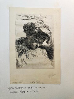
Young man looking down to right, fr Small Studies of Heads in Oriental Headdress
By Giovanni Benedetto Castiglione
Located in Middletown, NY
Etching on tissue thin laid paper. 4 3/8 x 3 1/16 inches (110 x 78 mm), trimmed at plate mark. A very good, well inked impression. Only known state. Adhered at all four corners to ar...
Category
Mid-17th Century Old Masters Carlos Antonini Art
Materials
Handmade Paper, Laid Paper, Tissue Paper, Etching
Johannes Sadeler I (Flemish 1550-1600) – Engraving 1582 - Jonah and the Whale II
By Johannes Sadeler I
Located in Meinisberg, CH
Johannes Sadeler I
(Flemish, ∗ 1550 in Brussels, Belgium – † 1600 Venice, Italy)
Jonah Spat Up by the Whale (Sheet II)
Engraved by Sadeler after an image created by Theodor Bernard...
Category
16th Century Renaissance Carlos Antonini Art
Materials
Laid Paper, Engraving
Free Shipping
H 15.56 in W 13.19 in D 0.6 in
The Windmill by François Vivares, after Rembrandt
By Rembrandt van Rijn
Located in Middletown, NY
Engraving on cream laid paper, 8 x 5 7/8 inches (202 x 149 mm), trimmed at the platemark. Adhered at each corner to a small sheet of archival laid paper. Horizontal edge loss at the ...
Category
Mid-18th Century Old Masters Carlos Antonini Art
Materials
Handmade Paper, Laid Paper, Etching
Christ and the Woman of Samaria Among Ruins by James Bretherton after Rembrandt
By Rembrandt van Rijn
Located in Middletown, NY
Bretherton, James (After Rembrandt van Rijn).
Christ and the Woman of Samaria Among Ruins.
London: c 1775.
Etching on light cream laid paper, 4 3/4...
Category
18th Century Old Masters Carlos Antonini Art
Materials
Handmade Paper, Etching, Laid Paper
Saint Michael fighting the Dragon
By Albrecht Dürer
Located in Zürich, CH
"Saint Michael Fighting the Dragon (B. 72; M., Holl. 174)"
This engraving is a print from the Latin publication of the text of the Apocalypse of 1511. Dürer’s series dedicated to the Apocalypse comprises 15 engravings and a title sheet. The master worked on this series from 1496 to 1498. In 1511, Dürer repeated his Latin edition and provided it with a prohibition on the series being copied. The Apocalypse was intended for extremely varied levels of society. All of the sheets are united by the theme of the battle between good and evil.
The work refers to a quote from the Revelation of St. John the Divine: “And there was war in heaven...
Category
16th Century Carlos Antonini Art
Materials
Engraving
St. Michael's Mount, Cornwall: A Framed 19th C. Engraving After Myles Foster
By Myles Birket Foster
Located in Alamo, CA
This beautiful 19th century framed hand-colored engraving is entitled "St. Michael's Mount, Cornwall" by J. Saddler after an original painting by the British artist Myles Birket Fost...
Category
Mid-19th Century Romantic Carlos Antonini Art
Materials
Engraving
H 14.38 in W 17.88 in D 1.5 in
Ireland: A Framed 17th Century Hand-colored Map by Jan Jannson
By Johannes Janssonius
Located in Alamo, CA
This is a 17th century hand-colored map entitled "Hibernia Regnum Vulgo Ireland" by Johannes Janssonius's (Jan Jansson), published in Amsterdam in 1640. This highly detailed map depicts the Emerald Isle with an extensive display of towns, roads, mountains, rivers, lakes and county borders, etc. It includes two decorative cartouches on the left. The title cartouche includes the Irish harp and the second, in the upper left, includes a lion wearing a crown on the left, a unicorn on the right and a coat-of-arms in the middle, which includes another Irish harp. A distance scale is seen in the lower right, augmented with two putti. The map is embellished with three sailing ships and a sea monster. Western portions of Scotland and England...
Category
Mid-17th Century Old Masters Carlos Antonini Art
Materials
Engraving
H 17.88 in W 22 in D 0.75 in
Street in Porto Maurizio
By John Taylor Arms
Located in Middletown, NY
Etching on antique cream laid paper with a partial watermark, 9 5/8 x 4 1/4 inches (246 x 109 mm); full margins. Signed and dated "1928" in pencil, lower margin. Inscribed "Street in Porto Maurizio...
Category
1920s American Modern Carlos Antonini Art
Materials
Handmade Paper, Laid Paper, Etching
A View of Scarborough, England: A Framed 19th C. Engraving After J. M. W. Turner
By J.M.W. Turner
Located in Alamo, CA
This beautiful 19th century framed engraving "Scarborough" by W. Chapman is based on an original painting by the renowned British artist J.M.W. Turner. It was published in London by ...
Category
Mid-19th Century Romantic Carlos Antonini Art
Materials
Engraving
H 18.25 in W 20.88 in D 1 in
Foke-Luste-Hajo, Seminole Chief: Original Hand Colored McKenney & Hall Engraving
By McKenney & Hall
Located in Alamo, CA
This is an original 19th century hand-colored McKenney and Hall engraving of a Native American entitled "Foke-Luste-Hajo, A Seminole Chief, No. 84", published by Rice, Rutter & Co. i...
Category
Mid-19th Century Naturalistic Carlos Antonini Art
Materials
Engraving
Tournai (Tournay), Belgium: A 16th Century Hand-colored Map by Braun & Hogenberg
By Franz Hogenberg
Located in Alamo, CA
This is a 16th century original hand-colored copperplate engraved map of Tournai, Belgium, entitled "Tornacum" by Georg Braun & Franz Hogenberg, in volume IV of their famous city atlas "Civitates Orbis Terrarum", published in Cologne or Augsberg, Germany in 1575. The map provides a bird's-eye view of the walled city of Tournai, the second oldest city in Belgium. It lies approximately one hour by car southwest of Brussels or from Ghent. The names of thirty of its streets, prominent buildings, churches and squares are listed in a key within a strap-work cartouche in the lower left. These locations are numbered in the key corresponding to their locations on the map.
This colorful map of Tournai (Tornacum or Tournay as it was called in the 16th century) includes the title in Latin in a cartouche in the upper center. Three crests are present across the upper map. A man and two woman are standing on a hill in the foreground in the lower right dressed in the style of 16th century upper class residents of the town.
This is an English translation of an excerpt of Braun's description of Tornai: “Tornacum or Turnacum is a city in Gallia Belgica, situated on the Schelde in the territory of the Nervii, called Tournai by its French inhabitants, but Dorneck by the Germans. Tournai has always been a large and powerful city, with an abundance of goods and commercial activities and wonderfully resourceful craftsmen, who invent new articles every day, and although some of these go out of use they constantly conceive of other new things, both useful and delightful, so that they have at all times something that provides work and a means of livelihood for the poor."
ReferencesVan der Krogt 4, 4435, State 1; Taschen, Braun and Hogenberg...
Category
16th Century Old Masters Carlos Antonini Art
Materials
Engraving
Carlos Antonini art for sale on 1stDibs.
Find a wide variety of authentic Carlos Antonini art available for sale on 1stDibs. You can also browse by medium to find art by Carlos Antonini in engraving, handmade paper, laid paper and more. Not every interior allows for large Carlos Antonini art, so small editions measuring 6 inches across are available. Customers who are interested in this artist might also find the work of Antonio Aquaroni, Martin Gropius, and John Wilkes. Carlos Antonini art prices can differ depending upon medium, time period and other attributes. On 1stDibs, the price for these items starts at $120 and tops out at $898, while the average work can sell for $875.
