Items Similar to Antique Map of Russia 'in Europe' by W. & A.K. Johnston, circa 1850


Want more images or videos?
Request additional images or videos from the seller
1 of 5
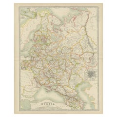
Antique Map of Russia 'in Europe' by W. & A.K. Johnston, circa 1850
About the Item
Detailed map of the region with a decorative piano key border. This map shows towns, railroads, rivers, lakes, mountains, railroad lines, Sub-oceanic Telegraph lines, etc.
- Creator:W. & A.K. Johnston (Artist)
- Dimensions:Height: 25.79 in (65.5 cm)Width: 21.07 in (53.5 cm)Depth: 0.02 in (0.5 mm)
- Materials and Techniques:
- Period:
- Date of Manufacture:circa 1850
- Condition:Please study images carefully.
- Seller Location:Langweer, NL
- Reference Number:
About the Seller
5.0
Platinum Seller
These expertly vetted sellers are 1stDibs' most experienced sellers and are rated highest by our customers.
Established in 2009
1stDibs seller since 2017
1,959 sales on 1stDibs
Typical response time: <1 hour
- ShippingRetrieving quote...Ships From: Langweer, Netherlands
- Return PolicyA return for this item may be initiated within 14 days of delivery.
More From This SellerView All
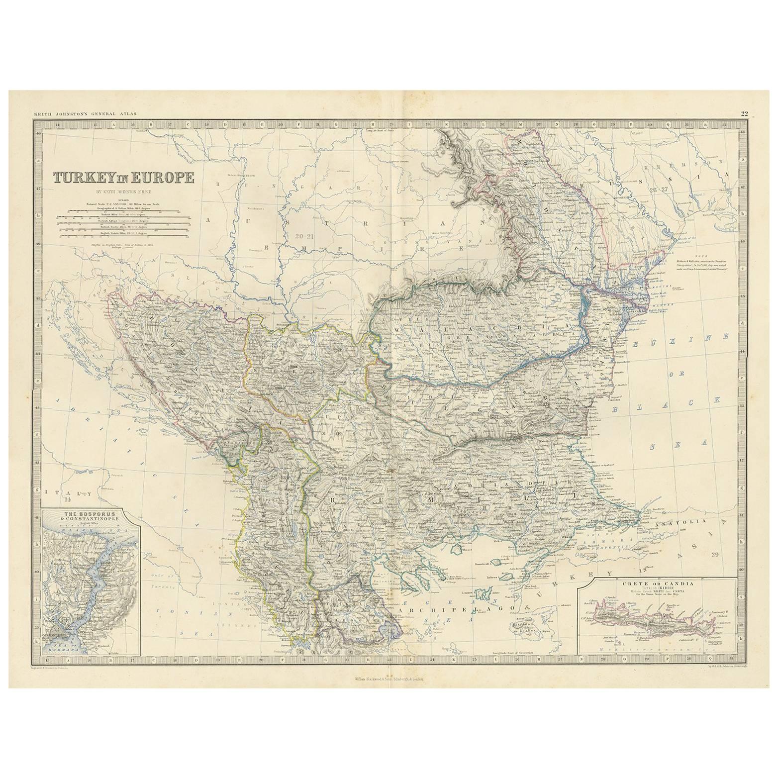
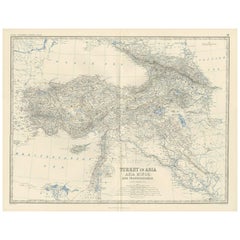
- Antique Map of Turkey in Europe by A.K. JohnstonLocated in Langweer, NLAntique map titled 'Turkey in Europe'. With an inset map of Crete, the Bosporus and Constantinople. This map originates from the ‘Royal Atlas of Modern Geography’ by Alexander Keith ...Category
Antique Mid-19th Century Maps
MaterialsPaper
- Antique Map of South-West Russia by A.K. Johnston, 1865Located in Langweer, NLAntique map titled 'South-West Russia showing the extent of the Kingdom of Poland previous to its partition in 1772'. This map originates from the ‘Royal Atlas of Modern Geography’ b...Category
Antique Mid-19th Century Maps
MaterialsPaper
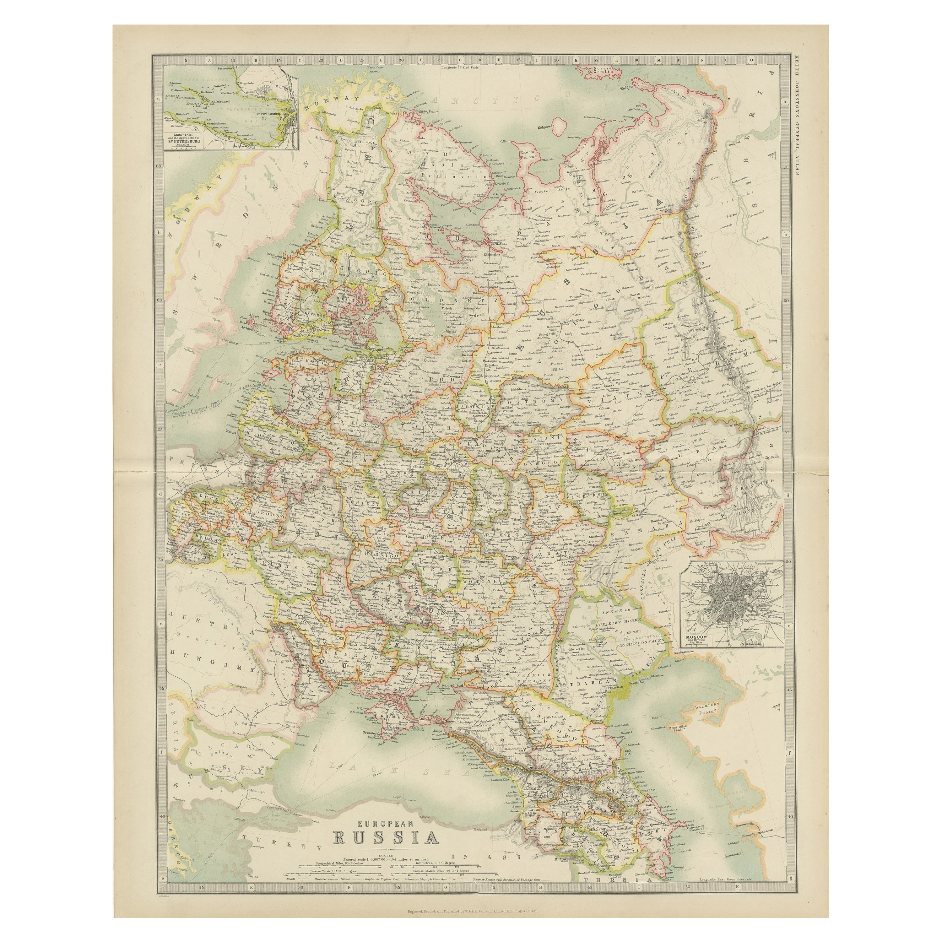
- Antique Map of Russia in Europe by Johnston (1909)Located in Langweer, NLAntique map titled 'European Russia'. Original antique map of Russia in Europe. With inset maps of St Petersburg and Moscow. This map originates from the ‘Royal Atlas of Modern Geogr...Category
Early 20th Century Maps
MaterialsPaper
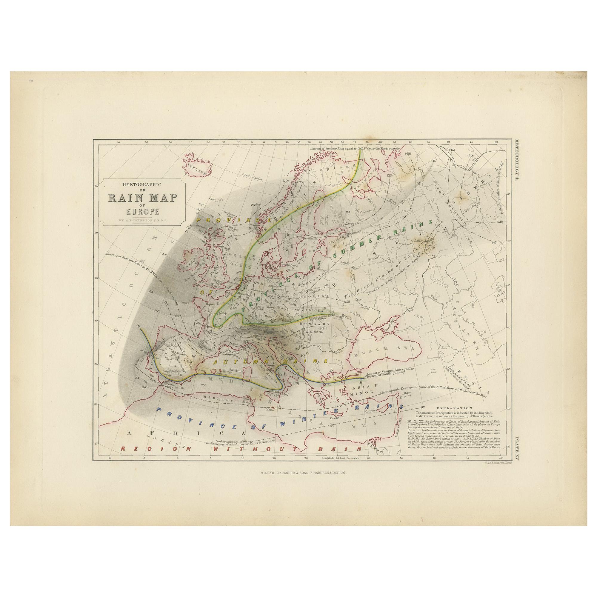
- Antique Rain Map of Europe by Johnston '1850'Located in Langweer, NLAntique map titled 'Hyetographic or Rain Map of Europe'. Original antique rain map of Europe. This map originates from 'The Physical Atlas of Natural Phenomena' by A.K. Johnston, pub...Category
Antique Mid-19th Century Maps
MaterialsPaper
- Antique Map of Denmark by A.K. Johnston, 1865Located in Langweer, NLAntique map titled 'Denmark and the Duchies Schleswig, Holstein & Lauenburg; Hanover, Brunswick, Mecklenburg, Oldenburg, Anhalt and Lippe'. With an inset map of Iceland, Copenhagen a...Category
Antique Mid-19th Century Maps
MaterialsPaper
- Antique Map of Turkey in Asia by A.K. Johnston, 1865Located in Langweer, NLAntique map titled 'Turkey in Asia (Asia Minor) and Transcaucasia'. This map originates from the ‘Royal Atlas of Modern Geography’ by Alexander Keith Johnston. Published by William B...Category
Antique Mid-19th Century Maps
MaterialsPaper


You May Also Like
- Original Antique Map of Belgium by Tallis, Circa 1850Located in St Annes, LancashireGreat map of Belgium Steel engraving Many lovely vignettes Published by London Printing & Publishing Co. ( Formerly Tallis ), C.1850 Origin...Category
Antique 1850s English Maps
MaterialsPaper
- Original Antique Map of Russia By Arrowsmith. 1820Located in St Annes, LancashireGreat map of Russia Drawn under the direction of Arrowsmith Copper-plate engraving Published by Longman, Hurst, Rees, Orme and Brown, 1820 Unframed.Category
Antique 1820s English Maps
MaterialsPaper
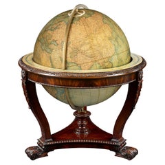
- Terrestrial Globe by W. & A.K. JohnstonBy W. & A.K. JohnstonLocated in New Orleans, LAMeasuring a monumental 30 inches in diameter, this impressive globe was crafted by the renowned firm W. & A.K. Johnston. Founded in 1825, the Johnston firm is considered the foremost...Category
Antique 19th Century English Victorian Globes
MaterialsBrass
- Original Antique Map of South America, circa 1830Located in St Annes, LancashireGreat map of South America Copper plate engraving Published by Butterworth, Livesey & Co., circa 1830 Unframed.Category
Antique Early 1800s English Other Maps
MaterialsPaper
- Original Antique Map of South East Asia by Becker, circa 1840Located in St Annes, LancashireGreat map of South East Asia Steel engraving with original color outline Engraved by Becker Published by Virtue, circa 1840. Unframed.Category
Antique 1840s English Other Maps
MaterialsPaper
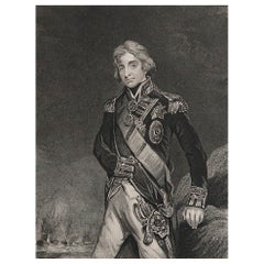
- Original Antique Print, Portrait of Lord Nelson, circa 1850Located in St Annes, LancashireGreat image of Lord Nelson Fine steel engraving by H.Robinson After J.Hoppner Published circa 1850 Unframed.Category
Antique 1850s English Prints
MaterialsPaper


Recently Viewed
View AllMore Ways To Browse
In Europe
Antique In Europe
Antique Furniture Dundee
Antique Map Chicago
Antique Map Copenhagen
Antique Map Malta
Antique Map Of Malta
Antique Maps Of Malta
Antique Maps Of Pennsylvania
Antique Queensland
Mitchell Antique Maps
North Carolina Map
Otto Petri
Ottoman Map
Alexandria Map
Antique Bassett Furniture
Antique Furniture Furniture Nova Scotia
Antique Furniture Nova Scotia Furniture