Items Similar to Antique Map of The United States of North America, Pacific States, 1882


Want more images or videos?
Request additional images or videos from the seller
1 of 6
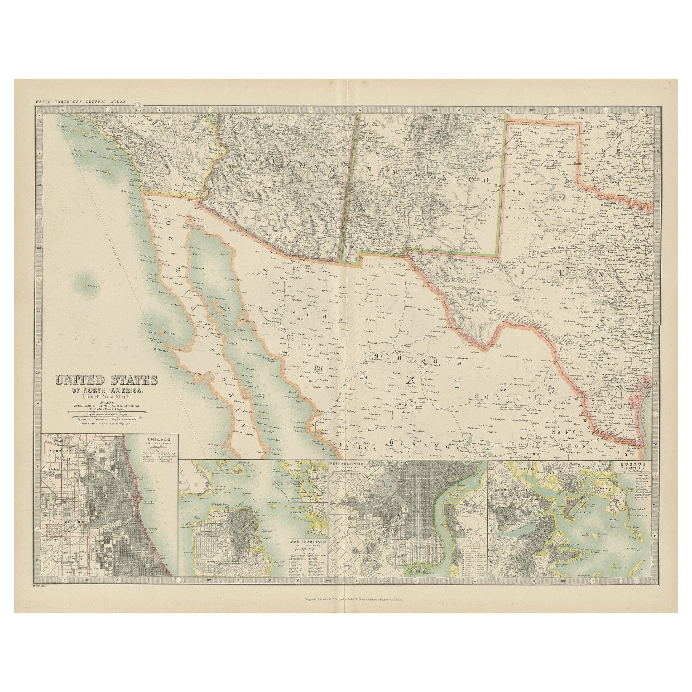
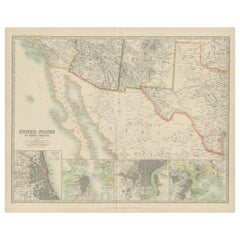
Antique Map of The United States of North America, Pacific States, 1882
About the Item
The map is from the same 1882 Blackie Atlas and focuses on the Pacific States of the United States of America during that period. Here are some details and historical context about this region at that time:
1. **Expansion and Settlement**: The latter half of the 19th century was a period of significant growth and settlement in the western United States, especially following the discovery of gold in California in 1848, which kicked off the California Gold Rush.
2. **Transcontinental Railroad**: By 1882, the Transcontinental Railroad had been connecting the west coast with the rest of the country for over a decade, greatly facilitating the movement of people and goods and accelerating the economic development of the region.
3. **Economic Development**: The west coast states, particularly California, were developing rapidly. Agriculture, mining, and shipping were significant industries. Cities like San Francisco and Los Angeles were growing into major urban centers.
4. **Native American Relations**: This was a time of continued conflict and displacement of Native American tribes. The expansion of settlements and the pursuit of natural resources often came at the expense of indigenous populations and their lands.
5. **Territorial Changes**: The territories of the west were in the process of being organized and seeking statehood. For example, Washington would not become a state until 1889, while Arizona and New Mexico would remain territories until 1912.
6. **Natural Features**: The map would showcase significant geographical features such as the Rocky Mountains, Sierra Nevada, and the Cascades. These natural barriers shaped the development and settlement patterns of the region.
7. **Climate and Agriculture**: The diverse climates of the Pacific States, from the wet climates of the Pacific Northwest to the arid areas of the Southwest, influenced the agricultural products and lifestyles of the inhabitants.
8. **Immigration and Diversity**: The Pacific Coast was also a point of entry for immigrants from Asia, contributing to the cultural diversity of the region. The Chinese Exclusion Act of 1882 was a significant and restrictive immigration law that reflected the tensions of the time.
The map would provide a detailed view of these aspects, showing the settlements, the railroads, the terrain, and natural resources that were critical to the development of the Pacific States.
- Dimensions:Height: 14.97 in (38 cm)Width: 11.03 in (28 cm)Depth: 0 in (0.02 mm)
- Materials and Techniques:
- Period:
- Date of Manufacture:1882
- Condition:Good condition, folding line in the middle. The outer borders are slightly discolored due to age, but not the image. Study the image carefully.
- Seller Location:Langweer, NL
- Reference Number:
About the Seller
5.0
Platinum Seller
These expertly vetted sellers are 1stDibs' most experienced sellers and are rated highest by our customers.
Established in 2009
1stDibs seller since 2017
1,960 sales on 1stDibs
Typical response time: <1 hour
- ShippingRetrieving quote...Ships From: Langweer, Netherlands
- Return PolicyA return for this item may be initiated within 14 days of delivery.
More From This SellerView All
- Antique Map of the United States of North America, c.1882Located in Langweer, NLAntique map titled 'United States of North America'. Old map of the United States of North America. This map originates from 'The Royal Atlas of Modern Geography, Exhibiting, in a Se...Category
Antique 1880s Maps
MaterialsPaper
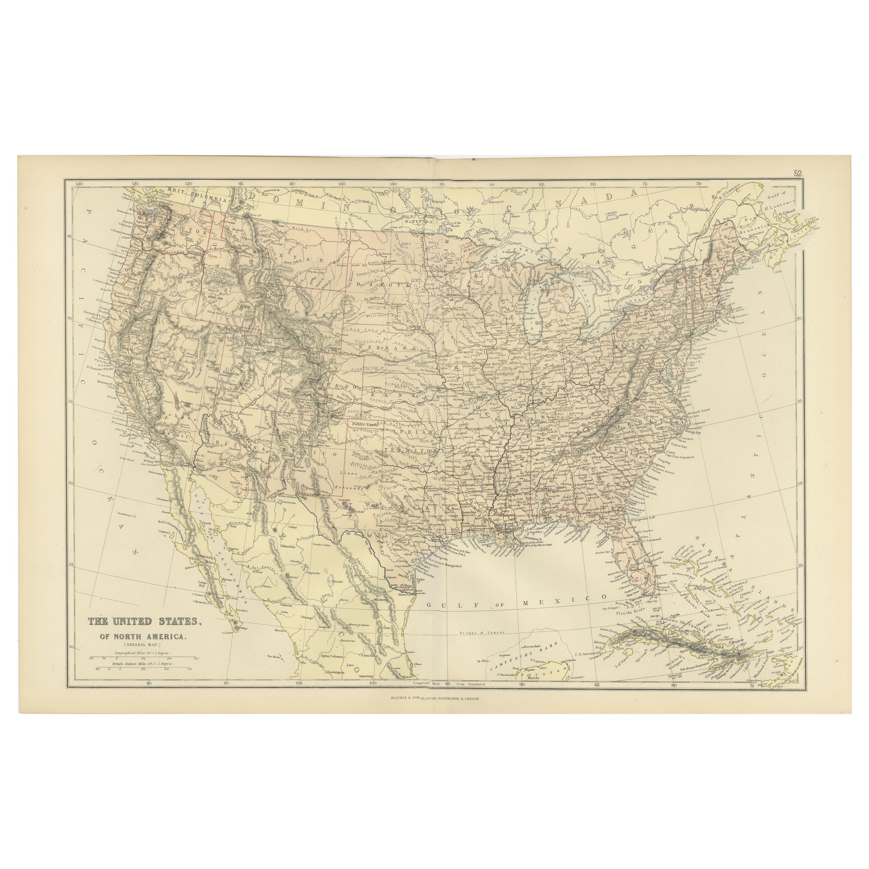
- Antique Map of The United States of North America, 1882Located in Langweer, NLThis is a historical map titled "The United States of North America, Central Part" from the 1882 Blackie Atlas. It depicts the continental United States with a high level of detail, ...Category
Antique 1880s Maps
MaterialsPaper
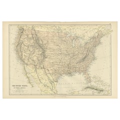
- Antique Map of the United States of North America by Wyld '1845'Located in Langweer, NLAntique map titled 'Map of The United States of North America'. Original antique map of the United States of North America. This map originates from 'An Atlas of the World, Comprehen...Category
Antique Mid-19th Century Maps
MaterialsPaper
- Antique Map of the United States of North America by Johnston '1909'Located in Langweer, NLAntique map titled 'United States of North America'. Original antique map of United States of North America ( South West Sheet ). With inset maps of Chicago...Category
Early 20th Century Maps
MaterialsPaper
- Antique Map Colton's United States of AmericaLocated in Langweer, NLAntique map titled 'Colton's United States of America'. Show railroads, canals, state capitals, major cities and towns, military posts, historic trails, Pony Express and U.S. mail routes; Dakota [Territory] extending deep into Nebraska, and Idaho [Territory] encompassing [modern day] Montana and Wyoming; Indian Territory...Category
Antique Mid-19th Century Maps
MaterialsPaper
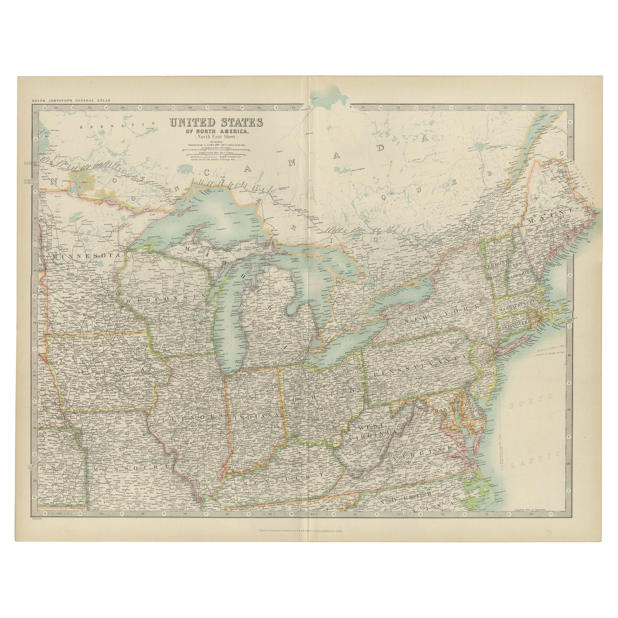
- Antique Map of the United States ' North East ' by Johnston '1909'Located in Langweer, NLAntique map titled 'United States of North America'. Original antique map of United States of North America ( North East ). This map orig...Category
Early 20th Century Maps
MaterialsPaper


You May Also Like
- Large Original Antique Map of the United States of America. 1891By Rand McNally & Co.Located in St Annes, LancashireFabulous map of The United States Original color By Rand, McNally & Co. Dated 1891 Unframed Free shipping.Category
Antique 1890s American Maps
MaterialsPaper
- Original Antique Map of The United States of America, circa 1890Located in St Annes, LancashireGreat map of the USA By The Stanford's Geographical Establishment Original colour Unframed.Category
Antique 1890s English Victorian Maps
MaterialsPaper
- 1859 "Map of the United States of America..." by J. H. ColtonBy J.H. ColtonLocated in Colorado Springs, COPresented is an 1859 “Map of the United States of America, the British Provinces, Mexico, the West Indies and Central America with Part of...Category
Antique 1850s American Maps
MaterialsPaper
- English Engraved Hand Colored Map of the North Eastern United States, circa 1817Located in Hollywood, SCEnglish copper engraved hand colored map of the North Eastern United States matted under glass in a gilt frame, Early 19th Century. Drawn and Engraved for Thomson's New General Atlas...Category
Antique 1810s English George III Maps
MaterialsPaper, Paint, Giltwood, Glass
- Framed 1839 Hand Colored Map of the United StatesLocated in Stamford, CTFramed hand colored map of the United States of America from 1839. Newly framed in a giltwood frame.Category
Antique 1830s American American Classical Maps
MaterialsGiltwood, Paper, Glass
- Framed 1820s Hand Colored Map of the United StatesLocated in Stamford, CTFramed 1820s hand colored map photos of North America and South America. As found framed in giltwood frame.Category
Antique 1820s American Spanish Colonial Maps
MaterialsGiltwood, Paper, Glass


Recently Viewed
View AllMore Ways To Browse
Pacific Northwest Furniture
Washington Map
North By Northwest
Arizona Antique
Antique New Mexican Furniture
New Mexico Antique Furniture
Native American Northwest
Antique Mining
Rocky Mountain Antique
Pacific Northwest Native American
Mining Collectible
North Cascades
19th Century New Mexico
Antique Furniture Arizona
Chinese Antique San Francisco
Mining Map
Northwest Coast Native American
Antique Chinese Furniture Los Angeles