Items Similar to Cambridgeshire J Cary


Want more images or videos?
Request additional images or videos from the seller
1 of 6
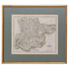
Cambridgeshire J Cary
About the Item
Cambridgeshire published may 1 1814 engraver no 181 strand
Maker John Cary c. 1754 – 1835.
- Creator:John Cary (Artist)
- Dimensions:Height: 8.67 in (22 cm)Width: 6.7 in (17 cm)Depth: 0.6 in (1.5 cm)
- Style:Georgian (Of the Period)
- Materials and Techniques:
- Place of Origin:
- Period:
- Date of Manufacture:1814
- Condition:Wear consistent with age and use.
- Seller Location:BUNGAY, GB
- Reference Number:1stDibs: LU3867332633732

John Cary
John Cary was an English cartographer. He was born in February of 1755 and died in August of 1835. His career started with his apprenticeship in London, and he opened up his own shop in the Strand in 1783. His atlas New and Correct English Atlas became the standard reference work in England. He was commissioned in 1794 by the Postmaster General to survey England's roads. Out of this commission, he published Cary's New Itinerary in 1798. He later produced Ordnance Survey maps before 1805. His business was eventually taken over by G.F. Cruchley.
About the Seller
5.0
Vetted Seller
These experienced sellers undergo a comprehensive evaluation by our team of in-house experts.
Established in 1985
1stDibs seller since 2018
86 sales on 1stDibs
Typical response time: 10 hours
- ShippingRetrieving quote...Ships From: BUNGAY, United Kingdom
- Return PolicyA return for this item may be initiated within 7 days of delivery.
More From This SellerView All
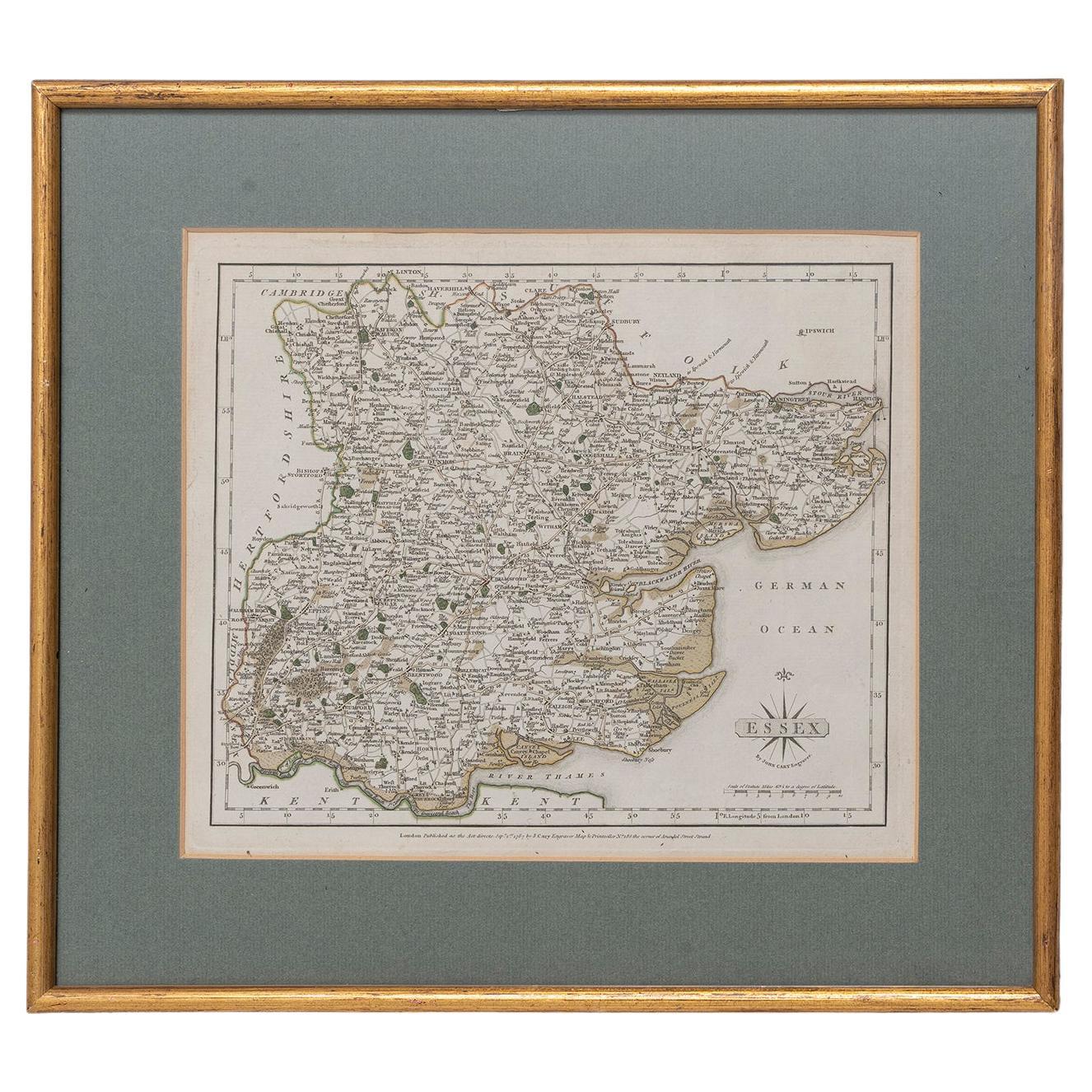
- Essex John Cary 1787 Cary's New & Correct English Atlas 40cm 16" long gilt frameBy John CaryLocated in BUNGAY, SUFFOLKMap of Essex by John Cary Engraver London published as the act directs Sept 1st 1787 by J Cary Engraver Map & Printseller no 188 the corner of Arundel Str...Category
Antique 18th Century English Georgian Maps
MaterialsPaper
- Map Lancashire 1793 John Cary engraver 37cm 14 1/2" highLocated in BUNGAY, SUFFOLKMap of Lancashire by John Cary engraver published 1st Jan 1793 by J Cary Engraver & Mapseller Strand in original black and gold classic map frameCategory
Antique 18th Century English Georgian Maps
MaterialsPaper
- Map Kyle Carrick Aireshire Thomas Kitchen 1749By Thomas KitchinLocated in BUNGAY, SUFFOLKA Map of Kyle & Carrick Aireshire Thomas Kitchen 1749 In original black and gold frame Just purchased more information to follow MAKER Thomas Kitchin (1718-1784) English engrave...Category
Antique 18th Century English Georgian Maps
MaterialsPaper
- Map Southern Scotland Thomas Conder Alex Hogg 1795Located in BUNGAY, SUFFOLKA new map of the southern part of Scotland containing the counties of Stirling, Lanerk, Renfrew, Linlithgow, Edinburgh, Peebles, Haddingtoun, Berwick, Selkirk, Roxburgh, Dumfries, Wigtoun, Kirkudbright & Air Published by Alex Hogg at the Kings Arms...Category
Antique 18th Century English Georgian Maps
MaterialsPaper
- Map Silk Embroidered Western Eastern Hemisphere New Old World Asia America AfriLocated in BUNGAY, SUFFOLKA rare, late-18th century, silk, embroidered, double hemisphere, world map, blackwork, sampler, showing the tracks of captain cook’s three voyages - Illustrating public understanding of the world in the late-18th century and the recent discoveries of the time delineating the tracks of Captain Cook’s three voyages. - Shows the incentive for further exploration during the 19th century as no mass is indicated within the southern polar region, the interior portions of western North America, Africa, and Australia are still relatively void of detail even though California is no longer shown as an island. - Includes beautifully worked allegories of the four continents Asia, the Americas, Africa & Europe, a cartouche being supported by two angels and a compass - The cream, silk ground is finely embroidered with a variety of stiches in black, silk threads emulating the black ink on maps. -“Recent international conflicts and voyages by Captain Cook and others made the study of geography exciting at the time this map was made. Elaborate embroidered maps...Category
Antique 18th Century British Georgian Maps
MaterialsSilk
- Map Turkey in Europe & Hungary Thomas Kitchin, 1783Located in BUNGAY, SUFFOLKThomas Kitchen (1718 - 1784) : Map of Turkey in Europe & Hungary 1783 Visible sheet within the cream mount 25.5cm., 10" height 20cm., 8" In an ebonised frame length 33cm. 13", height 28cm., 11" Kitchin, Thomas (1718 - 1784) Thomas Kitchin (August 4, 1718 – June 23, 1784) was a London based engraver, cartographer, and publisher. He was born in London to a hat-dyer of the same name. At 14, Kitchin apprenticed under Emanuel Bowen, under whom he mastered the art of engraving. He married Bowen daughter, Sarah Bowen, and later inherited much of his preceptor's prosperous business. Their son, Thomas Bowen Kitchin, also an engraver joined the family business, which thereafter published in Thomas Kitchin and Son. From 1858 or so Kitchin was the engraver to the Duke of York, and from about 1773 acquired the title, 'Royal Hydrographer to King George III.' He is responsible for numerous maps published in the The Star, Gentleman's Magazine, and London Magazine, as well as partnering with, at various times, with Thomas Jefferys, Emmanuel Bowen, Thomas Hinton, Issac Tayor, Andrew Dury, John Rocque, Louis de la Rochette, and Alexander Hogg, among others. Kitchin passed his business on to his son, Thomas Bowen Kitchin, who continued to republish many of his maps well after his death. Kitchin's apprentices included George Rollos...Category
Antique 18th Century English Georgian Maps
MaterialsPaper


You May Also Like
- Antique Map of Bavaria and Salzburg by Cary, 1811By John CaryLocated in Langweer, NLAntique map titled 'A New Map of the Circle of Bavaria'. Antique map of Bavaria and Salzburg, Germany. Covers the Duchy of Bavaria and the mountainous A...Category
Antique Early 19th Century Maps
MaterialsPaper
- Antique Map of the Upper and Lower Rhine by Cary '1811'By John CaryLocated in Langweer, NLAntique map titled 'A New Map of the Circles of the Upper and Lower Rhine'. Antique map covering an area from Westphalia and Lower Saxony in the north to France and Swabia in the south.Category
Antique Early 19th Century Maps
MaterialsPaper
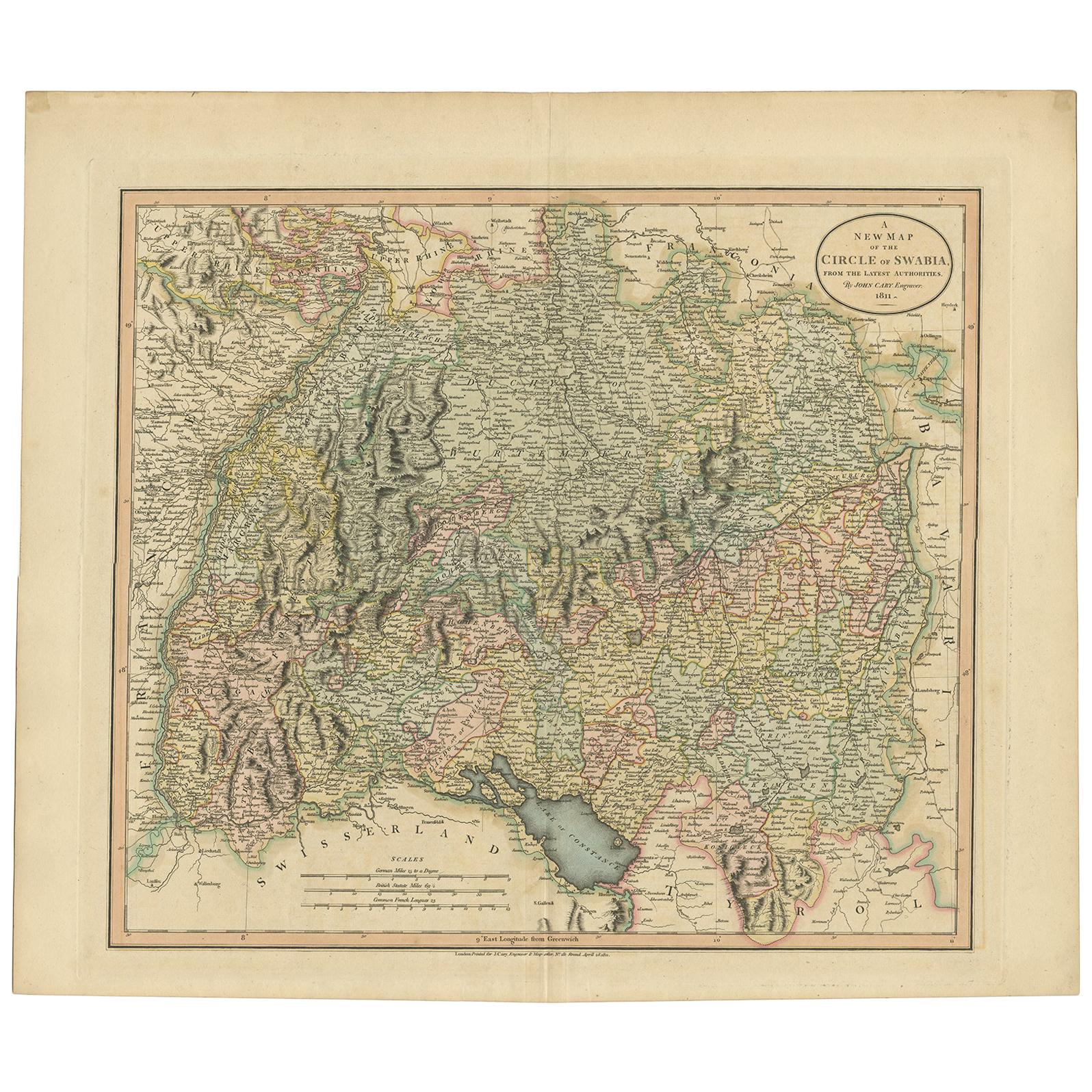
- Antique Map of the Swabia Region of Germany by Cary, '1811'By John CaryLocated in Langweer, NLAntique map titled 'A New Map of the Circle of Swabia'. Antique map of Swabia in Southwestern Germany. Covers from the Upper Rhine region south as far as Switzerland, Lake Constance ...Category
Antique Early 19th Century Maps
MaterialsPaper
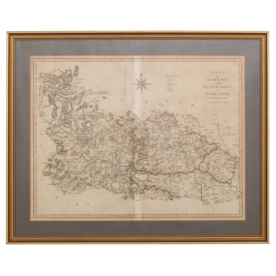
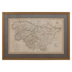
- 19th Century John Cary Map of North Part of West Riding of Yorkshire, C.1805By John CaryLocated in Royal Tunbridge Wells, KentAntique 19th century British original John Cary sr (1755-1835) map of North part of the West Riding of Yorkshire, From the beft Authorities. Engraved J Car...Category
Antique 19th Century British Maps
MaterialsPaper
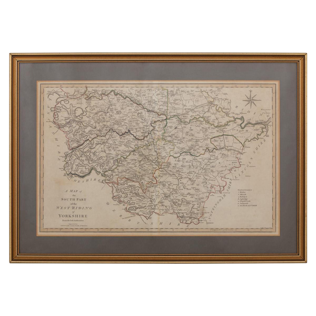
- 19th Century John Cary Map of South Part of West Riding of Yorkshire, circa 1805By John CaryLocated in Royal Tunbridge Wells, KentAntique 19th century British original John Cary sr (1755-1835) map of South part of the West Riding of Yorkshire, From the beft Authorities. Engraved J Car...Category
Antique 19th Century British Maps
MaterialsPaper
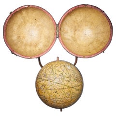
- Rare George III Celestial Pocket Globe by Cary, LondonBy CaryLocated in Oxfordshire, United KingdomA fine and rare 3" celestial pocket globe by G & W Cary, Strand, London circa 1791, housed in its original sharkskin case. A companion globe to terrestrial globes of this type we...Category
Antique Late 18th Century English George III Aviation Objects
MaterialsPlaster


Recently Viewed
View AllMore Ways To Browse
Antique Cambridgeshire
Antique Maps Of Virginia
Framed Africa Maps
G Plan Antique Furniture
G Plan Furniture Antique Furniture
Map Hawaii
Napoleon Map
Rand Mcnally Antique Maps
Victorian Staircase
Alsace Map
Antique Great Lakes Map
Antique Map Chile
Antique Map Of Jerusalem
Antique Ohio Maps
Burgundy Map
Macedonia Map
Map Of Hungary
Maps Of Ireland 18th Century